
Mombetsudake
紋別岳
Chitose, Hokkaido · Elevation 866 m
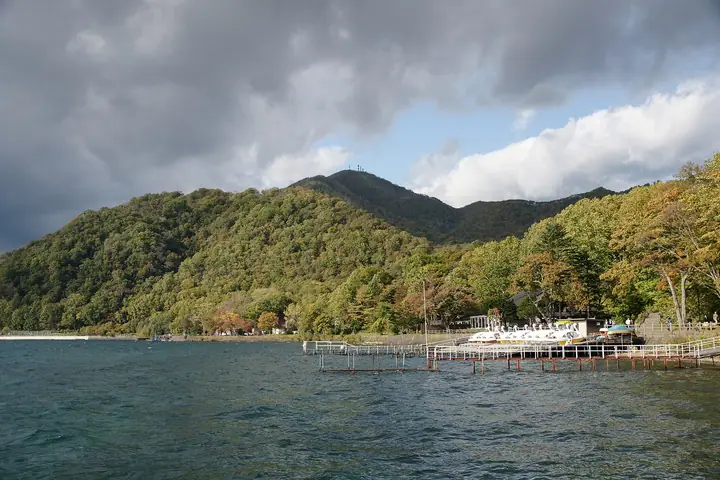
Mombetsudake is an 866 m peak on the eastern side of Lake Shikotsu in Chitose City, one of the rim mountains of the Shikotsu caldera. Its summit, which carries an NTT radio relay station, offers excellent views over the lake and the explosion crater of Mount Eniwa. Because it can be climbed in a relatively short time along a service road, it is a popular hike in the Lake Shikotsu area.
Mombetsudake at a glance
- Weather: The most settled day in the next 7 days is Thu, November 5: cloudy, gusts up to 8 m/s. Sat, Nov 7, Sun, Nov 8: strong wind (gusts up to 20 m/s).
- Route: The shortest is Lake Shikotsu Onsen–Mount Monbetsu Out-and-Back: about 3 h 34 min, 10.9 km, about 590 m of climbing.
Mombetsudake weather (hourly, 14 days)
Sunrise today 06:10, sunset 16:26
| Tue, 11/3 | Wed, 11/4 | Thu, 11/5 | Fri, 11/6 | Sat, 11/7 | Sun, 11/8 | Mon, 11/9 | Tue, 11/10 | Wed, 11/11 | Thu, 11/12 | Fri, 11/13 | Sat, 11/14 | Sun, 11/15 | Mon, 11/16 | Tue, 11/17 | |||||||||||||||||||||||||||||||||||||||||||||||||||||||||||||||||||||||
|---|---|---|---|---|---|---|---|---|---|---|---|---|---|---|---|---|---|---|---|---|---|---|---|---|---|---|---|---|---|---|---|---|---|---|---|---|---|---|---|---|---|---|---|---|---|---|---|---|---|---|---|---|---|---|---|---|---|---|---|---|---|---|---|---|---|---|---|---|---|---|---|---|---|---|---|---|---|---|---|---|---|---|---|---|---|
| Japan time | 15 | 17 | 19 | 21 | 23 | 1 | 3 | 5 | 7 | 9 | 11 | 13 | 15 | 18 | 21 | 0 | 3 | 6 | 9 | 12 | 15 | 18 | 21 | 0 | 3 | 6 | 9 | 12 | 15 | 18 | 21 | 0 | 3 | 6 | 9 | 12 | 15 | 18 | 21 | 0 | 3 | 6 | 9 | 12 | 15 | 18 | 21 | 0 | 3 | 6 | 9 | 15 | 21 | 3 | 9 | 15 | 21 | 3 | 9 | 15 | 21 | 3 | 9 | 15 | 21 | 3 | 9 | 15 | 21 | 3 | 9 | 15 | 21 | 3 | 9 | 15 | 21 | 3 | 9 | 15 | 21 | 3 | 9 | 15 | |
 |   | | |   |   | | |   | | | | |  | | | | |   |   | |   |   | | | |   |   |   |   | |   | |   |   | |   | | | | | | | | | | | | |   | | | | | | | | |   | | | | | | | | | | | | | |  | | | | | | |   | |  | | | ||
| Temperature | °C | 1° | -1° | -2° | -2° | -2° | -1° | 0° | 0° | 0° | 1° | 2° | 3° | 3° | 0° | -1° | 0° | 0° | 1° | 4° | 7° | 7° | 5° | 5° | 5° | 5° | 6° | 7° | 9° | 7° | 2° | 0° | -3° | -4° | -5° | -3° | -3° | -3° | -4° | -4° | -4° | -4° | -4° | -3° | -3° | -3° | -4° | -4° | -4° | -4° | -4° | -3° | -3° | -6° | -6° | -3° | -2° | -4° | -5° | -2° | 0° | -4° | -3° | -1° | -1° | -4° | -5° | -5° | -4° | -4° | -4° | -1° | 1° | -2° | -1° | 2° | 4° | 2° | 2° | 0° | -1° | -5° | -5° | -2° | 0° |
| Precipitation | mm | 0.2 | 2.0 | 0.5 | 0.3 | 4.7 | 5 | 8 | 1.2 | 0.1 | 0.4 | 0.1 | 0.2 | 0.1 | 0.2 | 0.3 | 0.6 | 0.6 | 0.5 | 0.5 | 0.4 | 0.4 | 0.5 | 0.4 | 0.2 | 1.6 | 1.4 | 0.1 | 0.2 | 0.1 | 0.1 | 0.1 | 0.4 | 1.5 | 2.8 | 1.4 | |||||||||||||||||||||||||||||||||||||||||||||||||
| New snow | cm | 0.1 | 1.3 | 0.1 | <.1 | 0.1 | <.1 | 0.1 | 0.2 | 0.3 | 0.6 | 0.6 | 0.5 | 0.5 | 0.4 | 0.4 | 0.5 | 0.3 | 0.2 | <.1 | <.1 | <.1 | <.1 | 1.6 | 1.4 | 0.1 | <.1 | <.1 | <.1 | 0.1 | <.1 | 0.2 | |||||||||||||||||||||||||||||||||||||||||||||||||||||
| Snow depth | cm | 0 | 0 | 0 | 0 | <1 | 1 | <1 | <1 | <1 | <1 | <1 | <1 | <1 | <1 | <1 | <1 | <1 | <1 | <1 | 0 | 0 | 0 | 0 | 0 | 0 | 0 | 0 | 0 | 0 | 0 | 0 | 0 | 0 | 0 | <1 | <1 | <1 | 1 | 1 | 2 | 2 | 2 | 2 | 2 | 2 | 2 | 2 | 2 | 2 | 2 | 2 | 2 | 2 | 2 | 2 | 2 | 2 | 3 | 4 | 3 | 3 | 3 | 3 | 3 | 3 | 3 | 2 | 2 | 2 | 2 | 2 | 2 | 2 | 2 | 2 | 1 | 1 | <1 | <1 | <1 | <1 | <1 | <1 | <1 |
| Wind | m/s | 4 | 2 | 2 | 1 | 2 | 4 | 4 | 5 | 4 | 3 | 2 | 2 | 2 | 1 | 2 | 2 | 2 | 2 | 2 | 3 | 2 | 0 | 1 | 2 | 1 | 2 | 2 | 4 | 5 | 3 | 4 | 5 | 6 | 6 | 7 | 7 | 6 | 5 | 6 | 6 | 7 | 7 | 7 | 7 | 6 | 4 | 3 | 3 | 3 | 3 | 4 | 4 | 2 | 2 | 1 | 3 | 3 | 3 | 3 | 2 | 1 | 1 | 2 | 3 | 2 | 1 | 5 | 4 | 3 | 1 | 1 | 1 | 1 | 2 | 2 | 3 | 3 | 2 | 4 | 6 | 5 | 2 | 1 | 2 |
| Wind gusts | m/s | 13 | 11 | 7 | 7 | 7 | 12 | 14 | 13 | 13 | 12 | 10 | 6 | 7 | 6 | 6 | 6 | 7 | 7 | 6 | 8 | 7 | 5 | 3 | 6 | 6 | 6 | 7 | 11 | 14 | 16 | 11 | 16 | 15 | 16 | 20 | 20 | 19 | 16 | 17 | 19 | 19 | 20 | 19 | 19 | 19 | 16 | 12 | 9 | 9 | 10 | 10 | 11 | 9 | 7 | 6 | 8 | 10 | 9 | 8 | 8 | 6 | 4 | 6 | 12 | 8 | 7 | 12 | 12 | 10 | 8 | 5 | 5 | 5 | 6 | 8 | 8 | 9 | 8 | 9 | 15 | 15 | 13 | 8 | 7 |
| Wind dir. | ↓ | ↓ | ↓ | ↓ | ↓ | ↓ | ↓ | ↓ | ↓ | ↓ | ↓ | ↓ | ↓ | ↓ | ↓ | ↓ | ↓ | ↓ | ↓ | ↓ | ↓ | ↓ | ↓ | ↓ | ↓ | ↓ | ↓ | ↓ | ↓ | ↓ | ↓ | ↓ | ↓ | ↓ | ↓ | ↓ | ↓ | ↓ | ↓ | ↓ | ↓ | ↓ | ↓ | ↓ | ↓ | ↓ | ↓ | ↓ | ↓ | ↓ | ↓ | ↓ | ↓ | ↓ | ↓ | ↓ | ↓ | ↓ | ↓ | ↓ | ↓ | ↓ | ↓ | ↓ | ↓ | ↓ | ↓ | ↓ | ↓ | ↓ | ↓ | ↓ | ↓ | ↓ | ↓ | ↓ | ↓ | ↓ | ↓ | ↓ | ↓ | ↓ | ↓ | ↓ | |
Mombetsudake hiking routes
Hiking times are estimates calculated from the terrain.
Huts, campsites and lodging near Mombetsudake
Lodging
- 散星湖寮
- オーベルージュ支笏湖翠山邸倶楽部
- Shikotsuko Youth Hostel
- 支笏湖第一寶亭留 翠山亭
- しこつ湖鶴雅別荘 碧の座
Mombetsudake facts
- Elevation
- 866 m
- Location
- Chitose, Hokkaido
42.794003, 141.394215 - National Park
- 支笏洞爺国立公園
- Website
- www.welcome-to-chitose.jp
- Wikipedia
- ja.wikipedia.org