
Kazemaki no Kashira
風巻ノ頭
Sagamihara, Kanagawa · Elevation 1,077 m
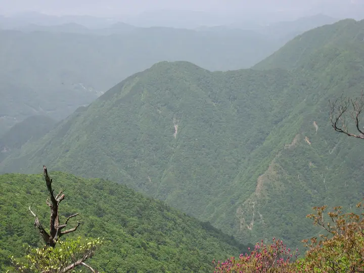
Within Tanzawa-Oyama Quasi-National Park, the peak takes its name from a tradition that winds swirl near the summit throughout the year. It lies on the Kazamaki ridge between Kannogawa Park and Sodehirayama. The steep ridge route as a whole gains 900 m over about 4 km.
Kazemaki no Kashira at a glance
- Weather: The most settled day in the next 7 days is Fri, November 6: clear, gusts up to 7 m/s.
Kazemaki no Kashira weather (hourly, 14 days)
Sunrise today 06:06, sunset 16:48
| Tue, 11/3 | Wed, 11/4 | Thu, 11/5 | Fri, 11/6 | Sat, 11/7 | Sun, 11/8 | Mon, 11/9 | Tue, 11/10 | Wed, 11/11 | Thu, 11/12 | Fri, 11/13 | Sat, 11/14 | Sun, 11/15 | Mon, 11/16 | Tue, 11/17 | |||||||||||||||||||||||||||||||||||||||||||||||||||||||||||||||||||||||
|---|---|---|---|---|---|---|---|---|---|---|---|---|---|---|---|---|---|---|---|---|---|---|---|---|---|---|---|---|---|---|---|---|---|---|---|---|---|---|---|---|---|---|---|---|---|---|---|---|---|---|---|---|---|---|---|---|---|---|---|---|---|---|---|---|---|---|---|---|---|---|---|---|---|---|---|---|---|---|---|---|---|---|---|---|---|
| Japan time | 15 | 17 | 19 | 21 | 23 | 1 | 3 | 5 | 7 | 9 | 11 | 13 | 15 | 18 | 21 | 0 | 3 | 6 | 9 | 12 | 15 | 18 | 21 | 0 | 3 | 6 | 9 | 12 | 15 | 18 | 21 | 0 | 3 | 6 | 9 | 12 | 15 | 18 | 21 | 0 | 3 | 6 | 9 | 12 | 15 | 18 | 21 | 0 | 3 | 6 | 9 | 15 | 21 | 3 | 9 | 15 | 21 | 3 | 9 | 15 | 21 | 3 | 9 | 15 | 21 | 3 | 9 | 15 | 21 | 3 | 9 | 15 | 21 | 3 | 9 | 15 | 21 | 3 | 9 | 15 | 21 | 3 | 9 | 15 | |
  |   | | | |   | | |   | | | | | | | | | | |   |   |   |   | | | |  | | |  | | | | |   | | | |   | | | | | | | | | | | | | | | | | | | | | |   |  | | | |   | | | | | | | | | | | | |   | | | | | | ||
| Temperature | °C | 10° | 9° | 7° | 7° | 7° | 6° | 6° | 5° | 5° | 6° | 7° | 7° | 6° | 5° | 5° | 6° | 6° | 6° | 9° | 14° | 13° | 10° | 8° | 7° | 7° | 6° | 13° | 17° | 16° | 10° | 9° | 9° | 8° | 5° | 9° | 11° | 9° | 5° | 4° | 4° | 3° | 3° | 7° | 9° | 8° | 6° | 5° | 4° | 4° | 3° | 4° | 6° | 3° | 2° | 3° | 7° | 3° | 3° | 6° | 9° | 0° | -2° | 6° | 7° | 4° | 1° | 8° | 8° | 1° | 0° | 4° | 6° | 2° | 1° | 9° | 11° | 8° | 7° | 13° | 14° | 5° | 3° | 3° | 5° |
| Precipitation | mm | 0.2 | 0.8 | 0.6 | 0.3 | 0.1 | 0.1 | 0.5 | 0.7 | 1.4 | 4.6 | 10 | 17 | 12 | 2.6 | 0.2 | 2.2 | 2.7 | 0.6 | 0.4 | 0.2 | 1.5 | 0.3 | 0.2 | 0.1 | 5 | 21 | 0.3 | 0.2 | ||||||||||||||||||||||||||||||||||||||||||||||||||||||||
| New snow | cm | ||||||||||||||||||||||||||||||||||||||||||||||||||||||||||||||||||||||||||||||||||||
| Snow depth | cm | 0 | 0 | 0 | 0 | 0 | 0 | 0 | 0 | 0 | 0 | 0 | 0 | 0 | 0 | 0 | 0 | 0 | 0 | 0 | 0 | 0 | 0 | 0 | 0 | 0 | 0 | 0 | 0 | 0 | 0 | 0 | 0 | 0 | 0 | 0 | 0 | 0 | 0 | 0 | 0 | 0 | 0 | 0 | 0 | 0 | 0 | 0 | 0 | 0 | 0 | 0 | 0 | 0 | 0 | 0 | 0 | 0 | 0 | 0 | 0 | 0 | 0 | 0 | 0 | 0 | 0 | 0 | 0 | 0 | 0 | 0 | 0 | 0 | 0 | 0 | 0 | 0 | 0 | 0 | 0 | 0 | 0 | 0 | 0 |
| Wind | m/s | 2 | 1 | 0 | 1 | 1 | 1 | 1 | 1 | 1 | 1 | 1 | 2 | 1 | 1 | 1 | 1 | 1 | 1 | 2 | 2 | 2 | 1 | 1 | 1 | 1 | 1 | 0 | 2 | 2 | 1 | 0 | 1 | 1 | 1 | 1 | 2 | 2 | 1 | 1 | 0 | 1 | 0 | 1 | 2 | 2 | 0 | 1 | 1 | 1 | 1 | 1 | 2 | 1 | 2 | 1 | 2 | 0 | 1 | 2 | 2 | 1 | 1 | 1 | 1 | 1 | 2 | 0 | 3 | 0 | 0 | 1 | 2 | 1 | 1 | 1 | 2 | 1 | 1 | 2 | 3 | 0 | 1 | 1 | 2 |
| Wind gusts | m/s | 5 | 5 | 3 | 2 | 3 | 3 | 3 | 3 | 3 | 3 | 5 | 5 | 5 | 4 | 4 | 4 | 4 | 6 | 6 | 8 | 6 | 4 | 3 | 3 | 5 | 5 | 4 | 6 | 7 | 6 | 2 | 2 | 4 | 4 | 4 | 7 | 8 | 7 | 3 | 3 | 3 | 2 | 4 | 7 | 6 | 6 | 2 | 3 | 4 | 3 | 4 | 8 | 6 | 5 | 5 | 7 | 7 | 4 | 9 | 10 | 7 | 4 | 4 | 7 | 5 | 5 | 5 | 9 | 8 | 2 | 4 | 6 | 6 | 3 | 5 | 10 | 7 | 8 | 7 | 8 | 7 | 4 | 5 | 6 |
| Wind dir. | ↓ | ↓ | ↓ | ↓ | ↓ | ↓ | ↓ | ↓ | ↓ | ↓ | ↓ | ↓ | ↓ | ↓ | ↓ | ↓ | ↓ | ↓ | ↓ | ↓ | ↓ | ↓ | ↓ | ↓ | ↓ | ↓ | ↓ | ↓ | ↓ | ↓ | ↓ | ↓ | ↓ | ↓ | ↓ | ↓ | ↓ | ↓ | ↓ | ↓ | ↓ | ↓ | ↓ | ↓ | ↓ | ↓ | ↓ | ↓ | ↓ | ↓ | ↓ | ↓ | ↓ | ↓ | ↓ | ↓ | ↓ | ↓ | ↓ | ↓ | ↓ | ↓ | ↓ | ↓ | ↓ | ↓ | ↓ | ↓ | ↓ | ↓ | ↓ | ↓ | ↓ | ↓ | ↓ | ↓ | ↓ | ↓ | ↓ | ↓ | ↓ | ↓ | ↓ | ||
Huts, campsites and lodging near Kazemaki no Kashira
Mountain huts
- 犬越路避難小屋 unstaffed
- 青ケ岳山荘 2026: open all year · reservation required · sleeps 35
- 黍殻避難小屋 unstaffed
- 蛭ヶ岳山荘 2026: open all year
Campsites
- 神の川ヒュッテ オートキャンプ場
- 神之川キャンプ場
- Kannogawa camping ground
- 月夜野キャンプ場
- 大渡キャンプ場
Kazemaki no Kashira facts
- Elevation
- 1,077 m
- Location
- Sagamihara, Kanagawa
35.510243, 139.108313 - Website
- www.pref.kanagawa.jp (PDF)
- Wikipedia
- ja.wikipedia.org