
Mt. Tenshigatake
天子ヶ岳
Fujinomiya, Shizuoka · Elevation 1,330 m
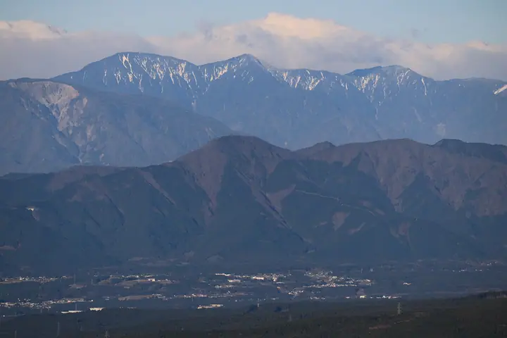
Mount Tenshi-ga-take is a 1,330 m peak in Fujinomiya City, Shizuoka Prefecture, one of the southern main peaks of the Tenshi Range west of Mount Fuji. Linked by ridge to neighbouring Mount Chōja, the standard loop from Tanuki Lake (Kyūkamura Fuji) traverses Chōja-ga-take, Tenshi-ga-take and Tateishi Pass before descending to Shiraito Falls — a route promoted by Fujinomiya City and the Fujisan Long Trail (Tenshi Range WEST). Goyō azalea bloom on the ridge in mid-May and mountain cherry on the descent in mid-April. The peak appears in many regional lists including Shizuoka Hyakuzan, Kai Hyakuzan, the Kantō Day-Hike 130 and Sumie Tanaka's 50 Flower-History peaks.
Mt. Tenshigatake at a glance
- Weather: The most settled day in the next 7 days is Sat, November 7: clear, gusts up to 8 m/s.
- Route: The shortest is Mount Chōja and Mount Tenshi Loop from Lake Tanuki: about 6 h 36 min, 12.3 km, about 940 m of climbing.
Mt. Tenshigatake weather (hourly, 14 days)
Sunrise today 06:08, sunset 16:51
| Tue, 11/3 | Wed, 11/4 | Thu, 11/5 | Fri, 11/6 | Sat, 11/7 | Sun, 11/8 | Mon, 11/9 | Tue, 11/10 | Wed, 11/11 | Thu, 11/12 | Fri, 11/13 | Sat, 11/14 | Sun, 11/15 | Mon, 11/16 | Tue, 11/17 | |||||||||||||||||||||||||||||||||||||||||||||||||||||||||||||||||||||||
|---|---|---|---|---|---|---|---|---|---|---|---|---|---|---|---|---|---|---|---|---|---|---|---|---|---|---|---|---|---|---|---|---|---|---|---|---|---|---|---|---|---|---|---|---|---|---|---|---|---|---|---|---|---|---|---|---|---|---|---|---|---|---|---|---|---|---|---|---|---|---|---|---|---|---|---|---|---|---|---|---|---|---|---|---|---|
| Japan time | 15 | 17 | 19 | 21 | 23 | 1 | 3 | 5 | 7 | 9 | 11 | 13 | 15 | 18 | 21 | 0 | 3 | 6 | 9 | 12 | 15 | 18 | 21 | 0 | 3 | 6 | 9 | 12 | 15 | 18 | 21 | 0 | 3 | 6 | 9 | 12 | 15 | 18 | 21 | 0 | 3 | 6 | 9 | 12 | 15 | 18 | 21 | 0 | 3 | 6 | 9 | 15 | 21 | 3 | 9 | 15 | 21 | 3 | 9 | 15 | 21 | 3 | 9 | 15 | 21 | 3 | 9 | 15 | 21 | 3 | 9 | 15 | 21 | 3 | 9 | 15 | 21 | 3 | 9 | 15 | 21 | 3 | 9 | 15 | |
  |   |   | | |   | | |   | | | |   | | | | | |   | | | | |   | | |  | | |  | | | | | | | | | | | | | | | | | | | | |   | | | | | | | | | |   | | | | | | | | | | | | | | | | |   |   | | | | | | ||
| Temperature | °C | 10° | 8° | 7° | 7° | 7° | 6° | 6° | 6° | 7° | 8° | 10° | 10° | 9° | 8° | 7° | 7° | 7° | 7° | 10° | 14° | 11° | 10° | 9° | 8° | 8° | 8° | 13° | 17° | 15° | 10° | 8° | 7° | 6° | 4° | 9° | 11° | 10° | 5° | 4° | 5° | 4° | 5° | 7° | 9° | 8° | 6° | 6° | 5° | 6° | 5° | 6° | 8° | 5° | 4° | 6° | 7° | 4° | 0° | 4° | 8° | 1° | 0° | 5° | 6° | 4° | 2° | 8° | 9° | 4° | 4° | 4° | 6° | 4° | 3° | 8° | 9° | 8° | 8° | 11° | 16° | 7° | 6° | 4° | 6° |
| Precipitation | mm | 0.2 | 0.1 | 0.5 | 0.1 | 9 | 13 | 12 | 2.0 | 1.3 | 0.7 | 0.3 | 0.3 | 0.2 | 0.3 | 0.2 | 0.2 | 15 | 23 | 1.5 | 0.1 | 2.9 | |||||||||||||||||||||||||||||||||||||||||||||||||||||||||||||||
| New snow | cm | ||||||||||||||||||||||||||||||||||||||||||||||||||||||||||||||||||||||||||||||||||||
| Snow depth | cm | 0 | 0 | 0 | 0 | 0 | 0 | 0 | 0 | 0 | 0 | 0 | 0 | 0 | 0 | 0 | 0 | 0 | 0 | 0 | 0 | 0 | 0 | 0 | 0 | 0 | 0 | 0 | 0 | 0 | 0 | 0 | 0 | 0 | 0 | 0 | 0 | 0 | 0 | 0 | 0 | 0 | 0 | 0 | 0 | 0 | 0 | 0 | 0 | 0 | 0 | 0 | 0 | 0 | 0 | 0 | 0 | 0 | 0 | 0 | 0 | 0 | 0 | 0 | 0 | 0 | 0 | 0 | 0 | 0 | 0 | 0 | 0 | 0 | 0 | 0 | 0 | 0 | 0 | 0 | 0 | 0 | 0 | 0 | 0 |
| Wind | m/s | 3 | 2 | 2 | 1 | 1 | 0 | 1 | 1 | 1 | 1 | 1 | 1 | 1 | 1 | 2 | 2 | 2 | 2 | 2 | 1 | 2 | 1 | 1 | 1 | 1 | 1 | 2 | 1 | 2 | 1 | 1 | 1 | 1 | 2 | 2 | 2 | 2 | 1 | 1 | 1 | 1 | 1 | 1 | 2 | 3 | 2 | 1 | 2 | 2 | 1 | 2 | 2 | 2 | 1 | 2 | 4 | 2 | 2 | 4 | 3 | 2 | 1 | 2 | 3 | 1 | 1 | 3 | 2 | 0 | 0 | 1 | 2 | 2 | 1 | 3 | 3 | 2 | 2 | 0 | 1 | 3 | 2 | 1 | 3 |
| Wind gusts | m/s | 10 | 8 | 6 | 6 | 6 | 5 | 3 | 4 | 4 | 5 | 6 | 6 | 6 | 5 | 7 | 7 | 9 | 10 | 9 | 8 | 7 | 7 | 5 | 5 | 4 | 4 | 6 | 7 | 8 | 7 | 4 | 3 | 4 | 5 | 6 | 8 | 7 | 6 | 4 | 4 | 4 | 4 | 5 | 8 | 9 | 9 | 6 | 7 | 7 | 7 | 7 | 11 | 8 | 7 | 7 | 13 | 11 | 7 | 15 | 15 | 9 | 6 | 8 | 12 | 10 | 4 | 10 | 10 | 6 | 3 | 4 | 9 | 8 | 5 | 9 | 12 | 11 | 13 | 8 | 7 | 9 | 7 | 7 | 10 |
| Wind dir. | ↓ | ↓ | ↓ | ↓ | ↓ | ↓ | ↓ | ↓ | ↓ | ↓ | ↓ | ↓ | ↓ | ↓ | ↓ | ↓ | ↓ | ↓ | ↓ | ↓ | ↓ | ↓ | ↓ | ↓ | ↓ | ↓ | ↓ | ↓ | ↓ | ↓ | ↓ | ↓ | ↓ | ↓ | ↓ | ↓ | ↓ | ↓ | ↓ | ↓ | ↓ | ↓ | ↓ | ↓ | ↓ | ↓ | ↓ | ↓ | ↓ | ↓ | ↓ | ↓ | ↓ | ↓ | ↓ | ↓ | ↓ | ↓ | ↓ | ↓ | ↓ | ↓ | ↓ | ↓ | ↓ | ↓ | ↓ | ↓ | ↓ | ↓ | ↓ | ↓ | ↓ | ↓ | ↓ | ↓ | ↓ | ↓ | ↓ | ↓ | ↓ | ↓ | ↓ | ↓ | |
Mt. Tenshigatake hiking routes
Hiking times are estimates calculated from the terrain.
Huts, campsites and lodging near Mt. Tenshigatake
Campsites
- Tenshi-no-mori car campsite
- Tanuki Lake Campground
- Foresters Village Kobitto Asagiri Camp Field
- 981上佐野ヒュッテ
- Fujiyama izumi-no-mori camping field
Lodging
- Kyukamura Fuji
- Sano Seiryo-so
Lists that include Mt. Tenshigatake
100 Mountains of Shizuoka · Elevations of 1003 Mountains of Japan · 1000 Mountains of Japan
Mt. Tenshigatake facts
- Elevation
- 1,330 m
- Location
- Fujinomiya, Shizuoka
35.329074, 138.536707 - Website
- www.city.fujinomiya.lg.jp
- Trail Map
- www.city.fujinomiya.lg.jp
- Wikipedia
- ja.wikipedia.org