
Mt. Shiroyama
城山
Tsuru, Yamanashi · Elevation 571 m
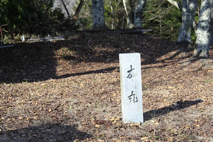
Mt. Shiroyama is a 571 m standalone peak in Kawatana, Tsuru City, Yamanashi Prefecture, with a 3.5 km perimeter. Its summit holds the ruins of Katsuyama Castle, established in the Sengoku period by Oyamada Echizen-no-kami Nobuari and later integrated into the Yamura Domain — the Edo-period storehouse here held tea presented to the shogun, commemorated each October in the "Ochatsubo Dochu" procession. Locally called "Oshiro-yama," the summit is reached on foot in roughly 30 minutes from Yamuramachi Station. The peak is included in the Tsuru City Twenty-One Scenic Peaks.
Mt. Shiroyama at a glance
- Weather: The most settled day in the next 7 days is Fri, November 6: clear, gusts up to 5 m/s.
Mt. Shiroyama weather (hourly, 14 days)
Sunrise today 06:07, sunset 16:49
| Tue, 11/3 | Wed, 11/4 | Thu, 11/5 | Fri, 11/6 | Sat, 11/7 | Sun, 11/8 | Mon, 11/9 | Tue, 11/10 | Wed, 11/11 | Thu, 11/12 | Fri, 11/13 | Sat, 11/14 | Sun, 11/15 | Mon, 11/16 | Tue, 11/17 | |||||||||||||||||||||||||||||||||||||||||||||||||||||||||||||||||||||||
|---|---|---|---|---|---|---|---|---|---|---|---|---|---|---|---|---|---|---|---|---|---|---|---|---|---|---|---|---|---|---|---|---|---|---|---|---|---|---|---|---|---|---|---|---|---|---|---|---|---|---|---|---|---|---|---|---|---|---|---|---|---|---|---|---|---|---|---|---|---|---|---|---|---|---|---|---|---|---|---|---|---|---|---|---|---|
| Japan time | 15 | 17 | 19 | 21 | 23 | 1 | 3 | 5 | 7 | 9 | 11 | 13 | 15 | 18 | 21 | 0 | 3 | 6 | 9 | 12 | 15 | 18 | 21 | 0 | 3 | 6 | 9 | 12 | 15 | 18 | 21 | 0 | 3 | 6 | 9 | 12 | 15 | 18 | 21 | 0 | 3 | 6 | 9 | 12 | 15 | 18 | 21 | 0 | 3 | 6 | 9 | 15 | 21 | 3 | 9 | 15 | 21 | 3 | 9 | 15 | 21 | 3 | 9 | 15 | 21 | 3 | 9 | 15 | 21 | 3 | 9 | 15 | 21 | 3 | 9 | 15 | 21 | 3 | 9 | 15 | 21 | 3 | 9 | 15 | |
  |   | | |   | | | |   | | | | | | | | | | |   |   | | | |   | |  | | |  |   |   | | | | | | | | | | | | | | | | | | |   | | | | | | | | | |   |  | | | | | | | | | | | | | | | | |   | | | | | | ||
| Temperature | °C | 13° | 12° | 11° | 11° | 10° | 9° | 9° | 8° | 8° | 9° | 11° | 11° | 9° | 9° | 8° | 9° | 9° | 10° | 13° | 18° | 16° | 13° | 12° | 10° | 10° | 9° | 16° | 22° | 20° | 14° | 12° | 11° | 10° | 7° | 13° | 16° | 13° | 9° | 7° | 8° | 8° | 7° | 12° | 15° | 12° | 10° | 9° | 7° | 7° | 6° | 8° | 10° | 7° | 6° | 7° | 12° | 7° | 5° | 8° | 12° | 3° | 1° | 9° | 12° | 7° | 4° | 11° | 14° | 5° | 4° | 8° | 11° | 5° | 4° | 12° | 17° | 11° | 10° | 15° | 20° | 9° | 8° | 6° | 9° |
| Precipitation | mm | 0.8 | 0.6 | 0.3 | 0.4 | 0.2 | 0.1 | 0.2 | 0.2 | 0.5 | 2.2 | 8 | 14 | 10 | 3.8 | 1.3 | 2.8 | 0.1 | 0.2 | 0.4 | 0.4 | 0.3 | 0.2 | 0.3 | 6 | 20 | 0.4 | 0.2 | |||||||||||||||||||||||||||||||||||||||||||||||||||||||||
| New snow | cm | ||||||||||||||||||||||||||||||||||||||||||||||||||||||||||||||||||||||||||||||||||||
| Snow depth | cm | 0 | 0 | 0 | 0 | 0 | 0 | 0 | 0 | 0 | 0 | 0 | 0 | 0 | 0 | 0 | 0 | 0 | 0 | 0 | 0 | 0 | 0 | 0 | 0 | 0 | 0 | 0 | 0 | 0 | 0 | 0 | 0 | 0 | 0 | 0 | 0 | 0 | 0 | 0 | 0 | 0 | 0 | 0 | 0 | 0 | 0 | 0 | 0 | 0 | 0 | 0 | 0 | 0 | 0 | 0 | 0 | 0 | 0 | 0 | 0 | 0 | 0 | 0 | 0 | 0 | 0 | 0 | 0 | 0 | 0 | 0 | 0 | 0 | 0 | 0 | 0 | 0 | 0 | 0 | 0 | 0 | 0 | 0 | 0 |
| Wind | m/s | 2 | 2 | 2 | 1 | 1 | 1 | 1 | 1 | 1 | 1 | 2 | 2 | 2 | 1 | 0 | 1 | 1 | 1 | 1 | 1 | 1 | 1 | 1 | 1 | 1 | 1 | 1 | 1 | 1 | 1 | 0 | 0 | 1 | 1 | 2 | 1 | 2 | 2 | 0 | 0 | 0 | 0 | 0 | 2 | 3 | 2 | 1 | 1 | 1 | 1 | 1 | 3 | 1 | 2 | 2 | 3 | 1 | 1 | 4 | 3 | 1 | 1 | 1 | 2 | 1 | 1 | 1 | 1 | 1 | 0 | 1 | 1 | 0 | 1 | 1 | 1 | 0 | 0 | 1 | 1 | 1 | 1 | 1 | 2 |
| Wind gusts | m/s | 6 | 5 | 4 | 4 | 3 | 3 | 4 | 4 | 3 | 4 | 5 | 6 | 6 | 5 | 4 | 4 | 6 | 4 | 4 | 6 | 5 | 4 | 3 | 4 | 5 | 5 | 5 | 5 | 5 | 4 | 2 | 2 | 4 | 5 | 7 | 8 | 7 | 6 | 4 | 2 | 2 | 2 | 3 | 5 | 10 | 8 | 4 | 3 | 3 | 3 | 5 | 9 | 7 | 6 | 7 | 8 | 8 | 4 | 15 | 14 | 9 | 4 | 4 | 5 | 6 | 4 | 5 | 10 | 6 | 3 | 4 | 5 | 4 | 4 | 4 | 7 | 4 | 5 | 6 | 8 | 5 | 5 | 6 | 6 |
| Wind dir. | ↓ | ↓ | ↓ | ↓ | ↓ | ↓ | ↓ | ↓ | ↓ | ↓ | ↓ | ↓ | ↓ | ↓ | ↓ | ↓ | ↓ | ↓ | ↓ | ↓ | ↓ | ↓ | ↓ | ↓ | ↓ | ↓ | ↓ | ↓ | ↓ | ↓ | ↓ | ↓ | ↓ | ↓ | ↓ | ↓ | ↓ | ↓ | ↓ | ↓ | ↓ | ↓ | ↓ | ↓ | ↓ | ↓ | ↓ | ↓ | ↓ | ↓ | ↓ | ↓ | ↓ | ↓ | ↓ | ↓ | ↓ | ↓ | ↓ | ↓ | ↓ | ↓ | ↓ | ↓ | ↓ | ↓ | ↓ | ↓ | ↓ | ↓ | ↓ | ↓ | ↓ | ↓ | ↓ | ↓ | ↓ | ↓ | ↓ | ↓ | ↓ | ↓ | ↓ | ↓ | |
Lists that include Mt. Shiroyama
Mt. Shiroyama facts
- Also known as
- 勝山城跡
- Elevation
- 571 m
- Location
- Tsuru, Yamanashi
35.554334, 138.903875 - Website
- www.city.tsuru.yamanashi.jp
- Wikipedia
- ja.wikipedia.org