
Mt. Ryuozan (Sanuki Ryuo)
竜王山 (讃岐竜王)
Takamatsu, Kagawa / Mima, Tokushima · Elevation 1,050 m
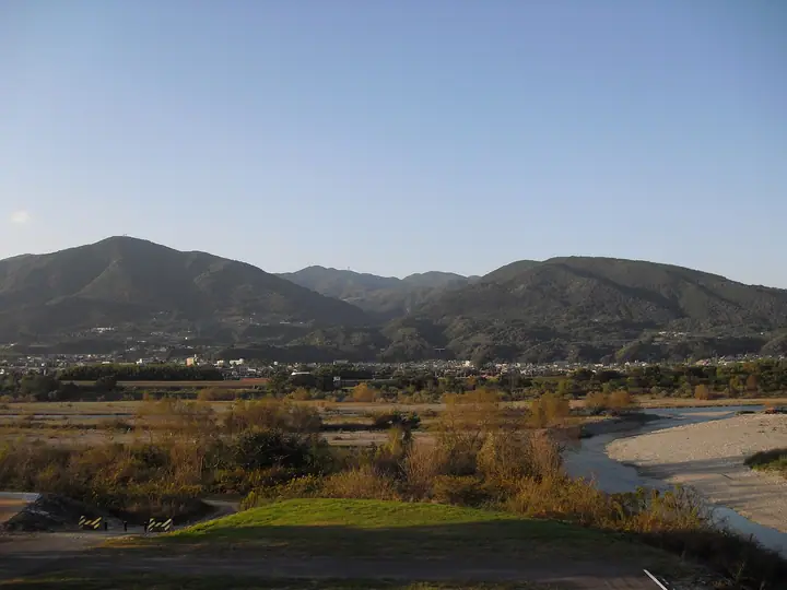
Ryuozan is the highest peak of the Sanuki Mountains along the Kagawa–Tokushima prefectural border. It comprises an eastern summit, Sanuki Ryuo (about 1,058 m, also called Takayama), straddling Takamatsu and Manno in Kagawa, and a western summit, Awa Ryuo (1,059.7 m). It is named among Shikoku's 100 Famous Mountains and Kagawa's 100 Selected Greenery sites, and is counted in the "1003 Mountains of Japan by Elevation."
Mt. Ryuozan (Sanuki Ryuo) at a glance
- Weather: The most settled day in the next 7 days is Sun, November 8: clear, gusts up to 7 m/s. Fri, Nov 6: strong wind (gusts up to 15 m/s).
- Route: The shortest is Mount Ryuo, Highest in the Sanuki Range, Visiting Both Awa Ryuo and Sanuki Ryuo: about 59 min, 1.6 km, about 150 m of climbing.
Mt. Ryuozan (Sanuki Ryuo) weather (hourly, 14 days)
Sunrise today 06:25, sunset 17:10
| Tue, 11/3 | Wed, 11/4 | Thu, 11/5 | Fri, 11/6 | Sat, 11/7 | Sun, 11/8 | Mon, 11/9 | Tue, 11/10 | Wed, 11/11 | Thu, 11/12 | Fri, 11/13 | Sat, 11/14 | Sun, 11/15 | Mon, 11/16 | Tue, 11/17 | |||||||||||||||||||||||||||||||||||||||||||||||||||||||||||||||||||||||
|---|---|---|---|---|---|---|---|---|---|---|---|---|---|---|---|---|---|---|---|---|---|---|---|---|---|---|---|---|---|---|---|---|---|---|---|---|---|---|---|---|---|---|---|---|---|---|---|---|---|---|---|---|---|---|---|---|---|---|---|---|---|---|---|---|---|---|---|---|---|---|---|---|---|---|---|---|---|---|---|---|---|---|---|---|---|
| Japan time | 15 | 17 | 19 | 21 | 23 | 1 | 3 | 5 | 7 | 9 | 11 | 13 | 15 | 18 | 21 | 0 | 3 | 6 | 9 | 12 | 15 | 18 | 21 | 0 | 3 | 6 | 9 | 12 | 15 | 18 | 21 | 0 | 3 | 6 | 9 | 12 | 15 | 18 | 21 | 0 | 3 | 6 | 9 | 12 | 15 | 18 | 21 | 0 | 3 | 6 | 9 | 15 | 21 | 3 | 9 | 15 | 21 | 3 | 9 | 15 | 21 | 3 | 9 | 15 | 21 | 3 | 9 | 15 | 21 | 3 | 9 | 15 | 21 | 3 | 9 | 15 | 21 | 3 | 9 | 15 | 21 | 3 | 9 | 15 | |
  | |   | |   | | | |   |   | | | | |   |   | | |   | | | |   | | | |  | | | |  | | | | | | | | | | | | | | | | | | | | | | |   | | |   | | | | |  | | | | | |   | | | | | | | | | | | | | |  | | | ||
| Temperature | °C | 14° | 11° | 9° | 9° | 8° | 9° | 8° | 8° | 8° | 10° | 12° | 11° | 12° | 9° | 11° | 9° | 9° | 9° | 11° | 14° | 16° | 12° | 12° | 12° | 12° | 10° | 12° | 14° | 14° | 10° | 7° | 6° | 6° | 4° | 7° | 9° | 9° | 5° | 4° | 3° | 3° | 3° | 8° | 10° | 10° | 6° | 7° | 6° | 6° | 6° | 10° | 12° | 7° | 5° | 9° | 10° | 5° | 3° | 6° | 7° | 3° | 1° | 7° | 9° | 5° | 4° | 8° | 9° | 3° | 0° | 7° | 11° | 5° | 4° | 11° | 13° | 10° | 11° | 11° | 13° | 8° | 4° | 6° | 9° |
| Precipitation | mm | 0.3 | 1.2 | 0.2 | 0.6 | 0.9 | 1.3 | 0.2 | 0.2 | 3.7 | 0.4 | 1.5 | 0.3 | ||||||||||||||||||||||||||||||||||||||||||||||||||||||||||||||||||||||||
| New snow | cm | ||||||||||||||||||||||||||||||||||||||||||||||||||||||||||||||||||||||||||||||||||||
| Snow depth | cm | 0 | 0 | 0 | 0 | 0 | 0 | 0 | 0 | 0 | 0 | 0 | 0 | 0 | 0 | 0 | 0 | 0 | 0 | 0 | 0 | 0 | 0 | 0 | 0 | 0 | 0 | 0 | 0 | 0 | 0 | 0 | 0 | 0 | 0 | 0 | 0 | 0 | 0 | 0 | 0 | 0 | 0 | 0 | 0 | 0 | 0 | 0 | 0 | 0 | 0 | 0 | 0 | 0 | 0 | 0 | 0 | 0 | 0 | 0 | 0 | 0 | 0 | 0 | 0 | 0 | 0 | 0 | 0 | 0 | 0 | 0 | 0 | 0 | 0 | 0 | 0 | 0 | 0 | 0 | 0 | 0 | 0 | 0 | 0 |
| Wind | m/s | 1 | 1 | 0 | 2 | 2 | 2 | 2 | 2 | 2 | 3 | 3 | 3 | 2 | 1 | 0 | 2 | 1 | 0 | 1 | 1 | 2 | 2 | 1 | 3 | 4 | 3 | 5 | 6 | 6 | 4 | 5 | 4 | 5 | 4 | 5 | 5 | 4 | 1 | 1 | 1 | 1 | 1 | 1 | 2 | 2 | 0 | 0 | 0 | 0 | 1 | 3 | 3 | 2 | 3 | 4 | 4 | 3 | 4 | 4 | 3 | 1 | 0 | 2 | 3 | 2 | 3 | 2 | 4 | 0 | 0 | 2 | 2 | 1 | 1 | 1 | 2 | 0 | 3 | 4 | 5 | 3 | 1 | 1 | 2 |
| Wind gusts | m/s | 7 | 4 | 3 | 5 | 6 | 5 | 5 | 5 | 6 | 9 | 9 | 9 | 7 | 6 | 3 | 5 | 4 | 2 | 4 | 4 | 5 | 5 | 5 | 8 | 11 | 11 | 12 | 15 | 15 | 15 | 14 | 13 | 12 | 13 | 14 | 14 | 12 | 10 | 5 | 4 | 3 | 3 | 4 | 6 | 7 | 6 | 1 | 2 | 2 | 2 | 7 | 11 | 7 | 7 | 10 | 13 | 11 | 12 | 12 | 12 | 8 | 3 | 5 | 9 | 8 | 7 | 7 | 10 | 9 | 2 | 6 | 7 | 6 | 3 | 3 | 6 | 5 | 9 | 11 | 14 | 12 | 8 | 4 | 7 |
| Wind dir. | ↓ | ↓ | ↓ | ↓ | ↓ | ↓ | ↓ | ↓ | ↓ | ↓ | ↓ | ↓ | ↓ | ↓ | ↓ | ↓ | ↓ | ↓ | ↓ | ↓ | ↓ | ↓ | ↓ | ↓ | ↓ | ↓ | ↓ | ↓ | ↓ | ↓ | ↓ | ↓ | ↓ | ↓ | ↓ | ↓ | ↓ | ↓ | ↓ | ↓ | ↓ | ↓ | ↓ | ↓ | ↓ | ↓ | ↓ | ↓ | ↓ | ↓ | ↓ | ↓ | ↓ | ↓ | ↓ | ↓ | ↓ | ↓ | ↓ | ↓ | ↓ | ↓ | ↓ | ↓ | ↓ | ↓ | ↓ | ↓ | ↓ | ↓ | ↓ | ↓ | ↓ | ↓ | ↓ | ↓ | ↓ | ↓ | ↓ | ↓ | ↓ | ↓ | ↓ | ↓ | |
Mt. Ryuozan (Sanuki Ryuo) hiking routes
Hiking times are estimates calculated from the terrain.
Lists that include Mt. Ryuozan (Sanuki Ryuo)
Mt. Ryuozan (Sanuki Ryuo) facts
- Also known as
- 鷹山
- Elevation
- 1,050 m
- Location
- Takamatsu, Kagawa / Mima, Tokushima
34.118182, 134.053615 - Website
- www.town.manno.lg.jp
- Wikipedia
- ja.wikipedia.org