
Mt. Daisen
大川山
Mannō-chō, Kagawa · Elevation 1,043 m
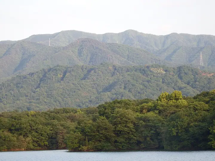
A 1,042.9 m peak rising on the prefectural border between Mannō Town in Naka-Tado District, Kagawa Prefecture, and Miyoshi City, Tokushima Prefecture, the second-highest summit of the Sanuki Range. Often called "the foremost mountain of Sanuki" for the elegant profile it presents to the Sanuki Plain. The Ōkawa Shrine at the summit has long been worshipped as a deity of rain-petitions and safe childbirth, and the surrounding nature-recreation area includes town- and prefecture-run campgrounds, a nature-study centre and the Mannō Astronomical Observatory. The mountain is included in the "Shikoku Hyakumeizan", "Shikoku Hyakuzan", "Nihon no Yama 1000", "Nihon no Sangaku Hyōkō 1003" and "Bunken Tozan Guide: Kagawa-ken no Yama" lists.
Mt. Daisen at a glance
- Weather: The most settled day in the next 7 days is Thu, November 5: clear, gusts up to 5 m/s.
Mt. Daisen weather (hourly, 14 days)
Sunrise today 06:25, sunset 17:11
| Tue, 11/3 | Wed, 11/4 | Thu, 11/5 | Fri, 11/6 | Sat, 11/7 | Sun, 11/8 | Mon, 11/9 | Tue, 11/10 | Wed, 11/11 | Thu, 11/12 | Fri, 11/13 | Sat, 11/14 | Sun, 11/15 | Mon, 11/16 | Tue, 11/17 | |||||||||||||||||||||||||||||||||||||||||||||||||||||||||||||||||||||||
|---|---|---|---|---|---|---|---|---|---|---|---|---|---|---|---|---|---|---|---|---|---|---|---|---|---|---|---|---|---|---|---|---|---|---|---|---|---|---|---|---|---|---|---|---|---|---|---|---|---|---|---|---|---|---|---|---|---|---|---|---|---|---|---|---|---|---|---|---|---|---|---|---|---|---|---|---|---|---|---|---|---|---|---|---|---|
| Japan time | 15 | 17 | 19 | 21 | 23 | 1 | 3 | 5 | 7 | 9 | 11 | 13 | 15 | 18 | 21 | 0 | 3 | 6 | 9 | 12 | 15 | 18 | 21 | 0 | 3 | 6 | 9 | 12 | 15 | 18 | 21 | 0 | 3 | 6 | 9 | 12 | 15 | 18 | 21 | 0 | 3 | 6 | 9 | 12 | 15 | 18 | 21 | 0 | 3 | 6 | 9 | 15 | 21 | 3 | 9 | 15 | 21 | 3 | 9 | 15 | 21 | 3 | 9 | 15 | 21 | 3 | 9 | 15 | 21 | 3 | 9 | 15 | 21 | 3 | 9 | 15 | 21 | 3 | 9 | 15 | 21 | 3 | 9 | 15 | |
 |   |   |   | |   | | |   |   | | | | | |   | |   |   | | | | | | | | | | | |  | | | | | | | | | | | | | | | | | | | | | |   |   | |   | | | | | |  | | | | | | | | | | | | | | | | | | | |  | | | ||
| Temperature | °C | 13° | 10° | 9° | 8° | 8° | 8° | 7° | 7° | 8° | 10° | 12° | 11° | 11° | 9° | 10° | 9° | 9° | 9° | 10° | 14° | 16° | 12° | 12° | 12° | 11° | 9° | 11° | 14° | 13° | 10° | 7° | 5° | 5° | 4° | 6° | 8° | 9° | 5° | 4° | 3° | 2° | 2° | 7° | 10° | 9° | 6° | 7° | 7° | 6° | 6° | 9° | 11° | 6° | 4° | 8° | 10° | 5° | 3° | 5° | 7° | 3° | 1° | 6° | 9° | 5° | 4° | 7° | 9° | 3° | 0° | 7° | 11° | 5° | 4° | 10° | 12° | 10° | 10° | 11° | 13° | 7° | 3° | 5° | 8° |
| Precipitation | mm | 1.1 | 0.7 | 0.8 | 0.6 | 2.1 | 0.1 | 0.3 | 0.2 | 0.1 | 4.0 | 0.5 | 1.4 | 0.3 | |||||||||||||||||||||||||||||||||||||||||||||||||||||||||||||||||||||||
| New snow | cm | ||||||||||||||||||||||||||||||||||||||||||||||||||||||||||||||||||||||||||||||||||||
| Snow depth | cm | 0 | 0 | 0 | 0 | 0 | 0 | 0 | 0 | 0 | 0 | 0 | 0 | 0 | 0 | 0 | 0 | 0 | 0 | 0 | 0 | 0 | 0 | 0 | 0 | 0 | 0 | 0 | 0 | 0 | 0 | 0 | 0 | 0 | 0 | 0 | 0 | 0 | 0 | 0 | 0 | 0 | 0 | 0 | 0 | 0 | 0 | 0 | 0 | 0 | 0 | 0 | 0 | 0 | 0 | 0 | 0 | 0 | 0 | 0 | 0 | 0 | 0 | 0 | 0 | 0 | 0 | 0 | 0 | 0 | 0 | 0 | 0 | 0 | 0 | 0 | 0 | 0 | 0 | 0 | 0 | 0 | 0 | 0 | 0 |
| Wind | m/s | 1 | 1 | 0 | 2 | 2 | 2 | 2 | 2 | 3 | 4 | 4 | 3 | 2 | 1 | 1 | 1 | 1 | 1 | 1 | 1 | 2 | 2 | 2 | 3 | 4 | 3 | 4 | 6 | 6 | 4 | 4 | 4 | 5 | 4 | 5 | 4 | 4 | 1 | 1 | 0 | 1 | 0 | 1 | 2 | 2 | 1 | 0 | 1 | 0 | 0 | 2 | 2 | 1 | 2 | 4 | 4 | 4 | 4 | 3 | 3 | 1 | 0 | 1 | 2 | 1 | 2 | 2 | 3 | 1 | 1 | 3 | 2 | 1 | 1 | 1 | 2 | 1 | 3 | 3 | 4 | 3 | 1 | 1 | 2 |
| Wind gusts | m/s | 7 | 4 | 2 | 4 | 7 | 6 | 6 | 6 | 7 | 10 | 10 | 10 | 8 | 6 | 4 | 6 | 4 | 2 | 4 | 4 | 5 | 5 | 6 | 8 | 10 | 10 | 12 | 14 | 14 | 14 | 13 | 11 | 12 | 12 | 13 | 13 | 11 | 9 | 4 | 4 | 2 | 2 | 3 | 6 | 6 | 6 | 2 | 2 | 2 | 2 | 6 | 10 | 6 | 6 | 9 | 12 | 11 | 11 | 11 | 11 | 7 | 3 | 5 | 9 | 7 | 6 | 6 | 9 | 9 | 3 | 8 | 8 | 6 | 3 | 4 | 5 | 5 | 8 | 10 | 13 | 11 | 9 | 4 | 7 |
| Wind dir. | ↓ | ↓ | ↓ | ↓ | ↓ | ↓ | ↓ | ↓ | ↓ | ↓ | ↓ | ↓ | ↓ | ↓ | ↓ | ↓ | ↓ | ↓ | ↓ | ↓ | ↓ | ↓ | ↓ | ↓ | ↓ | ↓ | ↓ | ↓ | ↓ | ↓ | ↓ | ↓ | ↓ | ↓ | ↓ | ↓ | ↓ | ↓ | ↓ | ↓ | ↓ | ↓ | ↓ | ↓ | ↓ | ↓ | ↓ | ↓ | ↓ | ↓ | ↓ | ↓ | ↓ | ↓ | ↓ | ↓ | ↓ | ↓ | ↓ | ↓ | ↓ | ↓ | ↓ | ↓ | ↓ | ↓ | ↓ | ↓ | ↓ | ↓ | ↓ | ↓ | ↓ | ↓ | ↓ | ↓ | ↓ | ↓ | ↓ | ↓ | ↓ | ↓ | ↓ | ↓ | |
Huts, campsites and lodging near Mt. Daisen
Lodging
- Asan Kotonami
Lists that include Mt. Daisen
Shikoku 100 Famous Mountains · Elevations of 1003 Mountains of Japan · 1000 Mountains of Japan
Mt. Daisen facts
- Also known as
- だいせんさん · だいせんざん
- Elevation
- 1,043 m
- Location
- Mannō-chō, Kagawa
34.115184, 133.939717 - Website
- www.town.manno.lg.jp
- Trail Map
- www.town.manno.lg.jp (PDF)
- Wikipedia
- ja.wikipedia.org