
Mount Ryuo
竜王山
Mannō-chō, Kagawa · Elevation 1,060 m
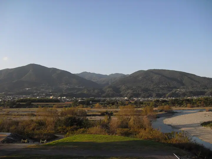
The highest mountain in Kagawa Prefecture and the Sanuki Mountains has two peaks: Sanuki Ryuo to the east and Awa Ryuo to the west. The triangulation point on Awa Ryuo lies on the Manno side of the boundary. An observation platform there overlooks the Sanuki Plain. Routes ascend along a gorge from Kotonami roadside station and from Okunoyu Campground.
Mount Ryuo at a glance
- Weather: The most settled day in the next 7 days is Sun, November 8: clear, gusts up to 7 m/s. Fri, Nov 6: strong wind (gusts up to 15 m/s).
- Route: The shortest is Mount Ryuo, Highest in the Sanuki Range, Visiting Both Awa Ryuo and Sanuki Ryuo: about 59 min, 1.6 km, about 150 m of climbing.
Mount Ryuo weather (hourly, 14 days)
Sunrise today 06:25, sunset 17:10
| Tue, 11/3 | Wed, 11/4 | Thu, 11/5 | Fri, 11/6 | Sat, 11/7 | Sun, 11/8 | Mon, 11/9 | Tue, 11/10 | Wed, 11/11 | Thu, 11/12 | Fri, 11/13 | Sat, 11/14 | Sun, 11/15 | Mon, 11/16 | Tue, 11/17 | |||||||||||||||||||||||||||||||||||||||||||||||||||||||||||||||||||||||
|---|---|---|---|---|---|---|---|---|---|---|---|---|---|---|---|---|---|---|---|---|---|---|---|---|---|---|---|---|---|---|---|---|---|---|---|---|---|---|---|---|---|---|---|---|---|---|---|---|---|---|---|---|---|---|---|---|---|---|---|---|---|---|---|---|---|---|---|---|---|---|---|---|---|---|---|---|---|---|---|---|---|---|---|---|---|
| Japan time | 15 | 17 | 19 | 21 | 23 | 1 | 3 | 5 | 7 | 9 | 11 | 13 | 15 | 18 | 21 | 0 | 3 | 6 | 9 | 12 | 15 | 18 | 21 | 0 | 3 | 6 | 9 | 12 | 15 | 18 | 21 | 0 | 3 | 6 | 9 | 12 | 15 | 18 | 21 | 0 | 3 | 6 | 9 | 12 | 15 | 18 | 21 | 0 | 3 | 6 | 9 | 15 | 21 | 3 | 9 | 15 | 21 | 3 | 9 | 15 | 21 | 3 | 9 | 15 | 21 | 3 | 9 | 15 | 21 | 3 | 9 | 15 | 21 | 3 | 9 | 15 | 21 | 3 | 9 | 15 | 21 | 3 | 9 | 15 | |
  | |   | |   | | | |   |   | | | | |   |   | | |   | | | |   | | | |  | | | |  | | | | | | | | | | | | | | | | | | | | | | |   | | |   | | | | |  | | | | | |   | | | | | | | | | | | | | |  | | | ||
| Temperature | °C | 14° | 11° | 9° | 9° | 8° | 8° | 8° | 7° | 8° | 10° | 12° | 11° | 12° | 9° | 10° | 9° | 9° | 9° | 11° | 14° | 16° | 12° | 12° | 12° | 12° | 10° | 12° | 14° | 14° | 10° | 7° | 6° | 6° | 4° | 7° | 9° | 9° | 5° | 4° | 3° | 3° | 3° | 8° | 10° | 10° | 6° | 7° | 6° | 6° | 6° | 10° | 12° | 7° | 5° | 9° | 10° | 5° | 3° | 6° | 7° | 3° | 1° | 7° | 9° | 5° | 4° | 8° | 9° | 3° | 0° | 7° | 11° | 4° | 4° | 11° | 13° | 10° | 11° | 11° | 13° | 8° | 4° | 6° | 9° |
| Precipitation | mm | 0.3 | 1.2 | 0.2 | 0.6 | 0.9 | 1.3 | 0.2 | 0.2 | 3.7 | 0.4 | 1.5 | 0.3 | ||||||||||||||||||||||||||||||||||||||||||||||||||||||||||||||||||||||||
| New snow | cm | ||||||||||||||||||||||||||||||||||||||||||||||||||||||||||||||||||||||||||||||||||||
| Snow depth | cm | 0 | 0 | 0 | 0 | 0 | 0 | 0 | 0 | 0 | 0 | 0 | 0 | 0 | 0 | 0 | 0 | 0 | 0 | 0 | 0 | 0 | 0 | 0 | 0 | 0 | 0 | 0 | 0 | 0 | 0 | 0 | 0 | 0 | 0 | 0 | 0 | 0 | 0 | 0 | 0 | 0 | 0 | 0 | 0 | 0 | 0 | 0 | 0 | 0 | 0 | 0 | 0 | 0 | 0 | 0 | 0 | 0 | 0 | 0 | 0 | 0 | 0 | 0 | 0 | 0 | 0 | 0 | 0 | 0 | 0 | 0 | 0 | 0 | 0 | 0 | 0 | 0 | 0 | 0 | 0 | 0 | 0 | 0 | 0 |
| Wind | m/s | 1 | 1 | 0 | 2 | 2 | 2 | 2 | 2 | 2 | 3 | 3 | 3 | 2 | 1 | 0 | 2 | 1 | 0 | 1 | 1 | 2 | 2 | 1 | 3 | 4 | 3 | 5 | 6 | 6 | 4 | 5 | 4 | 5 | 4 | 5 | 5 | 4 | 1 | 1 | 1 | 1 | 1 | 1 | 2 | 2 | 0 | 0 | 0 | 0 | 1 | 3 | 3 | 2 | 3 | 4 | 4 | 3 | 4 | 4 | 3 | 1 | 0 | 2 | 3 | 2 | 3 | 2 | 4 | 0 | 0 | 2 | 2 | 1 | 1 | 1 | 2 | 0 | 3 | 4 | 5 | 3 | 1 | 1 | 2 |
| Wind gusts | m/s | 7 | 4 | 3 | 5 | 6 | 5 | 5 | 5 | 6 | 9 | 9 | 9 | 7 | 6 | 3 | 5 | 4 | 2 | 4 | 4 | 5 | 5 | 5 | 8 | 11 | 11 | 12 | 15 | 15 | 15 | 14 | 13 | 12 | 13 | 14 | 14 | 12 | 10 | 5 | 4 | 3 | 3 | 4 | 6 | 7 | 6 | 1 | 2 | 2 | 2 | 7 | 11 | 7 | 7 | 10 | 13 | 11 | 12 | 12 | 12 | 8 | 3 | 5 | 9 | 8 | 7 | 7 | 10 | 9 | 2 | 6 | 7 | 6 | 3 | 3 | 6 | 5 | 9 | 11 | 14 | 12 | 8 | 4 | 7 |
| Wind dir. | ↓ | ↓ | ↓ | ↓ | ↓ | ↓ | ↓ | ↓ | ↓ | ↓ | ↓ | ↓ | ↓ | ↓ | ↓ | ↓ | ↓ | ↓ | ↓ | ↓ | ↓ | ↓ | ↓ | ↓ | ↓ | ↓ | ↓ | ↓ | ↓ | ↓ | ↓ | ↓ | ↓ | ↓ | ↓ | ↓ | ↓ | ↓ | ↓ | ↓ | ↓ | ↓ | ↓ | ↓ | ↓ | ↓ | ↓ | ↓ | ↓ | ↓ | ↓ | ↓ | ↓ | ↓ | ↓ | ↓ | ↓ | ↓ | ↓ | ↓ | ↓ | ↓ | ↓ | ↓ | ↓ | ↓ | ↓ | ↓ | ↓ | ↓ | ↓ | ↓ | ↓ | ↓ | ↓ | ↓ | ↓ | ↓ | ↓ | ↓ | ↓ | ↓ | ↓ | ↓ | |
Mount Ryuo hiking routes
Hiking times are estimates calculated from the terrain.
Mount Ryuo facts
- Elevation
- 1,060 m
- Location
- Mannō-chō, Kagawa
34.115535, 134.048154 - Website
- www.town.manno.lg.jp
- Trail Map
- www.kwaf.jp (PDF)
- Wikipedia
- ja.wikipedia.org