
Mt. Ōtaki
大滝山
Takamatsu, Kagawa / Mima, Tokushima · Elevation 946 m
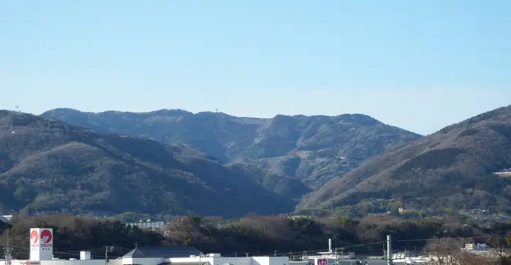
A 946-meter peak on the border between Wakichō in Mima City (Tokushima) and Shionoe Town in Takamatsu City (Kagawa), and the third-highest summit of the Sanuki Mountains. Long revered as a yakuyoke (misfortune-warding) sacred mountain, the upper slopes carry Ōtaki-ji — the twentieth temple of the Shikoku Betsukaku Twenty Sacred Places — and Saishō-jinja, the tutelary shrine for the Awa and Sanuki sides of the range. The summit area shelters the Sanuki Mountains' only stand of beech forest, and the Kagawa-side northwestern slope is designated a prefectural recreational forest. Listed in the Shikoku 100 Famous Mountains, the Bunken Tozan Guide for Kagawa and Shikoku Hyakuzan.
Mt. Ōtaki at a glance
- Weather: The most settled day in the next 7 days is Sun, November 8: clear, gusts up to 7 m/s. Fri, Nov 6: strong wind (gusts up to 15 m/s).
Mt. Ōtaki weather (hourly, 14 days)
Sunrise today 06:24, sunset 17:10
| Tue, 11/3 | Wed, 11/4 | Thu, 11/5 | Fri, 11/6 | Sat, 11/7 | Sun, 11/8 | Mon, 11/9 | Tue, 11/10 | Wed, 11/11 | Thu, 11/12 | Fri, 11/13 | Sat, 11/14 | Sun, 11/15 | Mon, 11/16 | Tue, 11/17 | |||||||||||||||||||||||||||||||||||||||||||||||||||||||||||||||||||||
|---|---|---|---|---|---|---|---|---|---|---|---|---|---|---|---|---|---|---|---|---|---|---|---|---|---|---|---|---|---|---|---|---|---|---|---|---|---|---|---|---|---|---|---|---|---|---|---|---|---|---|---|---|---|---|---|---|---|---|---|---|---|---|---|---|---|---|---|---|---|---|---|---|---|---|---|---|---|---|---|---|---|---|---|
| Japan time | 21 | 23 | 1 | 3 | 5 | 7 | 9 | 11 | 13 | 15 | 17 | 19 | 21 | 0 | 3 | 6 | 9 | 12 | 15 | 18 | 21 | 0 | 3 | 6 | 9 | 12 | 15 | 18 | 21 | 0 | 3 | 6 | 9 | 12 | 15 | 18 | 21 | 0 | 3 | 6 | 9 | 12 | 15 | 18 | 21 | 0 | 3 | 6 | 9 | 15 | 21 | 3 | 9 | 15 | 21 | 3 | 9 | 15 | 21 | 3 | 9 | 15 | 21 | 3 | 9 | 15 | 21 | 3 | 9 | 15 | 21 | 3 | 9 | 15 | 21 | 3 | 9 | 15 | 21 | 3 | 9 | 15 | |
  |   | |   | |   |   |   | | | | | | | | | |   | | |   | | | |  | | |  | | | | | | | | | | | | | | | | | | | | | | | |   | | | | | | | |  | | | | | | | | | | | | | | |   | |   | | |  | | | ||
| Temperature | °C | 9° | 9° | 9° | 9° | 9° | 8° | 11° | 12° | 12° | 12° | 11° | 10° | 10° | 10° | 10° | 9° | 12° | 16° | 15° | 13° | 12° | 11° | 13° | 10° | 13° | 15° | 14° | 11° | 8° | 6° | 6° | 5° | 7° | 9° | 10° | 6° | 4° | 3° | 3° | 3° | 9° | 11° | 10° | 7° | 7° | 5° | 5° | 6° | 10° | 13° | 7° | 5° | 9° | 11° | 6° | 4° | 6° | 8° | 3° | 1° | 7° | 10° | 5° | 4° | 9° | 10° | 3° | -1° | 7° | 12° | 4° | 3° | 11° | 14° | 10° | 11° | 12° | 14° | 8° | 5° | 6° | 9° |
| Precipitation | mm | 0.2 | 0.2 | 2.9 | 1.9 | 0.2 | 2.7 | 0.8 | 3.4 | 0.2 | 1.0 | 0.4 | |||||||||||||||||||||||||||||||||||||||||||||||||||||||||||||||||||||||
| New snow | cm | – | – | ||||||||||||||||||||||||||||||||||||||||||||||||||||||||||||||||||||||||||||||||
| Snow depth | cm | 0 | 0 | 0 | 0 | 0 | 0 | 0 | 0 | 0 | 0 | 0 | 0 | 0 | 0 | 0 | 0 | 0 | 0 | 0 | 0 | 0 | 0 | 0 | 0 | 0 | 0 | 0 | 0 | 0 | 0 | 0 | 0 | 0 | 0 | 0 | 0 | 0 | 0 | 0 | 0 | 0 | 0 | 0 | 0 | 0 | 0 | 0 | 0 | 0 | 0 | 0 | 0 | 0 | 0 | 0 | 0 | 0 | 0 | 0 | 0 | 0 | 0 | 0 | 0 | 0 | 0 | 0 | 0 | 0 | 0 | 0 | 0 | 0 | 0 | 0 | 0 | 0 | 0 | 0 | 0 | 0 | 0 |
| Wind | m/s | 1 | 1 | 1 | 1 | 1 | 1 | 3 | 3 | 2 | 2 | 0 | 1 | 1 | 1 | 0 | 1 | 0 | 0 | 1 | 1 | 1 | 2 | 4 | 3 | 5 | 6 | 6 | 4 | 5 | 4 | 4 | 4 | 5 | 5 | 4 | 1 | 1 | 2 | 2 | 1 | 1 | 2 | 2 | 0 | 1 | 1 | 0 | 1 | 3 | 3 | 2 | 3 | 4 | 4 | 3 | 4 | 4 | 3 | 1 | 1 | 1 | 3 | 3 | 3 | 3 | 4 | 1 | 1 | 1 | 2 | 1 | 1 | 1 | 1 | 0 | 3 | 4 | 5 | 3 | 1 | 1 | 3 |
| Wind gusts | m/s | 3 | 4 | 3 | 5 | 4 | 4 | 8 | 9 | 9 | 6 | 4 | 2 | 2 | 2 | 5 | 2 | 2 | 4 | 5 | 4 | 4 | 7 | 11 | 11 | 12 | 14 | 15 | 15 | 13 | 12 | 10 | 12 | 13 | 13 | 12 | 10 | 5 | 4 | 4 | 4 | 4 | 7 | 6 | 5 | 2 | 3 | 2 | 3 | 7 | 10 | 8 | 7 | 10 | 13 | 11 | 11 | 12 | 13 | 9 | 3 | 5 | 9 | 8 | 7 | 7 | 10 | 10 | 2 | 4 | 6 | 5 | 3 | 4 | 7 | 5 | 8 | 10 | 13 | 13 | 6 | 4 | 7 |
| Wind dir. | ↓ | ↓ | ↓ | ↓ | ↓ | ↓ | ↓ | ↓ | ↓ | ↓ | ↓ | ↓ | ↓ | ↓ | ↓ | ↓ | ↓ | ↓ | ↓ | ↓ | ↓ | ↓ | ↓ | ↓ | ↓ | ↓ | ↓ | ↓ | ↓ | ↓ | ↓ | ↓ | ↓ | ↓ | ↓ | ↓ | ↓ | ↓ | ↓ | ↓ | ↓ | ↓ | ↓ | ↓ | ↓ | ↓ | ↓ | ↓ | ↓ | ↓ | ↓ | ↓ | ↓ | ↓ | ↓ | ↓ | ↓ | ↓ | ↓ | ↓ | ↓ | ↓ | ↓ | ↓ | ↓ | ↓ | ↓ | ↓ | ↓ | ↓ | ↓ | ↓ | ↓ | ↓ | ↓ | ↓ | ↓ | ↓ | ↓ | ↓ | ↓ | ↓ | |
Huts, campsites and lodging near Mt. Ōtaki
Mountain huts
- 交流促進宿泊施設・美村が丘
Lists that include Mt. Ōtaki
Shikoku 100 Famous Mountains · Elevations of 1003 Mountains of Japan
Mt. Ōtaki facts
- Elevation
- 946 m
- Location
- Takamatsu, Kagawa / Mima, Tokushima
34.123036, 134.126823 - Website
- www.city.mima.lg.jp
- Trail Map
- www.pref.kagawa.lg.jp (PDF)
- Wikipedia
- ja.wikipedia.org