
Mt. Ruriyama
瑠璃山
Shinshiro, Aichi · Elevation 695 m
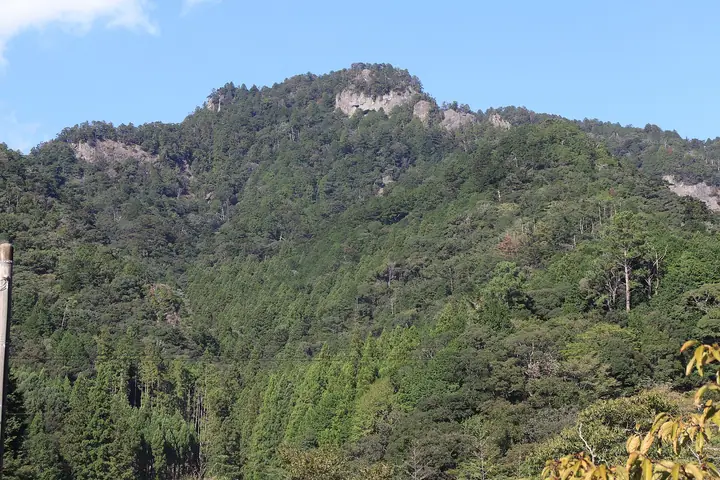
Ruriyama (695 m) is the highest point of Mt. Horaiji (whose triangulation peak is 684 m) in Shinshiro City, Aichi Prefecture, lying about 150 m north of the official summit. Mt. Horaiji holds the 1,300-year-old Horaiji Temple on its slopes; the whole mountain is a national Place of Scenic Beauty and Natural Monument and lies within Tenryu-Okumikawa Quasi-National Park. The Tokai Nature Trail crosses it, and its main approach climbs 1,425 stone steps. It appears in the Mountains of Aichi Prefecture hiking guide.
Mt. Ruriyama at a glance
- Weather: The most settled day in the next 7 days is Wed, November 4: cloudy, gusts up to 5 m/s. Fri, Nov 6, Sat, Nov 7: strong wind (gusts up to 18 m/s).
- Route: The shortest is Mount Horaiji, Mount Ruri, and Takauchiba Circuit: about 2 h 47 min, 4.9 km, about 400 m of climbing.
Mt. Ruriyama weather (hourly, 14 days)
Sunrise today 06:12, sunset 16:55
| Tue, 11/3 | Wed, 11/4 | Thu, 11/5 | Fri, 11/6 | Sat, 11/7 | Sun, 11/8 | Mon, 11/9 | Tue, 11/10 | Wed, 11/11 | Thu, 11/12 | Fri, 11/13 | Sat, 11/14 | Sun, 11/15 | Mon, 11/16 | Tue, 11/17 | |||||||||||||||||||||||||||||||||||||||||||||||||||||||||||||||||||||||
|---|---|---|---|---|---|---|---|---|---|---|---|---|---|---|---|---|---|---|---|---|---|---|---|---|---|---|---|---|---|---|---|---|---|---|---|---|---|---|---|---|---|---|---|---|---|---|---|---|---|---|---|---|---|---|---|---|---|---|---|---|---|---|---|---|---|---|---|---|---|---|---|---|---|---|---|---|---|---|---|---|---|---|---|---|---|
| Japan time | 15 | 17 | 19 | 21 | 23 | 1 | 3 | 5 | 7 | 9 | 11 | 13 | 15 | 18 | 21 | 0 | 3 | 6 | 9 | 12 | 15 | 18 | 21 | 0 | 3 | 6 | 9 | 12 | 15 | 18 | 21 | 0 | 3 | 6 | 9 | 12 | 15 | 18 | 21 | 0 | 3 | 6 | 9 | 12 | 15 | 18 | 21 | 0 | 3 | 6 | 9 | 15 | 21 | 3 | 9 | 15 | 21 | 3 | 9 | 15 | 21 | 3 | 9 | 15 | 21 | 3 | 9 | 15 | 21 | 3 | 9 | 15 | 21 | 3 | 9 | 15 | 21 | 3 | 9 | 15 | 21 | 3 | 9 | 15 | |
  |   | |   | | | |   | |   | | |   |   | | | | | | |   | | | |   |   | |  | | |  | | | | | | | | | | | | | | | | | | | | | | | | | |   | | | | |  | | | | | | | | | | | | |   | | | |   | | | | | | ||
| Temperature | °C | 16° | 12° | 9° | 8° | 8° | 8° | 7° | 7° | 8° | 12° | 13° | 13° | 13° | 11° | 11° | 11° | 11° | 11° | 14° | 19° | 15° | 13° | 11° | 10° | 10° | 12° | 15° | 17° | 16° | 11° | 9° | 8° | 6° | 5° | 8° | 11° | 10° | 6° | 4° | 3° | 3° | 2° | 10° | 13° | 12° | 6° | 7° | 8° | 6° | 5° | 12° | 13° | 5° | 4° | 11° | 12° | 7° | 4° | 6° | 9° | 3° | 2° | 10° | 11° | 4° | 6° | 9° | 11° | 3° | 5° | 9° | 9° | 8° | 9° | 12° | 11° | 10° | 11° | 14° | 17° | 8° | 6° | 10° | 10° |
| Precipitation | mm | 0.5 | 0.2 | 0.4 | 0.5 | 2.3 | 8 | 4.9 | 1.8 | 1.1 | 0.2 | 3.5 | 21 | 23 | 5 | 0.5 | |||||||||||||||||||||||||||||||||||||||||||||||||||||||||||||||||||||
| New snow | cm | ||||||||||||||||||||||||||||||||||||||||||||||||||||||||||||||||||||||||||||||||||||
| Snow depth | cm | 0 | 0 | 0 | 0 | 0 | 0 | 0 | 0 | 0 | 0 | 0 | 0 | 0 | 0 | 0 | 0 | 0 | 0 | 0 | 0 | 0 | 0 | 0 | 0 | 0 | 0 | 0 | 0 | 0 | 0 | 0 | 0 | 0 | 0 | 0 | 0 | 0 | 0 | 0 | 0 | 0 | 0 | 0 | 0 | 0 | 0 | 0 | 0 | 0 | 0 | 0 | 0 | 0 | 0 | 0 | 0 | 0 | 0 | 0 | 0 | 0 | 0 | 0 | 0 | 0 | 0 | 0 | 0 | 0 | 0 | 0 | 0 | 0 | 0 | 0 | 0 | 0 | 0 | 0 | 0 | 0 | 0 | 0 | 0 |
| Wind | m/s | 1 | 1 | 1 | 2 | 2 | 2 | 2 | 2 | 2 | 2 | 1 | 1 | 1 | 3 | 1 | 2 | 2 | 3 | 2 | 1 | 2 | 0 | 1 | 2 | 2 | 3 | 6 | 7 | 7 | 7 | 6 | 7 | 7 | 6 | 6 | 8 | 7 | 5 | 5 | 5 | 5 | 4 | 2 | 2 | 2 | 2 | 1 | 1 | 2 | 2 | 2 | 5 | 1 | 2 | 0 | 3 | 4 | 7 | 6 | 7 | 4 | 3 | 1 | 2 | 3 | 4 | 4 | 6 | 3 | 3 | 1 | 1 | 2 | 2 | 2 | 2 | 1 | 2 | 4 | 6 | 5 | 3 | 3 | 3 |
| Wind gusts | m/s | 6 | 5 | 3 | 4 | 4 | 4 | 4 | 4 | 4 | 5 | 4 | 3 | 4 | 8 | 8 | 7 | 6 | 7 | 6 | 4 | 7 | 5 | 3 | 4 | 5 | 8 | 13 | 17 | 17 | 16 | 17 | 17 | 17 | 17 | 15 | 18 | 18 | 16 | 12 | 11 | 11 | 11 | 9 | 6 | 8 | 6 | 4 | 3 | 4 | 4 | 5 | 11 | 11 | 5 | 5 | 8 | 9 | 18 | 19 | 18 | 16 | 8 | 6 | 7 | 8 | 10 | 11 | 15 | 14 | 7 | 6 | 4 | 4 | 4 | 7 | 9 | 7 | 8 | 9 | 16 | 17 | 14 | 8 | 9 |
| Wind dir. | ↓ | ↓ | ↓ | ↓ | ↓ | ↓ | ↓ | ↓ | ↓ | ↓ | ↓ | ↓ | ↓ | ↓ | ↓ | ↓ | ↓ | ↓ | ↓ | ↓ | ↓ | ↓ | ↓ | ↓ | ↓ | ↓ | ↓ | ↓ | ↓ | ↓ | ↓ | ↓ | ↓ | ↓ | ↓ | ↓ | ↓ | ↓ | ↓ | ↓ | ↓ | ↓ | ↓ | ↓ | ↓ | ↓ | ↓ | ↓ | ↓ | ↓ | ↓ | ↓ | ↓ | ↓ | ↓ | ↓ | ↓ | ↓ | ↓ | ↓ | ↓ | ↓ | ↓ | ↓ | ↓ | ↓ | ↓ | ↓ | ↓ | ↓ | ↓ | ↓ | ↓ | ↓ | ↓ | ↓ | ↓ | ↓ | ↓ | ↓ | ↓ | ↓ | ↓ | ↓ | |
Mt. Ruriyama hiking routes
- Mount Horaiji, Mount Ruri, and Takauchiba Circuit 4.9 km · Ascent 400 m 鳳来山パークウェイ駐車場
- Mount Horaiji Summit Circuit via Omotesando 8.1 km · Ascent 640 m 千の灯火, 鳳来寺 (Bus stop)
Hiking times are estimates calculated from the terrain.
Huts, campsites and lodging near Mt. Ruriyama
Campsites
- オートキャンプ場
- Bキャンプ場
- 第一キャンプファイアー場
- Aキャンプ場
Lodging
- 雲龍荘
- 桔梗屋旅館
- 湯谷観光ホテル泉山閣
- 旅館ひさご
- 旅荘みつい
Mt. Ruriyama facts
- Elevation
- 695 m
- Location
- Shinshiro, Aichi
34.984027, 137.582753 - National Park
- 天竜奥三河国定公園
- Website
- aichinow.pref.aichi.jp
- Trail Map
- www.city.shinshiro.lg.jp (PDF)
- Wikipedia
- ja.wikipedia.org