
Mt. Ōyorogi
大万木山
Iinan, Shimane / Shōbara-shi, Hiroshima · Elevation 1,218 m
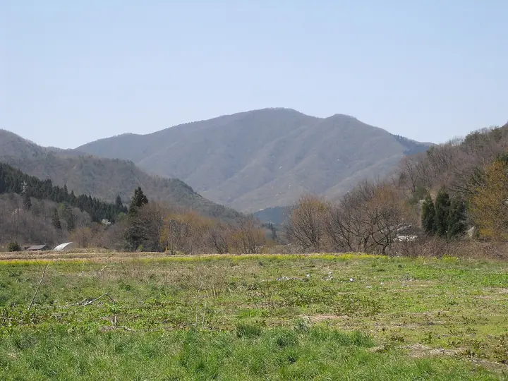
Mt. Ōyorogi is a 1,218 m peak on the border of Iinan Town (Shimane) and Shōbara City (Hiroshima), recorded as "Taka-yama" in the 8th-century Izumo-no-Kuni Fudoki. Designated as part of the Shimane Prefectural Forest (Tonbara–Yoshida District), its summit holds an enormous old beech locally called "Takobuna" amid an unbroken canopy of natural beech forest. Sanguinaria-related Sankayō blooms in May and golden-and-crimson foliage covers the slopes in autumn. Four maintained trails climb from the Iinan side: Takimi, Gongen, Keikoku, and the Dai-Kaidan course with the prefecture's longest 304-step stair from Kusa-tōge. Listed in Chūgoku 100 and other regional mountain guides.
Mt. Ōyorogi at a glance
- Weather: The most settled day in the next 7 days is Wed, November 4: clear, gusts up to 8 m/s.
Mt. Ōyorogi weather (hourly, 14 days)
Sunrise today 06:31, sunset 17:14
| Tue, 11/3 | Wed, 11/4 | Thu, 11/5 | Fri, 11/6 | Sat, 11/7 | Sun, 11/8 | Mon, 11/9 | Tue, 11/10 | Wed, 11/11 | Thu, 11/12 | Fri, 11/13 | Sat, 11/14 | Sun, 11/15 | Mon, 11/16 | Tue, 11/17 | |||||||||||||||||||||||||||||||||||||||||||||||||||||||||||||||||||||||
|---|---|---|---|---|---|---|---|---|---|---|---|---|---|---|---|---|---|---|---|---|---|---|---|---|---|---|---|---|---|---|---|---|---|---|---|---|---|---|---|---|---|---|---|---|---|---|---|---|---|---|---|---|---|---|---|---|---|---|---|---|---|---|---|---|---|---|---|---|---|---|---|---|---|---|---|---|---|---|---|---|---|---|---|---|---|
| Japan time | 15 | 17 | 19 | 21 | 23 | 1 | 3 | 5 | 7 | 9 | 11 | 13 | 15 | 18 | 21 | 0 | 3 | 6 | 9 | 12 | 15 | 18 | 21 | 0 | 3 | 6 | 9 | 12 | 15 | 18 | 21 | 0 | 3 | 6 | 9 | 12 | 15 | 18 | 21 | 0 | 3 | 6 | 9 | 12 | 15 | 18 | 21 | 0 | 3 | 6 | 9 | 15 | 21 | 3 | 9 | 15 | 21 | 3 | 9 | 15 | 21 | 3 | 9 | 15 | 21 | 3 | 9 | 15 | 21 | 3 | 9 | 15 | 21 | 3 | 9 | 15 | 21 | 3 | 9 | 15 | 21 | 3 | 9 | 15 | |
  | |   |   | | |   | |   |   | | | | | | | |   | |   | | | | | | |   | |   | | | | | | | | | |  | | | | | | | | | | | | | |   | | | | | | | | |   |  | | | | | | |  | | | | | | | | | | | | | | | ||
| Temperature | °C | 8° | 6° | 6° | 5° | 5° | 4° | 5° | 4° | 5° | 8° | 11° | 12° | 12° | 8° | 8° | 8° | 8° | 7° | 12° | 10° | 10° | 10° | 10° | 9° | 8° | 7° | 8° | 10° | 8° | 5° | 3° | 4° | 2° | 1° | 4° | 6° | 5° | 1° | 1° | 1° | 1° | 1° | 5° | 7° | 6° | 4° | 4° | 4° | 4° | 3° | 6° | 6° | 3° | 3° | 7° | 6° | 2° | -1° | 3° | 4° | 1° | 1° | 5° | 7° | 4° | 4° | 4° | 5° | 1° | 0° | 5° | 10° | 5° | 6° | 8° | 8° | 8° | 9° | 8° | 6° | 3° | 0° | 3° | 5° |
| Precipitation | mm | 0.5 | 0.5 | 0.1 | 0.5 | 3.9 | 4.3 | 2.3 | 5 | 2.9 | 0.4 | 0.3 | 0.5 | 0.5 | 1.8 | 0.2 | 1.2 | 0.2 | 1.2 | 1.1 | 0.1 | 0.6 | 0.1 | 0.2 | 9 | 16 | 1.4 | 2.8 | 3.3 | 2.2 | 0.1 | ||||||||||||||||||||||||||||||||||||||||||||||||||||||
| New snow | cm | ||||||||||||||||||||||||||||||||||||||||||||||||||||||||||||||||||||||||||||||||||||
| Snow depth | cm | 0 | 0 | 0 | 0 | 0 | 0 | 0 | 0 | 0 | 0 | 0 | 0 | 0 | 0 | 0 | 0 | 0 | 0 | 0 | 0 | 0 | 0 | 0 | 0 | 0 | 0 | 0 | 0 | 0 | 0 | 0 | 0 | 0 | 0 | 0 | 0 | 0 | 0 | 0 | 0 | 0 | 0 | 0 | 0 | 0 | 0 | 0 | 0 | 0 | 0 | 0 | 0 | 0 | 0 | 0 | 0 | 0 | 0 | 0 | 0 | 0 | 0 | 0 | 0 | 0 | 0 | 0 | 0 | 0 | 0 | 0 | 0 | 0 | 0 | 0 | 0 | 0 | 0 | 0 | 0 | 0 | 0 | 0 | 0 |
| Wind | m/s | 4 | 3 | 3 | 3 | 3 | 3 | 3 | 4 | 4 | 3 | 2 | 1 | 1 | 1 | 4 | 3 | 1 | 2 | 0 | 1 | 2 | 4 | 2 | 4 | 4 | 4 | 5 | 6 | 6 | 4 | 4 | 5 | 5 | 5 | 6 | 6 | 5 | 2 | 2 | 2 | 2 | 2 | 3 | 3 | 3 | 2 | 1 | 0 | 1 | 2 | 4 | 4 | 3 | 4 | 5 | 6 | 6 | 6 | 5 | 4 | 2 | 0 | 2 | 4 | 4 | 4 | 4 | 4 | 3 | 3 | 2 | 3 | 3 | 4 | 5 | 6 | 4 | 5 | 5 | 6 | 6 | 4 | 3 | 3 |
| Wind gusts | m/s | 10 | 10 | 8 | 7 | 7 | 7 | 7 | 8 | 8 | 8 | 7 | 7 | 5 | 4 | 9 | 10 | 7 | 4 | 3 | 6 | 5 | 9 | 11 | 9 | 9 | 10 | 12 | 14 | 14 | 13 | 10 | 11 | 12 | 12 | 15 | 15 | 14 | 11 | 5 | 5 | 4 | 4 | 7 | 9 | 8 | 7 | 3 | 2 | 3 | 5 | 9 | 10 | 10 | 9 | 12 | 14 | 15 | 16 | 13 | 11 | 9 | 4 | 6 | 11 | 10 | 10 | 11 | 12 | 10 | 7 | 7 | 9 | 9 | 10 | 12 | 16 | 21 | 10 | 11 | 14 | 14 | 12 | 9 | 9 |
| Wind dir. | ↓ | ↓ | ↓ | ↓ | ↓ | ↓ | ↓ | ↓ | ↓ | ↓ | ↓ | ↓ | ↓ | ↓ | ↓ | ↓ | ↓ | ↓ | ↓ | ↓ | ↓ | ↓ | ↓ | ↓ | ↓ | ↓ | ↓ | ↓ | ↓ | ↓ | ↓ | ↓ | ↓ | ↓ | ↓ | ↓ | ↓ | ↓ | ↓ | ↓ | ↓ | ↓ | ↓ | ↓ | ↓ | ↓ | ↓ | ↓ | ↓ | ↓ | ↓ | ↓ | ↓ | ↓ | ↓ | ↓ | ↓ | ↓ | ↓ | ↓ | ↓ | ↓ | ↓ | ↓ | ↓ | ↓ | ↓ | ↓ | ↓ | ↓ | ↓ | ↓ | ↓ | ↓ | ↓ | ↓ | ↓ | ↓ | ↓ | ↓ | ↓ | ↓ | ↓ | ↓ | |
Huts, campsites and lodging near Mt. Ōyorogi
Mountain huts
- 大万木山山頂避難小屋
Lists that include Mt. Ōyorogi
Chugoku 100 Famous Mountains · Hiroshima Prefecture 100 Famous Mountains · Elevations of 1003 Mountains of Japan · 1000 Mountains of Japan
Mt. Ōyorogi facts
- Also known as
- 多加山
- Elevation
- 1,218 m
- Location
- Iinan, Shimane / Shōbara-shi, Hiroshima
35.087586, 132.854533 - Website
- www.satoyamania.net
- Trail Map
- www1.pref.shimane.lg.jp (PDF)
- Wikipedia
- ja.wikipedia.org