
Mt. Nishi
西山
Miyawaka, Fukuoka · Elevation 645 m
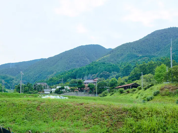
Mt. Nishi, also called Mt. Ayusaka, is a 644.6 m peak straddling the border between Yamaguchi district of Miyawaka City and Ono district of Koga City in Fukuoka Prefecture, and the main summit of the Inunaki Range. As the highest point of Koga City, it offers a 360-degree summit panorama spanning the Genkai Sea, the Onga district and Fukuoka City — with Iki and Tsushima Islands visible on clear days. The Inunaki Dam lies at the southern foot, and the mountain forms the source of the Inunaki River in the Onga River system. The standard route ascends from the Komono bus stop on the Koga side via Kiyotaki and Komono Pass, and a citizens' climb is held annually on the third Sunday of April. The peak is listed in the Fukuoka Mountain Guide.
Mt. Nishi at a glance
- Weather: The most settled day in the next 7 days is Sun, November 8: clear, gusts up to 7 m/s.
Mt. Nishi weather (hourly, 14 days)
Sunrise today 06:38, sunset 17:25
| Tue, 11/3 | Wed, 11/4 | Thu, 11/5 | Fri, 11/6 | Sat, 11/7 | Sun, 11/8 | Mon, 11/9 | Tue, 11/10 | Wed, 11/11 | Thu, 11/12 | Fri, 11/13 | Sat, 11/14 | Sun, 11/15 | Mon, 11/16 | Tue, 11/17 | |||||||||||||||||||||||||||||||||||||||||||||||||||||||||||||||||||||
|---|---|---|---|---|---|---|---|---|---|---|---|---|---|---|---|---|---|---|---|---|---|---|---|---|---|---|---|---|---|---|---|---|---|---|---|---|---|---|---|---|---|---|---|---|---|---|---|---|---|---|---|---|---|---|---|---|---|---|---|---|---|---|---|---|---|---|---|---|---|---|---|---|---|---|---|---|---|---|---|---|---|---|---|
| Japan time | 21 | 23 | 1 | 3 | 5 | 7 | 9 | 11 | 13 | 15 | 17 | 19 | 21 | 0 | 3 | 6 | 9 | 12 | 15 | 18 | 21 | 0 | 3 | 6 | 9 | 12 | 15 | 18 | 21 | 0 | 3 | 6 | 9 | 12 | 15 | 18 | 21 | 0 | 3 | 6 | 9 | 12 | 15 | 18 | 21 | 0 | 3 | 6 | 9 | 15 | 21 | 3 | 9 | 15 | 21 | 3 | 9 | 15 | 21 | 3 | 9 | 15 | 21 | 3 | 9 | 15 | 21 | 3 | 9 | 15 | 21 | 3 | 9 | 15 | 21 | 3 | 9 | 15 | 21 | 3 | 9 | 15 | |
  | | |   | |   | | |   | |   | |   | | | | |   | |   | | | |  |   |  | | | | | | | | | | | | | | | | | | | | | | | |   | | | | | |   | | |   |  | | | | | | | | | | | | | | | | | | | |   | | | ||
| Temperature | °C | 11° | 10° | 11° | 10° | 9° | 10° | 12° | 14° | 15° | 15° | 13° | 12° | 13° | 12° | 12° | 11° | 12° | 13° | 17° | 15° | 14° | 14° | 13° | 12° | 14° | 14° | 12° | 10° | 10° | 8° | 7° | 7° | 8° | 10° | 9° | 6° | 6° | 4° | 4° | 4° | 8° | 11° | 12° | 10° | 9° | 8° | 8° | 9° | 12° | 12° | 8° | 7° | 10° | 11° | 11° | 7° | 8° | 10° | 5° | 3° | 9° | 12° | 7° | 6° | 11° | 13° | 8° | 6° | 9° | 16° | 9° | 9° | 10° | 12° | 14° | 13° | 14° | 14° | 10° | 9° | 10° | 12° |
| Precipitation | mm | 0.3 | 0.2 | 1.3 | 15 | 6 | 0.8 | 0.6 | 0.4 | 0.2 | 0.2 | 0.1 | 0.2 | 0.3 | 0.6 | 1.0 | 0.7 | 0.1 | 0.6 | 8 | 20 | 6 | 0.5 | 0.5 | 0.2 | 0.3 | |||||||||||||||||||||||||||||||||||||||||||||||||||||||||
| New snow | cm | – | – | ||||||||||||||||||||||||||||||||||||||||||||||||||||||||||||||||||||||||||||||||
| Snow depth | cm | 0 | 0 | 0 | 0 | 0 | 0 | 0 | 0 | 0 | 0 | 0 | 0 | 0 | 0 | 0 | 0 | 0 | 0 | 0 | 0 | 0 | 0 | 0 | 0 | 0 | 0 | 0 | 0 | 0 | 0 | 0 | 0 | 0 | 0 | 0 | 0 | 0 | 0 | 0 | 0 | 0 | 0 | 0 | 0 | 0 | 0 | 0 | 0 | 0 | 0 | 0 | 0 | 0 | 0 | 0 | 0 | 0 | 0 | 0 | 0 | 0 | 0 | 0 | 0 | 0 | 0 | 0 | 0 | 0 | 0 | 0 | 0 | 0 | 0 | 0 | 0 | 0 | 0 | 0 | 0 | 0 | 0 |
| Wind | m/s | 2 | 1 | 2 | 2 | 2 | 2 | 2 | 4 | 4 | 3 | 2 | 2 | 4 | 3 | 2 | 2 | 3 | 2 | 4 | 4 | 2 | 4 | 4 | 4 | 6 | 6 | 6 | 6 | 6 | 6 | 6 | 6 | 5 | 4 | 3 | 1 | 1 | 1 | 2 | 2 | 2 | 2 | 3 | 2 | 1 | 1 | 1 | 1 | 2 | 3 | 2 | 1 | 4 | 5 | 5 | 4 | 4 | 3 | 1 | 2 | 2 | 3 | 0 | 2 | 2 | 4 | 2 | 2 | 3 | 2 | 2 | 2 | 3 | 3 | 2 | 3 | 4 | 5 | 5 | 3 | 3 | 3 |
| Wind gusts | m/s | 6 | 5 | 5 | 5 | 5 | 5 | 5 | 9 | 10 | 9 | 8 | 5 | 8 | 8 | 6 | 5 | 7 | 9 | 10 | 11 | 12 | 8 | 9 | 9 | 13 | 14 | 14 | 13 | 13 | 14 | 13 | 12 | 12 | 12 | 10 | 7 | 2 | 3 | 4 | 5 | 4 | 6 | 7 | 6 | 3 | 3 | 3 | 3 | 5 | 10 | 8 | 4 | 8 | 12 | 12 | 12 | 9 | 10 | 8 | 4 | 5 | 8 | 7 | 4 | 5 | 9 | 8 | 6 | 6 | 7 | 6 | 6 | 8 | 9 | 9 | 8 | 10 | 12 | 12 | 11 | 7 | 8 |
| Wind dir. | ↓ | ↓ | ↓ | ↓ | ↓ | ↓ | ↓ | ↓ | ↓ | ↓ | ↓ | ↓ | ↓ | ↓ | ↓ | ↓ | ↓ | ↓ | ↓ | ↓ | ↓ | ↓ | ↓ | ↓ | ↓ | ↓ | ↓ | ↓ | ↓ | ↓ | ↓ | ↓ | ↓ | ↓ | ↓ | ↓ | ↓ | ↓ | ↓ | ↓ | ↓ | ↓ | ↓ | ↓ | ↓ | ↓ | ↓ | ↓ | ↓ | ↓ | ↓ | ↓ | ↓ | ↓ | ↓ | ↓ | ↓ | ↓ | ↓ | ↓ | ↓ | ↓ | ↓ | ↓ | ↓ | ↓ | ↓ | ↓ | ↓ | ↓ | ↓ | ↓ | ↓ | ↓ | ↓ | ↓ | ↓ | ↓ | ↓ | ↓ | ↓ | ↓ | |
Huts, campsites and lodging near Mt. Nishi
Lodging
- 鬼王荘
Mt. Nishi facts
- Also known as
- 鮎坂山
- Elevation
- 645 m
- Location
- Miyawaka, Fukuoka
33.720391, 130.559244 - Website
- www.city.koga.fukuoka.jp
- Trail Map
- www.city.koga.fukuoka.jp
- Wikipedia
- ja.wikipedia.org