
Mt. Nemotosan
根本山
Sano, Tochigi / Midori, Gunma · Elevation 1,199 m
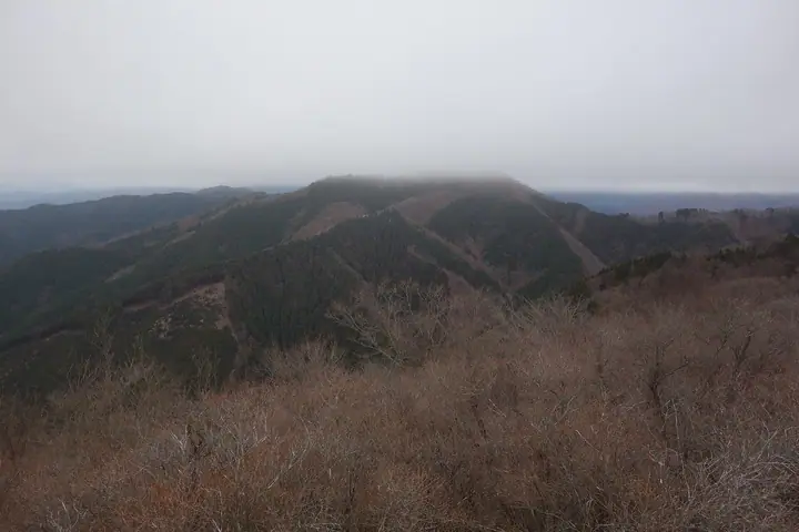
Mount Nemotosan (1,199 m) rises at the headwaters of the Kiryu River, straddling Kiryu and Midori (Gunma) and Sano (Tochigi). In the Edo period the mountain was the focus of the Nemoto-san Shinkō faith centered on the Bhaisajyaguru bodhisattva, drawing pilgrims from across the Kantō region, and chained passages and ladders to a cliff-edge inner shrine survive from that era. The peak appears on numerous selections including the Gunma 100, Kanto 100 and Tochigi 100 Mountains lists.
Mt. Nemotosan at a glance
- Weather: The most settled day in the next 7 days is Fri, November 6: clear, gusts up to 7 m/s. Sat, Nov 7: strong wind (gusts up to 17 m/s).
Mt. Nemotosan weather (hourly, 14 days)
Sunrise today 06:07, sunset 16:45
| Tue, 11/3 | Wed, 11/4 | Thu, 11/5 | Fri, 11/6 | Sat, 11/7 | Sun, 11/8 | Mon, 11/9 | Tue, 11/10 | Wed, 11/11 | Thu, 11/12 | Fri, 11/13 | Sat, 11/14 | Sun, 11/15 | Mon, 11/16 | Tue, 11/17 | |||||||||||||||||||||||||||||||||||||||||||||||||||||||||||||||||||||||
|---|---|---|---|---|---|---|---|---|---|---|---|---|---|---|---|---|---|---|---|---|---|---|---|---|---|---|---|---|---|---|---|---|---|---|---|---|---|---|---|---|---|---|---|---|---|---|---|---|---|---|---|---|---|---|---|---|---|---|---|---|---|---|---|---|---|---|---|---|---|---|---|---|---|---|---|---|---|---|---|---|---|---|---|---|---|
| Japan time | 15 | 17 | 19 | 21 | 23 | 1 | 3 | 5 | 7 | 9 | 11 | 13 | 15 | 18 | 21 | 0 | 3 | 6 | 9 | 12 | 15 | 18 | 21 | 0 | 3 | 6 | 9 | 12 | 15 | 18 | 21 | 0 | 3 | 6 | 9 | 12 | 15 | 18 | 21 | 0 | 3 | 6 | 9 | 12 | 15 | 18 | 21 | 0 | 3 | 6 | 9 | 15 | 21 | 3 | 9 | 15 | 21 | 3 | 9 | 15 | 21 | 3 | 9 | 15 | 21 | 3 | 9 | 15 | 21 | 3 | 9 | 15 | 21 | 3 | 9 | 15 | 21 | 3 | 9 | 15 | 21 | 3 | 9 | 15 | |
  |   |   |   | | |   | | | |   | |   | |   | | | |   | |   |   | | |  | |  | |   | | | | | | | | | | | | | | | | | | | | | | | | | | | | | |   | | |  | | | | | | | | | | | | | | | | | | | | | | | ||
| Temperature | °C | 12° | 7° | 6° | 5° | 6° | 3° | 4° | 3° | 4° | 8° | 10° | 10° | 8° | 6° | 6° | 6° | 7° | 8° | 10° | 14° | 12° | 9° | 7° | 7° | 7° | 8° | 14° | 17° | 16° | 9° | 7° | 6° | 5° | 4° | 6° | 7° | 5° | 2° | 2° | 2° | 1° | 0° | 7° | 10° | 8° | 3° | 2° | 3° | 3° | 3° | 4° | 6° | 4° | 2° | 3° | 6° | 2° | 0° | 4° | 5° | 1° | -1° | 5° | 6° | 2° | 0° | 8° | 7° | 0° | -3° | 3° | 5° | 0° | 0° | 7° | 9° | 7° | 7° | 13° | 12° | 5° | -1° | 3° | 5° |
| Precipitation | mm | 0.2 | 0.3 | 1.9 | 8 | 10 | 4.5 | 0.1 | 0.3 | 0.3 | 0.3 | 0.1 | 1.9 | 0.4 | 0.1 | 0.5 | 0.5 | 4.1 | 7 | ||||||||||||||||||||||||||||||||||||||||||||||||||||||||||||||||||
| New snow | cm | <.1 | |||||||||||||||||||||||||||||||||||||||||||||||||||||||||||||||||||||||||||||||||||
| Snow depth | cm | 0 | 0 | 0 | 0 | 0 | 0 | 0 | 0 | 0 | 0 | 0 | 0 | 0 | 0 | 0 | 0 | 0 | 0 | 0 | 0 | 0 | 0 | 0 | 0 | 0 | 0 | 0 | 0 | 0 | 0 | 0 | 0 | 0 | 0 | 0 | 0 | 0 | 0 | 0 | 0 | 0 | 0 | 0 | 0 | 0 | 0 | 0 | 0 | 0 | 0 | 0 | 0 | 0 | 0 | 0 | 0 | 0 | 0 | 0 | 0 | 0 | 0 | 0 | 0 | 0 | 0 | 0 | 0 | 0 | 0 | 0 | 0 | 0 | 0 | 0 | 0 | 0 | 0 | 0 | 0 | 0 | 0 | 0 | 0 |
| Wind | m/s | 0 | 1 | 1 | 2 | 2 | 1 | 1 | 1 | 0 | 1 | 2 | 3 | 2 | 1 | 1 | 2 | 2 | 3 | 2 | 1 | 1 | 1 | 1 | 0 | 1 | 0 | 1 | 2 | 1 | 1 | 3 | 5 | 4 | 5 | 5 | 6 | 6 | 5 | 6 | 5 | 4 | 2 | 2 | 1 | 2 | 1 | 2 | 1 | 1 | 0 | 1 | 2 | 0 | 1 | 1 | 2 | 1 | 1 | 3 | 2 | 1 | 1 | 1 | 2 | 1 | 2 | 1 | 2 | 1 | 1 | 1 | 2 | 1 | 0 | 1 | 1 | 0 | 0 | 1 | 5 | 2 | 1 | 1 | 2 |
| Wind gusts | m/s | 6 | 4 | 3 | 4 | 4 | 4 | 4 | 3 | 2 | 5 | 6 | 8 | 8 | 5 | 4 | 5 | 6 | 9 | 10 | 6 | 4 | 5 | 3 | 3 | 3 | 3 | 5 | 7 | 6 | 4 | 8 | 13 | 14 | 16 | 16 | 17 | 17 | 17 | 16 | 17 | 13 | 11 | 7 | 8 | 7 | 5 | 5 | 4 | 4 | 3 | 3 | 7 | 5 | 3 | 4 | 6 | 7 | 5 | 16 | 15 | 10 | 4 | 5 | 8 | 6 | 4 | 6 | 10 | 7 | 5 | 5 | 7 | 5 | 4 | 4 | 7 | 4 | 4 | 5 | 17 | 14 | 8 | 5 | 7 |
| Wind dir. | ↓ | ↓ | ↓ | ↓ | ↓ | ↓ | ↓ | ↓ | ↓ | ↓ | ↓ | ↓ | ↓ | ↓ | ↓ | ↓ | ↓ | ↓ | ↓ | ↓ | ↓ | ↓ | ↓ | ↓ | ↓ | ↓ | ↓ | ↓ | ↓ | ↓ | ↓ | ↓ | ↓ | ↓ | ↓ | ↓ | ↓ | ↓ | ↓ | ↓ | ↓ | ↓ | ↓ | ↓ | ↓ | ↓ | ↓ | ↓ | ↓ | ↓ | ↓ | ↓ | ↓ | ↓ | ↓ | ↓ | ↓ | ↓ | ↓ | ↓ | ↓ | ↓ | ↓ | ↓ | ↓ | ↓ | ↓ | ↓ | ↓ | ↓ | ↓ | ↓ | ↓ | ↓ | ↓ | ↓ | ↓ | ↓ | ↓ | ↓ | ↓ | ↓ | ↓ | ↓ | |
Lists that include Mt. Nemotosan
Kanto 100 Famous Mountains · Gunma 100 Famous Mountains · Tochigi 100 Famous Mountains · 1000 Mountains of Japan
Mt. Nemotosan facts
- Elevation
- 1,199 m
- Location
- Sano, Tochigi / Midori, Gunma
36.549707, 139.451083 - Website
- www.city.kiryu.lg.jp
- Trail Map
- www.city.kiryu.lg.jp (PDF)
- Wikipedia
- ja.wikipedia.org