
Mt. Kinoyama
亀山
Tatsuno, Hyogo · Elevation 458 m
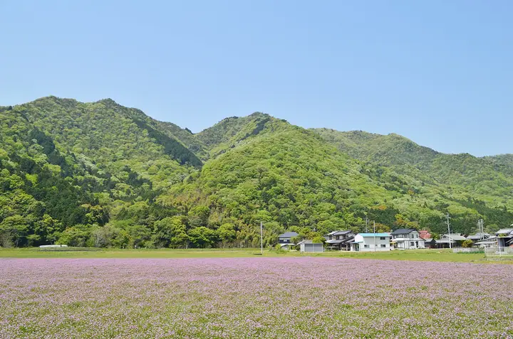
Mt. Kinoyama, 458 m, rises in the Shingū area of Tatsuno City in Hyōgo Prefecture, overlooking the right bank of the Ibo River. Its summit hosts Kinoyama Castle, a nationally designated historic site notable for combining an ancient mountain castle — said to have been built by the Yamato court after Japan's defeat at Baekgang (663 CE) and thought to be the oldest in Hyōgo — with a medieval castle developed from about 1352 by Akamatsu Norisuke. During the Kakitsu Rebellion of 1441, Akamatsu Mitsusuke took refuge here and ended his life along with sixty-nine of his clan when the fortress fell. A four-hour loop trail starts at Ochibe-nishi Park and is listed among the 'Nishiharima Yamajiro 11', offering wide views of the Harima Plain, the Ibo River and the Ie-shima Islands.
Mt. Kinoyama at a glance
- Weather: The most settled day in the next 7 days is Thu, November 5: cloudy, gusts up to 5 m/s.
Mt. Kinoyama weather (hourly, 14 days)
Sunrise today 06:24, sunset 17:07
| Tue, 11/3 | Wed, 11/4 | Thu, 11/5 | Fri, 11/6 | Sat, 11/7 | Sun, 11/8 | Mon, 11/9 | Tue, 11/10 | Wed, 11/11 | Thu, 11/12 | Fri, 11/13 | Sat, 11/14 | Sun, 11/15 | Mon, 11/16 | Tue, 11/17 | |||||||||||||||||||||||||||||||||||||||||||||||||||||||||||||||||||||||
|---|---|---|---|---|---|---|---|---|---|---|---|---|---|---|---|---|---|---|---|---|---|---|---|---|---|---|---|---|---|---|---|---|---|---|---|---|---|---|---|---|---|---|---|---|---|---|---|---|---|---|---|---|---|---|---|---|---|---|---|---|---|---|---|---|---|---|---|---|---|---|---|---|---|---|---|---|---|---|---|---|---|---|---|---|---|
| Japan time | 15 | 17 | 19 | 21 | 23 | 1 | 3 | 5 | 7 | 9 | 11 | 13 | 15 | 18 | 21 | 0 | 3 | 6 | 9 | 12 | 15 | 18 | 21 | 0 | 3 | 6 | 9 | 12 | 15 | 18 | 21 | 0 | 3 | 6 | 9 | 12 | 15 | 18 | 21 | 0 | 3 | 6 | 9 | 12 | 15 | 18 | 21 | 0 | 3 | 6 | 9 | 15 | 21 | 3 | 9 | 15 | 21 | 3 | 9 | 15 | 21 | 3 | 9 | 15 | 21 | 3 | 9 | 15 | 21 | 3 | 9 | 15 | 21 | 3 | 9 | 15 | 21 | 3 | 9 | 15 | 21 | 3 | 9 | 15 | |
  |   |   | | | | | |   | |  | | | |   |   | | | | | | |   |   | |  | | | | | | | | | | | | | | | | | | | | | | | | | | |   | | | | | | | | | | | |  | | | | | | | | | | | | | | |   | |  | | | ||
| Temperature | °C | 16° | 13° | 11° | 10° | 9° | 8° | 8° | 8° | 8° | 13° | 16° | 17° | 16° | 13° | 13° | 11° | 11° | 11° | 13° | 18° | 18° | 15° | 14° | 13° | 12° | 11° | 14° | 18° | 17° | 12° | 10° | 8° | 6° | 6° | 10° | 12° | 12° | 8° | 5° | 4° | 3° | 2° | 9° | 13° | 14° | 10° | 9° | 8° | 8° | 7° | 12° | 15° | 7° | 4° | 10° | 15° | 7° | 6° | 9° | 11° | 4° | 3° | 8° | 13° | 7° | 6° | 11° | 12° | 4° | 1° | 8° | 13° | 6° | 8° | 11° | 15° | 14° | 12° | 15° | 15° | 9° | 4° | 8° | 12° |
| Precipitation | mm | 0.5 | 1.0 | 0.3 | 2.2 | 0.1 | 0.3 | 0.4 | 0.4 | 0.7 | 6 | 3.1 | 0.1 | ||||||||||||||||||||||||||||||||||||||||||||||||||||||||||||||||||||||||
| New snow | cm | ||||||||||||||||||||||||||||||||||||||||||||||||||||||||||||||||||||||||||||||||||||
| Snow depth | cm | 0 | 0 | 0 | 0 | 0 | 0 | 0 | 0 | 0 | 0 | 0 | 0 | 0 | 0 | 0 | 0 | 0 | 0 | 0 | 0 | 0 | 0 | 0 | 0 | 0 | 0 | 0 | 0 | 0 | 0 | 0 | 0 | 0 | 0 | 0 | 0 | 0 | 0 | 0 | 0 | 0 | 0 | 0 | 0 | 0 | 0 | 0 | 0 | 0 | 0 | 0 | 0 | 0 | 0 | 0 | 0 | 0 | 0 | 0 | 0 | 0 | 0 | 0 | 0 | 0 | 0 | 0 | 0 | 0 | 0 | 0 | 0 | 0 | 0 | 0 | 0 | 0 | 0 | 0 | 0 | 0 | 0 | 0 | 0 |
| Wind | m/s | 2 | 2 | 3 | 2 | 2 | 2 | 2 | 2 | 1 | 2 | 3 | 3 | 3 | 2 | 3 | 4 | 2 | 1 | 0 | 1 | 1 | 1 | 1 | 2 | 3 | 2 | 2 | 4 | 5 | 4 | 3 | 3 | 2 | 3 | 4 | 5 | 5 | 2 | 1 | 2 | 2 | 2 | 1 | 1 | 1 | 3 | 1 | 1 | 2 | 2 | 1 | 3 | 1 | 2 | 3 | 4 | 3 | 4 | 3 | 5 | 1 | 2 | 1 | 1 | 3 | 3 | 3 | 4 | 1 | 2 | 1 | 2 | 1 | 2 | 2 | 3 | 2 | 1 | 3 | 5 | 4 | 1 | 1 | 3 |
| Wind gusts | m/s | 7 | 6 | 7 | 6 | 4 | 4 | 4 | 4 | 4 | 5 | 7 | 7 | 7 | 6 | 5 | 6 | 6 | 4 | 5 | 5 | 5 | 3 | 1 | 5 | 7 | 6 | 6 | 10 | 12 | 11 | 8 | 7 | 6 | 6 | 9 | 12 | 13 | 12 | 5 | 3 | 5 | 5 | 5 | 5 | 5 | 7 | 6 | 3 | 3 | 3 | 4 | 8 | 7 | 4 | 7 | 11 | 9 | 9 | 8 | 12 | 10 | 4 | 5 | 6 | 6 | 7 | 6 | 11 | 9 | 5 | 5 | 5 | 5 | 4 | 5 | 8 | 7 | 4 | 7 | 11 | 12 | 9 | 5 | 7 |
| Wind dir. | ↓ | ↓ | ↓ | ↓ | ↓ | ↓ | ↓ | ↓ | ↓ | ↓ | ↓ | ↓ | ↓ | ↓ | ↓ | ↓ | ↓ | ↓ | ↓ | ↓ | ↓ | ↓ | ↓ | ↓ | ↓ | ↓ | ↓ | ↓ | ↓ | ↓ | ↓ | ↓ | ↓ | ↓ | ↓ | ↓ | ↓ | ↓ | ↓ | ↓ | ↓ | ↓ | ↓ | ↓ | ↓ | ↓ | ↓ | ↓ | ↓ | ↓ | ↓ | ↓ | ↓ | ↓ | ↓ | ↓ | ↓ | ↓ | ↓ | ↓ | ↓ | ↓ | ↓ | ↓ | ↓ | ↓ | ↓ | ↓ | ↓ | ↓ | ↓ | ↓ | ↓ | ↓ | ↓ | ↓ | ↓ | ↓ | ↓ | ↓ | ↓ | ↓ | ↓ | ↓ | |
Huts, campsites and lodging near Mt. Kinoyama
Lodging
- たつの市国民宿舎 志んぐ荘
- 国民宿舎 赤とんぼ荘
- 梅玉旅館
Lists that include Mt. Kinoyama
Mt. Kinoyama facts
- Also known as
- 城山城跡
- Elevation
- 458 m
- Location
- Tatsuno, Hyogo
34.896614, 134.526252 - Website
- www.nishiharima.jp
- Trail Map
- www.nishiharima.jp
- Wikipedia
- ja.wikipedia.org