
Mt. Shosha
書写山
Himeji, Hyogo · Elevation 371 m
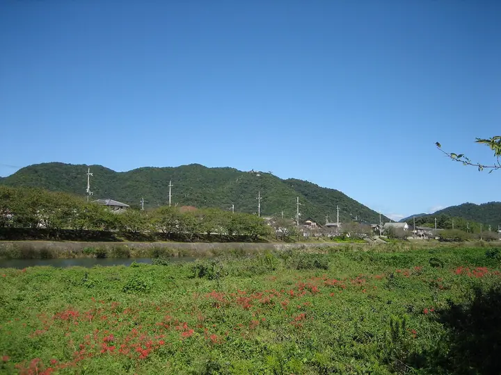
A 371 m peak on the western edge of Himeji City, Hyōgo, crowned by Shoshazan Engyō-ji, the Tendai mountain-temple founded in 966 by the monk Shōkū and ranked as the 27th of the Saikoku 33 pilgrimage temples. Sometimes called the "Hiei of the West" for its imposing dharma halls, the mountain also served as a location for the film *The Last Samurai*. A 781 m ropeway runs from the foot of the hill to the upper station, from which a 15–20 minute pilgrim path climbs through cedar forest to the Maniden and other halls. The peak appears in the Furusato Hyōgo 100 Yama list, among others.
Mt. Shosha at a glance
- Weather: The most settled day in the next 7 days is Thu, November 5: clear, gusts up to 4 m/s.
- Route: The shortest is Mount Shosha and Nenbi-zaka Junction Out-and-Back via Higashi-zaka: about 2 h 17 min, 5.8 km, about 410 m of climbing.
Mt. Shosha weather (hourly, 14 days)
Sunrise today 06:23, sunset 17:07
| Tue, 11/3 | Wed, 11/4 | Thu, 11/5 | Fri, 11/6 | Sat, 11/7 | Sun, 11/8 | Mon, 11/9 | Tue, 11/10 | Wed, 11/11 | Thu, 11/12 | Fri, 11/13 | Sat, 11/14 | Sun, 11/15 | Mon, 11/16 | Tue, 11/17 | |||||||||||||||||||||||||||||||||||||||||||||||||||||||||||||||||||||||
|---|---|---|---|---|---|---|---|---|---|---|---|---|---|---|---|---|---|---|---|---|---|---|---|---|---|---|---|---|---|---|---|---|---|---|---|---|---|---|---|---|---|---|---|---|---|---|---|---|---|---|---|---|---|---|---|---|---|---|---|---|---|---|---|---|---|---|---|---|---|---|---|---|---|---|---|---|---|---|---|---|---|---|---|---|---|
| Japan time | 21 | 23 | 1 | 3 | 5 | 7 | 9 | 11 | 13 | 15 | 17 | 19 | 21 | 0 | 3 | 6 | 9 | 12 | 15 | 18 | 21 | 0 | 3 | 6 | 9 | 12 | 15 | 18 | 21 | 0 | 3 | 6 | 9 | 12 | 15 | 18 | 21 | 0 | 3 | 6 | 9 | 12 | 15 | 18 | 21 | 0 | 3 | 6 | 9 | 12 | 15 | 21 | 3 | 9 | 15 | 21 | 3 | 9 | 15 | 21 | 3 | 9 | 15 | 21 | 3 | 9 | 15 | 21 | 3 | 9 | 15 | 21 | 3 | 9 | 15 | 21 | 3 | 9 | 15 | 21 | 3 | 9 | 15 | 21 | |
  | | | |   |   | |   | | | | |   |   |   |   | |   | | | | |  | |  | | | | | | | | | | | | | | | | | | | | | | | | |   | |   | | | | | | | | | | | |  | | | | | | | | | | |   | | | | | | | | |  | ||
| Temperature | °C | 11° | 10° | 9° | 9° | 10° | 10° | 14° | 16° | 16° | 16° | 14° | 13° | 14° | 13° | 12° | 12° | 15° | 18° | 18° | 15° | 15° | 14° | 12° | 11° | 15° | 18° | 17° | 13° | 10° | 8° | 7° | 6° | 11° | 13° | 12° | 9° | 6° | 5° | 4° | 4° | 9° | 12° | 12° | 9° | 8° | 8° | 8° | 8° | 11° | 16° | 16° | 8° | 5° | 11° | 15° | 8° | 7° | 9° | 12° | 5° | 4° | 9° | 13° | 8° | 7° | 12° | 12° | 5° | 3° | 8° | 14° | 7° | 8° | 12° | 16° | 15° | 13° | 15° | 16° | 9° | 5° | 9° | 12° | 7° |
| Precipitation | mm | 0.4 | 0.9 | 0.8 | 0.7 | 0.1 | 1.0 | 1.5 | 0.2 | 0.2 | 6 | 2.3 | 0.3 | ||||||||||||||||||||||||||||||||||||||||||||||||||||||||||||||||||||||||
| New snow | cm | ||||||||||||||||||||||||||||||||||||||||||||||||||||||||||||||||||||||||||||||||||||
| Snow depth | cm | 0 | 0 | 0 | 0 | 0 | 0 | 0 | 0 | 0 | 0 | 0 | 0 | 0 | 0 | 0 | 0 | 0 | 0 | 0 | 0 | 0 | 0 | 0 | 0 | 0 | 0 | 0 | 0 | 0 | 0 | 0 | 0 | 0 | 0 | 0 | 0 | 0 | 0 | 0 | 0 | 0 | 0 | 0 | 0 | 0 | 0 | 0 | 0 | 0 | 0 | 0 | 0 | 0 | 0 | 0 | 0 | 0 | 0 | 0 | 0 | 0 | 0 | 0 | 0 | 0 | 0 | 0 | 0 | 0 | 0 | 0 | 0 | 0 | 0 | 0 | 0 | 0 | 0 | 0 | 0 | 0 | 0 | 0 | 0 |
| Wind | m/s | 2 | 3 | 2 | 2 | 2 | 2 | 3 | 3 | 4 | 3 | 2 | 2 | 2 | 2 | 1 | 2 | 0 | 0 | 1 | 0 | 1 | 3 | 3 | 2 | 3 | 4 | 5 | 4 | 2 | 2 | 2 | 3 | 3 | 5 | 5 | 2 | 2 | 1 | 2 | 1 | 1 | 3 | 3 | 2 | 2 | 2 | 2 | 2 | 1 | 1 | 3 | 1 | 1 | 3 | 4 | 3 | 4 | 3 | 4 | 2 | 2 | 1 | 2 | 2 | 3 | 3 | 4 | 2 | 3 | 0 | 2 | 2 | 2 | 2 | 3 | 2 | 1 | 2 | 5 | 5 | 1 | 1 | 3 | 2 |
| Wind gusts | m/s | 7 | 5 | 5 | 5 | 5 | 5 | 6 | 8 | 8 | 8 | 7 | 5 | 6 | 6 | 6 | 5 | 4 | 4 | 4 | 4 | 2 | 6 | 7 | 6 | 7 | 10 | 13 | 11 | 8 | 5 | 4 | 5 | 8 | 13 | 13 | 13 | 5 | 3 | 4 | 4 | 4 | 9 | 8 | 8 | 4 | 3 | 3 | 3 | 4 | 5 | 8 | 7 | 3 | 7 | 11 | 9 | 9 | 7 | 12 | 10 | 4 | 4 | 7 | 6 | 6 | 7 | 12 | 9 | 5 | 5 | 5 | 5 | 4 | 5 | 8 | 7 | 5 | 6 | 12 | 12 | 10 | 5 | 8 | 9 |
| Wind dir. | ↓ | ↓ | ↓ | ↓ | ↓ | ↓ | ↓ | ↓ | ↓ | ↓ | ↓ | ↓ | ↓ | ↓ | ↓ | ↓ | ↓ | ↓ | ↓ | ↓ | ↓ | ↓ | ↓ | ↓ | ↓ | ↓ | ↓ | ↓ | ↓ | ↓ | ↓ | ↓ | ↓ | ↓ | ↓ | ↓ | ↓ | ↓ | ↓ | ↓ | ↓ | ↓ | ↓ | ↓ | ↓ | ↓ | ↓ | ↓ | ↓ | ↓ | ↓ | ↓ | ↓ | ↓ | ↓ | ↓ | ↓ | ↓ | ↓ | ↓ | ↓ | ↓ | ↓ | ↓ | ↓ | ↓ | ↓ | ↓ | ↓ | ↓ | ↓ | ↓ | ↓ | ↓ | ↓ | ↓ | ↓ | ↓ | ↓ | ↓ | ↓ | ↓ | ↓ | ↓ | |
Mt. Shosha hiking routes
- Mount Shosha and Nenbi-zaka Junction Out-and-Back via Higashi-zaka 5.8 km · Ascent 406 m Shosha-higashisaka (Bus stop) (parking)
- Mount Shosha and Engyōji Return via the Higashizaka Pilgrimage Path 6.4 km · Ascent 383 m 書写山ロープウェイ (Bus stop), Shosha (Aerialway station), Tamada-minamiguchi (Bus stop) (parking)
- Shoshazan Engyōji Return via the Katanadezaka Pilgrimage Trail 4.5 km · Ascent 341 m 刀出坂登山口, 刀出登山駐車場
- Mount Shosha Loop via Okishiozaka and Higashizaka 7.2 km · Ascent 382 m Tamada-minamiguchi (Bus stop), Shosha (Aerialway station), 書写山ロープウェイ (Bus stop) (parking) → 書写山ロープウェイ (Bus stop), Shosha (Aerialway station), Tamada-minamiguchi (Bus stop) (parking)
Hiking times are estimates calculated from the terrain.
Huts, campsites and lodging near Mt. Shosha
Campsites
- タロリン村
Lodging
- Newサンピア姫路ゆめさき
Lists that include Mt. Shosha
Illustrated Collection of Japan's Famous Mountains · 100 Mountains of Our Home Hyogo · Elevations of 1003 Mountains of Japan
Mt. Shosha facts
- Also known as
- 素盞山(すさざん)
- Elevation
- 371 m
- Location
- Himeji, Hyogo
34.892760, 134.656366 - Website
- www.city.himeji.lg.jp
- Access Information
- www.mt-shosha.info
- Wikipedia
- ja.wikipedia.org