
Mt. Hanao
花尾山
Nagato, Yamaguchi / Mine, Yamaguchi · Elevation 669 m
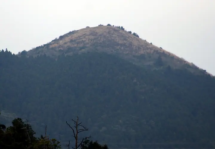
A 669-meter sacred peak straddling the boundary between Nagato City and Mine City in Yamaguchi Prefecture, historically a training ground for Shugendō ascetics with the Hanao Gongen shrine at its summit. It forms one of the watershed divides between the San'in and San'yō sides of western Honshu; the broad summit offers views over Akiyoshidai, the Sea of Japan, and on clear days the Seto Inland Sea and Kyushu's Kunisaki Peninsula. The most popular ascent is the Ichinō (Tatara) Course from the Nagato side, complemented by the Beppu Course from Mine. A first-class triangulation point sits on the summit, and the peak is included in the Chūgoku Hyakumeizan, Yamaguchi Hyakumeizan, and Bōchō Hyakuzan.
Mt. Hanao at a glance
- Weather: The most settled day in the next 7 days is Sun, November 8: clear, gusts up to 7 m/s. Fri, Nov 6: strong wind (gusts up to 15 m/s).
- Route: The shortest is Nagato Mount Hanao above Akiyoshidai and the Sea of Japan, Loop from Ichinoo: about 3 h 46 min, 6.9 km, about 570 m of climbing.
Mt. Hanao weather (hourly, 14 days)
Sunrise today 06:36, sunset 17:21
| Tue, 11/3 | Wed, 11/4 | Thu, 11/5 | Fri, 11/6 | Sat, 11/7 | Sun, 11/8 | Mon, 11/9 | Tue, 11/10 | Wed, 11/11 | Thu, 11/12 | Fri, 11/13 | Sat, 11/14 | Sun, 11/15 | Mon, 11/16 | Tue, 11/17 | |||||||||||||||||||||||||||||||||||||||||||||||||||||||||||||||||||||||
|---|---|---|---|---|---|---|---|---|---|---|---|---|---|---|---|---|---|---|---|---|---|---|---|---|---|---|---|---|---|---|---|---|---|---|---|---|---|---|---|---|---|---|---|---|---|---|---|---|---|---|---|---|---|---|---|---|---|---|---|---|---|---|---|---|---|---|---|---|---|---|---|---|---|---|---|---|---|---|---|---|---|---|---|---|---|
| Japan time | 15 | 17 | 19 | 21 | 23 | 1 | 3 | 5 | 7 | 9 | 11 | 13 | 15 | 18 | 21 | 0 | 3 | 6 | 9 | 12 | 15 | 18 | 21 | 0 | 3 | 6 | 9 | 12 | 15 | 18 | 21 | 0 | 3 | 6 | 9 | 12 | 15 | 18 | 21 | 0 | 3 | 6 | 9 | 12 | 15 | 18 | 21 | 0 | 3 | 6 | 9 | 15 | 21 | 3 | 9 | 15 | 21 | 3 | 9 | 15 | 21 | 3 | 9 | 15 | 21 | 3 | 9 | 15 | 21 | 3 | 9 | 15 | 21 | 3 | 9 | 15 | 21 | 3 | 9 | 15 | 21 | 3 | 9 | 15 | |
  | |   | | | | | |  | |   | | |   |   | | | | |   | |   | |   | | | | | |  | | | | | | | | | | | | | | | | | | | | |   | | | | | |   | |   | | |  | | | | |   | | | | | | | | | | | | | | | | | | ||
| Temperature | °C | 14° | 12° | 11° | 10° | 9° | 8° | 8° | 9° | 9° | 13° | 15° | 15° | 15° | 12° | 11° | 11° | 11° | 11° | 13° | 13° | 14° | 13° | 14° | 13° | 10° | 10° | 13° | 13° | 11° | 8° | 8° | 6° | 6° | 6° | 8° | 9° | 9° | 5° | 4° | 3° | 3° | 3° | 8° | 11° | 11° | 9° | 8° | 8° | 9° | 8° | 10° | 11° | 7° | 6° | 10° | 10° | 9° | 6° | 7° | 9° | 6° | 4° | 9° | 11° | 7° | 8° | 11° | 11° | 6° | 3° | 9° | 13° | 9° | 11° | 11° | 13° | 12° | 12° | 12° | 12° | 8° | 7° | 9° | 10° |
| Precipitation | mm | 0.2 | 0.2 | 3.9 | 2.9 | 1.1 | 3.1 | 0.5 | 0.2 | 0.1 | 0.1 | 1.6 | 0.9 | 0.4 | 0.8 | 0.2 | 0.1 | 1.8 | 18 | 8 | 0.5 | 1.3 | 1.1 | 1.3 | |||||||||||||||||||||||||||||||||||||||||||||||||||||||||||||
| New snow | cm | ||||||||||||||||||||||||||||||||||||||||||||||||||||||||||||||||||||||||||||||||||||
| Snow depth | cm | 0 | 0 | 0 | 0 | 0 | 0 | 0 | 0 | 0 | 0 | 0 | 0 | 0 | 0 | 0 | 0 | 0 | 0 | 0 | 0 | 0 | 0 | 0 | 0 | 0 | 0 | 0 | 0 | 0 | 0 | 0 | 0 | 0 | 0 | 0 | 0 | 0 | 0 | 0 | 0 | 0 | 0 | 0 | 0 | 0 | 0 | 0 | 0 | 0 | 0 | 0 | 0 | 0 | 0 | 0 | 0 | 0 | 0 | 0 | 0 | 0 | 0 | 0 | 0 | 0 | 0 | 0 | 0 | 0 | 0 | 0 | 0 | 0 | 0 | 0 | 0 | 0 | 0 | 0 | 0 | 0 | 0 | 0 | 0 |
| Wind | m/s | 5 | 3 | 3 | 3 | 2 | 3 | 3 | 3 | 3 | 2 | 2 | 1 | 1 | 0 | 3 | 3 | 2 | 1 | 2 | 3 | 6 | 4 | 3 | 4 | 5 | 5 | 6 | 7 | 6 | 5 | 6 | 6 | 6 | 6 | 5 | 5 | 4 | 2 | 1 | 1 | 2 | 2 | 2 | 2 | 3 | 2 | 0 | 0 | 2 | 3 | 4 | 4 | 2 | 2 | 4 | 6 | 6 | 7 | 4 | 4 | 1 | 0 | 1 | 3 | 2 | 2 | 3 | 4 | 3 | 1 | 1 | 3 | 3 | 5 | 6 | 6 | 2 | 5 | 5 | 5 | 6 | 4 | 3 | 4 |
| Wind gusts | m/s | 11 | 10 | 7 | 7 | 6 | 7 | 7 | 7 | 7 | 6 | 6 | 5 | 4 | 3 | 6 | 7 | 6 | 3 | 5 | 8 | 14 | 12 | 8 | 10 | 10 | 10 | 14 | 15 | 15 | 14 | 12 | 13 | 13 | 12 | 12 | 12 | 11 | 9 | 4 | 3 | 3 | 4 | 5 | 6 | 7 | 7 | 3 | 1 | 4 | 8 | 9 | 11 | 10 | 5 | 9 | 12 | 12 | 14 | 14 | 10 | 10 | 2 | 4 | 9 | 8 | 5 | 7 | 10 | 9 | 5 | 4 | 8 | 7 | 11 | 14 | 16 | 15 | 10 | 10 | 13 | 13 | 12 | 8 | 9 |
| Wind dir. | ↓ | ↓ | ↓ | ↓ | ↓ | ↓ | ↓ | ↓ | ↓ | ↓ | ↓ | ↓ | ↓ | ↓ | ↓ | ↓ | ↓ | ↓ | ↓ | ↓ | ↓ | ↓ | ↓ | ↓ | ↓ | ↓ | ↓ | ↓ | ↓ | ↓ | ↓ | ↓ | ↓ | ↓ | ↓ | ↓ | ↓ | ↓ | ↓ | ↓ | ↓ | ↓ | ↓ | ↓ | ↓ | ↓ | ↓ | ↓ | ↓ | ↓ | ↓ | ↓ | ↓ | ↓ | ↓ | ↓ | ↓ | ↓ | ↓ | ↓ | ↓ | ↓ | ↓ | ↓ | ↓ | ↓ | ↓ | ↓ | ↓ | ↓ | ↓ | ↓ | ↓ | ↓ | ↓ | ↓ | ↓ | ↓ | ↓ | ↓ | ↓ | ↓ | ↓ | ↓ | |
Mt. Hanao hiking routes
Hiking times are estimates calculated from the terrain.
Lists that include Mt. Hanao
Chugoku 100 Famous Mountains · Yamaguchi Prefecture 100 Famous Mountains · Elevations of 1003 Mountains of Japan
Mt. Hanao facts
- Elevation
- 669 m
- Location
- Nagato, Yamaguchi / Mine, Yamaguchi
34.283842, 131.221014 - Website
- yamaguchi-tourism.jp
- Trail Map
- www.japanecotrack.net (PDF)
- Access Information
- nanavi.jp
- Wikipedia
- ja.wikipedia.org