
Ryūgohō
龍護峰
Mine, Yamaguchi · Elevation 426 m
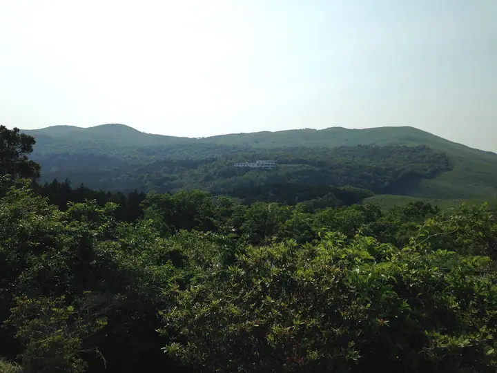
A 425.5-meter peak in Mine City, Yamaguchi Prefecture, and the highest summit of Akiyoshidai — Japan's largest karst plateau, within Akiyoshidai Quasi-National Park. The top carries a second-order triangulation point (named Akiyoshidai-yama) and looks out over a 360-degree panorama of pale limestone pinnacles scattered across open grassland. Akiyoshidai was designated a quasi-national park in 1955 and a Special Natural Monument in 1964; collection of plants, animals or stones is prohibited throughout the plateau, including the slopes of Ryūgohō. The Mine City Tourism Association maintains an advanced trekking circuit from Akiyoshidai Family Travel Village over Ryūgohō, Ohachi-yama and Nishi-no-Nishiyama (about 2 hours 15 minutes). Listed in the Chūgoku 100 Mountains, the Yamaguchi 100 Mountains, the Chūgoku-area 100 Mountains and the Bōchō Hyakuzan.
Ryūgohō at a glance
- Weather: The most settled day in the next 7 days is Sun, November 8: clear, gusts up to 7 m/s. Fri, Nov 6: strong wind (gusts up to 15 m/s).
Ryūgohō weather (hourly, 14 days)
Sunrise today 06:36, sunset 17:21
| Tue, 11/3 | Wed, 11/4 | Thu, 11/5 | Fri, 11/6 | Sat, 11/7 | Sun, 11/8 | Mon, 11/9 | Tue, 11/10 | Wed, 11/11 | Thu, 11/12 | Fri, 11/13 | Sat, 11/14 | Sun, 11/15 | Mon, 11/16 | Tue, 11/17 | |||||||||||||||||||||||||||||||||||||||||||||||||||||||||||||||||||||||
|---|---|---|---|---|---|---|---|---|---|---|---|---|---|---|---|---|---|---|---|---|---|---|---|---|---|---|---|---|---|---|---|---|---|---|---|---|---|---|---|---|---|---|---|---|---|---|---|---|---|---|---|---|---|---|---|---|---|---|---|---|---|---|---|---|---|---|---|---|---|---|---|---|---|---|---|---|---|---|---|---|---|---|---|---|---|
| Japan time | 15 | 17 | 19 | 21 | 23 | 1 | 3 | 5 | 7 | 9 | 11 | 13 | 15 | 18 | 21 | 0 | 3 | 6 | 9 | 12 | 15 | 18 | 21 | 0 | 3 | 6 | 9 | 12 | 15 | 18 | 21 | 0 | 3 | 6 | 9 | 12 | 15 | 18 | 21 | 0 | 3 | 6 | 9 | 12 | 15 | 18 | 21 | 0 | 3 | 6 | 9 | 15 | 21 | 3 | 9 | 15 | 21 | 3 | 9 | 15 | 21 | 3 | 9 | 15 | 21 | 3 | 9 | 15 | 21 | 3 | 9 | 15 | 21 | 3 | 9 | 15 | 21 | 3 | 9 | 15 | 21 | 3 | 9 | 15 | |
  | |   | | | | | |  | |   | | |   |   | | | | |   | |   | |   | | | | | |  | | | | | | | | | | | | | | | | | | | | |   | | | | | |   | |   | | |  | | | | |   | | | | | | | | | | | | | | | | | | ||
| Temperature | °C | 16° | 14° | 12° | 12° | 10° | 10° | 10° | 11° | 11° | 14° | 17° | 17° | 16° | 13° | 13° | 13° | 13° | 13° | 15° | 15° | 15° | 15° | 15° | 14° | 12° | 12° | 15° | 14° | 13° | 10° | 9° | 8° | 8° | 7° | 9° | 11° | 11° | 7° | 6° | 5° | 5° | 5° | 10° | 13° | 13° | 10° | 10° | 10° | 10° | 10° | 12° | 12° | 8° | 7° | 11° | 12° | 11° | 8° | 9° | 11° | 7° | 6° | 11° | 12° | 9° | 10° | 13° | 13° | 8° | 4° | 11° | 15° | 11° | 12° | 13° | 15° | 14° | 13° | 14° | 14° | 9° | 9° | 10° | 12° |
| Precipitation | mm | 0.2 | 0.2 | 3.9 | 2.9 | 1.1 | 3.1 | 0.5 | 0.2 | 0.1 | 0.1 | 1.6 | 0.9 | 0.4 | 0.8 | 0.2 | 0.1 | 1.8 | 18 | 8 | 0.5 | 1.3 | 1.1 | 1.3 | |||||||||||||||||||||||||||||||||||||||||||||||||||||||||||||
| New snow | cm | ||||||||||||||||||||||||||||||||||||||||||||||||||||||||||||||||||||||||||||||||||||
| Snow depth | cm | 0 | 0 | 0 | 0 | 0 | 0 | 0 | 0 | 0 | 0 | 0 | 0 | 0 | 0 | 0 | 0 | 0 | 0 | 0 | 0 | 0 | 0 | 0 | 0 | 0 | 0 | 0 | 0 | 0 | 0 | 0 | 0 | 0 | 0 | 0 | 0 | 0 | 0 | 0 | 0 | 0 | 0 | 0 | 0 | 0 | 0 | 0 | 0 | 0 | 0 | 0 | 0 | 0 | 0 | 0 | 0 | 0 | 0 | 0 | 0 | 0 | 0 | 0 | 0 | 0 | 0 | 0 | 0 | 0 | 0 | 0 | 0 | 0 | 0 | 0 | 0 | 0 | 0 | 0 | 0 | 0 | 0 | 0 | 0 |
| Wind | m/s | 5 | 3 | 3 | 3 | 2 | 3 | 3 | 3 | 3 | 2 | 2 | 1 | 1 | 0 | 3 | 3 | 2 | 1 | 2 | 3 | 6 | 4 | 3 | 4 | 5 | 5 | 6 | 7 | 6 | 5 | 6 | 6 | 6 | 6 | 5 | 5 | 4 | 2 | 1 | 1 | 2 | 2 | 2 | 2 | 3 | 2 | 0 | 0 | 2 | 3 | 4 | 4 | 2 | 2 | 4 | 6 | 6 | 7 | 4 | 4 | 1 | 0 | 1 | 3 | 2 | 2 | 3 | 4 | 3 | 1 | 1 | 3 | 3 | 5 | 6 | 6 | 2 | 5 | 5 | 5 | 6 | 4 | 3 | 4 |
| Wind gusts | m/s | 11 | 10 | 7 | 7 | 6 | 7 | 7 | 7 | 7 | 6 | 6 | 5 | 4 | 3 | 6 | 7 | 6 | 3 | 5 | 8 | 14 | 12 | 8 | 10 | 10 | 10 | 14 | 15 | 15 | 14 | 12 | 13 | 13 | 12 | 12 | 12 | 11 | 9 | 4 | 3 | 3 | 4 | 5 | 6 | 7 | 7 | 3 | 1 | 4 | 8 | 9 | 11 | 10 | 5 | 9 | 12 | 12 | 14 | 14 | 10 | 10 | 2 | 4 | 9 | 8 | 5 | 7 | 10 | 9 | 5 | 4 | 8 | 7 | 11 | 14 | 16 | 15 | 10 | 10 | 13 | 13 | 12 | 8 | 9 |
| Wind dir. | ↓ | ↓ | ↓ | ↓ | ↓ | ↓ | ↓ | ↓ | ↓ | ↓ | ↓ | ↓ | ↓ | ↓ | ↓ | ↓ | ↓ | ↓ | ↓ | ↓ | ↓ | ↓ | ↓ | ↓ | ↓ | ↓ | ↓ | ↓ | ↓ | ↓ | ↓ | ↓ | ↓ | ↓ | ↓ | ↓ | ↓ | ↓ | ↓ | ↓ | ↓ | ↓ | ↓ | ↓ | ↓ | ↓ | ↓ | ↓ | ↓ | ↓ | ↓ | ↓ | ↓ | ↓ | ↓ | ↓ | ↓ | ↓ | ↓ | ↓ | ↓ | ↓ | ↓ | ↓ | ↓ | ↓ | ↓ | ↓ | ↓ | ↓ | ↓ | ↓ | ↓ | ↓ | ↓ | ↓ | ↓ | ↓ | ↓ | ↓ | ↓ | ↓ | ↓ | ↓ | |
Huts, campsites and lodging near Ryūgohō
Campsites
- 秋吉台家族旅行村
Lodging
- 秋吉台ユースビレッジ
Lists that include Ryūgohō
Chugoku 100 Famous Mountains · Yamaguchi Prefecture 100 Famous Mountains
Ryūgohō facts
- Elevation
- 426 m
- Location
- Mine, Yamaguchi
34.233049, 131.280699 - National Park
- 秋吉台国定公園
- Website
- karusuto.com
- Trail Map
- karusuto.com (PDF)
- Wikipedia
- ja.wikipedia.org