
Mt. Babamedake
馬場目岳
Gojōme-machi, Akita / Akita, Akita · Elevation 1,037 m
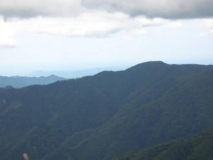
Mt. Babamedake is a 1,037.4 m peak on the boundary between Gojome Town in Minami-Akita District and Akita City, forming a horseshoe-shaped ridge with neighboring Mt. Taihei at the western end of the Taihei Mountain Range. It lies within Taiheizan Prefectural Natural Park, surrounded by the Nibune National Forest. A small Aizome-jinja shrine in a depression near the summit, dedicated to a guardian deity of horses, attests to its long association with the region's horse-breeding tradition. Four trails reach the summit — most commonly via the Asahimata trailhead — where a triangulation point and a 2005-rebuilt emergency hut command a 360-degree view. The peak is included in the Akita Prefecture mountains guidebook.
Mt. Babamedake at a glance
- Weather: The most settled day in the next 7 days is Mon, November 9: cloudy, gusts up to 9 m/s. Fri, Nov 6, Sat, Nov 7, Sun, Nov 8: strong wind (gusts up to 23 m/s).
Mt. Babamedake weather (hourly, 14 days)
Sunrise today 06:09, sunset 16:36
| Tue, 11/3 | Wed, 11/4 | Thu, 11/5 | Fri, 11/6 | Sat, 11/7 | Sun, 11/8 | Mon, 11/9 | Tue, 11/10 | Wed, 11/11 | Thu, 11/12 | Fri, 11/13 | Sat, 11/14 | Sun, 11/15 | Mon, 11/16 | Tue, 11/17 | |||||||||||||||||||||||||||||||||||||||||||||||||||||||||||||||||||||||
|---|---|---|---|---|---|---|---|---|---|---|---|---|---|---|---|---|---|---|---|---|---|---|---|---|---|---|---|---|---|---|---|---|---|---|---|---|---|---|---|---|---|---|---|---|---|---|---|---|---|---|---|---|---|---|---|---|---|---|---|---|---|---|---|---|---|---|---|---|---|---|---|---|---|---|---|---|---|---|---|---|---|---|---|---|---|
| Japan time | 15 | 17 | 19 | 21 | 23 | 1 | 3 | 5 | 7 | 9 | 11 | 13 | 15 | 18 | 21 | 0 | 3 | 6 | 9 | 12 | 15 | 18 | 21 | 0 | 3 | 6 | 9 | 12 | 15 | 18 | 21 | 0 | 3 | 6 | 9 | 12 | 15 | 18 | 21 | 0 | 3 | 6 | 9 | 12 | 15 | 18 | 21 | 0 | 3 | 6 | 9 | 15 | 21 | 3 | 9 | 15 | 21 | 3 | 9 | 15 | 21 | 3 | 9 | 15 | 21 | 3 | 9 | 15 | 21 | 3 | 9 | 15 | 21 | 3 | 9 | 15 | 21 | 3 | 9 | 15 | 21 | 3 | 9 | 15 | |
 |  |   | | |   |   | |   | | | | | | | | |   |   | |   |   | | | | | | | | | | |   | |   | | |   |   | | | |   |   | | | | | | | | | | | | | | | | | | | | | | | | | | | | |  | | | | | | | |   |   | | | ||
| Temperature | °C | 5° | 2° | 2° | 1° | 1° | 2° | 3° | 3° | 4° | 7° | 8° | 9° | 8° | 2° | 1° | 5° | 7° | 7° | 7° | 8° | 8° | 7° | 7° | 7° | 7° | 7° | 9° | 11° | 7° | 4° | 1° | 0° | -1° | -2° | 0° | 0° | 0° | -1° | -1° | -1° | -1° | -1° | 1° | 1° | 1° | 0° | 0° | -1° | 0° | -2° | 0° | 1° | -2° | -4° | 1° | 4° | -1° | 0° | 0° | 2° | -3° | -2° | 3° | 3° | 1° | 0° | 0° | 0° | -2° | -2° | 3° | 3° | -3° | -4° | 6° | 7° | 4° | 4° | 5° | 1° | -3° | -2° | 0° | 2° |
| Precipitation | mm | 0.6 | 2.1 | 2.0 | 0.4 | 1.0 | 1.1 | 2.7 | 1.5 | 0.4 | 1.0 | 5 | 4.9 | 0.7 | 2.4 | 0.5 | 0.6 | 0.7 | 0.9 | 1.9 | 0.8 | 0.2 | 0.1 | 0.2 | 0.6 | 3.0 | 8 | 3.7 | 0.1 | 1.0 | 5 | 2.0 | 4.5 | 1.0 | 4.8 | 3.0 | 0.1 | ||||||||||||||||||||||||||||||||||||||||||||||||
| New snow | cm | <.1 | <.1 | 0.4 | 1.4 | 0.3 | 0.1 | <.1 | <.1 | 0.5 | <.1 | <.1 | |||||||||||||||||||||||||||||||||||||||||||||||||||||||||||||||||||||||||
| Snow depth | cm | 0 | 0 | 0 | 0 | 0 | 0 | 0 | 0 | 0 | 0 | 0 | 0 | 0 | 0 | 0 | 0 | 0 | 0 | 0 | 0 | 0 | 0 | 0 | 0 | 0 | 0 | 0 | 0 | 0 | 0 | 0 | 0 | 0 | 0 | <1 | <1 | <1 | <1 | <1 | <1 | <1 | <1 | <1 | 0 | 0 | 0 | 0 | 0 | 0 | 0 | 0 | 0 | 0 | 0 | 0 | 0 | <1 | 0 | 0 | 0 | 0 | 0 | 0 | 0 | 0 | 0 | 0 | 0 | 0 | 0 | 0 | 0 | 0 | 0 | 0 | 0 | 0 | 0 | 0 | 0 | 0 | 0 | 0 | 0 |
| Wind | m/s | 5 | 3 | 3 | 0 | 3 | 3 | 5 | 3 | 3 | 4 | 3 | 3 | 1 | 1 | 3 | 4 | 5 | 5 | 6 | 4 | 2 | 2 | 1 | 1 | 2 | 2 | 3 | 6 | 5 | 4 | 5 | 5 | 5 | 6 | 8 | 9 | 8 | 7 | 7 | 6 | 6 | 6 | 7 | 7 | 7 | 4 | 4 | 3 | 3 | 1 | 3 | 4 | 2 | 2 | 2 | 3 | 7 | 4 | 4 | 4 | 2 | 1 | 2 | 4 | 1 | 2 | 5 | 5 | 2 | 1 | 1 | 2 | 1 | 2 | 2 | 2 | 3 | 2 | 2 | 6 | 4 | 2 | 0 | 2 |
| Wind gusts | m/s | 13 | 12 | 8 | 8 | 7 | 8 | 12 | 12 | 9 | 11 | 11 | 9 | 7 | 4 | 6 | 10 | 12 | 13 | 14 | 14 | 10 | 5 | 4 | 4 | 6 | 7 | 9 | 16 | 17 | 13 | 14 | 14 | 14 | 15 | 21 | 23 | 23 | 21 | 19 | 17 | 17 | 16 | 17 | 19 | 19 | 16 | 11 | 9 | 8 | 8 | 9 | 9 | 9 | 6 | 6 | 8 | 19 | 20 | 10 | 16 | 10 | 5 | 6 | 11 | 9 | 6 | 12 | 14 | 13 | 6 | 5 | 8 | 6 | 4 | 5 | 8 | 8 | 9 | 4 | 14 | 15 | 11 | 6 | 8 |
| Wind dir. | ↓ | ↓ | ↓ | ↓ | ↓ | ↓ | ↓ | ↓ | ↓ | ↓ | ↓ | ↓ | ↓ | ↓ | ↓ | ↓ | ↓ | ↓ | ↓ | ↓ | ↓ | ↓ | ↓ | ↓ | ↓ | ↓ | ↓ | ↓ | ↓ | ↓ | ↓ | ↓ | ↓ | ↓ | ↓ | ↓ | ↓ | ↓ | ↓ | ↓ | ↓ | ↓ | ↓ | ↓ | ↓ | ↓ | ↓ | ↓ | ↓ | ↓ | ↓ | ↓ | ↓ | ↓ | ↓ | ↓ | ↓ | ↓ | ↓ | ↓ | ↓ | ↓ | ↓ | ↓ | ↓ | ↓ | ↓ | ↓ | ↓ | ↓ | ↓ | ↓ | ↓ | ↓ | ↓ | ↓ | ↓ | ↓ | ↓ | ↓ | ↓ | ↓ | ↓ | ↓ | |
Mt. Babamedake facts
- Elevation
- 1,037 m
- Location
- Gojōme-machi, Akita / Akita, Akita
39.835218, 140.281747 - National Park
- 太平山県立自然公園
- Website
- www.city.akita.lg.jp
- Trail Map
- www.city.akita.lg.jp (PDF)
- Wikipedia
- ja.wikipedia.org