
Mount Takahara
高原山
Nikkō-shi, Tochigi / Shioya, Tochigi · Elevation 1,795 m
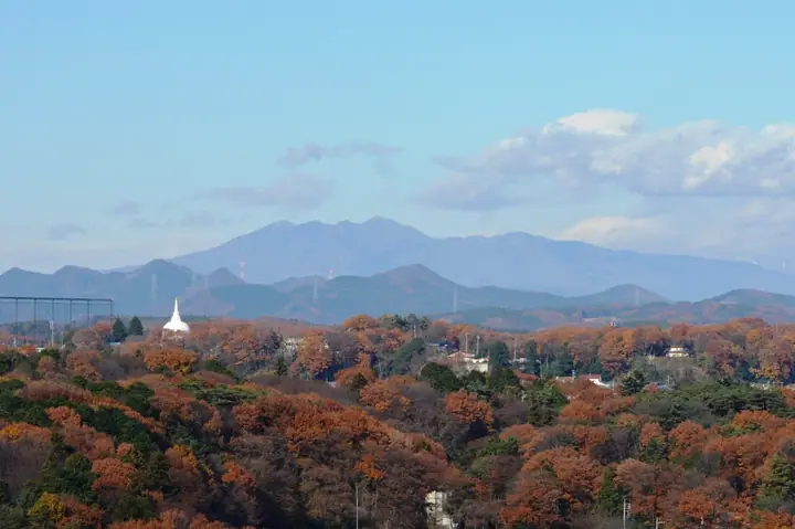
Mount Takahara is a volcanic complex spanning Shioya, Nikko, Yaita and Nasushiobara in Tochigi Prefecture. Its highest summit is Shakagatake at 1,795 m. It comprises the Shakagatake volcanic group to the south and the Shiobara volcanic group to the north, with its main peaks in Nikko National Park. Happogahara is famed for its colonies of Japanese azaleas, while the ridges have Rhododendron quinquefolium. Takaharayama Shrine on the summit is traditionally dated to 724.
Mount Takahara at a glance
- Weather: The most settled day in the next 7 days is Wed, November 4: clear, gusts up to 8 m/s. Sat, Nov 7: strong wind (gusts up to 16 m/s).
- Route: The shortest is Nikko Mount Keicho of the Takahara Group, Return from the Old Ski Area by the Marsh Junctions to the Summit Shrine: about 4 h 15 min, 7.6 km, about 540 m of climbing.
Mount Takahara weather (hourly, 14 days)
Sunrise today 06:06, sunset 16:43
| Tue, 11/3 | Wed, 11/4 | Thu, 11/5 | Fri, 11/6 | Sat, 11/7 | Sun, 11/8 | Mon, 11/9 | Tue, 11/10 | Wed, 11/11 | Thu, 11/12 | Fri, 11/13 | Sat, 11/14 | Sun, 11/15 | Mon, 11/16 | Tue, 11/17 | |||||||||||||||||||||||||||||||||||||||||||||||||||||||||||||||||||||||
|---|---|---|---|---|---|---|---|---|---|---|---|---|---|---|---|---|---|---|---|---|---|---|---|---|---|---|---|---|---|---|---|---|---|---|---|---|---|---|---|---|---|---|---|---|---|---|---|---|---|---|---|---|---|---|---|---|---|---|---|---|---|---|---|---|---|---|---|---|---|---|---|---|---|---|---|---|---|---|---|---|---|---|---|---|---|
| Japan time | 15 | 17 | 19 | 21 | 23 | 1 | 3 | 5 | 7 | 9 | 11 | 13 | 15 | 18 | 21 | 0 | 3 | 6 | 9 | 12 | 15 | 18 | 21 | 0 | 3 | 6 | 9 | 12 | 15 | 18 | 21 | 0 | 3 | 6 | 9 | 12 | 15 | 18 | 21 | 0 | 3 | 6 | 9 | 12 | 15 | 18 | 21 | 0 | 3 | 6 | 9 | 15 | 21 | 3 | 9 | 15 | 21 | 3 | 9 | 15 | 21 | 3 | 9 | 15 | 21 | 3 | 9 | 15 | 21 | 3 | 9 | 15 | 21 | 3 | 9 | 15 | 21 | 3 | 9 | 15 | 21 | 3 | 9 | 15 | |
  |   | |   | | |  | |  | | | |   |   | |   | | |   |   | | | | | | | |   | | | | | | | | | | | | | | | | | | | | | | | |   | | | | |   | |   | | | | | | | | | | |  | | | | | | | |   | | | | | | | ||
| Temperature | °C | 6° | 3° | 0° | -1° | 0° | -1° | -3° | -3° | -2° | 4° | 6° | 6° | 4° | 2° | 1° | 1° | 3° | 3° | 4° | 7° | 8° | 5° | 3° | 2° | 1° | 1° | 9° | 12° | 10° | 6° | 5° | 3° | 2° | 1° | 2° | 3° | 1° | -1° | -1° | -2° | -2° | -2° | 1° | 3° | 2° | -1° | -2° | -2° | -2° | -2° | 0° | 3° | -1° | -2° | 0° | 1° | -4° | -3° | -1° | 0° | -2° | -3° | 0° | 2° | -2° | -3° | 0° | -1° | -3° | -5° | -1° | 1° | -5° | -6° | 2° | 4° | 2° | 2° | 8° | 6° | -1° | -4° | -1° | 1° |
| Precipitation | mm | 0.7 | 9 | 9 | 6 | 0.7 | 0.2 | 0.5 | 0.1 | 0.3 | 0.2 | 0.2 | 0.2 | 1.7 | 0.8 | 0.3 | 1.0 | 3.8 | 10 | 0.6 | |||||||||||||||||||||||||||||||||||||||||||||||||||||||||||||||||
| New snow | cm | 0.2 | |||||||||||||||||||||||||||||||||||||||||||||||||||||||||||||||||||||||||||||||||||
| Snow depth | cm | 0 | 0 | 0 | 0 | 0 | 0 | 0 | 0 | 0 | 0 | 0 | 0 | 0 | 0 | 0 | 0 | 0 | 0 | 0 | 0 | 0 | 0 | 0 | 0 | 0 | 0 | 0 | 0 | 0 | 0 | 0 | 0 | 0 | 0 | 0 | 0 | 0 | 0 | 0 | 0 | 0 | 0 | 0 | 0 | 0 | 0 | 0 | 0 | 0 | 0 | 0 | 0 | 0 | 0 | 0 | 0 | 0 | 0 | 0 | 0 | 0 | 0 | 0 | 0 | 0 | 0 | 0 | 0 | 0 | 0 | 0 | 0 | 0 | 0 | 0 | 0 | 0 | 0 | 0 | 0 | 0 | 0 | 0 | 0 |
| Wind | m/s | 3 | 2 | 2 | 3 | 3 | 2 | 2 | 3 | 2 | 0 | 2 | 2 | 3 | 1 | 1 | 1 | 0 | 1 | 2 | 2 | 0 | 1 | 1 | 1 | 2 | 3 | 1 | 1 | 4 | 4 | 6 | 6 | 6 | 4 | 5 | 5 | 5 | 4 | 4 | 4 | 5 | 3 | 4 | 4 | 4 | 2 | 3 | 2 | 2 | 2 | 1 | 2 | 2 | 1 | 2 | 3 | 0 | 3 | 5 | 8 | 4 | 3 | 1 | 1 | 1 | 2 | 5 | 6 | 3 | 4 | 0 | 2 | 1 | 1 | 1 | 1 | 0 | 0 | 1 | 6 | 5 | 4 | 2 | 2 |
| Wind gusts | m/s | 11 | 9 | 7 | 7 | 7 | 7 | 6 | 7 | 7 | 5 | 6 | 7 | 8 | 8 | 5 | 6 | 6 | 4 | 4 | 6 | 4 | 5 | 4 | 4 | 6 | 8 | 9 | 8 | 11 | 11 | 17 | 17 | 18 | 18 | 14 | 16 | 16 | 15 | 13 | 13 | 16 | 15 | 13 | 14 | 13 | 13 | 8 | 8 | 5 | 7 | 6 | 7 | 6 | 6 | 7 | 9 | 9 | 10 | 16 | 24 | 24 | 12 | 9 | 7 | 6 | 5 | 15 | 19 | 17 | 12 | 11 | 7 | 5 | 4 | 4 | 7 | 5 | 5 | 6 | 17 | 20 | 17 | 12 | 7 |
| Wind dir. | ↓ | ↓ | ↓ | ↓ | ↓ | ↓ | ↓ | ↓ | ↓ | ↓ | ↓ | ↓ | ↓ | ↓ | ↓ | ↓ | ↓ | ↓ | ↓ | ↓ | ↓ | ↓ | ↓ | ↓ | ↓ | ↓ | ↓ | ↓ | ↓ | ↓ | ↓ | ↓ | ↓ | ↓ | ↓ | ↓ | ↓ | ↓ | ↓ | ↓ | ↓ | ↓ | ↓ | ↓ | ↓ | ↓ | ↓ | ↓ | ↓ | ↓ | ↓ | ↓ | ↓ | ↓ | ↓ | ↓ | ↓ | ↓ | ↓ | ↓ | ↓ | ↓ | ↓ | ↓ | ↓ | ↓ | ↓ | ↓ | ↓ | ↓ | ↓ | ↓ | ↓ | ↓ | ↓ | ↓ | ↓ | ↓ | ↓ | ↓ | ↓ | ↓ | ↓ | ↓ | |
Mount Takahara hiking routes
- Nikko Mount Keicho of the Takahara Group, Return from the Old Ski Area by the Marsh Junctions to the Summit Shrine 7.6 km · Ascent 537 m
- Takaharayama's Mount Shakagatake via Kengamine from Oomamadai 10.2 km · Ascent 804 m 大間々駐車場(見晴園地)
- Keichozan and Shakagatake via the Fujiwara Trailhead 9.9 km · Ascent 816 m parking
Hiking times are estimates calculated from the terrain.
Lists that include Mount Takahara
Japan's 300 Famous Mountains · Illustrated Collection of Japan's Famous Mountains · 100 Famous Hot Spring Mountains · Kanto 100 Famous Mountains · Tochigi 100 Famous Mountains · Elevations of 1003 Mountains of Japan · 1000 Mountains of Japan
Mount Takahara facts
- Also known as
- 釈迦ヶ岳
- Elevation
- 1,795 m
- Location
- Nikkō-shi, Tochigi / Shioya, Tochigi
36.900000, 139.776667 - National Park
- 日光国立公園
- Volcano
- Active volcano (高原山)
- Website
- www.city.yaita.tochigi.jp
- Trail Map
- www.city.yaita.tochigi.jp (PDF)
- Wikipedia
- ja.wikipedia.org