
Mount Sanbe
三瓶山
Ōda-shi, Shimane · Elevation 1,126 m
This active volcano is distinguished by peaks surrounding Muronouchi and grasslands maintained through controlled burning and grazing. At its foot are Sanbe Onsen and the Azukihara buried forest, where huge trees buried by an eruption are displayed. Trails from Kita-no-hara, Nishi-no-hara, Higashi-no-hara and other trailheads offer routes for different fitness levels.
Mount Sanbe at a glance
- Weather: The most settled day in the next 7 days is Wed, November 4: clear, gusts up to 8 m/s.
- Route: The shortest is Mount Osanbe Himenogaike Course Out-and-Back: about 3 h 8 min, 4.6 km, about 540 m of climbing.
Mount Sanbe weather (hourly, 14 days)
Sunrise today 06:32, sunset 17:14
| Tue, 11/3 | Wed, 11/4 | Thu, 11/5 | Fri, 11/6 | Sat, 11/7 | Sun, 11/8 | Mon, 11/9 | Tue, 11/10 | Wed, 11/11 | Thu, 11/12 | Fri, 11/13 | Sat, 11/14 | Sun, 11/15 | Mon, 11/16 | Tue, 11/17 | |||||||||||||||||||||||||||||||||||||||||||||||||||||||||||||||||||||||
|---|---|---|---|---|---|---|---|---|---|---|---|---|---|---|---|---|---|---|---|---|---|---|---|---|---|---|---|---|---|---|---|---|---|---|---|---|---|---|---|---|---|---|---|---|---|---|---|---|---|---|---|---|---|---|---|---|---|---|---|---|---|---|---|---|---|---|---|---|---|---|---|---|---|---|---|---|---|---|---|---|---|---|---|---|---|
| Japan time | 15 | 17 | 19 | 21 | 23 | 1 | 3 | 5 | 7 | 9 | 11 | 13 | 15 | 18 | 21 | 0 | 3 | 6 | 9 | 12 | 15 | 18 | 21 | 0 | 3 | 6 | 9 | 12 | 15 | 18 | 21 | 0 | 3 | 6 | 9 | 12 | 15 | 18 | 21 | 0 | 3 | 6 | 9 | 12 | 15 | 18 | 21 | 0 | 3 | 6 | 9 | 15 | 21 | 3 | 9 | 15 | 21 | 3 | 9 | 15 | 21 | 3 | 9 | 15 | 21 | 3 | 9 | 15 | 21 | 3 | 9 | 15 | 21 | 3 | 9 | 15 | 21 | 3 | 9 | 15 | 21 | 3 | 9 | 15 | |
  | |   | | | | | |  |   |   | | |   | |   | | |   | | |   | | |   | | | | | | | | | | | | | | | | | | | | | | | | | | | | | | |   | | |   | |   | | | | | | | | |  | | | | | | | | | | | | | | | ||
| Temperature | °C | 9° | 8° | 6° | 5° | 5° | 5° | 5° | 4° | 5° | 9° | 12° | 13° | 12° | 9° | 9° | 8° | 8° | 8° | 11° | 11° | 11° | 10° | 9° | 9° | 9° | 8° | 11° | 11° | 9° | 7° | 6° | 6° | 5° | 4° | 6° | 7° | 7° | 4° | 3° | 2° | 1° | 1° | 6° | 8° | 7° | 6° | 5° | 4° | 5° | 4° | 7° | 8° | 4° | 4° | 8° | 8° | 3° | 2° | 5° | 6° | 2° | 2° | 6° | 9° | 6° | 6° | 6° | 7° | 3° | 1° | 6° | 12° | 6° | 8° | 10° | 9° | 9° | 9° | 9° | 6° | 4° | 2° | 4° | 6° |
| Precipitation | mm | 1.6 | 0.5 | 0.1 | 0.5 | 2.6 | 4.9 | 4.0 | 3.6 | 3.5 | 0.5 | 0.2 | 0.3 | 2.2 | 0.2 | 0.2 | 0.9 | 0.3 | 1.2 | 0.3 | 0.2 | 0.9 | 6 | 19 | 3.2 | 5 | 3.3 | 0.9 | |||||||||||||||||||||||||||||||||||||||||||||||||||||||||
| New snow | cm | ||||||||||||||||||||||||||||||||||||||||||||||||||||||||||||||||||||||||||||||||||||
| Snow depth | cm | 0 | 0 | 0 | 0 | 0 | 0 | 0 | 0 | 0 | 0 | 0 | 0 | 0 | 0 | 0 | 0 | 0 | 0 | 0 | 0 | 0 | 0 | 0 | 0 | 0 | 0 | 0 | 0 | 0 | 0 | 0 | 0 | 0 | 0 | 0 | 0 | 0 | 0 | 0 | 0 | 0 | 0 | 0 | 0 | 0 | 0 | 0 | 0 | 0 | 0 | 0 | 0 | 0 | 0 | 0 | 0 | 0 | 0 | 0 | 0 | 0 | 0 | 0 | 0 | 0 | 0 | 0 | 0 | 0 | 0 | 0 | 0 | 0 | 0 | 0 | 0 | 0 | 0 | 0 | 0 | 0 | 0 | 0 | 0 |
| Wind | m/s | 4 | 2 | 2 | 2 | 2 | 2 | 3 | 3 | 3 | 3 | 3 | 2 | 3 | 1 | 3 | 2 | 2 | 1 | 1 | 1 | 2 | 1 | 1 | 1 | 4 | 4 | 6 | 6 | 6 | 5 | 4 | 6 | 5 | 5 | 5 | 5 | 4 | 2 | 1 | 1 | 1 | 1 | 1 | 3 | 3 | 2 | 2 | 0 | 0 | 1 | 2 | 4 | 2 | 3 | 3 | 5 | 5 | 5 | 3 | 3 | 1 | 2 | 2 | 5 | 2 | 4 | 4 | 4 | 2 | 3 | 1 | 2 | 4 | 5 | 6 | 6 | 5 | 3 | 3 | 6 | 4 | 3 | 3 | 2 |
| Wind gusts | m/s | 11 | 9 | 5 | 4 | 5 | 5 | 5 | 6 | 7 | 8 | 8 | 8 | 7 | 6 | 7 | 7 | 6 | 5 | 4 | 5 | 6 | 6 | 5 | 7 | 9 | 9 | 15 | 14 | 14 | 13 | 10 | 13 | 13 | 12 | 13 | 13 | 12 | 10 | 4 | 2 | 2 | 3 | 4 | 7 | 8 | 6 | 4 | 4 | 2 | 2 | 5 | 9 | 9 | 8 | 8 | 13 | 15 | 15 | 11 | 9 | 8 | 3 | 6 | 12 | 11 | 9 | 9 | 10 | 9 | 7 | 7 | 7 | 9 | 11 | 14 | 21 | 22 | 10 | 9 | 14 | 13 | 10 | 7 | 8 |
| Wind dir. | ↓ | ↓ | ↓ | ↓ | ↓ | ↓ | ↓ | ↓ | ↓ | ↓ | ↓ | ↓ | ↓ | ↓ | ↓ | ↓ | ↓ | ↓ | ↓ | ↓ | ↓ | ↓ | ↓ | ↓ | ↓ | ↓ | ↓ | ↓ | ↓ | ↓ | ↓ | ↓ | ↓ | ↓ | ↓ | ↓ | ↓ | ↓ | ↓ | ↓ | ↓ | ↓ | ↓ | ↓ | ↓ | ↓ | ↓ | ↓ | ↓ | ↓ | ↓ | ↓ | ↓ | ↓ | ↓ | ↓ | ↓ | ↓ | ↓ | ↓ | ↓ | ↓ | ↓ | ↓ | ↓ | ↓ | ↓ | ↓ | ↓ | ↓ | ↓ | ↓ | ↓ | ↓ | ↓ | ↓ | ↓ | ↓ | ↓ | ↓ | ↓ | ↓ | ↓ | ↓ | |
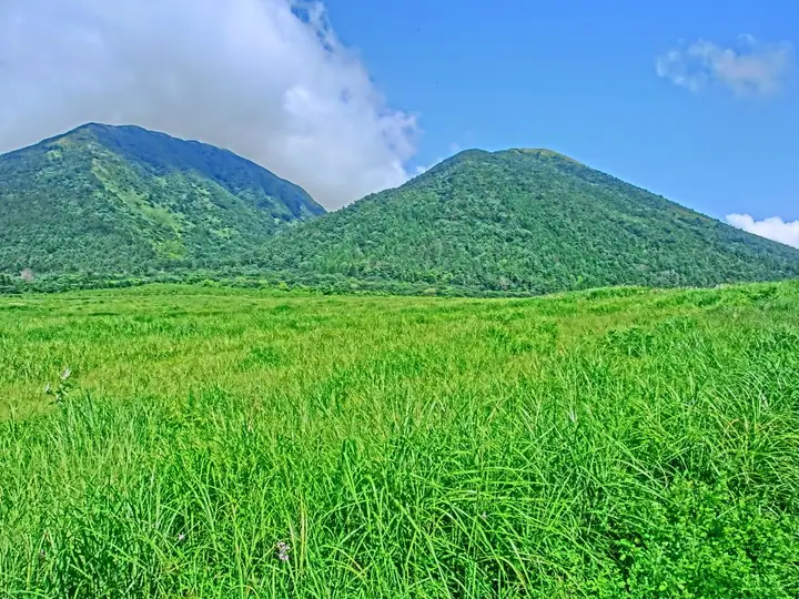
Mount Sanbe live cameras
Mount Sanbe hiking routes
- Mount Osanbe Himenogaike Course Out-and-Back 4.6 km · Ascent 539 m 姫逃池登山口 (parking)
- Mount Osanbe Out-and-Back via Nishinohara 6.0 km · Ascent 662 m 西の原登山口 (parking)
- Sanbe Caldera Rim Circuit from Higashi-no-hara 9.6 km · Ascent 924 m 三瓶観光リフト (Aerialway station) (parking)
Hiking times are estimates calculated from the terrain.
Huts, campsites and lodging near Mount Sanbe
Mountain huts
Campsites
- 三瓶山北の原キャンプ場
Lodging
- 国民宿舎さんべ荘
Mount Sanbe facts
- Also known as
- Sanbesan
- Elevation
- 1,126 m
- Location
- Ōda-shi, Shimane
35.140556, 132.621667 - Volcano
- Active volcano (三瓶山)
- Website
- chushikoku.env.go.jp
- Trail Map
- www.ginzan-wm.jp
- Wikipedia
- ja.wikipedia.org