
Mount Saihō
西方が岳
Mihama, Fukui / Tsuruga, Fukui · Elevation 764 m
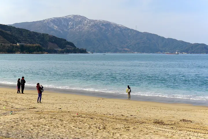
Mount Saihō (Saihōgatake, 764 m) rises on the boundary between Tsuruga City and Mihama Town on the Tsuruga Peninsula in Fukui Prefecture, forming the main ridge of the peninsula and one of the celebrated 'Tsuruga Three Mountains'. Unusually for Fukui it is built entirely of granite, weathered to alpine-white slabs that lend a rocky, climber-friendly character. The trail starts behind Jōgū Shrine at the peninsula's northern tip, and the Okuno-in overlook just thirty minutes up gives panoramic views over Tsuruga Bay and Mishima Island. It is listed on Japan's 100 Low Mountains and the Kinki Hyakumeizan.
Mount Saihō at a glance
- Weather: The most settled day in the next 7 days is Wed, November 4: clear, gusts up to 5 m/s.
- Route: The shortest is Tsuruga Peninsula Traverse from Jogu Shrine over Saihogadake and Kamoshikadai to Sazaegadake: about 5 h 25 min, 8.3 km, about 890 m of climbing.
Mount Saihō weather (hourly, 14 days)
Sunrise today 06:19, sunset 17:00
| Tue, 11/3 | Wed, 11/4 | Thu, 11/5 | Fri, 11/6 | Sat, 11/7 | Sun, 11/8 | Mon, 11/9 | Tue, 11/10 | Wed, 11/11 | Thu, 11/12 | Fri, 11/13 | Sat, 11/14 | Sun, 11/15 | Mon, 11/16 | Tue, 11/17 | |||||||||||||||||||||||||||||||||||||||||||||||||||||||||||||||||||||||
|---|---|---|---|---|---|---|---|---|---|---|---|---|---|---|---|---|---|---|---|---|---|---|---|---|---|---|---|---|---|---|---|---|---|---|---|---|---|---|---|---|---|---|---|---|---|---|---|---|---|---|---|---|---|---|---|---|---|---|---|---|---|---|---|---|---|---|---|---|---|---|---|---|---|---|---|---|---|---|---|---|---|---|---|---|---|
| Japan time | 15 | 17 | 19 | 21 | 23 | 1 | 3 | 5 | 7 | 9 | 11 | 13 | 15 | 18 | 21 | 0 | 3 | 6 | 9 | 12 | 15 | 18 | 21 | 0 | 3 | 6 | 9 | 12 | 15 | 18 | 21 | 0 | 3 | 6 | 9 | 12 | 15 | 18 | 21 | 0 | 3 | 6 | 9 | 12 | 15 | 18 | 21 | 0 | 3 | 6 | 9 | 15 | 21 | 3 | 9 | 15 | 21 | 3 | 9 | 15 | 21 | 3 | 9 | 15 | 21 | 3 | 9 | 15 | 21 | 3 | 9 | 15 | 21 | 3 | 9 | 15 | 21 | 3 | 9 | 15 | 21 | 3 | 9 | 15 | |
  |  |   | | | | | | |  | | | |   | |   | |   |   | |   | |   | | | |   | | | | | | | | | | | | | | | |   |   | |   | | | | | | | | | | | | | | | | | | | | | | |  | | | | | | | | | | | | | | | | ||
| Temperature | °C | 13° | 12° | 11° | 10° | 9° | 9° | 9° | 8° | 8° | 10° | 12° | 13° | 13° | 12° | 12° | 11° | 11° | 10° | 11° | 14° | 13° | 13° | 13° | 12° | 12° | 13° | 14° | 15° | 13° | 12° | 11° | 10° | 9° | 7° | 7° | 8° | 9° | 7° | 8° | 7° | 7° | 6° | 8° | 9° | 9° | 9° | 7° | 7° | 7° | 7° | 9° | 11° | 8° | 6° | 10° | 9° | 9° | 6° | 8° | 9° | 8° | 6° | 8° | 10° | 8° | 8° | 8° | 9° | 6° | 4° | 7° | 11° | 9° | 10° | 12° | 14° | 12° | 12° | 12° | 10° | 7° | 5° | 6° | 9° |
| Precipitation | mm | 0.6 | 2.5 | 1.4 | 2.5 | 0.1 | 0.3 | 0.1 | 0.3 | 6 | 0.6 | 6 | 0.2 | 1.7 | 0.5 | 0.6 | 0.3 | 0.5 | 1.3 | 1.4 | 0.8 | 0.1 | 0.5 | 0.5 | 0.9 | 0.7 | 3.2 | 11 | 8 | 0.5 | 0.2 | 4.5 | 1.2 | 0.1 | 4.9 | 6 | 2.7 | 1.5 | 0.1 | ||||||||||||||||||||||||||||||||||||||||||||||
| New snow | cm | ||||||||||||||||||||||||||||||||||||||||||||||||||||||||||||||||||||||||||||||||||||
| Snow depth | cm | 0 | 0 | 0 | 0 | 0 | 0 | 0 | 0 | 0 | 0 | 0 | 0 | 0 | 0 | 0 | 0 | 0 | 0 | 0 | 0 | 0 | 0 | 0 | 0 | 0 | 0 | 0 | 0 | 0 | 0 | 0 | 0 | 0 | 0 | 0 | 0 | 0 | 0 | 0 | 0 | 0 | 0 | 0 | 0 | 0 | 0 | 0 | 0 | 0 | 0 | 0 | 0 | 0 | 0 | 0 | 0 | 0 | 0 | 0 | 0 | 0 | 0 | 0 | 0 | 0 | 0 | 0 | 0 | 0 | 0 | 0 | 0 | 0 | 0 | 0 | 0 | 0 | 0 | 0 | 0 | 0 | 0 | 0 | 0 |
| Wind | m/s | 4 | 3 | 3 | 3 | 3 | 2 | 2 | 3 | 2 | 1 | 1 | 1 | 1 | 1 | 1 | 2 | 2 | 2 | 1 | 1 | 2 | 1 | 1 | 0 | 3 | 4 | 6 | 7 | 7 | 7 | 7 | 8 | 7 | 6 | 6 | 7 | 6 | 4 | 4 | 3 | 3 | 4 | 4 | 4 | 4 | 3 | 2 | 1 | 1 | 1 | 1 | 3 | 2 | 2 | 4 | 5 | 7 | 9 | 8 | 7 | 4 | 3 | 3 | 3 | 2 | 4 | 6 | 6 | 3 | 3 | 0 | 2 | 4 | 4 | 6 | 6 | 5 | 3 | 5 | 8 | 5 | 4 | 4 | 3 |
| Wind gusts | m/s | 7 | 6 | 5 | 5 | 5 | 5 | 5 | 5 | 5 | 4 | 4 | 3 | 3 | 3 | 3 | 3 | 5 | 4 | 5 | 3 | 4 | 3 | 3 | 3 | 6 | 8 | 9 | 10 | 11 | 12 | 10 | 11 | 12 | 11 | 10 | 11 | 10 | 10 | 8 | 7 | 6 | 6 | 7 | 7 | 7 | 7 | 6 | 5 | 3 | 3 | 3 | 7 | 6 | 5 | 7 | 9 | 11 | 15 | 14 | 12 | 11 | 7 | 6 | 5 | 5 | 7 | 9 | 10 | 10 | 6 | 5 | 5 | 6 | 8 | 9 | 10 | 10 | 9 | 8 | 13 | 13 | 8 | 7 | 6 |
| Wind dir. | ↓ | ↓ | ↓ | ↓ | ↓ | ↓ | ↓ | ↓ | ↓ | ↓ | ↓ | ↓ | ↓ | ↓ | ↓ | ↓ | ↓ | ↓ | ↓ | ↓ | ↓ | ↓ | ↓ | ↓ | ↓ | ↓ | ↓ | ↓ | ↓ | ↓ | ↓ | ↓ | ↓ | ↓ | ↓ | ↓ | ↓ | ↓ | ↓ | ↓ | ↓ | ↓ | ↓ | ↓ | ↓ | ↓ | ↓ | ↓ | ↓ | ↓ | ↓ | ↓ | ↓ | ↓ | ↓ | ↓ | ↓ | ↓ | ↓ | ↓ | ↓ | ↓ | ↓ | ↓ | ↓ | ↓ | ↓ | ↓ | ↓ | ↓ | ↓ | ↓ | ↓ | ↓ | ↓ | ↓ | ↓ | ↓ | ↓ | ↓ | ↓ | ↓ | ↓ | ↓ | |
Mount Saihō hiking routes
Hiking times are estimates calculated from the terrain.
Huts, campsites and lodging near Mount Saihō
Mountain huts
Campsites
- 丹生オートキャンプ場
- 水晶浜
Lodging
- Beach Comver
- 旅館中村屋
Lists that include Mount Saihō
Kinki 100 Famous Mountains · 100 Mountains of Hokuriku · 1000 Mountains of Japan
Mount Saihō facts
- Elevation
- 764 m
- Location
- Mihama, Fukui / Tsuruga, Fukui
35.710023, 136.010265 - Website
- www.fuku-e.com
- Wikipedia
- ja.wikipedia.org