
Mount Ōyama-Mitsumine
三峰山
Kiyokawa, Kanagawa · Elevation 935 m
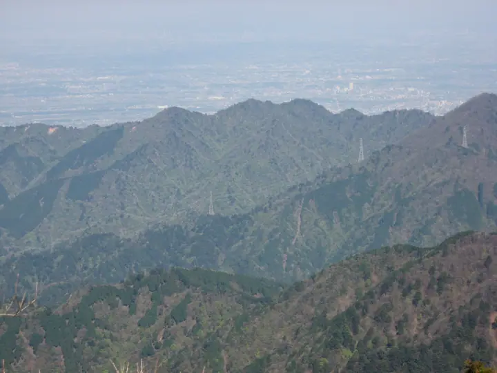
A 935 m peak in Kiyokawa Village, Kanagawa, lying within the eastern part of Tanzawa-Ōyama Quasi-National Park north of Mount Ōyama (1,252 m). Its name comes from three jagged rock summits along the ridge, linked by chained sections and exposed knife-edge traverses — a demanding hike despite the modest elevation. The Fudōjiri area at its northern foot is a famous mitsumata (paperbush) grove that draws many hikers in spring. Standard approaches are from Susugaya bus stop or Michi-no-eki Kiyokawa via Monomi Pass.
Mount Ōyama-Mitsumine at a glance
- Weather: The most settled day in the next 7 days is Fri, November 6: clear, gusts up to 7 m/s.
- Route: The shortest is Kiyokawa Oyama Mitsumine Loop from Susugaya over the Chained Knife Ridge and down to Fudojiri: about 7 h 1 min, 12.8 km, about 1,060 m of climbing.
Mount Ōyama-Mitsumine weather (hourly, 14 days)
Sunrise today 06:06, sunset 16:47
| Tue, 11/3 | Wed, 11/4 | Thu, 11/5 | Fri, 11/6 | Sat, 11/7 | Sun, 11/8 | Mon, 11/9 | Tue, 11/10 | Wed, 11/11 | Thu, 11/12 | Fri, 11/13 | Sat, 11/14 | Sun, 11/15 | Mon, 11/16 | Tue, 11/17 | |||||||||||||||||||||||||||||||||||||||||||||||||||||||||||||||||||||||
|---|---|---|---|---|---|---|---|---|---|---|---|---|---|---|---|---|---|---|---|---|---|---|---|---|---|---|---|---|---|---|---|---|---|---|---|---|---|---|---|---|---|---|---|---|---|---|---|---|---|---|---|---|---|---|---|---|---|---|---|---|---|---|---|---|---|---|---|---|---|---|---|---|---|---|---|---|---|---|---|---|---|---|---|---|---|
| Japan time | 15 | 17 | 19 | 21 | 23 | 1 | 3 | 5 | 7 | 9 | 11 | 13 | 15 | 18 | 21 | 0 | 3 | 6 | 9 | 12 | 15 | 18 | 21 | 0 | 3 | 6 | 9 | 12 | 15 | 18 | 21 | 0 | 3 | 6 | 9 | 12 | 15 | 18 | 21 | 0 | 3 | 6 | 9 | 12 | 15 | 18 | 21 | 0 | 3 | 6 | 9 | 15 | 21 | 3 | 9 | 15 | 21 | 3 | 9 | 15 | 21 | 3 | 9 | 15 | 21 | 3 | 9 | 15 | 21 | 3 | 9 | 15 | 21 | 3 | 9 | 15 | 21 | 3 | 9 | 15 | 21 | 3 | 9 | 15 | |
  |   |   | | | | | |   | | | | | | | | | | |   |   |   |   |   | | |  | | |  | | | | | | |   | | | | | | | | | | | | | | | | | | | | | | | |   |  | | | | | | | | | | | | | | | | |   | | |   | | | ||
| Temperature | °C | 12° | 10° | 9° | 9° | 9° | 8° | 8° | 8° | 7° | 8° | 9° | 9° | 8° | 7° | 7° | 7° | 8° | 9° | 11° | 15° | 14° | 11° | 10° | 8° | 8° | 8° | 14° | 17° | 16° | 11° | 11° | 10° | 9° | 6° | 10° | 11° | 11° | 8° | 5° | 5° | 4° | 4° | 8° | 10° | 9° | 7° | 6° | 6° | 6° | 5° | 6° | 8° | 6° | 4° | 6° | 8° | 4° | 5° | 8° | 11° | 3° | 1° | 7° | 8° | 6° | 3° | 10° | 9° | 3° | 2° | 4° | 7° | 5° | 4° | 9° | 12° | 10° | 9° | 13° | 16° | 7° | 5° | 5° | 6° |
| Precipitation | mm | 0.2 | 0.2 | 0.3 | 0.3 | 1.0 | 1.7 | 4.9 | 12 | 17 | 15 | 1.4 | 0.8 | 0.4 | 0.1 | 0.7 | 0.2 | 0.1 | 0.1 | 7 | 17 | 0.7 | 0.1 | ||||||||||||||||||||||||||||||||||||||||||||||||||||||||||||||
| New snow | cm | ||||||||||||||||||||||||||||||||||||||||||||||||||||||||||||||||||||||||||||||||||||
| Snow depth | cm | 0 | 0 | 0 | 0 | 0 | 0 | 0 | 0 | 0 | 0 | 0 | 0 | 0 | 0 | 0 | 0 | 0 | 0 | 0 | 0 | 0 | 0 | 0 | 0 | 0 | 0 | 0 | 0 | 0 | 0 | 0 | 0 | 0 | 0 | 0 | 0 | 0 | 0 | 0 | 0 | 0 | 0 | 0 | 0 | 0 | 0 | 0 | 0 | 0 | 0 | 0 | 0 | 0 | 0 | 0 | 0 | 0 | 0 | 0 | 0 | 0 | 0 | 0 | 0 | 0 | 0 | 0 | 0 | 0 | 0 | 0 | 0 | 0 | 0 | 0 | 0 | 0 | 0 | 0 | 0 | 0 | 0 | 0 | 0 |
| Wind | m/s | 2 | 1 | 1 | 1 | 2 | 2 | 2 | 2 | 2 | 2 | 2 | 2 | 2 | 3 | 3 | 3 | 4 | 4 | 4 | 3 | 1 | 1 | 1 | 1 | 1 | 1 | 0 | 2 | 2 | 1 | 1 | 1 | 1 | 1 | 1 | 2 | 2 | 2 | 1 | 1 | 1 | 1 | 1 | 1 | 2 | 1 | 0 | 1 | 2 | 2 | 2 | 2 | 2 | 2 | 2 | 2 | 1 | 0 | 1 | 2 | 2 | 1 | 1 | 2 | 1 | 2 | 1 | 2 | 1 | 1 | 1 | 2 | 1 | 0 | 1 | 3 | 1 | 0 | 1 | 2 | 2 | 2 | 2 | 2 |
| Wind gusts | m/s | 5 | 5 | 3 | 3 | 4 | 5 | 5 | 5 | 5 | 6 | 7 | 7 | 7 | 7 | 8 | 8 | 10 | 11 | 12 | 11 | 8 | 3 | 3 | 3 | 4 | 4 | 4 | 6 | 7 | 5 | 4 | 3 | 3 | 4 | 4 | 6 | 5 | 5 | 5 | 3 | 3 | 3 | 4 | 6 | 6 | 5 | 3 | 3 | 4 | 5 | 6 | 7 | 7 | 7 | 7 | 8 | 5 | 4 | 8 | 10 | 7 | 5 | 3 | 7 | 6 | 5 | 5 | 7 | 6 | 5 | 4 | 6 | 5 | 3 | 5 | 9 | 8 | 11 | 5 | 7 | 9 | 6 | 5 | 6 |
| Wind dir. | ↓ | ↓ | ↓ | ↓ | ↓ | ↓ | ↓ | ↓ | ↓ | ↓ | ↓ | ↓ | ↓ | ↓ | ↓ | ↓ | ↓ | ↓ | ↓ | ↓ | ↓ | ↓ | ↓ | ↓ | ↓ | ↓ | ↓ | ↓ | ↓ | ↓ | ↓ | ↓ | ↓ | ↓ | ↓ | ↓ | ↓ | ↓ | ↓ | ↓ | ↓ | ↓ | ↓ | ↓ | ↓ | ↓ | ↓ | ↓ | ↓ | ↓ | ↓ | ↓ | ↓ | ↓ | ↓ | ↓ | ↓ | ↓ | ↓ | ↓ | ↓ | ↓ | ↓ | ↓ | ↓ | ↓ | ↓ | ↓ | ↓ | ↓ | ↓ | ↓ | ↓ | ↓ | ↓ | ↓ | ↓ | ↓ | ↓ | ↓ | ↓ | ↓ | ↓ | ↓ | |
Mount Ōyama-Mitsumine hiking routes
Hiking times are estimates calculated from the terrain.
Huts, campsites and lodging near Mount Ōyama-Mitsumine
Mountain huts
Campsites
- 唐沢キャンプ場
- ふれあい広場
- けやきの広場
- すぎのき広場
- 国際一ノ瀬キャンプ場
Lodging
- 国民宿舎丹沢ホーム
- Gyokusuiro
- 宿泊棟C
- 宿泊棟D
- 宿泊棟B
Mount Ōyama-Mitsumine facts
- Also known as
- 大山三峰山
- Elevation
- 935 m
- Location
- Kiyokawa, Kanagawa
35.464694, 139.244757 - Website
- www.town.kiyokawa.kanagawa.jp
- Trail Map
- www.police.pref.kanagawa.jp (PDF)
- Wikipedia
- ja.wikipedia.org