
Mount Oohiei
比叡山
Otsu, Shiga · Elevation 848 m
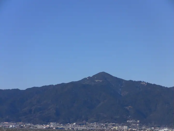
Mount Oohiei is the higher summit of Mount Hiei, at 848.3 m, rising on the border between western Otsu City in Shiga Prefecture and northeastern Sakyo Ward of Kyoto City. It forms the eastern peak of a twin-summited massif, paired with Shimei-ga-take (838 m) to the west. The mountain is the seat of Enryaku-ji, head temple of the Tendai school of Buddhism, registered as a component of the UNESCO World Heritage 'Historic Monuments of Ancient Kyoto.' The peak lies within Lake Biwa Quasi-National Park and is included in the 339 Mountains of Kyoto Prefecture guide.
Mount Oohiei at a glance
- Weather: The most settled day in the next 7 days is Wed, November 4: clear, gusts up to 7 m/s.
- Route: The shortest is Mount Hiei Traverse from Sakamoto-hieizanguchi to Shugakuin Station: about 4 h 27 min, 10.4 km, about 700 m of climbing.
Mount Oohiei weather (hourly, 14 days)
Sunrise today 06:19, sunset 17:02
| Tue, 11/3 | Wed, 11/4 | Thu, 11/5 | Fri, 11/6 | Sat, 11/7 | Sun, 11/8 | Mon, 11/9 | Tue, 11/10 | Wed, 11/11 | Thu, 11/12 | Fri, 11/13 | Sat, 11/14 | Sun, 11/15 | Mon, 11/16 | Tue, 11/17 | |||||||||||||||||||||||||||||||||||||||||||||||||||||||||||||||||||||||
|---|---|---|---|---|---|---|---|---|---|---|---|---|---|---|---|---|---|---|---|---|---|---|---|---|---|---|---|---|---|---|---|---|---|---|---|---|---|---|---|---|---|---|---|---|---|---|---|---|---|---|---|---|---|---|---|---|---|---|---|---|---|---|---|---|---|---|---|---|---|---|---|---|---|---|---|---|---|---|---|---|---|---|---|---|---|
| Japan time | 15 | 17 | 19 | 21 | 23 | 1 | 3 | 5 | 7 | 9 | 11 | 13 | 15 | 18 | 21 | 0 | 3 | 6 | 9 | 12 | 15 | 18 | 21 | 0 | 3 | 6 | 9 | 12 | 15 | 18 | 21 | 0 | 3 | 6 | 9 | 12 | 15 | 18 | 21 | 0 | 3 | 6 | 9 | 12 | 15 | 18 | 21 | 0 | 3 | 6 | 9 | 15 | 21 | 3 | 9 | 15 | 21 | 3 | 9 | 15 | 21 | 3 | 9 | 15 | 21 | 3 | 9 | 15 | 21 | 3 | 9 | 15 | 21 | 3 | 9 | 15 | 21 | 3 | 9 | 15 | 21 | 3 | 9 | 15 | |
  | |   | | | | | | | | | |   |   |   |   | |   |   | |  |  | | | | | | | | | | | | | | | | | | | | |   | | | | | | | | |   |   | | | |   | | | | |  | | | | | | | | | | | | | |   | | | | | | | | | ||
| Temperature | °C | 14° | 11° | 10° | 9° | 9° | 8° | 7° | 7° | 7° | 11° | 14° | 15° | 13° | 12° | 11° | 10° | 10° | 10° | 11° | 13° | 15° | 12° | 12° | 11° | 12° | 11° | 13° | 16° | 15° | 11° | 9° | 8° | 6° | 5° | 8° | 9° | 8° | 6° | 5° | 4° | 4° | 4° | 8° | 10° | 9° | 8° | 7° | 7° | 6° | 6° | 9° | 12° | 5° | 4° | 7° | 11° | 7° | 5° | 8° | 8° | 5° | 2° | 6° | 11° | 5° | 3° | 8° | 9° | 5° | 2° | 6° | 12° | 6° | 5° | 9° | 11° | 9° | 10° | 11° | 12° | 7° | 4° | 6° | 10° |
| Precipitation | mm | 5 | 7 | 2.2 | 1.1 | 0.3 | 0.5 | 0.2 | 0.2 | 0.1 | 0.5 | 0.5 | 3.2 | 3.4 | 0.3 | 0.2 | |||||||||||||||||||||||||||||||||||||||||||||||||||||||||||||||||||||
| New snow | cm | ||||||||||||||||||||||||||||||||||||||||||||||||||||||||||||||||||||||||||||||||||||
| Snow depth | cm | 0 | 0 | 0 | 0 | 0 | 0 | 0 | 0 | 0 | 0 | 0 | 0 | 0 | 0 | 0 | 0 | 0 | 0 | 0 | 0 | 0 | 0 | 0 | 0 | 0 | 0 | 0 | 0 | 0 | 0 | 0 | 0 | 0 | 0 | 0 | 0 | 0 | 0 | 0 | 0 | 0 | 0 | 0 | 0 | 0 | 0 | 0 | 0 | 0 | 0 | 0 | 0 | 0 | 0 | 0 | 0 | 0 | 0 | 0 | 0 | 0 | 0 | 0 | 0 | 0 | 0 | 0 | 0 | 0 | 0 | 0 | 0 | 0 | 0 | 0 | 0 | 0 | 0 | 0 | 0 | 0 | 0 | 0 | 0 |
| Wind | m/s | 3 | 2 | 1 | 0 | 1 | 1 | 1 | 0 | 0 | 1 | 2 | 2 | 2 | 2 | 1 | 1 | 2 | 2 | 1 | 1 | 1 | 1 | 1 | 1 | 1 | 1 | 4 | 4 | 5 | 4 | 3 | 3 | 2 | 2 | 5 | 5 | 4 | 2 | 1 | 1 | 1 | 0 | 1 | 4 | 2 | 1 | 1 | 0 | 0 | 1 | 1 | 3 | 1 | 1 | 1 | 4 | 4 | 3 | 4 | 5 | 1 | 1 | 1 | 1 | 1 | 1 | 2 | 4 | 0 | 0 | 0 | 0 | 1 | 1 | 2 | 2 | 2 | 0 | 1 | 5 | 3 | 1 | 1 | 2 |
| Wind gusts | m/s | 7 | 7 | 5 | 3 | 2 | 3 | 4 | 3 | 2 | 3 | 6 | 7 | 7 | 5 | 5 | 5 | 4 | 4 | 4 | 4 | 4 | 4 | 3 | 3 | 7 | 5 | 10 | 10 | 11 | 11 | 10 | 9 | 9 | 7 | 12 | 13 | 13 | 10 | 5 | 3 | 4 | 3 | 4 | 9 | 9 | 6 | 3 | 2 | 2 | 3 | 4 | 8 | 7 | 3 | 5 | 11 | 10 | 12 | 10 | 15 | 13 | 4 | 5 | 7 | 6 | 4 | 6 | 12 | 11 | 3 | 3 | 5 | 3 | 3 | 5 | 7 | 6 | 4 | 5 | 12 | 13 | 9 | 4 | 6 |
| Wind dir. | ↓ | ↓ | ↓ | ↓ | ↓ | ↓ | ↓ | ↓ | ↓ | ↓ | ↓ | ↓ | ↓ | ↓ | ↓ | ↓ | ↓ | ↓ | ↓ | ↓ | ↓ | ↓ | ↓ | ↓ | ↓ | ↓ | ↓ | ↓ | ↓ | ↓ | ↓ | ↓ | ↓ | ↓ | ↓ | ↓ | ↓ | ↓ | ↓ | ↓ | ↓ | ↓ | ↓ | ↓ | ↓ | ↓ | ↓ | ↓ | ↓ | ↓ | ↓ | ↓ | ↓ | ↓ | ↓ | ↓ | ↓ | ↓ | ↓ | ↓ | ↓ | ↓ | ↓ | ↓ | ↓ | ↓ | ↓ | ↓ | ↓ | ↓ | ↓ | ↓ | ↓ | ↓ | ↓ | ↓ | ↓ | ↓ | ↓ | ↓ | ↓ | ↓ | ↓ | ↓ | |
Mount Oohiei hiking routes
- Mount Hiei Traverse from Sakamoto-hieizanguchi to Shugakuin Station 10.4 km · Ascent 702 m Cable Sakamoto (Station), ケーブル坂本 (Bus stop) (parking) → Shugakuin Station (Bus stop), 修学院駅 (Station), Shugakuin (Station), Shugakuin-michi (Bus stop) (parking)
- Mount Hiei Traverse from Hieizan-Sakamoto to Shugakuin Station 11.3 km · Ascent 758 m Hieizan-Sakamoto (Station) (parking) → 修学院駅 (Station), Shugakuin (Station), Shugakuin Station (Bus stop), Shugakuin-michi (Bus stop), Matsugasakibashi (Bus stop)
Hiking times are estimates calculated from the terrain.
Huts, campsites and lodging near Mount Oohiei
Lodging
- Enryakuji Kaikan
- ロテルド比叡
- エクシブ京都 八瀬離宮
- Jonni's Place Guest House
- ユースホステル西教寺
Mount Oohiei facts
- Also known as
- 大比叡 · 都富士
- Elevation
- 848 m
- Location
- Otsu, Shiga
35.065806, 135.834419 - National Park
- 琵琶湖国定公園
- Website
- www.hieizan.gr.jp
- Trail Map
- www.hieizan.gr.jp (PDF)
- Access Information
- www.hieizan.or.jp
- Wikipedia
- ja.wikipedia.org