
Mount Kanuki
香貫山
Numazu, Shizuoka · Elevation 193 m
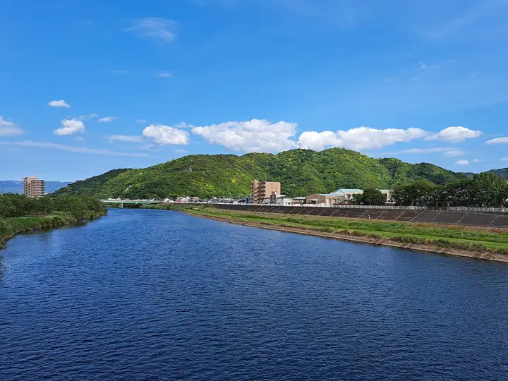
Mount Kanuki is a 193-metre hill in the south-eastern part of central Numazu City, Shizuoka Prefecture, jutting out over the confluence of the Kano River with Suruga Bay. It forms the northern terminus of the Numazu Alps traverse and is crowned by a five-storied memorial pagoda and an observation deck overlooking Mount Fuji, Suruga Bay, and the Izu Peninsula. The mountain is part of Numazu City's official Numazu Alps hiking course and features on multiple renowned lists including the Kantō Top 100 and the Shizuoka Bunken Guide.
Mount Kanuki at a glance
- Weather: The most settled day in the next 7 days is Sun, November 8: clear, gusts up to 8 m/s.
- Route: The shortest is Numazu Alps Full Traverse from Tabi to Kurose: about 6 h 25 min, 11.0 km, about 1,050 m of climbing.
Mount Kanuki weather (hourly, 14 days)
Sunrise today 06:07, sunset 16:50
| Tue, 11/3 | Wed, 11/4 | Thu, 11/5 | Fri, 11/6 | Sat, 11/7 | Sun, 11/8 | Mon, 11/9 | Tue, 11/10 | Wed, 11/11 | Thu, 11/12 | Fri, 11/13 | Sat, 11/14 | Sun, 11/15 | Mon, 11/16 | Tue, 11/17 | |||||||||||||||||||||||||||||||||||||||||||||||||||||||||||||||||||||||
|---|---|---|---|---|---|---|---|---|---|---|---|---|---|---|---|---|---|---|---|---|---|---|---|---|---|---|---|---|---|---|---|---|---|---|---|---|---|---|---|---|---|---|---|---|---|---|---|---|---|---|---|---|---|---|---|---|---|---|---|---|---|---|---|---|---|---|---|---|---|---|---|---|---|---|---|---|---|---|---|---|---|---|---|---|---|
| Japan time | 21 | 23 | 1 | 3 | 5 | 7 | 9 | 11 | 13 | 15 | 17 | 19 | 21 | 0 | 3 | 6 | 9 | 12 | 15 | 18 | 21 | 0 | 3 | 6 | 9 | 12 | 15 | 18 | 21 | 0 | 3 | 6 | 9 | 12 | 15 | 18 | 21 | 0 | 3 | 6 | 9 | 12 | 15 | 18 | 21 | 0 | 3 | 6 | 9 | 12 | 15 | 21 | 3 | 9 | 15 | 21 | 3 | 9 | 15 | 21 | 3 | 9 | 15 | 21 | 3 | 9 | 15 | 21 | 3 | 9 | 15 | 21 | 3 | 9 | 15 | 21 | 3 | 9 | 15 | 21 | 3 | 9 | 15 | 21 | |
  |   |   | | |   | | |   | |   | | | | | |   |   | | | | | |   | |  | |  | | | | | | | | | | | | | | | | | | | | | | | | | | |   | | | | | | | | | |   | | | | | | | | | | | | | | | | | | | | ||
| Temperature | °C | 14° | 14° | 14° | 15° | 14° | 14° | 14° | 14° | 15° | 13° | 12° | 12° | 13° | 13° | 13° | 14° | 17° | 20° | 20° | 17° | 15° | 15° | 17° | 18° | 20° | 21° | 22° | 19° | 16° | 13° | 13° | 12° | 16° | 18° | 18° | 15° | 12° | 11° | 11° | 10° | 14° | 16° | 15° | 13° | 13° | 11° | 10° | 10° | 11° | 13° | 14° | 12° | 11° | 13° | 14° | 11° | 12° | 12° | 15° | 9° | 8° | 12° | 12° | 11° | 10° | 13° | 16° | 10° | 9° | 11° | 13° | 10° | 9° | 13° | 15° | 14° | 16° | 18° | 22° | 15° | 11° | 11° | 12° | 11° |
| Precipitation | mm | 0.1 | 1.3 | 5 | 6 | 7 | 6 | 5 | 1.7 | 0.1 | 0.4 | 2.0 | 0.2 | 0.5 | 0.5 | 0.2 | 0.2 | 0.1 | 2.1 | 11 | 24 | 10 | |||||||||||||||||||||||||||||||||||||||||||||||||||||||||||||||
| New snow | cm | ||||||||||||||||||||||||||||||||||||||||||||||||||||||||||||||||||||||||||||||||||||
| Snow depth | cm | 0 | 0 | 0 | 0 | 0 | 0 | 0 | 0 | 0 | 0 | 0 | 0 | 0 | 0 | 0 | 0 | 0 | 0 | 0 | 0 | 0 | 0 | 0 | 0 | 0 | 0 | 0 | 0 | 0 | 0 | 0 | 0 | 0 | 0 | 0 | 0 | 0 | 0 | 0 | 0 | 0 | 0 | 0 | 0 | 0 | 0 | 0 | 0 | 0 | 0 | 0 | 0 | 0 | 0 | 0 | 0 | 0 | 0 | 0 | 0 | 0 | 0 | 0 | 0 | 0 | 0 | 0 | 0 | 0 | 0 | 0 | 0 | 0 | 0 | 0 | 0 | 0 | 0 | 0 | 0 | 0 | 0 | 0 | 0 |
| Wind | m/s | 2 | 3 | 2 | 3 | 4 | 4 | 5 | 5 | 5 | 5 | 5 | 4 | 4 | 3 | 3 | 3 | 2 | 1 | 0 | 2 | 1 | 1 | 4 | 5 | 1 | 3 | 3 | 4 | 3 | 2 | 3 | 3 | 3 | 2 | 4 | 3 | 2 | 3 | 3 | 3 | 3 | 2 | 4 | 4 | 4 | 4 | 3 | 3 | 4 | 4 | 5 | 4 | 4 | 5 | 4 | 2 | 4 | 1 | 1 | 2 | 3 | 3 | 1 | 2 | 2 | 1 | 2 | 4 | 4 | 4 | 2 | 2 | 1 | 1 | 1 | 1 | 1 | 4 | 2 | 3 | 5 | 5 | 5 | 4 |
| Wind gusts | m/s | 5 | 5 | 5 | 6 | 9 | 9 | 10 | 10 | 10 | 10 | 10 | 10 | 10 | 9 | 8 | 6 | 6 | 5 | 4 | 3 | 4 | 3 | 8 | 12 | 10 | 6 | 6 | 9 | 8 | 5 | 5 | 6 | 7 | 7 | 8 | 11 | 7 | 6 | 6 | 6 | 7 | 7 | 8 | 9 | 9 | 8 | 8 | 8 | 8 | 9 | 9 | 10 | 9 | 10 | 10 | 9 | 8 | 15 | 6 | 5 | 6 | 7 | 6 | 5 | 5 | 4 | 5 | 7 | 8 | 9 | 9 | 6 | 4 | 3 | 5 | 4 | 14 | 8 | 8 | 10 | 9 | 11 | 12 | 10 |
| Wind dir. | ↓ | ↓ | ↓ | ↓ | ↓ | ↓ | ↓ | ↓ | ↓ | ↓ | ↓ | ↓ | ↓ | ↓ | ↓ | ↓ | ↓ | ↓ | ↓ | ↓ | ↓ | ↓ | ↓ | ↓ | ↓ | ↓ | ↓ | ↓ | ↓ | ↓ | ↓ | ↓ | ↓ | ↓ | ↓ | ↓ | ↓ | ↓ | ↓ | ↓ | ↓ | ↓ | ↓ | ↓ | ↓ | ↓ | ↓ | ↓ | ↓ | ↓ | ↓ | ↓ | ↓ | ↓ | ↓ | ↓ | ↓ | ↓ | ↓ | ↓ | ↓ | ↓ | ↓ | ↓ | ↓ | ↓ | ↓ | ↓ | ↓ | ↓ | ↓ | ↓ | ↓ | ↓ | ↓ | ↓ | ↓ | ↓ | ↓ | ↓ | ↓ | ↓ | ↓ | ↓ | |
Mount Kanuki hiking routes
- Numazu Alps Full Traverse from Tabi to Kurose 11.0 km · Ascent 1,054 m 多比バス停 (Bus stop), Tabi (Bus stop) → 黒瀬バス停 (Bus stop), 黒瀬 (Bus stop)
- Numazu Alps Full Traverse 15.0 km · Ascent 1,270 m 沼津駅 (Bus stop), Numazu (Station), 沼津駅北口 (Bus stop), 上本町 (Bus stop), 大手町 (Bus stop) → 原木駅 (Station), Baraki (Station) (parking)
Hiking times are estimates calculated from the terrain.
Huts, campsites and lodging near Mount Kanuki
Lodging
- Axis 5 Bldg
- 沼津グランドホテル
- NUMAZU RIVERSIDE HOTEL
- ダイワロイネットホテル
- Sanco Inn
Lists that include Mount Kanuki
Mount Kanuki facts
- Elevation
- 193 m
- Location
- Numazu, Shizuoka
35.092252, 138.877594 - Website
- www.city.numazu.shizuoka.jp
- Wikipedia
- ja.wikipedia.org