
Mount Kamuishiri
神居尻山
Tobetsu, Hokkaido · Elevation 947 m
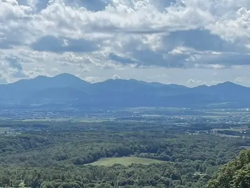
Mount Kamuishiri is a 946.7-meter peak in Hokkaido's Kabato Mountains, set in Tobetsu Town, Ishikari District. Together with Pinneshiri and Kumaneshiri it forms the "Kabato Three Mountains," and the name derives from the Ainu "kamuy-shir" meaning "divine mountain." The peak rises within the prefectural Domin-no-Mori recreation area's Kamuishiri district, which maintains three courses (A, B, and C) to the summit. Despite its modest elevation, it bears a notably rich alpine flora and is counted among the 100 famous mountains of Hokkaido.
Mount Kamuishiri at a glance
- Weather: The most settled day in the next 7 days is Thu, November 5: clear, gusts up to 8 m/s. Sat, Nov 7: strong wind (gusts up to 23 m/s).
- Route: The shortest is Mount Kamuishiri Circuit via Courses B and C: about 4 h 2 min, 6.3 km, about 710 m of climbing.
Mount Kamuishiri weather (hourly, 14 days)
Sunrise today 06:10, sunset 16:24
| Tue, 11/3 | Wed, 11/4 | Thu, 11/5 | Fri, 11/6 | Sat, 11/7 | Sun, 11/8 | Mon, 11/9 | Tue, 11/10 | Wed, 11/11 | Thu, 11/12 | Fri, 11/13 | Sat, 11/14 | Sun, 11/15 | Mon, 11/16 | Tue, 11/17 | |||||||||||||||||||||||||||||||||||||||||||||||||||||||||||||||||||||||
|---|---|---|---|---|---|---|---|---|---|---|---|---|---|---|---|---|---|---|---|---|---|---|---|---|---|---|---|---|---|---|---|---|---|---|---|---|---|---|---|---|---|---|---|---|---|---|---|---|---|---|---|---|---|---|---|---|---|---|---|---|---|---|---|---|---|---|---|---|---|---|---|---|---|---|---|---|---|---|---|---|---|---|---|---|---|
| Japan time | 21 | 23 | 1 | 3 | 5 | 7 | 9 | 11 | 13 | 15 | 17 | 19 | 21 | 0 | 3 | 6 | 9 | 12 | 15 | 18 | 21 | 0 | 3 | 6 | 9 | 12 | 15 | 18 | 21 | 0 | 3 | 6 | 9 | 12 | 15 | 18 | 21 | 0 | 3 | 6 | 9 | 12 | 15 | 18 | 21 | 0 | 3 | 6 | 9 | 12 | 15 | 21 | 3 | 9 | 15 | 21 | 3 | 9 | 15 | 21 | 3 | 9 | 15 | 21 | 3 | 9 | 15 | 21 | 3 | 9 | 15 | 21 | 3 | 9 | 15 | 21 | 3 | 9 | 15 | 21 | 3 | 9 | 15 | 21 | |
  |   | | |   |   | | |  | |  | | | |   | |   | | |   |   | | | |   |   | |   |   | | | |   | | | | | | | | | | | | | | | | |   | | | | | | | | | | |   | | | | |   | | | | | | | | | | | | |   | | | | | | ||
| Temperature | °C | -4° | -5° | -5° | -5° | -2° | -2° | -1° | 0° | 0° | -1° | -4° | -5° | -5° | -5° | -4° | -3° | 3° | 6° | 6° | 2° | 3° | 3° | 2° | 2° | 3° | 5° | 5° | 1° | -3° | -5° | -6° | -6° | -6° | -5° | -6° | -5° | -5° | -5° | -6° | -6° | -5° | -4° | -5° | -6° | -6° | -6° | -6° | -6° | -6° | -5° | -6° | -9° | -11° | -6° | -5° | -11° | -9° | -3° | -2° | -6° | -6° | -4° | -3° | -6° | -8° | -6° | -5° | -9° | -12° | -4° | -1° | -6° | -4° | -1° | 1° | 1° | 0° | -2° | -2° | -7° | -6° | -3° | -3° | -4° |
| Precipitation | mm | 2.0 | 2.3 | 1.0 | 2.8 | 1.2 | 0.6 | 4.0 | 3.1 | 3.4 | 5 | 2.4 | 0.7 | 2.2 | 1.3 | 1.6 | 1.8 | 2.0 | 2.0 | 1.2 | 1.0 | 1.2 | 1.1 | 1.3 | 1.4 | 1.4 | 0.8 | 0.6 | 0.4 | 0.1 | 0.1 | 0.1 | 0.9 | 1.0 | 0.3 | 0.2 | 0.7 | 0.5 | 0.3 | 0.2 | 1.1 | 2.2 | 0.3 | 0.6 | 0.3 | 1.7 | 0.5 | 2.3 | 1.4 | 6 | 3.5 | 1.5 | 0.2 | 0.1 | |||||||||||||||||||||||||||||||
| New snow | cm | 2.0 | 2.3 | 1.0 | 2.8 | 1.1 | <.1 | 1.4 | 1.8 | 2.0 | 2.0 | 1.3 | 1.0 | 1.1 | 1.1 | 1.3 | 1.4 | 1.5 | 0.8 | 0.6 | 0.3 | 0.1 | 0.1 | 0.1 | <.1 | <.1 | 0.9 | 1.1 | 0.4 | 0.2 | 0.7 | 0.5 | <.1 | 0.3 | 0.2 | <.1 | 1.1 | 2.1 | <.1 | 0.3 | 0.6 | 0.3 | 1.7 | <.1 | <.1 | 0.2 | 0.1 | ||||||||||||||||||||||||||||||||||||||
| Snow depth | cm | 0 | <1 | 2 | 4 | 4 | 4 | 4 | 4 | 3 | 3 | 3 | 3 | 3 | 3 | 3 | 2 | 2 | <1 | <1 | <1 | <1 | <1 | 0 | 0 | 0 | 0 | 0 | 0 | 0 | <1 | 2 | 4 | 5 | 6 | 6 | 7 | 7 | 8 | 9 | 9 | 10 | 11 | 11 | 12 | 12 | 12 | 12 | 12 | 12 | 12 | 11 | 11 | 12 | 12 | 12 | 12 | 12 | 12 | 11 | 11 | 11 | 12 | 13 | 13 | 13 | 13 | 13 | 14 | 14 | 14 | 13 | 13 | 13 | 12 | 9 | 7 | 5 | 4 | 4 | 4 | 4 | 4 | 4 | 4 |
| Wind | m/s | 1 | 2 | 2 | 2 | 5 | 5 | 5 | 4 | 3 | 2 | 2 | 2 | 2 | 1 | 2 | 2 | 2 | 3 | 1 | 0 | 0 | 0 | 1 | 1 | 1 | 2 | 4 | 8 | 7 | 7 | 7 | 8 | 8 | 9 | 9 | 9 | 8 | 8 | 8 | 6 | 6 | 6 | 4 | 3 | 3 | 3 | 3 | 4 | 2 | 5 | 4 | 2 | 1 | 1 | 1 | 1 | 2 | 1 | 0 | 2 | 1 | 2 | 4 | 3 | 2 | 3 | 3 | 1 | 0 | 1 | 2 | 1 | 1 | 3 | 3 | 2 | 1 | 1 | 3 | 2 | 2 | 2 | 3 | 1 |
| Wind gusts | m/s | 8 | 6 | 8 | 7 | 12 | 12 | 13 | 12 | 10 | 9 | 7 | 5 | 5 | 6 | 6 | 6 | 7 | 8 | 8 | 4 | 4 | 3 | 2 | 3 | 3 | 5 | 12 | 20 | 17 | 18 | 20 | 21 | 20 | 23 | 23 | 23 | 20 | 20 | 19 | 18 | 15 | 15 | 14 | 10 | 7 | 8 | 8 | 8 | 8 | 12 | 12 | 10 | 5 | 4 | 5 | 4 | 5 | 5 | 4 | 5 | 5 | 6 | 12 | 10 | 7 | 8 | 10 | 7 | 3 | 2 | 7 | 5 | 5 | 7 | 9 | 7 | 7 | 4 | 7 | 7 | 6 | 6 | 8 | 7 |
| Wind dir. | ↓ | ↓ | ↓ | ↓ | ↓ | ↓ | ↓ | ↓ | ↓ | ↓ | ↓ | ↓ | ↓ | ↓ | ↓ | ↓ | ↓ | ↓ | ↓ | ↓ | ↓ | ↓ | ↓ | ↓ | ↓ | ↓ | ↓ | ↓ | ↓ | ↓ | ↓ | ↓ | ↓ | ↓ | ↓ | ↓ | ↓ | ↓ | ↓ | ↓ | ↓ | ↓ | ↓ | ↓ | ↓ | ↓ | ↓ | ↓ | ↓ | ↓ | ↓ | ↓ | ↓ | ↓ | ↓ | ↓ | ↓ | ↓ | ↓ | ↓ | ↓ | ↓ | ↓ | ↓ | ↓ | ↓ | ↓ | ↓ | ↓ | ↓ | ↓ | ↓ | ↓ | ↓ | ↓ | ↓ | ↓ | ↓ | ↓ | ↓ | ↓ | ↓ | ↓ | ↓ | |
Mount Kamuishiri hiking routes
Hiking times are estimates calculated from the terrain.
Huts, campsites and lodging near Mount Kamuishiri
Mountain huts
Lists that include Mount Kamuishiri
Mount Kamuishiri facts
- Elevation
- 947 m
- Location
- Tobetsu, Hokkaido
43.500472, 141.662537 - Season Opens
- May 1
- Season Closes
- October 31
- Website
- dominno-mori.org
- Trail Map
- dominno-mori.org
- Access Information
- dominno-mori.org
- Wikipedia
- ja.wikipedia.org