
Mount Bonore
棒ノ嶺(棒ノ折山)
Hannō, Saitama · Elevation 969 m
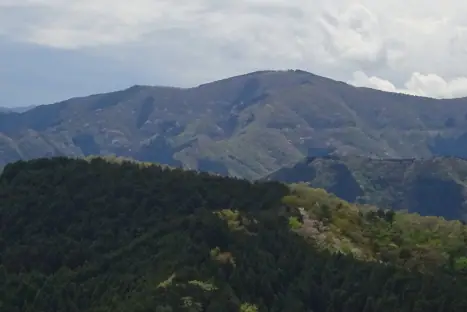
Mount Bonore, also called Mount Bonoreshi, is a 969 m peak on the border between Hanno City in Saitama and Okutama Town in western Tokyo, at the meeting point of the Okumusashi and Okutama mountain areas. Its broad, grassland-like summit offers views as far as Mount Tsukuba and the Nikko range, and the steep Shiratani-zawa approach climbs a chert gorge fitted with chains. Local tradition holds that the Kamakura-period warrior Hatakeyama Shigetada snapped his stone staff here, giving the mountain its name. The peak sits on the Saitama section of the Kanto Fureai-no-Michi (Mizugen-no-Michi route) and is listed in the 100 Famous Mountains of Kanto, Kanto 100 and 100 Low Mountains of Japan, among many other selections.
Mount Bonore at a glance
- Weather: The most settled day in the next 7 days is Wed, November 4: cloudy, gusts up to 5 m/s.
- Route: The shortest is Mount Bonoore Circuit via Shiratanizawa and the Northeast Ridge: about 4 h 3 min, 5.9 km, about 700 m of climbing.
Mount Bonore weather (hourly, 14 days)
Sunrise today 06:07, sunset 16:47
| Tue, 11/3 | Wed, 11/4 | Thu, 11/5 | Fri, 11/6 | Sat, 11/7 | Sun, 11/8 | Mon, 11/9 | Tue, 11/10 | Wed, 11/11 | Thu, 11/12 | Fri, 11/13 | Sat, 11/14 | Sun, 11/15 | Mon, 11/16 | Tue, 11/17 | |||||||||||||||||||||||||||||||||||||||||||||||||||||||||||||||||||||||
|---|---|---|---|---|---|---|---|---|---|---|---|---|---|---|---|---|---|---|---|---|---|---|---|---|---|---|---|---|---|---|---|---|---|---|---|---|---|---|---|---|---|---|---|---|---|---|---|---|---|---|---|---|---|---|---|---|---|---|---|---|---|---|---|---|---|---|---|---|---|---|---|---|---|---|---|---|---|---|---|---|---|---|---|---|---|
| Japan time | 15 | 17 | 19 | 21 | 23 | 1 | 3 | 5 | 7 | 9 | 11 | 13 | 15 | 18 | 21 | 0 | 3 | 6 | 9 | 12 | 15 | 18 | 21 | 0 | 3 | 6 | 9 | 12 | 15 | 18 | 21 | 0 | 3 | 6 | 9 | 12 | 15 | 18 | 21 | 0 | 3 | 6 | 9 | 12 | 15 | 18 | 21 | 0 | 3 | 6 | 9 | 15 | 21 | 3 | 9 | 15 | 21 | 3 | 9 | 15 | 21 | 3 | 9 | 15 | 21 | 3 | 9 | 15 | 21 | 3 | 9 | 15 | 21 | 3 | 9 | 15 | 21 | 3 | 9 | 15 | 21 | 3 | 9 | 15 | |
  |   |   | | | | | |   | | | | | | | | | | |   |   |   |   |  | | |  |   |   | | | | | | | | | | | | | | | | | |   | | | | | | | | | | | | | |   |  | | | | | | | | | | | | | | | |   | | | | | | | ||
| Temperature | °C | 11° | 9° | 8° | 8° | 8° | 7° | 7° | 7° | 7° | 7° | 8° | 8° | 7° | 6° | 7° | 7° | 7° | 8° | 10° | 15° | 12° | 10° | 9° | 9° | 9° | 9° | 14° | 17° | 16° | 12° | 9° | 7° | 6° | 5° | 10° | 10° | 9° | 4° | 2° | 2° | 1° | 0° | 7° | 10° | 8° | 5° | 5° | 5° | 3° | 3° | 5° | 7° | 5° | 3° | 5° | 6° | 3° | 0° | 7° | 7° | 1° | 0° | 6° | 6° | 5° | 1° | 9° | 9° | -1° | 0° | 5° | 7° | 2° | 1° | 7° | 9° | 8° | 8° | 13° | 14° | 6° | 4° | 3° | 5° |
| Precipitation | mm | 0.2 | 0.4 | 0.9 | 0.5 | 0.9 | 0.2 | 0.2 | 0.3 | 1.0 | 6 | 14 | 13 | 3.6 | 0.5 | 1.4 | 0.2 | 0.1 | 0.3 | 0.9 | 0.3 | 3.1 | 15 | ||||||||||||||||||||||||||||||||||||||||||||||||||||||||||||||
| New snow | cm | ||||||||||||||||||||||||||||||||||||||||||||||||||||||||||||||||||||||||||||||||||||
| Snow depth | cm | 0 | 0 | 0 | 0 | 0 | 0 | 0 | 0 | 0 | 0 | 0 | 0 | 0 | 0 | 0 | 0 | 0 | 0 | 0 | 0 | 0 | 0 | 0 | 0 | 0 | 0 | 0 | 0 | 0 | 0 | 0 | 0 | 0 | 0 | 0 | 0 | 0 | 0 | 0 | 0 | 0 | 0 | 0 | 0 | 0 | 0 | 0 | 0 | 0 | 0 | 0 | 0 | 0 | 0 | 0 | 0 | 0 | 0 | 0 | 0 | 0 | 0 | 0 | 0 | 0 | 0 | 0 | 0 | 0 | 0 | 0 | 0 | 0 | 0 | 0 | 0 | 0 | 0 | 0 | 0 | 0 | 0 | 0 | 0 |
| Wind | m/s | 2 | 1 | 0 | 1 | 0 | 0 | 0 | 0 | 1 | 1 | 1 | 1 | 1 | 1 | 1 | 2 | 3 | 3 | 3 | 2 | 2 | 1 | 0 | 0 | 0 | 0 | 1 | 2 | 1 | 1 | 2 | 2 | 1 | 1 | 1 | 3 | 3 | 1 | 1 | 1 | 2 | 2 | 1 | 2 | 2 | 1 | 1 | 0 | 1 | 0 | 1 | 2 | 1 | 2 | 2 | 3 | 1 | 1 | 8 | 6 | 2 | 1 | 1 | 1 | 1 | 1 | 3 | 6 | 2 | 0 | 1 | 2 | 0 | 0 | 1 | 1 | 0 | 0 | 0 | 6 | 4 | 1 | 1 | 2 |
| Wind gusts | m/s | 5 | 4 | 2 | 2 | 2 | 2 | 2 | 2 | 2 | 3 | 4 | 5 | 5 | 3 | 3 | 4 | 6 | 6 | 7 | 8 | 6 | 4 | 2 | 2 | 2 | 2 | 4 | 6 | 6 | 4 | 5 | 5 | 5 | 3 | 5 | 9 | 9 | 8 | 4 | 4 | 5 | 5 | 5 | 6 | 7 | 5 | 3 | 3 | 3 | 3 | 4 | 7 | 5 | 5 | 5 | 8 | 7 | 4 | 21 | 22 | 15 | 6 | 4 | 8 | 4 | 3 | 8 | 16 | 14 | 5 | 5 | 7 | 6 | 2 | 4 | 6 | 5 | 6 | 4 | 15 | 17 | 11 | 4 | 7 |
| Wind dir. | ↓ | ↓ | ↓ | ↓ | ↓ | ↓ | ↓ | ↓ | ↓ | ↓ | ↓ | ↓ | ↓ | ↓ | ↓ | ↓ | ↓ | ↓ | ↓ | ↓ | ↓ | ↓ | ↓ | ↓ | ↓ | ↓ | ↓ | ↓ | ↓ | ↓ | ↓ | ↓ | ↓ | ↓ | ↓ | ↓ | ↓ | ↓ | ↓ | ↓ | ↓ | ↓ | ↓ | ↓ | ↓ | ↓ | ↓ | ↓ | ↓ | ↓ | ↓ | ↓ | ↓ | ↓ | ↓ | ↓ | ↓ | ↓ | ↓ | ↓ | ↓ | ↓ | ↓ | ↓ | ↓ | ↓ | ↓ | ↓ | ↓ | ↓ | ↓ | ↓ | ↓ | ↓ | ↓ | ↓ | ↓ | ↓ | ↓ | ↓ | ↓ | ↓ | ↓ | ↓ | |
Mount Bonore hiking routes
- Mount Bonoore Circuit via Shiratanizawa and the Northeast Ridge 5.9 km · Ascent 704 m 棒ノ折山白谷橋登山口, 白谷沢登山口第1駐車場
- Shiratani-sawa, Mount Bonorei (Mount Bonoore), and Takinodaira Ridge Loop 8.7 km · Ascent 842 m さわらびの湯 第三駐車場, Nolla Naguri (Bus stop), RVパーク狩太23 (parking)
- Oku-Musashi to Okutama from a Scrambly Gorge over Bonomine along the Takamizu Three Peaks Ridge to the Station 14.1 km · Ascent 1,198 m Nolla Naguri (Bus stop), RVパーク狩太23, さわらびの湯 第三駐車場 (parking) → 軍畑駅 (Station), Ikusabata (Station), 軍畑駅入口 (Bus stop)
- Mount Bono, Mount Iwatakeishi and Mount Sogaku Traverse to Mitake Station 13.8 km · Ascent 1,261 m Nolla Naguri (Bus stop), RVパーク狩太23, さわらびの湯 第三駐車場 (parking) → 御嶽駅 (Station), Mitake (Station), Mitake Station (Bus stop), 御岳駅バス停 (Bus stop)
Hiking times are estimates calculated from the terrain.
Huts, campsites and lodging near Mount Bonore
Campsites
- 奥茶屋キャンプ場
- 百軒茶屋キャンプ場
- NAKACHAYA
- 清東園キャンプ場
- Nolla Naguri
Lodging
- Taishokaku
Lists that include Mount Bonore
100 Low Mountains of Japan · Kanto 100 Famous Mountains · 100 Mountains of Tama · 50 Mountains of Saitama Prefecture · 1000 Mountains of Japan
Mount Bonore facts
- Also known as
- 棒ノ折山 · 棒ノ峰
- Elevation
- 969 m
- Location
- Hannō, Saitama
35.858679, 139.155101 - Website
- www.pref.saitama.lg.jp
- Trail Map
- www.pref.saitama.lg.jp (PDF)
- Wikipedia
- ja.wikipedia.org