
Mount Bonju
梵珠山
Goshogawara, Aomori / Aomori, Aomori · Elevation 468 m
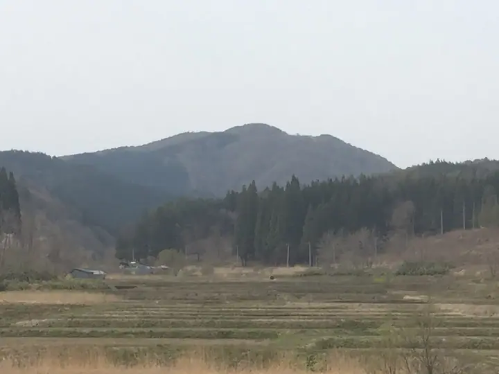
Mount Bonju is a 468-meter peak at the southern end of Aomori Prefecture's Tsugaru Mountains, straddling the Namioka district of Aomori City and Goshogawara City. From around 150 meters upward, layered Japan-Sea-type beech forest blankets its slopes, and in 1968 the mountain was designated a Prefectural Forest of Aomori as part of the Meiji Centennial Project. Its name is traditionally attributed to the Nara-era priest Dōshō, who chose "Bonju" in honour of the bodhisattva Manjushri. Aomori Prefectural Bonju Youth Nature House sits at its foot, and the peak is listed among Japan's 100 low famous mountains (2017 edition).
Mount Bonju at a glance
- Weather: The most settled day in the next 7 days is Thu, November 5: cloudy, gusts up to 4 m/s. Sat, Nov 7, Sun, Nov 8: strong wind (gusts up to 20 m/s).
- Route: The shortest is Mount Bonju Loop via the Mangan and Sawagurumi Trails: about 2 h 36 min, 4.4 km, about 340 m of climbing.
Mount Bonju weather (hourly, 14 days)
Sunrise today 06:10, sunset 16:33
| Tue, 11/3 | Wed, 11/4 | Thu, 11/5 | Fri, 11/6 | Sat, 11/7 | Sun, 11/8 | Mon, 11/9 | Tue, 11/10 | Wed, 11/11 | Thu, 11/12 | Fri, 11/13 | Sat, 11/14 | Sun, 11/15 | Mon, 11/16 | Tue, 11/17 | |||||||||||||||||||||||||||||||||||||||||||||||||||||||||||||||||||||||
|---|---|---|---|---|---|---|---|---|---|---|---|---|---|---|---|---|---|---|---|---|---|---|---|---|---|---|---|---|---|---|---|---|---|---|---|---|---|---|---|---|---|---|---|---|---|---|---|---|---|---|---|---|---|---|---|---|---|---|---|---|---|---|---|---|---|---|---|---|---|---|---|---|---|---|---|---|---|---|---|---|---|---|---|---|---|
| Japan time | 21 | 23 | 1 | 3 | 5 | 7 | 9 | 11 | 13 | 15 | 17 | 19 | 21 | 0 | 3 | 6 | 9 | 12 | 15 | 18 | 21 | 0 | 3 | 6 | 9 | 12 | 15 | 18 | 21 | 0 | 3 | 6 | 9 | 12 | 15 | 18 | 21 | 0 | 3 | 6 | 9 | 12 | 15 | 18 | 21 | 0 | 3 | 6 | 9 | 12 | 15 | 21 | 3 | 9 | 15 | 21 | 3 | 9 | 15 | 21 | 3 | 9 | 15 | 21 | 3 | 9 | 15 | 21 | 3 | 9 | 15 | 21 | 3 | 9 | 15 | 21 | 3 | 9 | 15 | 21 | 3 | 9 | 15 | 21 | |
  | | |   | |   | | |  | | |  | | | |   |   |   | |   | |   | | | | |   |   | | | | |   | |   | | |   |   |   | |   | | | | | | | | | | | | | | | | | | | |   | | | | | | | | | |  | | | | | | | | | | | | | ||
| Temperature | °C | 3° | 3° | 3° | 4° | 4° | 5° | 9° | 10° | 10° | 9° | 5° | 3° | 3° | 2° | 3° | 3° | 7° | 8° | 8° | 8° | 8° | 8° | 7° | 7° | 12° | 12° | 11° | 8° | 5° | 2° | 1° | 1° | 2° | 2° | 1° | 1° | 1° | 1° | 0° | 1° | 3° | 4° | 3° | 2° | 3° | 2° | 2° | 1° | 1° | 2° | 2° | 2° | 1° | 2° | 5° | 2° | 2° | 2° | 4° | 3° | 1° | 6° | 7° | 3° | 1° | 3° | 4° | 2° | 1° | 4° | 7° | -1° | -1° | 7° | 11° | 5° | 6° | 7° | 3° | 1° | 2° | 4° | 5° | 3° |
| Precipitation | mm | 0.1 | 0.7 | 0.1 | 0.2 | 0.9 | 4.5 | 4.7 | 0.7 | 0.1 | 0.8 | 2.3 | 0.4 | 0.6 | 0.7 | 0.9 | 1.2 | 1.3 | 1.3 | 0.5 | 0.7 | 0.7 | 0.9 | 0.3 | 0.3 | 0.1 | 0.1 | 0.5 | 1.5 | 1.4 | 0.2 | 0.1 | 3.3 | 4.7 | 12 | 1.4 | 0.3 | 0.2 | 3.3 | 2.9 | 0.1 | 1.9 | 3.5 | 1.6 | 2.9 | 1.5 | |||||||||||||||||||||||||||||||||||||||
| New snow | cm | <.1 | <.1 | <.1 | 0.2 | 0.1 | <.1 | <.1 | <.1 | <.1 | 0.2 | 0.7 | <.1 | <.1 | |||||||||||||||||||||||||||||||||||||||||||||||||||||||||||||||||||||||
| Snow depth | cm | 0 | 0 | 0 | 0 | 0 | 0 | 0 | 0 | 0 | 0 | 0 | 0 | 0 | 0 | 0 | 0 | 0 | 0 | 0 | 0 | 0 | 0 | 0 | 0 | 0 | 0 | 0 | 0 | 0 | 0 | 0 | 0 | 0 | 0 | 0 | 0 | 0 | 0 | 0 | 0 | 0 | 0 | 0 | 0 | 0 | 0 | 0 | 0 | 0 | 0 | 0 | 0 | 0 | 0 | 0 | 0 | 0 | 0 | 0 | 0 | 0 | 0 | 0 | 0 | 0 | 0 | 0 | 0 | 0 | 0 | 0 | 0 | 0 | 0 | 0 | 0 | 0 | 0 | 0 | 0 | 0 | 0 | 0 | 0 |
| Wind | m/s | 2 | 3 | 3 | 2 | 2 | 2 | 5 | 4 | 3 | 2 | 0 | 0 | 0 | 0 | 0 | 1 | 0 | 2 | 1 | 1 | 0 | 1 | 1 | 1 | 4 | 4 | 7 | 7 | 8 | 8 | 6 | 7 | 8 | 9 | 8 | 7 | 7 | 6 | 6 | 5 | 7 | 8 | 7 | 4 | 3 | 2 | 1 | 1 | 1 | 4 | 4 | 2 | 1 | 2 | 5 | 4 | 5 | 5 | 2 | 0 | 2 | 3 | 4 | 1 | 1 | 4 | 5 | 1 | 1 | 2 | 3 | 2 | 2 | 2 | 2 | 2 | 1 | 2 | 5 | 2 | 2 | 1 | 4 | 2 |
| Wind gusts | m/s | 5 | 5 | 6 | 6 | 6 | 4 | 9 | 10 | 8 | 7 | 5 | 1 | 1 | 1 | 1 | 1 | 1 | 4 | 4 | 3 | 2 | 1 | 2 | 3 | 9 | 11 | 14 | 14 | 16 | 17 | 15 | 14 | 17 | 20 | 19 | 17 | 15 | 14 | 13 | 11 | 13 | 16 | 16 | 13 | 8 | 5 | 3 | 2 | 3 | 7 | 8 | 9 | 4 | 6 | 10 | 12 | 9 | 12 | 10 | 3 | 4 | 7 | 11 | 8 | 4 | 7 | 12 | 10 | 2 | 5 | 8 | 6 | 4 | 5 | 6 | 5 | 4 | 4 | 11 | 9 | 4 | 5 | 9 | 7 |
| Wind dir. | ↓ | ↓ | ↓ | ↓ | ↓ | ↓ | ↓ | ↓ | ↓ | ↓ | ↓ | ↓ | ↓ | ↓ | ↓ | ↓ | ↓ | ↓ | ↓ | ↓ | ↓ | ↓ | ↓ | ↓ | ↓ | ↓ | ↓ | ↓ | ↓ | ↓ | ↓ | ↓ | ↓ | ↓ | ↓ | ↓ | ↓ | ↓ | ↓ | ↓ | ↓ | ↓ | ↓ | ↓ | ↓ | ↓ | ↓ | ↓ | ↓ | ↓ | ↓ | ↓ | ↓ | ↓ | ↓ | ↓ | ↓ | ↓ | ↓ | ↓ | ↓ | ↓ | ↓ | ↓ | ↓ | ↓ | ↓ | ↓ | ↓ | ↓ | ↓ | ↓ | ↓ | ↓ | ↓ | ↓ | ↓ | ↓ | ↓ | ↓ | ↓ | ↓ | ↓ | ||
Mount Bonju hiking routes
Hiking times are estimates calculated from the terrain.
Huts, campsites and lodging near Mount Bonju
Mountain huts
- 釈迦堂山避難小屋
Campsites
- 青森県民の森キャンプ場
Lists that include Mount Bonju
110 Mountains of Aomori · Elevations of 1003 Mountains of Japan · 1000 Mountains of Japan
Mount Bonju facts
- Elevation
- 468 m
- Location
- Goshogawara, Aomori / Aomori, Aomori
40.799638, 140.575433 - Website
- www.bonjyu-furesen.info
- Wikipedia
- ja.wikipedia.org