
Mount Amagi
万三郎岳
Higashiizu, Shizuoka / Izu, Shizuoka · Elevation 1,405 m
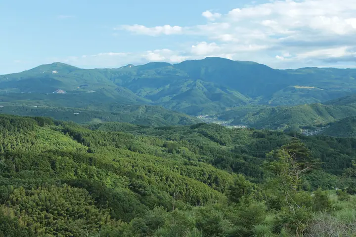
Mount Amagi (Banzaburō-dake, 1,405 m) is a chain of volcanic peaks running east–west across the central Izu Peninsula in Shizuoka Prefecture, with Banzaburō-dake the highest of the range. Designated within Fuji-Hakone-Izu National Park, the ridge supports stands of Amagi rhododendron and beech, while Hatchō Pond and the Tozaka Pass area are protected as a Special Protection Zone. The mountain is famously evoked in Kawabata's *The Izu Dancer* and is listed in the 100 Famous Japanese Mountains, the Hundred Flowering Mountains, and the First-Class Triangulation Point 100.
Mount Amagi at a glance
- Weather: The most settled day in the next 7 days is Sun, November 8: clear, gusts up to 10 m/s. Wed, Nov 4: strong wind (gusts up to 19 m/s).
- Route: The shortest is Mount Amagi Rhododendron Loop: Mount Banjiro and Mount Banzaburo: about 6 h 3 min, 9.9 km, about 780 m of climbing.
Mount Amagi weather (hourly, 14 days)
Sunrise today 06:06, sunset 16:49
| Tue, 11/3 | Wed, 11/4 | Thu, 11/5 | Fri, 11/6 | Sat, 11/7 | Sun, 11/8 | Mon, 11/9 | Tue, 11/10 | Wed, 11/11 | Thu, 11/12 | Fri, 11/13 | Sat, 11/14 | Sun, 11/15 | Mon, 11/16 | Tue, 11/17 | |||||||||||||||||||||||||||||||||||||||||||||||||||||||||||||||||||||||
|---|---|---|---|---|---|---|---|---|---|---|---|---|---|---|---|---|---|---|---|---|---|---|---|---|---|---|---|---|---|---|---|---|---|---|---|---|---|---|---|---|---|---|---|---|---|---|---|---|---|---|---|---|---|---|---|---|---|---|---|---|---|---|---|---|---|---|---|---|---|---|---|---|---|---|---|---|---|---|---|---|---|---|---|---|---|
| Japan time | 15 | 17 | 19 | 21 | 23 | 1 | 3 | 5 | 7 | 9 | 11 | 13 | 15 | 18 | 21 | 0 | 3 | 6 | 9 | 12 | 15 | 18 | 21 | 0 | 3 | 6 | 9 | 12 | 15 | 18 | 21 | 0 | 3 | 6 | 9 | 12 | 15 | 18 | 21 | 0 | 3 | 6 | 9 | 12 | 15 | 18 | 21 | 0 | 3 | 6 | 9 | 15 | 21 | 3 | 9 | 15 | 21 | 3 | 9 | 15 | 21 | 3 | 9 | 15 | 21 | 3 | 9 | 15 | 21 | 3 | 9 | 15 | 21 | 3 | 9 | 15 | 21 | 3 | 9 | 15 | 21 | 3 | 9 | 15 | |
  |   | | |   | |   | |   | |   | | | | | | | | | |   | | | | | | |   |  |  | | | |   | | | | | |   | | | | | | | | | | | | | | | |   | | | | |   | | | | | | | |  | | | | | | | | | | | | | | | | ||
| Temperature | °C | 10° | 8° | 7° | 8° | 8° | 7° | 6° | 6° | 6° | 7° | 7° | 7° | 6° | 5° | 5° | 6° | 7° | 6° | 10° | 12° | 9° | 9° | 8° | 8° | 7° | 8° | 12° | 15° | 15° | 10° | 7° | 5° | 4° | 4° | 9° | 10° | 9° | 6° | 6° | 4° | 2° | 2° | 6° | 8° | 7° | 5° | 5° | 5° | 5° | 4° | 4° | 6° | 4° | 3° | 4° | 7° | 2° | 3° | 6° | 9° | 2° | 1° | 5° | 7° | 2° | 2° | 7° | 8° | 3° | 1° | 4° | 5° | 1° | 3° | 8° | 8° | 9° | 9° | 12° | 14° | 7° | 4° | 4° | 5° |
| Precipitation | mm | 0.3 | 0.1 | 0.2 | 0.2 | 0.5 | 1.9 | 4.8 | 2.3 | 6 | 9 | 0.3 | 0.8 | 6 | 9 | 0.1 | 0.1 | 0.2 | 0.2 | 0.4 | 0.1 | 0.4 | 0.2 | 0.7 | 0.2 | 0.5 | 0.3 | 0.2 | 0.2 | 0.5 | 5 | 21 | 49 | 6 | 0.3 | ||||||||||||||||||||||||||||||||||||||||||||||||||
| New snow | cm | ||||||||||||||||||||||||||||||||||||||||||||||||||||||||||||||||||||||||||||||||||||
| Snow depth | cm | 0 | 0 | 0 | 0 | 0 | 0 | 0 | 0 | 0 | 0 | 0 | 0 | 0 | 0 | 0 | 0 | 0 | 0 | 0 | 0 | 0 | 0 | 0 | 0 | 0 | 0 | 0 | 0 | 0 | 0 | 0 | 0 | 0 | 0 | 0 | 0 | 0 | 0 | 0 | 0 | 0 | 0 | 0 | 0 | 0 | 0 | 0 | 0 | 0 | 0 | 0 | 0 | 0 | 0 | 0 | 0 | 0 | 0 | 0 | 0 | 0 | 0 | 0 | 0 | 0 | 0 | 0 | 0 | 0 | 0 | 0 | 0 | 0 | 0 | 0 | 0 | 0 | 0 | 0 | 0 | 0 | 0 | 0 | 0 |
| Wind | m/s | 3 | 2 | 2 | 2 | 3 | 3 | 5 | 5 | 5 | 6 | 6 | 6 | 6 | 6 | 5 | 5 | 3 | 4 | 3 | 2 | 2 | 1 | 0 | 0 | 1 | 2 | 1 | 0 | 2 | 3 | 2 | 1 | 2 | 1 | 1 | 2 | 3 | 2 | 4 | 3 | 1 | 2 | 3 | 3 | 3 | 2 | 3 | 2 | 2 | 3 | 3 | 4 | 4 | 5 | 5 | 2 | 0 | 3 | 1 | 0 | 1 | 2 | 2 | 1 | 1 | 0 | 2 | 2 | 4 | 3 | 3 | 2 | 0 | 1 | 1 | 3 | 4 | 3 | 3 | 1 | 4 | 5 | 5 | 4 |
| Wind gusts | m/s | 10 | 9 | 6 | 7 | 9 | 9 | 12 | 12 | 14 | 16 | 17 | 17 | 19 | 19 | 18 | 17 | 15 | 11 | 10 | 8 | 8 | 7 | 5 | 5 | 8 | 12 | 12 | 7 | 9 | 12 | 13 | 11 | 7 | 7 | 6 | 7 | 8 | 8 | 13 | 10 | 7 | 6 | 9 | 10 | 8 | 7 | 7 | 8 | 6 | 8 | 8 | 10 | 11 | 12 | 14 | 13 | 7 | 14 | 19 | 8 | 5 | 6 | 8 | 7 | 4 | 5 | 6 | 8 | 11 | 11 | 9 | 10 | 5 | 6 | 6 | 12 | 14 | 20 | 16 | 13 | 12 | 12 | 13 | 13 |
| Wind dir. | ↓ | ↓ | ↓ | ↓ | ↓ | ↓ | ↓ | ↓ | ↓ | ↓ | ↓ | ↓ | ↓ | ↓ | ↓ | ↓ | ↓ | ↓ | ↓ | ↓ | ↓ | ↓ | ↓ | ↓ | ↓ | ↓ | ↓ | ↓ | ↓ | ↓ | ↓ | ↓ | ↓ | ↓ | ↓ | ↓ | ↓ | ↓ | ↓ | ↓ | ↓ | ↓ | ↓ | ↓ | ↓ | ↓ | ↓ | ↓ | ↓ | ↓ | ↓ | ↓ | ↓ | ↓ | ↓ | ↓ | ↓ | ↓ | ↓ | ↓ | ↓ | ↓ | ↓ | ↓ | ↓ | ↓ | ↓ | ↓ | ↓ | ↓ | ↓ | ↓ | ↓ | ↓ | ↓ | ↓ | ↓ | ↓ | ↓ | ↓ | ↓ | ↓ | ↓ | ↓ | |
Mount Amagi hiking routes
- Mount Amagi Rhododendron Loop: Mount Banjiro and Mount Banzaburo 9.9 km · Ascent 781 m ハイカー用駐車場, 天城高原ゴルフ場 (Bus stop) (parking)
- Amagi Range Traverse from Amagi Kogen via Hatcho Pond to Amagi Pass 16.2 km · Ascent 834 m 天城縦走登山口, 天城高原ゴルフ場 (Bus stop), ハイカー用駐車場 (parking) → 天城峠バス停 (Bus stop), Amagi Pass (Bus stop), 水生地下バス停 (Bus stop), 水生地下駐車場
Hiking times are estimates calculated from the terrain.
Huts, campsites and lodging near Mount Amagi
Lodging
- Hotel Harvest Amagikougen
- Riderhouse Bagrant Reich (Riders House Guesthouse Amagi)
Lists that include Mount Amagi
100 Famous Japanese Mountains · Japan 200 Famous Mountains · Japan's 300 Famous Mountains · 100 Famous Mountains of Flowers · 100 Famous Mountains with First-order Triangulation Points · New Japan 100 Famous Mountains · 100 Low Mountains of Japan · Illustrated Collection of Japan's Famous Mountains · 100 Mountains of Shizuoka · Elevations of 1003 Mountains of Japan · 1000 Mountains of Japan
Mount Amagi facts
- Elevation
- 1,405 m
- Location
- Higashiizu, Shizuoka / Izu, Shizuoka
34.862795, 139.001850 - National Park
- 富士箱根伊豆国立公園
- Website
- kanko.city.izu.shizuoka.jp
- Trail Map
- kanko.city.izu.shizuoka.jp (PDF)
- Wikipedia
- ja.wikipedia.org