
Eboshidake
烏帽子岳
Ōgaki-shi, Gifu · Elevation 865 m
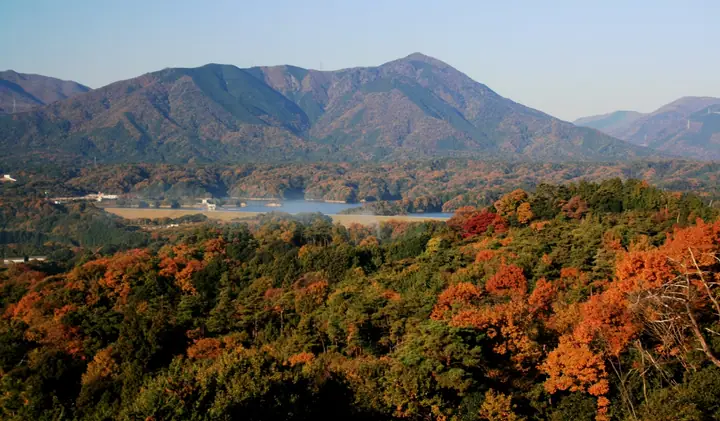
Named for its resemblance to an eboshi ceremonial cap, the mountain is also called Mino Fuji. Trails lead up from Hosono and Tokiyama, and the summit overlooks Kamiishizu’s villages, the Yoro Mountains and Ise Bay. Rhododendrons and red-flowered Enkianthus grow near the summit; the northern slope is a designated nature conservation area.
Eboshidake at a glance
- Weather: The most settled day in the next 7 days is Wed, November 4: clear, gusts up to 6 m/s. Fri, Nov 6, Sat, Nov 7: strong wind (gusts up to 20 m/s).
- Route: The shortest is Mount Eboshi, the Mino Fuji, Loop of the Oiwa and Tenboiwa Courses from Hosono Forest Plaza: about 3 h 26 min, 5.0 km, about 630 m of climbing.
Eboshidake weather (hourly, 14 days)
Sunrise today 06:17, sunset 16:59
| Tue, 11/3 | Wed, 11/4 | Thu, 11/5 | Fri, 11/6 | Sat, 11/7 | Sun, 11/8 | Mon, 11/9 | Tue, 11/10 | Wed, 11/11 | Thu, 11/12 | Fri, 11/13 | Sat, 11/14 | Sun, 11/15 | Mon, 11/16 | Tue, 11/17 | |||||||||||||||||||||||||||||||||||||||||||||||||||||||||||||||||||||||
|---|---|---|---|---|---|---|---|---|---|---|---|---|---|---|---|---|---|---|---|---|---|---|---|---|---|---|---|---|---|---|---|---|---|---|---|---|---|---|---|---|---|---|---|---|---|---|---|---|---|---|---|---|---|---|---|---|---|---|---|---|---|---|---|---|---|---|---|---|---|---|---|---|---|---|---|---|---|---|---|---|---|---|---|---|---|
| Japan time | 15 | 17 | 19 | 21 | 23 | 1 | 3 | 5 | 7 | 9 | 11 | 13 | 15 | 18 | 21 | 0 | 3 | 6 | 9 | 12 | 15 | 18 | 21 | 0 | 3 | 6 | 9 | 12 | 15 | 18 | 21 | 0 | 3 | 6 | 9 | 12 | 15 | 18 | 21 | 0 | 3 | 6 | 9 | 12 | 15 | 18 | 21 | 0 | 3 | 6 | 9 | 15 | 21 | 3 | 9 | 15 | 21 | 3 | 9 | 15 | 21 | 3 | 9 | 15 | 21 | 3 | 9 | 15 | 21 | 3 | 9 | 15 | 21 | 3 | 9 | 15 | 21 | 3 | 9 | 15 | 21 | 3 | 9 | 15 | |
 |  |   | | | | | |   | | | |   |   | |   | | |   |   |   |   | | | | | | | |  | |   | | | | | | | | | | | | | | | | | | | | |   | | | |   | | | | |  | | | | | | | | | | | | | |   | | | | | | | | | ||
| Temperature | °C | 13° | 10° | 7° | 7° | 6° | 5° | 5° | 4° | 5° | 11° | 14° | 16° | 14° | 11° | 11° | 10° | 9° | 9° | 12° | 13° | 15° | 12° | 11° | 10° | 11° | 11° | 11° | 14° | 12° | 9° | 8° | 7° | 5° | 5° | 5° | 8° | 7° | 5° | 3° | 3° | 3° | 2° | 7° | 9° | 8° | 6° | 5° | 5° | 5° | 5° | 8° | 10° | 5° | 2° | 9° | 12° | 5° | 3° | 6° | 7° | 3° | 1° | 7° | 9° | 3° | 5° | 7° | 8° | 2° | 0° | 8° | 11° | 6° | 7° | 9° | 10° | 9° | 9° | 11° | 12° | 5° | 3° | 5° | 8° |
| Precipitation | mm | 2.9 | 1.9 | 0.7 | 1.2 | 0.5 | 3.2 | 0.8 | 0.8 | 1.0 | 0.3 | 0.2 | 0.3 | 0.8 | 0.7 | 0.2 | 1.1 | 1.1 | 0.5 | 1.3 | 3.4 | 7 | 0.4 | 0.5 | |||||||||||||||||||||||||||||||||||||||||||||||||||||||||||||
| New snow | cm | ||||||||||||||||||||||||||||||||||||||||||||||||||||||||||||||||||||||||||||||||||||
| Snow depth | cm | 0 | 0 | 0 | 0 | 0 | 0 | 0 | 0 | 0 | 0 | 0 | 0 | 0 | 0 | 0 | 0 | 0 | 0 | 0 | 0 | 0 | 0 | 0 | 0 | 0 | 0 | 0 | 0 | 0 | 0 | 0 | 0 | 0 | 0 | 0 | 0 | 0 | 0 | 0 | 0 | 0 | 0 | 0 | 0 | 0 | 0 | 0 | 0 | 0 | 0 | 0 | 0 | 0 | 0 | 0 | 0 | 0 | 0 | 0 | 0 | 0 | 0 | 0 | 0 | 0 | 0 | 0 | 0 | 0 | 0 | 0 | 0 | 0 | 0 | 0 | 0 | 0 | 0 | 0 | 0 | 0 | 0 | 0 | 0 |
| Wind | m/s | 4 | 3 | 2 | 2 | 2 | 2 | 2 | 2 | 2 | 1 | 1 | 2 | 2 | 1 | 2 | 1 | 1 | 0 | 1 | 0 | 1 | 1 | 1 | 1 | 2 | 3 | 4 | 6 | 7 | 6 | 6 | 6 | 5 | 6 | 5 | 6 | 6 | 4 | 3 | 2 | 2 | 2 | 3 | 5 | 4 | 3 | 2 | 2 | 2 | 2 | 3 | 4 | 2 | 1 | 1 | 4 | 5 | 6 | 6 | 6 | 3 | 2 | 3 | 4 | 2 | 3 | 3 | 6 | 3 | 2 | 1 | 2 | 1 | 1 | 3 | 2 | 1 | 0 | 3 | 5 | 3 | 4 | 3 | 2 |
| Wind gusts | m/s | 11 | 10 | 8 | 7 | 6 | 6 | 6 | 6 | 5 | 5 | 4 | 6 | 6 | 6 | 7 | 7 | 7 | 4 | 4 | 3 | 3 | 3 | 3 | 4 | 6 | 11 | 13 | 17 | 20 | 19 | 18 | 17 | 18 | 17 | 17 | 18 | 18 | 17 | 13 | 9 | 9 | 8 | 10 | 14 | 14 | 10 | 7 | 6 | 6 | 7 | 8 | 13 | 11 | 7 | 4 | 12 | 14 | 20 | 19 | 19 | 16 | 10 | 8 | 12 | 11 | 10 | 10 | 16 | 16 | 8 | 4 | 7 | 7 | 4 | 7 | 10 | 7 | 9 | 9 | 16 | 15 | 11 | 11 | 8 |
| Wind dir. | ↓ | ↓ | ↓ | ↓ | ↓ | ↓ | ↓ | ↓ | ↓ | ↓ | ↓ | ↓ | ↓ | ↓ | ↓ | ↓ | ↓ | ↓ | ↓ | ↓ | ↓ | ↓ | ↓ | ↓ | ↓ | ↓ | ↓ | ↓ | ↓ | ↓ | ↓ | ↓ | ↓ | ↓ | ↓ | ↓ | ↓ | ↓ | ↓ | ↓ | ↓ | ↓ | ↓ | ↓ | ↓ | ↓ | ↓ | ↓ | ↓ | ↓ | ↓ | ↓ | ↓ | ↓ | ↓ | ↓ | ↓ | ↓ | ↓ | ↓ | ↓ | ↓ | ↓ | ↓ | ↓ | ↓ | ↓ | ↓ | ↓ | ↓ | ↓ | ↓ | ↓ | ↓ | ↓ | ↓ | ↓ | ↓ | ↓ | ↓ | ↓ | ↓ | ↓ | ↓ | |
Eboshidake hiking routes
Hiking times are estimates calculated from the terrain.
Huts, campsites and lodging near Eboshidake
Campsites
- もんでこキャンプ場トキヤマ
- 時山養魚場 キャンプ場
Eboshidake facts
- Elevation
- 865 m
- Location
- Ōgaki-shi, Gifu
35.228093, 136.434338 - Website
- www.city.ogaki.lg.jp
- Access Information
- www.city.ogaki.lg.jp
- Wikipedia
- ja.wikipedia.org