
Saragamine
皿ヶ嶺
Kumakogen, Ehime · Elevation 1,271 m
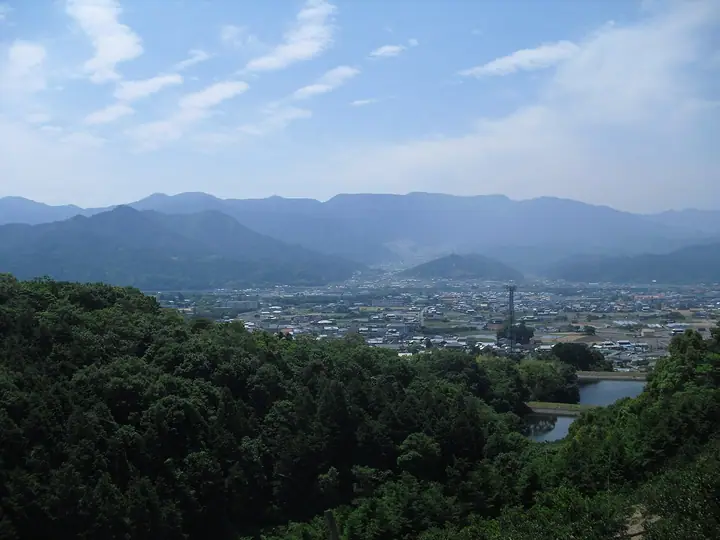
A popular route starts at Kazaana and passes Ryujindaira, a broad wetland with a mountain hut. Beyond it, the trail crosses old-growth beech woodland to the summit, which overlooks Kumakogen to the south. Seasonal flowers, autumn beech foliage and winter rime add interest throughout the year.
Saragamine at a glance
- Weather: The most settled day in the next 7 days is Sun, November 8: clear, gusts up to 7 m/s.
- Route: The shortest is Mount Saragamine via Kazana and Ryujindaira: about 2 h 57 min, 5.0 km, about 380 m of climbing.
Saragamine weather (hourly, 14 days)
Sunrise today 06:29, sunset 17:16
| Tue, 11/3 | Wed, 11/4 | Thu, 11/5 | Fri, 11/6 | Sat, 11/7 | Sun, 11/8 | Mon, 11/9 | Tue, 11/10 | Wed, 11/11 | Thu, 11/12 | Fri, 11/13 | Sat, 11/14 | Sun, 11/15 | Mon, 11/16 | Tue, 11/17 | |||||||||||||||||||||||||||||||||||||||||||||||||||||||||||||||||||||||
|---|---|---|---|---|---|---|---|---|---|---|---|---|---|---|---|---|---|---|---|---|---|---|---|---|---|---|---|---|---|---|---|---|---|---|---|---|---|---|---|---|---|---|---|---|---|---|---|---|---|---|---|---|---|---|---|---|---|---|---|---|---|---|---|---|---|---|---|---|---|---|---|---|---|---|---|---|---|---|---|---|---|---|---|---|---|
| Japan time | 15 | 17 | 19 | 21 | 23 | 1 | 3 | 5 | 7 | 9 | 11 | 13 | 15 | 18 | 21 | 0 | 3 | 6 | 9 | 12 | 15 | 18 | 21 | 0 | 3 | 6 | 9 | 12 | 15 | 18 | 21 | 0 | 3 | 6 | 9 | 12 | 15 | 18 | 21 | 0 | 3 | 6 | 9 | 12 | 15 | 18 | 21 | 0 | 3 | 6 | 9 | 15 | 21 | 3 | 9 | 15 | 21 | 3 | 9 | 15 | 21 | 3 | 9 | 15 | 21 | 3 | 9 | 15 | 21 | 3 | 9 | 15 | 21 | 3 | 9 | 15 | 21 | 3 | 9 | 15 | 21 | 3 | 9 | 15 | |
  |   |   |   | |   | | | | | | | | |   |   | | |   | | | | | | |   | | |  |  | | | | | | | | | | | | | | | | | | | | | | | | | |   | | | | |   | | | | |  | | | | | | | | |   |   | | | | | |  | | | ||
| Temperature | °C | 11° | 8° | 6° | 5° | 4° | 4° | 5° | 5° | 5° | 8° | 9° | 11° | 12° | 7° | 7° | 8° | 8° | 7° | 10° | 15° | 13° | 12° | 10° | 10° | 9° | 8° | 9° | 10° | 10° | 6° | 3° | 2° | 2° | 1° | 4° | 6° | 6° | 2° | 0° | -2° | -2° | 0° | 5° | 9° | 8° | 5° | 4° | 3° | 3° | 3° | 7° | 9° | 3° | -1° | 5° | 7° | 2° | 1° | 2° | 6° | 0° | -2° | 4° | 6° | 1° | -1° | 5° | 7° | 2° | -1° | 7° | 9° | 4° | 4° | 9° | 10° | 8° | 8° | 8° | 11° | 5° | 1° | 4° | 7° |
| Precipitation | mm | 0.2 | 0.1 | 0.2 | 1.1 | 0.2 | 0.2 | 0.8 | 1.0 | 2.8 | 2.0 | 0.3 | 0.3 | 0.2 | 1.7 | 5 | 2.1 | 1.1 | 0.5 | 0.2 | |||||||||||||||||||||||||||||||||||||||||||||||||||||||||||||||||
| New snow | cm | ||||||||||||||||||||||||||||||||||||||||||||||||||||||||||||||||||||||||||||||||||||
| Snow depth | cm | 0 | 0 | 0 | 0 | 0 | 0 | 0 | 0 | 0 | 0 | 0 | 0 | 0 | 0 | 0 | 0 | 0 | 0 | 0 | 0 | 0 | 0 | 0 | 0 | 0 | 0 | 0 | 0 | 0 | 0 | 0 | 0 | 0 | 0 | 0 | 0 | 0 | 0 | 0 | 0 | 0 | 0 | 0 | 0 | 0 | 0 | 0 | 0 | 0 | 0 | 0 | 0 | 0 | 0 | 0 | 0 | 0 | 0 | 0 | 0 | 0 | 0 | 0 | 0 | 0 | 0 | 0 | 0 | 0 | 0 | 0 | 0 | 0 | 0 | 0 | 0 | 0 | 0 | 0 | 0 | 0 | 0 | 0 | 0 |
| Wind | m/s | 2 | 1 | 1 | 1 | 2 | 2 | 2 | 3 | 4 | 4 | 3 | 2 | 2 | 2 | 2 | 2 | 0 | 2 | 1 | 2 | 1 | 1 | 1 | 4 | 2 | 3 | 3 | 4 | 5 | 4 | 3 | 3 | 2 | 2 | 3 | 3 | 3 | 1 | 2 | 2 | 2 | 2 | 2 | 2 | 2 | 2 | 2 | 1 | 0 | 1 | 1 | 3 | 1 | 2 | 1 | 4 | 2 | 4 | 4 | 4 | 1 | 2 | 1 | 2 | 1 | 1 | 2 | 3 | 2 | 3 | 1 | 2 | 3 | 3 | 3 | 2 | 2 | 1 | 2 | 4 | 4 | 3 | 3 | 2 |
| Wind gusts | m/s | 8 | 7 | 3 | 4 | 6 | 6 | 6 | 8 | 10 | 10 | 9 | 8 | 6 | 5 | 5 | 7 | 6 | 6 | 4 | 6 | 9 | 5 | 5 | 11 | 12 | 9 | 9 | 12 | 13 | 13 | 10 | 9 | 8 | 8 | 10 | 10 | 9 | 8 | 5 | 5 | 6 | 6 | 7 | 7 | 6 | 5 | 5 | 5 | 4 | 2 | 5 | 10 | 8 | 4 | 4 | 10 | 11 | 11 | 11 | 11 | 10 | 4 | 4 | 7 | 5 | 5 | 6 | 11 | 9 | 8 | 8 | 7 | 6 | 8 | 11 | 11 | 11 | 8 | 7 | 11 | 11 | 11 | 8 | 7 |
| Wind dir. | ↓ | ↓ | ↓ | ↓ | ↓ | ↓ | ↓ | ↓ | ↓ | ↓ | ↓ | ↓ | ↓ | ↓ | ↓ | ↓ | ↓ | ↓ | ↓ | ↓ | ↓ | ↓ | ↓ | ↓ | ↓ | ↓ | ↓ | ↓ | ↓ | ↓ | ↓ | ↓ | ↓ | ↓ | ↓ | ↓ | ↓ | ↓ | ↓ | ↓ | ↓ | ↓ | ↓ | ↓ | ↓ | ↓ | ↓ | ↓ | ↓ | ↓ | ↓ | ↓ | ↓ | ↓ | ↓ | ↓ | ↓ | ↓ | ↓ | ↓ | ↓ | ↓ | ↓ | ↓ | ↓ | ↓ | ↓ | ↓ | ↓ | ↓ | ↓ | ↓ | ↓ | ↓ | ↓ | ↓ | ↓ | ↓ | ↓ | ↓ | ↓ | ↓ | ↓ | ↓ | |
Saragamine hiking routes
Hiking times are estimates calculated from the terrain.
Huts, campsites and lodging near Saragamine
Mountain huts
Saragamine facts
- Elevation
- 1,271 m
- Location
- Kumakogen, Ehime
33.717495, 132.894396 - Website
- toon-kanko.jp
- Trail Map
- www.city.toon.ehime.jp
- Wikipedia
- ja.wikipedia.org