
Mt. Zozu
象頭山
Zentsūji-shi, Kagawa / Mitoyo, Kagawa / Kotohira, Kagawa · Elevation 538 m
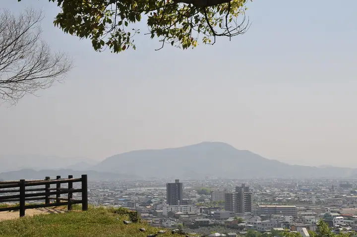
Mt. Zozu is the southern peak of the Kotohira-yama massif (Kotohira-yama and Taimasan) that lies mainly in Kotohira Town and stretches into Zentsuji and Mitoyo cities of Kagawa Prefecture, at an elevation of about 538 m. Its outline is said to resemble a crouching elephant's head, giving it the name Zōzu-san. On its slope sits Kotohira-gū, the famous "Konpira-san" shrine of seafarers, reached by 785 stone steps to the main hall and 1,368 in total to the inner shrine. The mountain is included in the "34 Mountains with Divine Blessing" and the Japan 1003 Mountain Elevations lists, and the entire massif lies within Setonaikai National Park and is designated a National Place of Scenic Beauty and Natural Monument.
Mt. Zozu at a glance
- Weather: The most settled day in the next 7 days is Thu, November 5: clear, gusts up to 6 m/s.
Mt. Zozu weather (hourly, 14 days)
Sunrise today 06:26, sunset 17:11
| Tue, 11/3 | Wed, 11/4 | Thu, 11/5 | Fri, 11/6 | Sat, 11/7 | Sun, 11/8 | Mon, 11/9 | Tue, 11/10 | Wed, 11/11 | Thu, 11/12 | Fri, 11/13 | Sat, 11/14 | Sun, 11/15 | Mon, 11/16 | Tue, 11/17 | |||||||||||||||||||||||||||||||||||||||||||||||||||||||||||||||||||||||
|---|---|---|---|---|---|---|---|---|---|---|---|---|---|---|---|---|---|---|---|---|---|---|---|---|---|---|---|---|---|---|---|---|---|---|---|---|---|---|---|---|---|---|---|---|---|---|---|---|---|---|---|---|---|---|---|---|---|---|---|---|---|---|---|---|---|---|---|---|---|---|---|---|---|---|---|---|---|---|---|---|---|---|---|---|---|
| Japan time | 15 | 17 | 19 | 21 | 23 | 1 | 3 | 5 | 7 | 9 | 11 | 13 | 15 | 18 | 21 | 0 | 3 | 6 | 9 | 12 | 15 | 18 | 21 | 0 | 3 | 6 | 9 | 12 | 15 | 18 | 21 | 0 | 3 | 6 | 9 | 12 | 15 | 18 | 21 | 0 | 3 | 6 | 9 | 12 | 15 | 18 | 21 | 0 | 3 | 6 | 9 | 15 | 21 | 3 | 9 | 15 | 21 | 3 | 9 | 15 | 21 | 3 | 9 | 15 | 21 | 3 | 9 | 15 | 21 | 3 | 9 | 15 | 21 | 3 | 9 | 15 | 21 | 3 | 9 | 15 | 21 | 3 | 9 | 15 | |
 |   |   | | |   | | |   | | | | | |   | | |   |   | | |   | | |   | | | |   |  | | | | | | | | | | | | | | | | | | | | | | | | | | | | | | |   |  | | | | |   | | | | | | | | | | | | |   | |  | | | ||
| Temperature | °C | 15° | 13° | 12° | 10° | 11° | 10° | 9° | 9° | 10° | 13° | 15° | 14° | 14° | 11° | 11° | 11° | 10° | 10° | 13° | 17° | 18° | 15° | 14° | 14° | 13° | 12° | 15° | 16° | 16° | 13° | 10° | 9° | 8° | 7° | 9° | 11° | 12° | 8° | 6° | 4° | 2° | 2° | 10° | 12° | 12° | 8° | 8° | 8° | 7° | 7° | 12° | 14° | 9° | 6° | 11° | 12° | 8° | 7° | 8° | 10° | 7° | 2° | 9° | 12° | 6° | 7° | 10° | 12° | 5° | 1° | 9° | 13° | 6° | 6° | 13° | 16° | 12° | 12° | 14° | 16° | 9° | 6° | 8° | 10° |
| Precipitation | mm | 0.3 | 1.0 | 1.0 | 1.1 | 0.4 | 0.2 | 3.7 | 0.3 | 0.4 | 0.6 | 0.5 | 0.1 | 3.9 | 0.4 | 1.0 | 0.3 | ||||||||||||||||||||||||||||||||||||||||||||||||||||||||||||||||||||
| New snow | cm | ||||||||||||||||||||||||||||||||||||||||||||||||||||||||||||||||||||||||||||||||||||
| Snow depth | cm | 0 | 0 | 0 | 0 | 0 | 0 | 0 | 0 | 0 | 0 | 0 | 0 | 0 | 0 | 0 | 0 | 0 | 0 | 0 | 0 | 0 | 0 | 0 | 0 | 0 | 0 | 0 | 0 | 0 | 0 | 0 | 0 | 0 | 0 | 0 | 0 | 0 | 0 | 0 | 0 | 0 | 0 | 0 | 0 | 0 | 0 | 0 | 0 | 0 | 0 | 0 | 0 | 0 | 0 | 0 | 0 | 0 | 0 | 0 | 0 | 0 | 0 | 0 | 0 | 0 | 0 | 0 | 0 | 0 | 0 | 0 | 0 | 0 | 0 | 0 | 0 | 0 | 0 | 0 | 0 | 0 | 0 | 0 | 0 |
| Wind | m/s | 2 | 0 | 1 | 1 | 3 | 2 | 2 | 2 | 3 | 4 | 4 | 4 | 3 | 1 | 1 | 1 | 0 | 1 | 1 | 1 | 1 | 1 | 2 | 2 | 4 | 3 | 4 | 5 | 6 | 5 | 4 | 4 | 5 | 3 | 4 | 3 | 3 | 1 | 1 | 1 | 1 | 2 | 0 | 2 | 2 | 1 | 1 | 1 | 1 | 1 | 1 | 2 | 2 | 2 | 3 | 4 | 4 | 4 | 3 | 2 | 2 | 1 | 1 | 2 | 0 | 1 | 2 | 3 | 2 | 2 | 3 | 2 | 2 | 2 | 2 | 1 | 1 | 2 | 3 | 3 | 4 | 1 | 1 | 1 |
| Wind gusts | m/s | 6 | 6 | 1 | 3 | 7 | 6 | 5 | 5 | 6 | 9 | 10 | 10 | 9 | 7 | 4 | 6 | 3 | 3 | 3 | 4 | 6 | 4 | 4 | 5 | 9 | 8 | 10 | 12 | 13 | 13 | 12 | 9 | 10 | 10 | 10 | 10 | 9 | 8 | 4 | 3 | 3 | 4 | 4 | 6 | 6 | 5 | 3 | 3 | 3 | 2 | 4 | 8 | 5 | 4 | 7 | 11 | 10 | 10 | 9 | 8 | 6 | 3 | 4 | 7 | 5 | 4 | 4 | 9 | 8 | 4 | 6 | 7 | 6 | 5 | 5 | 5 | 5 | 6 | 8 | 10 | 11 | 8 | 4 | 6 |
| Wind dir. | ↓ | ↓ | ↓ | ↓ | ↓ | ↓ | ↓ | ↓ | ↓ | ↓ | ↓ | ↓ | ↓ | ↓ | ↓ | ↓ | ↓ | ↓ | ↓ | ↓ | ↓ | ↓ | ↓ | ↓ | ↓ | ↓ | ↓ | ↓ | ↓ | ↓ | ↓ | ↓ | ↓ | ↓ | ↓ | ↓ | ↓ | ↓ | ↓ | ↓ | ↓ | ↓ | ↓ | ↓ | ↓ | ↓ | ↓ | ↓ | ↓ | ↓ | ↓ | ↓ | ↓ | ↓ | ↓ | ↓ | ↓ | ↓ | ↓ | ↓ | ↓ | ↓ | ↓ | ↓ | ↓ | ↓ | ↓ | ↓ | ↓ | ↓ | ↓ | ↓ | ↓ | ↓ | ↓ | ↓ | ↓ | ↓ | ↓ | ↓ | ↓ | ↓ | ↓ | ↓ | |
Huts, campsites and lodging near Mt. Zozu
Campsites
- 302 Osayama Camping Ground
Lodging
- 旅館とら丸
- Kotohira Hot Springs Kotosankaku
- Shikishimakan
- つるや旅館
- Kotori Coworking & Hostel Kotohira
Lists that include Mt. Zozu
Mt. Zozu facts
- Also known as
- 琴平山 · 大麻山
- Elevation
- 538 m
- Location
- Zentsūji-shi, Kagawa / Mitoyo, Kagawa / Kotohira, Kagawa
34.187772, 133.798483 - Website
- www.konpira.or.jp
- Trail Map
- www.konpira.or.jp (PDF)
- Access Information
- www.kotohirakankou.jp
- Wikipedia
- ja.wikipedia.org