
Mt. Yoryusan
楊柳山
Kōya-chō, Wakayama / Kudoyama, Wakayama · Elevation 1,009 m
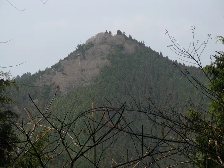
Mt. Yoryusan is a 1,009 m peak in Kōya-cho, Wakayama Prefecture, and the highest of the Kōya Sanzan — the three sacred mountains (Manisan, Yoryūsan, Tenjikusan) encircling the Okunoin inner sanctum of UNESCO World Heritage Mt. Kōya. It is one of the 'outer eight petals' that Kūkai is said to have likened the Kōya massif to upon founding the monastery, and the summit enshrines Yoryūsan Gongen with Eleven-Faced Kannon as its honji; the peak sits on pilgrimage paths including the Nyonin-michi. It lies within Kōya-Ryūjin Quasi-National Park and appears on lists including the Kansai Hyakumeizan, Nihon Hyaku-Reihō, and Nihon Hyaku-Teizan.
Mt. Yoryusan at a glance
- Weather: The most settled day in the next 7 days is Sun, November 8: clear, gusts up to 9 m/s.
Mt. Yoryusan weather (hourly, 14 days)
Sunrise today 06:18, sunset 17:04
| Tue, 11/3 | Wed, 11/4 | Thu, 11/5 | Fri, 11/6 | Sat, 11/7 | Sun, 11/8 | Mon, 11/9 | Tue, 11/10 | Wed, 11/11 | Thu, 11/12 | Fri, 11/13 | Sat, 11/14 | Sun, 11/15 | Mon, 11/16 | Tue, 11/17 | |||||||||||||||||||||||||||||||||||||||||||||||||||||||||||||||||||||||
|---|---|---|---|---|---|---|---|---|---|---|---|---|---|---|---|---|---|---|---|---|---|---|---|---|---|---|---|---|---|---|---|---|---|---|---|---|---|---|---|---|---|---|---|---|---|---|---|---|---|---|---|---|---|---|---|---|---|---|---|---|---|---|---|---|---|---|---|---|---|---|---|---|---|---|---|---|---|---|---|---|---|---|---|---|---|
| Japan time | 15 | 17 | 19 | 21 | 23 | 1 | 3 | 5 | 7 | 9 | 11 | 13 | 15 | 18 | 21 | 0 | 3 | 6 | 9 | 12 | 15 | 18 | 21 | 0 | 3 | 6 | 9 | 12 | 15 | 18 | 21 | 0 | 3 | 6 | 9 | 12 | 15 | 18 | 21 | 0 | 3 | 6 | 9 | 12 | 15 | 18 | 21 | 0 | 3 | 6 | 9 | 15 | 21 | 3 | 9 | 15 | 21 | 3 | 9 | 15 | 21 | 3 | 9 | 15 | 21 | 3 | 9 | 15 | 21 | 3 | 9 | 15 | 21 | 3 | 9 | 15 | 21 | 3 | 9 | 15 | 21 | 3 | 9 | 15 | |
  |   |   | | |  |   | | | | | | | |   | | | | |   | |   | | |   | |   |   | | |   | | | | |   | | |  | | | | | | | | | |   | |  | | | | | | | | | | |  | | | | | | | | | | | | | | | | | | | |  | | | ||
| Temperature | °C | 13° | 10° | 8° | 7° | 6° | 6° | 5° | 5° | 6° | 10° | 12° | 15° | 14° | 9° | 9° | 10° | 10° | 10° | 14° | 15° | 17° | 12° | 10° | 12° | 13° | 12° | 12° | 14° | 13° | 10° | 8° | 6° | 5° | 5° | 7° | 7° | 8° | 5° | 2° | 2° | 2° | 1° | 7° | 9° | 9° | 4° | 4° | 5° | 5° | 4° | 10° | 11° | 5° | 3° | 9° | 10° | 6° | 3° | 5° | 7° | 2° | 0° | 6° | 9° | 2° | 2° | 6° | 8° | 2° | 0° | 8° | 13° | 1° | 3° | 12° | 13° | 11° | 12° | 11° | 12° | 6° | 2° | 5° | 8° |
| Precipitation | mm | 1.0 | 0.3 | 0.2 | 0.9 | 1.2 | 0.8 | 0.6 | 0.1 | 0.1 | 0.4 | 0.2 | 1.4 | 0.2 | 0.1 | 0.5 | 0.1 | 2.6 | 16 | 1.2 | 3.1 | 1.0 | |||||||||||||||||||||||||||||||||||||||||||||||||||||||||||||||
| New snow | cm | ||||||||||||||||||||||||||||||||||||||||||||||||||||||||||||||||||||||||||||||||||||
| Snow depth | cm | 0 | 0 | 0 | 0 | 0 | 0 | 0 | 0 | 0 | 0 | 0 | 0 | 0 | 0 | 0 | 0 | 0 | 0 | 0 | 0 | 0 | 0 | 0 | 0 | 0 | 0 | 0 | 0 | 0 | 0 | 0 | 0 | 0 | 0 | 0 | 0 | 0 | 0 | 0 | 0 | 0 | 0 | 0 | 0 | 0 | 0 | 0 | 0 | 0 | 0 | 0 | 0 | 0 | 0 | 0 | 0 | 0 | 0 | 0 | 0 | 0 | 0 | 0 | 0 | 0 | 0 | 0 | 0 | 0 | 0 | 0 | 0 | 0 | 0 | 0 | 0 | 0 | 0 | 0 | 0 | 0 | 0 | 0 | 0 |
| Wind | m/s | 2 | 1 | 1 | 1 | 1 | 2 | 2 | 2 | 2 | 2 | 2 | 2 | 2 | 1 | 1 | 1 | 1 | 1 | 1 | 1 | 1 | 0 | 2 | 3 | 4 | 3 | 3 | 4 | 5 | 2 | 3 | 4 | 3 | 2 | 5 | 4 | 5 | 3 | 1 | 1 | 1 | 1 | 3 | 3 | 3 | 1 | 1 | 1 | 1 | 1 | 1 | 3 | 1 | 1 | 2 | 3 | 3 | 5 | 4 | 6 | 2 | 1 | 1 | 2 | 1 | 2 | 3 | 4 | 2 | 1 | 0 | 1 | 1 | 2 | 2 | 3 | 3 | 2 | 3 | 4 | 3 | 1 | 2 | 2 |
| Wind gusts | m/s | 7 | 7 | 3 | 3 | 4 | 4 | 5 | 5 | 5 | 6 | 7 | 7 | 7 | 4 | 3 | 3 | 5 | 3 | 4 | 5 | 4 | 5 | 5 | 7 | 11 | 9 | 8 | 11 | 13 | 12 | 8 | 9 | 9 | 8 | 12 | 13 | 12 | 12 | 8 | 4 | 4 | 4 | 7 | 9 | 9 | 8 | 3 | 2 | 2 | 2 | 4 | 9 | 8 | 3 | 6 | 9 | 9 | 11 | 12 | 15 | 14 | 4 | 4 | 7 | 6 | 5 | 8 | 12 | 11 | 4 | 4 | 5 | 5 | 5 | 6 | 8 | 10 | 10 | 7 | 12 | 11 | 9 | 5 | 7 |
| Wind dir. | ↓ | ↓ | ↓ | ↓ | ↓ | ↓ | ↓ | ↓ | ↓ | ↓ | ↓ | ↓ | ↓ | ↓ | ↓ | ↓ | ↓ | ↓ | ↓ | ↓ | ↓ | ↓ | ↓ | ↓ | ↓ | ↓ | ↓ | ↓ | ↓ | ↓ | ↓ | ↓ | ↓ | ↓ | ↓ | ↓ | ↓ | ↓ | ↓ | ↓ | ↓ | ↓ | ↓ | ↓ | ↓ | ↓ | ↓ | ↓ | ↓ | ↓ | ↓ | ↓ | ↓ | ↓ | ↓ | ↓ | ↓ | ↓ | ↓ | ↓ | ↓ | ↓ | ↓ | ↓ | ↓ | ↓ | ↓ | ↓ | ↓ | ↓ | ↓ | ↓ | ↓ | ↓ | ↓ | ↓ | ↓ | ↓ | ↓ | ↓ | ↓ | ↓ | ↓ | ↓ | |
Huts, campsites and lodging near Mt. Yoryusan
Lodging
- Kokuu Guesthouse
- Sekishoin
- Henjoko-in
- Hongakuin Temple
- Koasan Shukubo Daimoo-in
Lists that include Mt. Yoryusan
100 Low Mountains of Japan · Illustrated Collection of Japan's Famous Mountains · Kansai 100 Famous Mountains · 1000 Mountains of Japan
Mt. Yoryusan facts
- Elevation
- 1,009 m
- Location
- Kōya-chō, Wakayama / Kudoyama, Wakayama
34.235484, 135.606759 - National Park
- 高野龍神国定公園
- Website
- www.pref.wakayama.lg.jp
- Trail Map
- www.pref.wakayama.lg.jp (PDF)