
Mt. Yokoyamadake
横山岳
Nagahama, Shiga · Elevation 1,132 m
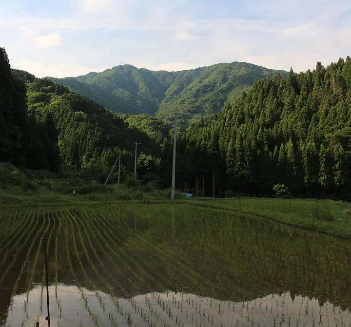
Mt. Yokoyamadake is a 1,132-meter twin-summit peak in Kinomoto-chō of Nagahama City, Shiga Prefecture, on the northern flank of the Ibuki Range. A second-class triangulation station marks the western summit. Multiple trails — the Shirotani main-stream course past the Kyō Falls and Gochōshi Falls, the East-Ridge course through old-growth beech, and the Koechidani route — are maintained by the local Sugino Yama-no-Kai. The summit overlooks Chikubu-shima on Lake Biwa, Mt. Ibuki, and Mt. Hakusan, and an annual mountain-opening ceremony with a climb-along event is held on the third Sunday of May. The peak is included in the Kansai Hyakumeizan, Ōmi Hyakuzan, and Kinki Hyakumeizan lists.
Mt. Yokoyamadake at a glance
- Weather: The most settled day in the next 7 days is Wed, November 4: clear, gusts up to 7 m/s. Fri, Nov 6, Sat, Nov 7: strong wind (gusts up to 17 m/s).
- Route: The shortest is Mount Yokoyama Shirotani Main Stream and East Ridge Loop: about 5 h 1 min, 8.4 km, about 930 m of climbing.
Mt. Yokoyamadake weather (hourly, 14 days)
Sunrise today 06:18, sunset 16:59
| Tue, 11/3 | Wed, 11/4 | Thu, 11/5 | Fri, 11/6 | Sat, 11/7 | Sun, 11/8 | Mon, 11/9 | Tue, 11/10 | Wed, 11/11 | Thu, 11/12 | Fri, 11/13 | Sat, 11/14 | Sun, 11/15 | Mon, 11/16 | Tue, 11/17 | |||||||||||||||||||||||||||||||||||||||||||||||||||||||||||||||||||||||
|---|---|---|---|---|---|---|---|---|---|---|---|---|---|---|---|---|---|---|---|---|---|---|---|---|---|---|---|---|---|---|---|---|---|---|---|---|---|---|---|---|---|---|---|---|---|---|---|---|---|---|---|---|---|---|---|---|---|---|---|---|---|---|---|---|---|---|---|---|---|---|---|---|---|---|---|---|---|---|---|---|---|---|---|---|---|
| Japan time | 15 | 17 | 19 | 21 | 23 | 1 | 3 | 5 | 7 | 9 | 11 | 13 | 15 | 18 | 21 | 0 | 3 | 6 | 9 | 12 | 15 | 18 | 21 | 0 | 3 | 6 | 9 | 12 | 15 | 18 | 21 | 0 | 3 | 6 | 9 | 12 | 15 | 18 | 21 | 0 | 3 | 6 | 9 | 12 | 15 | 18 | 21 | 0 | 3 | 6 | 9 | 15 | 21 | 3 | 9 | 15 | 21 | 3 | 9 | 15 | 21 | 3 | 9 | 15 | 21 | 3 | 9 | 15 | 21 | 3 | 9 | 15 | 21 | 3 | 9 | 15 | 21 | 3 | 9 | 15 | 21 | 3 | 9 | 15 | |
 |  |   | | | | | |   | | | |   |   | |   | |   |   | |   |   | | | | | |   | | | | | | | | | | | | | | | | | |   | | | | | | | | | | | | |   | | | | | | | | | |  | | | | | | | | | | | | | | | | ||
| Temperature | °C | 11° | 8° | 5° | 5° | 5° | 4° | 3° | 4° | 4° | 10° | 13° | 14° | 13° | 10° | 10° | 9° | 9° | 9° | 10° | 15° | 14° | 11° | 11° | 11° | 10° | 10° | 10° | 13° | 9° | 8° | 6° | 5° | 4° | 3° | 3° | 5° | 5° | 3° | 2° | 3° | 2° | 2° | 5° | 7° | 7° | 4° | 3° | 3° | 3° | 3° | 7° | 8° | 4° | 3° | 7° | 7° | 4° | 1° | 4° | 5° | 3° | 0° | 5° | 7° | 3° | 4° | 5° | 6° | 1° | -1° | 8° | 11° | 6° | 6° | 8° | 10° | 9° | 9° | 10° | 7° | 3° | 1° | 4° | 6° |
| Precipitation | mm | 1.1 | 5 | 3.5 | 2.4 | 0.5 | 1.4 | 5 | 1.5 | 3.4 | 0.9 | 1.3 | 0.7 | 1.1 | 0.8 | 0.7 | 1.4 | 1.2 | 1.2 | 0.1 | 0.2 | 0.1 | 0.6 | 0.2 | 0.1 | 1.8 | 11 | 6 | 0.2 | 0.2 | 3.0 | 0.9 | 7 | 10 | 3.8 | 1.9 | 0.6 | ||||||||||||||||||||||||||||||||||||||||||||||||
| New snow | cm | ||||||||||||||||||||||||||||||||||||||||||||||||||||||||||||||||||||||||||||||||||||
| Snow depth | cm | 0 | 0 | 0 | 0 | 0 | 0 | 0 | 0 | 0 | 0 | 0 | 0 | 0 | 0 | 0 | 0 | 0 | 0 | 0 | 0 | 0 | 0 | 0 | 0 | 0 | 0 | 0 | 0 | 0 | 0 | 0 | 0 | 0 | 0 | 0 | 0 | 0 | 0 | 0 | 0 | 0 | 0 | 0 | 0 | 0 | 0 | 0 | 0 | 0 | 0 | 0 | 0 | 0 | 0 | 0 | 0 | 0 | 0 | 0 | 0 | 0 | 0 | 0 | 0 | 0 | 0 | 0 | 0 | 0 | 0 | 0 | 0 | 0 | 0 | 0 | 0 | 0 | 0 | 0 | 0 | 0 | 0 | 0 | 0 |
| Wind | m/s | 4 | 3 | 3 | 3 | 3 | 3 | 3 | 3 | 2 | 1 | 1 | 1 | 1 | 0 | 2 | 1 | 3 | 1 | 1 | 1 | 1 | 1 | 2 | 3 | 3 | 4 | 4 | 6 | 5 | 5 | 5 | 6 | 6 | 5 | 5 | 7 | 6 | 4 | 4 | 4 | 3 | 3 | 4 | 5 | 4 | 2 | 1 | 1 | 1 | 1 | 2 | 3 | 0 | 2 | 3 | 2 | 4 | 7 | 8 | 7 | 4 | 3 | 3 | 3 | 0 | 2 | 6 | 6 | 3 | 2 | 2 | 3 | 3 | 4 | 4 | 4 | 5 | 2 | 5 | 6 | 5 | 4 | 3 | 3 |
| Wind gusts | m/s | 11 | 11 | 7 | 8 | 8 | 8 | 7 | 8 | 7 | 5 | 4 | 5 | 5 | 4 | 6 | 6 | 10 | 9 | 4 | 4 | 5 | 4 | 5 | 8 | 9 | 10 | 11 | 16 | 16 | 14 | 13 | 14 | 15 | 15 | 14 | 17 | 17 | 16 | 11 | 11 | 10 | 9 | 10 | 13 | 13 | 10 | 7 | 4 | 3 | 4 | 6 | 10 | 9 | 4 | 9 | 12 | 11 | 18 | 20 | 20 | 17 | 11 | 8 | 9 | 9 | 6 | 15 | 16 | 16 | 9 | 6 | 9 | 8 | 9 | 10 | 12 | 13 | 13 | 12 | 18 | 18 | 14 | 10 | 8 |
| Wind dir. | ↓ | ↓ | ↓ | ↓ | ↓ | ↓ | ↓ | ↓ | ↓ | ↓ | ↓ | ↓ | ↓ | ↓ | ↓ | ↓ | ↓ | ↓ | ↓ | ↓ | ↓ | ↓ | ↓ | ↓ | ↓ | ↓ | ↓ | ↓ | ↓ | ↓ | ↓ | ↓ | ↓ | ↓ | ↓ | ↓ | ↓ | ↓ | ↓ | ↓ | ↓ | ↓ | ↓ | ↓ | ↓ | ↓ | ↓ | ↓ | ↓ | ↓ | ↓ | ↓ | ↓ | ↓ | ↓ | ↓ | ↓ | ↓ | ↓ | ↓ | ↓ | ↓ | ↓ | ↓ | ↓ | ↓ | ↓ | ↓ | ↓ | ↓ | ↓ | ↓ | ↓ | ↓ | ↓ | ↓ | ↓ | ↓ | ↓ | ↓ | ↓ | ↓ | ↓ | ||
Mt. Yokoyamadake hiking routes
Hiking times are estimates calculated from the terrain.
Huts, campsites and lodging near Mt. Yokoyamadake
Mountain huts
- 横山岳白谷小屋
Lodging
- Choijian
Lists that include Mt. Yokoyamadake
Kansai 100 Famous Mountains · Kinki 100 Famous Mountains · Omi 100 Mountains · 1000 Mountains of Japan
Mt. Yokoyamadake facts
- Elevation
- 1,132 m
- Location
- Nagahama, Shiga
35.601529, 136.261636 - Website
- kitabiwako.jp
- Trail Map
- kitabiwako.jp (PDF)
- Wikipedia
- ja.wikipedia.org