
Mt. Takagoyama
高宕山
Kimitsu, Chiba · Elevation 330 m
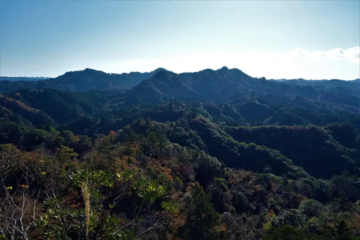
Mt. Takagoyama is a 330-meter peak on the border of Kimitsu and Futtsu cities in Chiba Prefecture, a representative summit of the Boso Hills. Distinctive rock outcrops, an old rain-prayer iron kettle on the summit, and the Takago Kannon hall to its north preserve its long history as a place of folk worship; on clear days the panorama reaches Mount Fuji and Mount Tsukuba. The surrounding 11-square-kilometer area is designated a National Natural Monument as a habitat of the Japanese macaque, and the mountain lies within Chiba Prefectural Takagoyama Natural Park (designated 1935), traversed by the "Path of Meeting Japanese Macaques" segment of the Kanto Fureai Trail. It appears in many renowned lists including the Kanto Hyakumeizan and the Hana no 50 Meizan.
Mt. Takagoyama at a glance
- Weather: The most settled day in the next 7 days is Fri, November 6: clear, gusts up to 6 m/s. Thu, Nov 5: strong wind (gusts up to 15 m/s).
- Route: The shortest is Mount Ishiitaro–Mount Takagoyama Return Hike: about 3 h 22 min, 5.5 km, about 430 m of climbing.
Mt. Takagoyama weather (hourly, 14 days)
Sunrise today 06:02, sunset 16:45
| Tue, 11/3 | Wed, 11/4 | Thu, 11/5 | Fri, 11/6 | Sat, 11/7 | Sun, 11/8 | Mon, 11/9 | Tue, 11/10 | Wed, 11/11 | Thu, 11/12 | Fri, 11/13 | Sat, 11/14 | Sun, 11/15 | Mon, 11/16 | Tue, 11/17 | |||||||||||||||||||||||||||||||||||||||||||||||||||||||||||||||||||||||
|---|---|---|---|---|---|---|---|---|---|---|---|---|---|---|---|---|---|---|---|---|---|---|---|---|---|---|---|---|---|---|---|---|---|---|---|---|---|---|---|---|---|---|---|---|---|---|---|---|---|---|---|---|---|---|---|---|---|---|---|---|---|---|---|---|---|---|---|---|---|---|---|---|---|---|---|---|---|---|---|---|---|---|---|---|---|
| Japan time | 15 | 17 | 19 | 21 | 23 | 1 | 3 | 5 | 7 | 9 | 11 | 13 | 15 | 18 | 21 | 0 | 3 | 6 | 9 | 12 | 15 | 18 | 21 | 0 | 3 | 6 | 9 | 12 | 15 | 18 | 21 | 0 | 3 | 6 | 9 | 12 | 15 | 18 | 21 | 0 | 3 | 6 | 9 | 12 | 15 | 18 | 21 | 0 | 3 | 6 | 9 | 15 | 21 | 3 | 9 | 15 | 21 | 3 | 9 | 15 | 21 | 3 | 9 | 15 | 21 | 3 | 9 | 15 | 21 | 3 | 9 | 15 | 21 | 3 | 9 | 15 | 21 | 3 | 9 | 15 | 21 | 3 | 9 | 15 | |
  |   | | |   | | | |   | | | | | | | | | | | |   |   |   |   | | |  | | |  | | | | |   | |   | | | | | | | | | | | | | | | | | | |   | |   | | |   |  | | | | | | | | | | | | | | | | | | | | | | | ||
| Temperature | °C | 17° | 14° | 14° | 14° | 14° | 14° | 12° | 11° | 12° | 13° | 14° | 14° | 13° | 11° | 12° | 11° | 12° | 12° | 13° | 16° | 15° | 14° | 14° | 13° | 12° | 12° | 17° | 21° | 20° | 16° | 14° | 15° | 13° | 13° | 14° | 17° | 16° | 13° | 12° | 10° | 10° | 10° | 11° | 13° | 13° | 12° | 11° | 11° | 10° | 9° | 9° | 11° | 10° | 9° | 9° | 10° | 6° | 7° | 12° | 13° | 9° | 6° | 11° | 13° | 9° | 7° | 12° | 14° | 7° | 5° | 10° | 13° | 9° | 9° | 13° | 15° | 15° | 16° | 19° | 19° | 13° | 9° | 10° | 11° |
| Precipitation | mm | 0.3 | 0.1 | 0.4 | 0.6 | 0.2 | 0.4 | 2.2 | 3.9 | 8 | 9 | 12 | 3.6 | 0.4 | 4.0 | 11 | 7 | 0.6 | 0.4 | 0.2 | 1.2 | 0.4 | 0.5 | 0.7 | 3.0 | 4.1 | 2.4 | 1.2 | 0.4 | 1.6 | 2.9 | 24 | 9 | ||||||||||||||||||||||||||||||||||||||||||||||||||||
| New snow | cm | ||||||||||||||||||||||||||||||||||||||||||||||||||||||||||||||||||||||||||||||||||||
| Snow depth | cm | 0 | 0 | 0 | 0 | 0 | 0 | 0 | 0 | 0 | 0 | 0 | 0 | 0 | 0 | 0 | 0 | 0 | 0 | 0 | 0 | 0 | 0 | 0 | 0 | 0 | 0 | 0 | 0 | 0 | 0 | 0 | 0 | 0 | 0 | 0 | 0 | 0 | 0 | 0 | 0 | 0 | 0 | 0 | 0 | 0 | 0 | 0 | 0 | 0 | 0 | 0 | 0 | 0 | 0 | 0 | 0 | 0 | 0 | 0 | 0 | 0 | 0 | 0 | 0 | 0 | 0 | 0 | 0 | 0 | 0 | 0 | 0 | 0 | 0 | 0 | 0 | 0 | 0 | 0 | 0 | 0 | 0 | 0 | 0 |
| Wind | m/s | 2 | 2 | 2 | 3 | 3 | 4 | 4 | 5 | 5 | 5 | 5 | 5 | 6 | 5 | 4 | 5 | 5 | 6 | 6 | 6 | 2 | 2 | 2 | 2 | 1 | 0 | 1 | 0 | 2 | 2 | 1 | 2 | 2 | 3 | 3 | 3 | 2 | 2 | 4 | 4 | 4 | 4 | 3 | 2 | 2 | 3 | 2 | 3 | 4 | 5 | 4 | 5 | 5 | 5 | 5 | 4 | 3 | 2 | 7 | 7 | 5 | 3 | 3 | 2 | 3 | 2 | 3 | 5 | 5 | 4 | 4 | 1 | 2 | 2 | 0 | 4 | 6 | 7 | 6 | 4 | 5 | 4 | 4 | 4 |
| Wind gusts | m/s | 6 | 5 | 5 | 5 | 6 | 7 | 8 | 10 | 10 | 11 | 10 | 10 | 12 | 12 | 11 | 10 | 11 | 16 | 15 | 14 | 14 | 6 | 4 | 5 | 5 | 3 | 4 | 6 | 6 | 6 | 3 | 4 | 6 | 5 | 8 | 8 | 7 | 6 | 7 | 8 | 9 | 10 | 9 | 8 | 6 | 6 | 6 | 6 | 8 | 10 | 10 | 11 | 11 | 11 | 11 | 12 | 8 | 5 | 18 | 20 | 16 | 11 | 7 | 6 | 5 | 7 | 7 | 13 | 11 | 10 | 9 | 9 | 5 | 4 | 4 | 11 | 11 | 17 | 17 | 12 | 18 | 12 | 10 | 10 |
| Wind dir. | ↓ | ↓ | ↓ | ↓ | ↓ | ↓ | ↓ | ↓ | ↓ | ↓ | ↓ | ↓ | ↓ | ↓ | ↓ | ↓ | ↓ | ↓ | ↓ | ↓ | ↓ | ↓ | ↓ | ↓ | ↓ | ↓ | ↓ | ↓ | ↓ | ↓ | ↓ | ↓ | ↓ | ↓ | ↓ | ↓ | ↓ | ↓ | ↓ | ↓ | ↓ | ↓ | ↓ | ↓ | ↓ | ↓ | ↓ | ↓ | ↓ | ↓ | ↓ | ↓ | ↓ | ↓ | ↓ | ↓ | ↓ | ↓ | ↓ | ↓ | ↓ | ↓ | ↓ | ↓ | ↓ | ↓ | ↓ | ↓ | ↓ | ↓ | ↓ | ↓ | ↓ | ↓ | ↓ | ↓ | ↓ | ↓ | ↓ | ↓ | ↓ | ↓ | ↓ | ↓ | |
Mt. Takagoyama hiking routes
Hiking times are estimates calculated from the terrain.
Huts, campsites and lodging near Mt. Takagoyama
Campsites
- Roman no Mori Auto Campground
- オートキャンプ・フルーツ村
- Seiwa-kenmin-no-mori-camping site
Lodging
- Hotel Silk Villa
- 鎌田屋旅館
- 房総クロスヴィレッジ
Lists that include Mt. Takagoyama
Mt. Takagoyama facts
- Elevation
- 330 m
- Location
- Kimitsu, Chiba
35.198286, 139.992498 - Website
- www.city.kimitsu.lg.jp
- Trail Map
- www.pref.chiba.lg.jp (PDF)
- Wikipedia
- ja.wikipedia.org