
Mt. Ogonzan
黄金山
Hiroshima, Hiroshima · Elevation 222 m
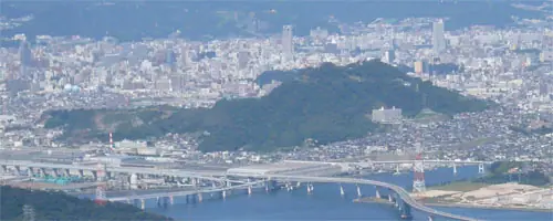
Ogonzan is a 221.7 m peak in the Ogonyama district of Minami Ward, Hiroshima City — an isolated hill regarded as the remnant of Nihojima, formerly an island in Hiroshima Bay. The site of a Sengoku-era mountain castle, its summit holds an observation deck and broadcasting facilities offering broad views over the bay and city, and is famous for some five hundred cherry trees lining the approach in spring. The peak is included in the 広島市の山を歩く guide.
Mt. Ogonzan at a glance
- Weather: The most settled day in the next 7 days is Thu, November 5: cloudy, gusts up to 4 m/s.
Mt. Ogonzan weather (hourly, 14 days)
Sunrise today 06:31, sunset 17:16
| Tue, 11/3 | Wed, 11/4 | Thu, 11/5 | Fri, 11/6 | Sat, 11/7 | Sun, 11/8 | Mon, 11/9 | Tue, 11/10 | Wed, 11/11 | Thu, 11/12 | Fri, 11/13 | Sat, 11/14 | Sun, 11/15 | Mon, 11/16 | Tue, 11/17 | |||||||||||||||||||||||||||||||||||||||||||||||||||||||||||||||||||||||
|---|---|---|---|---|---|---|---|---|---|---|---|---|---|---|---|---|---|---|---|---|---|---|---|---|---|---|---|---|---|---|---|---|---|---|---|---|---|---|---|---|---|---|---|---|---|---|---|---|---|---|---|---|---|---|---|---|---|---|---|---|---|---|---|---|---|---|---|---|---|---|---|---|---|---|---|---|---|---|---|---|---|---|---|---|---|
| Japan time | 15 | 17 | 19 | 21 | 23 | 1 | 3 | 5 | 7 | 9 | 11 | 13 | 15 | 18 | 21 | 0 | 3 | 6 | 9 | 12 | 15 | 18 | 21 | 0 | 3 | 6 | 9 | 12 | 15 | 18 | 21 | 0 | 3 | 6 | 9 | 12 | 15 | 18 | 21 | 0 | 3 | 6 | 9 | 12 | 15 | 18 | 21 | 0 | 3 | 6 | 9 | 15 | 21 | 3 | 9 | 15 | 21 | 3 | 9 | 15 | 21 | 3 | 9 | 15 | 21 | 3 | 9 | 15 | 21 | 3 | 9 | 15 | 21 | 3 | 9 | 15 | 21 | 3 | 9 | 15 | 21 | 3 | 9 | 15 | |
  |   |   | | | | |   | | | |   | | |   | | | | | |   |   | |   | | | |  | |  | | | | | | | | | | | | | | | | | | | | | |   |   | | | | | | | | | | | | | | | |  | | | | | | |   | |   | | | |  | | | ||
| Temperature | °C | 18° | 15° | 14° | 13° | 12° | 11° | 11° | 10° | 10° | 13° | 16° | 17° | 17° | 15° | 14° | 13° | 12° | 13° | 14° | 18° | 18° | 17° | 16° | 16° | 15° | 14° | 16° | 18° | 16° | 12° | 12° | 11° | 10° | 9° | 11° | 13° | 13° | 10° | 8° | 6° | 6° | 6° | 10° | 13° | 15° | 13° | 12° | 11° | 11° | 10° | 13° | 16° | 11° | 9° | 12° | 14° | 11° | 9° | 10° | 13° | 8° | 6° | 9° | 13° | 9° | 7° | 12° | 15° | 8° | 6° | 10° | 15° | 11° | 10° | 12° | 14° | 14° | 13° | 15° | 17° | 11° | 8° | 9° | 14° |
| Precipitation | mm | 0.2 | 1.0 | 0.4 | 0.8 | 1.9 | 0.2 | 0.4 | 0.4 | 0.1 | 0.3 | 6 | 15 | ||||||||||||||||||||||||||||||||||||||||||||||||||||||||||||||||||||||||
| New snow | cm | ||||||||||||||||||||||||||||||||||||||||||||||||||||||||||||||||||||||||||||||||||||
| Snow depth | cm | 0 | 0 | 0 | 0 | 0 | 0 | 0 | 0 | 0 | 0 | 0 | 0 | 0 | 0 | 0 | 0 | 0 | 0 | 0 | 0 | 0 | 0 | 0 | 0 | 0 | 0 | 0 | 0 | 0 | 0 | 0 | 0 | 0 | 0 | 0 | 0 | 0 | 0 | 0 | 0 | 0 | 0 | 0 | 0 | 0 | 0 | 0 | 0 | 0 | 0 | 0 | 0 | 0 | 0 | 0 | 0 | 0 | 0 | 0 | 0 | 0 | 0 | 0 | 0 | 0 | 0 | 0 | 0 | 0 | 0 | 0 | 0 | 0 | 0 | 0 | 0 | 0 | 0 | 0 | 0 | 0 | 0 | 0 | 0 |
| Wind | m/s | 4 | 4 | 4 | 3 | 3 | 3 | 3 | 3 | 3 | 3 | 3 | 2 | 2 | 1 | 2 | 2 | 2 | 1 | 2 | 1 | 1 | 1 | 2 | 2 | 2 | 1 | 1 | 4 | 4 | 3 | 2 | 3 | 3 | 3 | 3 | 3 | 3 | 3 | 2 | 2 | 2 | 2 | 2 | 2 | 2 | 1 | 2 | 2 | 2 | 2 | 2 | 2 | 2 | 1 | 1 | 4 | 3 | 5 | 1 | 4 | 2 | 1 | 1 | 2 | 1 | 1 | 2 | 4 | 3 | 3 | 3 | 2 | 1 | 2 | 2 | 2 | 1 | 1 | 1 | 4 | 5 | 3 | 3 | 1 |
| Wind gusts | m/s | 8 | 9 | 8 | 8 | 7 | 6 | 6 | 6 | 6 | 6 | 7 | 6 | 5 | 4 | 4 | 4 | 4 | 5 | 4 | 4 | 3 | 4 | 4 | 4 | 6 | 5 | 4 | 8 | 8 | 8 | 6 | 7 | 7 | 7 | 7 | 7 | 7 | 7 | 5 | 4 | 5 | 5 | 6 | 6 | 5 | 4 | 4 | 4 | 5 | 4 | 4 | 6 | 7 | 5 | 3 | 9 | 8 | 9 | 9 | 8 | 7 | 4 | 4 | 5 | 6 | 4 | 5 | 8 | 7 | 6 | 6 | 6 | 5 | 4 | 4 | 7 | 7 | 3 | 4 | 8 | 10 | 9 | 6 | 7 |
| Wind dir. | ↓ | ↓ | ↓ | ↓ | ↓ | ↓ | ↓ | ↓ | ↓ | ↓ | ↓ | ↓ | ↓ | ↓ | ↓ | ↓ | ↓ | ↓ | ↓ | ↓ | ↓ | ↓ | ↓ | ↓ | ↓ | ↓ | ↓ | ↓ | ↓ | ↓ | ↓ | ↓ | ↓ | ↓ | ↓ | ↓ | ↓ | ↓ | ↓ | ↓ | ↓ | ↓ | ↓ | ↓ | ↓ | ↓ | ↓ | ↓ | ↓ | ↓ | ↓ | ↓ | ↓ | ↓ | ↓ | ↓ | ↓ | ↓ | ↓ | ↓ | ↓ | ↓ | ↓ | ↓ | ↓ | ↓ | ↓ | ↓ | ↓ | ↓ | ↓ | ↓ | ↓ | ↓ | ↓ | ↓ | ↓ | ↓ | ↓ | ↓ | ↓ | ↓ | ↓ | ↓ | |
Huts, campsites and lodging near Mt. Ogonzan
Lodging
- Tamy Tenjingawa
- SOCIO RESIDENTIAL HOTEL(ソシオ レジデンシャル ホテル)
- HOTEL 石本
- Toyoko Inn
- ベッセルイン広島駅前 Vessel Inn Hiroshima Stashion
Mt. Ogonzan facts
- Elevation
- 222 m
- Location
- Hiroshima, Hiroshima
34.367200, 132.490654 - Website
- www.city.hiroshima.lg.jp
- Trail Map
- www.city.hiroshima.lg.jp (PDF)
- Wikipedia
- ja.wikipedia.org