
Mt. Nihonkoku
日本国
Murakami, Niigata / Tsuruoka, Yamagata · Elevation 555 m
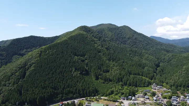
Mt. Nihonkoku is a 555.4 m low peak straddling Tsuruoka City in Yamagata and Murakami City in Niigata, also called Ishibachi-yama. It lies on a historic Shonai-Echigo route, with its evocative name attributed variously to a falconry tribute or an Ainu boundary marker. The mountain holds a yamabiraki opening ceremony each May 5 chosen to match its 555 m elevation, and summiters can receive a certificate of ascent. It is listed in Niigata 100 Meizan, Yamagata 100 Meizan, and Japan's 100 Low Mountains.
Mt. Nihonkoku at a glance
- Weather: The most settled day in the next 7 days is Wed, November 4: clear, gusts up to 7 m/s. Fri, Nov 6, Sat, Nov 7, Sun, Nov 8: strong wind (gusts up to 23 m/s).
- Route: The shortest is Murakami Nihonkoku on the Prefectural Border from Omata-juku on the Dewa Kaido, Loop via Janigetoge down to Zaodo: about 3 h 14 min, 5.3 km, about 530 m of climbing.
Mt. Nihonkoku weather (hourly, 14 days)
Sunrise today 06:09, sunset 16:41
| Tue, 11/3 | Wed, 11/4 | Thu, 11/5 | Fri, 11/6 | Sat, 11/7 | Sun, 11/8 | Mon, 11/9 | Tue, 11/10 | Wed, 11/11 | Thu, 11/12 | Fri, 11/13 | Sat, 11/14 | Sun, 11/15 | Mon, 11/16 | Tue, 11/17 | |||||||||||||||||||||||||||||||||||||||||||||||||||||||||||||||||||||||
|---|---|---|---|---|---|---|---|---|---|---|---|---|---|---|---|---|---|---|---|---|---|---|---|---|---|---|---|---|---|---|---|---|---|---|---|---|---|---|---|---|---|---|---|---|---|---|---|---|---|---|---|---|---|---|---|---|---|---|---|---|---|---|---|---|---|---|---|---|---|---|---|---|---|---|---|---|---|---|---|---|---|---|---|---|---|
| Japan time | 15 | 17 | 19 | 21 | 23 | 1 | 3 | 5 | 7 | 9 | 11 | 13 | 15 | 18 | 21 | 0 | 3 | 6 | 9 | 12 | 15 | 18 | 21 | 0 | 3 | 6 | 9 | 12 | 15 | 18 | 21 | 0 | 3 | 6 | 9 | 12 | 15 | 18 | 21 | 0 | 3 | 6 | 9 | 12 | 15 | 18 | 21 | 0 | 3 | 6 | 9 | 15 | 21 | 3 | 9 | 15 | 21 | 3 | 9 | 15 | 21 | 3 | 9 | 15 | 21 | 3 | 9 | 15 | 21 | 3 | 9 | 15 | 21 | 3 | 9 | 15 | 21 | 3 | 9 | 15 | 21 | 3 | 9 | 15 | |
 |  |   | |   | | |   |   | |   | | | | |   | | |   |   | | | |   | | | | | | | | | | |   | |   |   | | | | | | | | | | | | |   | | | | | | | | | | | | | | | | | | | | | | | |   | | | | | | | | | | ||
| Temperature | °C | 10° | 9° | 9° | 9° | 10° | 10° | 10° | 9° | 8° | 10° | 12° | 12° | 12° | 10° | 10° | 12° | 12° | 11° | 12° | 12° | 14° | 13° | 12° | 12° | 12° | 12° | 13° | 14° | 11° | 9° | 8° | 7° | 6° | 6° | 5° | 7° | 6° | 6° | 6° | 6° | 6° | 6° | 6° | 7° | 7° | 7° | 7° | 7° | 6° | 6° | 7° | 6° | 6° | 4° | 6° | 11° | 7° | 5° | 7° | 7° | 7° | 7° | 8° | 8° | 6° | 8° | 7° | 6° | 6° | 6° | 7° | 8° | 4° | 4° | 11° | 13° | 9° | 10° | 11° | 8° | 5° | 4° | 5° | 6° |
| Precipitation | mm | 0.3 | 0.5 | 0.2 | 0.1 | 2.0 | 2.9 | 1.5 | 0.6 | 2.9 | 0.6 | 6 | 11 | 6 | 7 | 5 | 3.7 | 2.6 | 2.2 | 2.4 | 3.4 | 2.2 | 3.2 | 1.1 | 1.2 | 1.5 | 1.1 | 1.2 | 0.9 | 0.1 | 0.3 | 0.1 | 0.1 | 0.1 | 1.6 | 0.1 | 6 | 19 | 7 | 1.5 | 2.4 | 0.1 | 1.0 | 0.7 | 11 | 1.1 | 0.3 | 2.7 | 2.8 | 4.7 | 4.7 | 1.1 | 0.4 | 0.4 | |||||||||||||||||||||||||||||||
| New snow | cm | <.1 | <.1 | <.1 | |||||||||||||||||||||||||||||||||||||||||||||||||||||||||||||||||||||||||||||||||
| Snow depth | cm | 0 | 0 | 0 | 0 | 0 | 0 | 0 | 0 | 0 | 0 | 0 | 0 | 0 | 0 | 0 | 0 | 0 | 0 | 0 | 0 | 0 | 0 | 0 | 0 | 0 | 0 | 0 | 0 | 0 | 0 | 0 | 0 | 0 | 0 | 0 | 0 | 0 | 0 | 0 | 0 | 0 | 0 | 0 | 0 | 0 | 0 | 0 | 0 | 0 | 0 | 0 | 0 | 0 | 0 | 0 | 0 | 0 | 0 | 0 | 0 | 0 | 0 | 0 | 0 | 0 | 0 | 0 | 0 | 0 | 0 | 0 | 0 | 0 | 0 | 0 | 0 | 0 | 0 | 0 | 0 | 0 | 0 | 0 | 0 |
| Wind | m/s | 5 | 4 | 4 | 4 | 4 | 4 | 4 | 3 | 4 | 4 | 3 | 2 | 3 | 5 | 3 | 2 | 2 | 3 | 5 | 3 | 3 | 2 | 4 | 4 | 5 | 6 | 8 | 9 | 8 | 8 | 10 | 8 | 10 | 11 | 12 | 13 | 13 | 12 | 12 | 11 | 11 | 10 | 10 | 9 | 8 | 6 | 5 | 5 | 4 | 1 | 2 | 5 | 3 | 3 | 3 | 2 | 8 | 3 | 2 | 8 | 6 | 4 | 5 | 5 | 6 | 7 | 8 | 7 | 6 | 4 | 3 | 2 | 2 | 2 | 2 | 4 | 4 | 2 | 2 | 11 | 8 | 5 | 3 | 2 |
| Wind gusts | m/s | 9 | 8 | 7 | 7 | 6 | 7 | 7 | 7 | 6 | 7 | 7 | 7 | 6 | 8 | 7 | 6 | 5 | 6 | 7 | 7 | 6 | 5 | 7 | 8 | 7 | 11 | 13 | 15 | 16 | 14 | 15 | 15 | 16 | 19 | 19 | 23 | 23 | 21 | 20 | 19 | 18 | 17 | 16 | 16 | 15 | 13 | 9 | 8 | 8 | 7 | 5 | 10 | 8 | 5 | 6 | 6 | 15 | 15 | 10 | 15 | 13 | 9 | 9 | 9 | 9 | 10 | 14 | 12 | 11 | 9 | 7 | 6 | 5 | 4 | 5 | 7 | 7 | 6 | 10 | 18 | 17 | 13 | 9 | 6 |
| Wind dir. | ↓ | ↓ | ↓ | ↓ | ↓ | ↓ | ↓ | ↓ | ↓ | ↓ | ↓ | ↓ | ↓ | ↓ | ↓ | ↓ | ↓ | ↓ | ↓ | ↓ | ↓ | ↓ | ↓ | ↓ | ↓ | ↓ | ↓ | ↓ | ↓ | ↓ | ↓ | ↓ | ↓ | ↓ | ↓ | ↓ | ↓ | ↓ | ↓ | ↓ | ↓ | ↓ | ↓ | ↓ | ↓ | ↓ | ↓ | ↓ | ↓ | ↓ | ↓ | ↓ | ↓ | ↓ | ↓ | ↓ | ↓ | ↓ | ↓ | ↓ | ↓ | ↓ | ↓ | ↓ | ↓ | ↓ | ↓ | ↓ | ↓ | ↓ | ↓ | ↓ | ↓ | ↓ | ↓ | ↓ | ↓ | ↓ | ↓ | ↓ | ↓ | ↓ | ↓ | ↓ | |
Mt. Nihonkoku hiking routes
Hiking times are estimates calculated from the terrain.
Lists that include Mt. Nihonkoku
100 Low Mountains of Japan · Yamagata 100 Famous Mountains · Niigata 100 Famous Mountains
Mt. Nihonkoku facts
- Also known as
- 石鉢山
- Elevation
- 555 m
- Location
- Murakami, Niigata / Tsuruoka, Yamagata
38.525108, 139.596888 - Season Opens
- May 5
- Website
- www.city.murakami.lg.jp
- Trail Map
- www.city.murakami.lg.jp
- Wikipedia
- ja.wikipedia.org