
Mt. Narabara
楢原山
Imabari, Ehime · Elevation 1,041 m
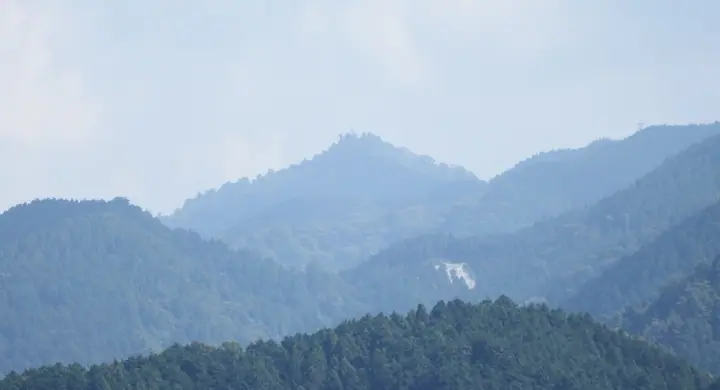
A 1,041 m peak in Imabari City, Ehime Prefecture, the highest summit of the Takanawa Peninsula reaching out into the Seto Inland Sea. Long revered as a guardian of cattle and a rain-summoning sacred mountain, it is crowned by Naraharasan Shrine. Excavations near the shrine in 1934 yielded a bronze reliquary stupa and other Heian-period sutra-mound artefacts, designated together as a National Treasure in 1956 under the name 'Iyo Naraharasan Sutra-mound Excavated Objects'. The mountain lies within the Okudogo-Tamagawa Prefectural Natural Park, is served by the 9.4 km 'Path to Mt. Narabara' segment of the Shikoku Nature Trail, and is one of the One Hundred Famous Mountains of Shikoku.
Mt. Narabara at a glance
- Weather: The most settled day in the next 7 days is Mon, November 9: clear, gusts up to 8 m/s.
Mt. Narabara weather (hourly, 14 days)
Sunrise today 06:29, sunset 17:15
| Tue, 11/3 | Wed, 11/4 | Thu, 11/5 | Fri, 11/6 | Sat, 11/7 | Sun, 11/8 | Mon, 11/9 | Tue, 11/10 | Wed, 11/11 | Thu, 11/12 | Fri, 11/13 | Sat, 11/14 | Sun, 11/15 | Mon, 11/16 | Tue, 11/17 | |||||||||||||||||||||||||||||||||||||||||||||||||||||||||||||||||||||||
|---|---|---|---|---|---|---|---|---|---|---|---|---|---|---|---|---|---|---|---|---|---|---|---|---|---|---|---|---|---|---|---|---|---|---|---|---|---|---|---|---|---|---|---|---|---|---|---|---|---|---|---|---|---|---|---|---|---|---|---|---|---|---|---|---|---|---|---|---|---|---|---|---|---|---|---|---|---|---|---|---|---|---|---|---|---|
| Japan time | 15 | 17 | 19 | 21 | 23 | 1 | 3 | 5 | 7 | 9 | 11 | 13 | 15 | 18 | 21 | 0 | 3 | 6 | 9 | 12 | 15 | 18 | 21 | 0 | 3 | 6 | 9 | 12 | 15 | 18 | 21 | 0 | 3 | 6 | 9 | 12 | 15 | 18 | 21 | 0 | 3 | 6 | 9 | 12 | 15 | 18 | 21 | 0 | 3 | 6 | 9 | 15 | 21 | 3 | 9 | 15 | 21 | 3 | 9 | 15 | 21 | 3 | 9 | 15 | 21 | 3 | 9 | 15 | 21 | 3 | 9 | 15 | 21 | 3 | 9 | 15 | 21 | 3 | 9 | 15 | 21 | 3 | 9 | 15 | |
  | |   |   | |   |   | |   |   | | | | | | | | |   | |   | | | |   | |  | | |  | | | | | | | | | | | | | | | | | | | | | | | | | | | | | | | | | | | | | | | | | | | | |   | | | | | | |   | | | ||
| Temperature | °C | 15° | 11° | 10° | 9° | 8° | 9° | 9° | 9° | 9° | 10° | 11° | 13° | 13° | 9° | 9° | 10° | 9° | 9° | 11° | 16° | 16° | 13° | 13° | 14° | 12° | 10° | 13° | 15° | 14° | 9° | 7° | 6° | 6° | 4° | 8° | 9° | 10° | 6° | 4° | 4° | 4° | 4° | 9° | 10° | 10° | 7° | 7° | 6° | 7° | 7° | 11° | 13° | 7° | 2° | 9° | 11° | 6° | 5° | 6° | 10° | 5° | 3° | 8° | 11° | 5° | 4° | 9° | 11° | 7° | 3° | 8° | 12° | 6° | 5° | 11° | 12° | 10° | 11° | 12° | 15° | 8° | 6° | 7° | 9° |
| Precipitation | mm | 0.3 | 0.4 | 0.2 | 1.3 | 2.4 | 1.6 | 0.3 | 1.1 | 0.3 | 1.8 | 1.3 | 0.9 | 0.6 | 0.3 | 0.2 | 0.6 | 1.7 | 8 | 1.6 | 0.5 | 0.3 | 1.3 | 0.2 | |||||||||||||||||||||||||||||||||||||||||||||||||||||||||||||
| New snow | cm | ||||||||||||||||||||||||||||||||||||||||||||||||||||||||||||||||||||||||||||||||||||
| Snow depth | cm | 0 | 0 | 0 | 0 | 0 | 0 | 0 | 0 | 0 | 0 | 0 | 0 | 0 | 0 | 0 | 0 | 0 | 0 | 0 | 0 | 0 | 0 | 0 | 0 | 0 | 0 | 0 | 0 | 0 | 0 | 0 | 0 | 0 | 0 | 0 | 0 | 0 | 0 | 0 | 0 | 0 | 0 | 0 | 0 | 0 | 0 | 0 | 0 | 0 | 0 | 0 | 0 | 0 | 0 | 0 | 0 | 0 | 0 | 0 | 0 | 0 | 0 | 0 | 0 | 0 | 0 | 0 | 0 | 0 | 0 | 0 | 0 | 0 | 0 | 0 | 0 | 0 | 0 | 0 | 0 | 0 | 0 | 0 | 0 |
| Wind | m/s | 1 | 0 | 1 | 1 | 2 | 2 | 2 | 3 | 3 | 4 | 4 | 3 | 3 | 1 | 1 | 1 | 1 | 1 | 1 | 1 | 1 | 0 | 2 | 3 | 1 | 2 | 2 | 5 | 5 | 3 | 2 | 1 | 2 | 1 | 3 | 2 | 2 | 2 | 1 | 1 | 1 | 2 | 3 | 3 | 3 | 1 | 1 | 1 | 1 | 0 | 2 | 2 | 0 | 0 | 1 | 4 | 2 | 3 | 3 | 3 | 1 | 0 | 0 | 2 | 2 | 0 | 2 | 3 | 4 | 3 | 2 | 1 | 1 | 1 | 1 | 0 | 2 | 2 | 1 | 3 | 4 | 3 | 3 | 2 |
| Wind gusts | m/s | 7 | 5 | 5 | 5 | 5 | 5 | 6 | 8 | 9 | 10 | 11 | 10 | 9 | 8 | 4 | 6 | 4 | 5 | 5 | 5 | 5 | 5 | 6 | 11 | 11 | 6 | 8 | 13 | 14 | 14 | 10 | 7 | 7 | 7 | 9 | 9 | 7 | 7 | 6 | 4 | 4 | 5 | 8 | 9 | 9 | 8 | 4 | 4 | 3 | 2 | 6 | 8 | 6 | 3 | 5 | 10 | 11 | 10 | 11 | 11 | 9 | 4 | 3 | 7 | 6 | 5 | 6 | 10 | 10 | 10 | 7 | 7 | 5 | 4 | 6 | 6 | 8 | 9 | 6 | 10 | 11 | 11 | 9 | 9 |
| Wind dir. | ↓ | ↓ | ↓ | ↓ | ↓ | ↓ | ↓ | ↓ | ↓ | ↓ | ↓ | ↓ | ↓ | ↓ | ↓ | ↓ | ↓ | ↓ | ↓ | ↓ | ↓ | ↓ | ↓ | ↓ | ↓ | ↓ | ↓ | ↓ | ↓ | ↓ | ↓ | ↓ | ↓ | ↓ | ↓ | ↓ | ↓ | ↓ | ↓ | ↓ | ↓ | ↓ | ↓ | ↓ | ↓ | ↓ | ↓ | ↓ | ↓ | ↓ | ↓ | ↓ | ↓ | ↓ | ↓ | ↓ | ↓ | ↓ | ↓ | ↓ | ↓ | ↓ | ↓ | ↓ | ↓ | ↓ | ↓ | ↓ | ↓ | ↓ | ↓ | ↓ | ↓ | ↓ | ↓ | ↓ | ↓ | ↓ | ↓ | ↓ | ↓ | ↓ | ↓ | ↓ | |
Huts, campsites and lodging near Mt. Narabara
Lodging
- 皆楽荘
- 鈍川温泉ホテル
- 鈍川温泉 美賀登
- カドヤ別荘
- 門田旅館
Lists that include Mt. Narabara
Mt. Narabara facts
- Elevation
- 1,041 m
- Location
- Imabari, Ehime
33.940249, 132.944435 - Website
- shikoku-nature-trail.com
- Trail Map
- www.pref.ehime.jp (PDF)
- Wikipedia
- ja.wikipedia.org