
Mt. Kazashi
風師山
Kitakyūshū, Fukuoka · Elevation 362 m
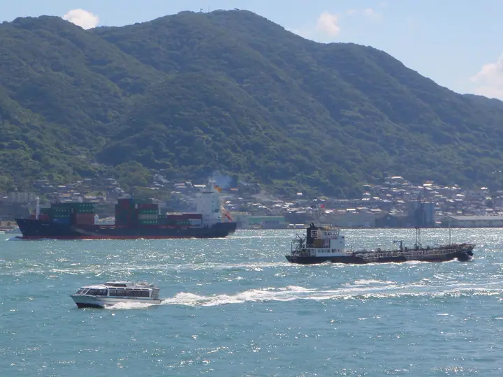
Mt. Kazashi is a 362.2-meter peak in the Komorie district of Moji Ward, Kitakyushu City, Fukuoka Prefecture, in the Kiku Peninsula at Kyushu's northern tip. It joins Mt. Adachi and Mt. Tonokami as the "Three Peaks of Kiku." The mountain has three summits — Kazagashira Rock Peak, the main summit, and the South Peak — and offers wide views of the Kanmon Strait, Suo-nada and Genkai-nada seas from the Kazagashira viewpoint and the Momijidani autumn-foliage valley.
Mt. Kazashi at a glance
- Weather: The most settled day in the next 7 days is Sun, November 8: clear, gusts up to 9 m/s.
- Route: The shortest is Moji Loop from Kazagashira and Mount Kazashi to Mount Yahazu and the Shimonoseki Fortress Ruins: about 2 h 44 min, 5.2 km, about 420 m of climbing.
Mt. Kazashi weather (hourly, 14 days)
Sunrise today 06:37, sunset 17:23
| Tue, 11/3 | Wed, 11/4 | Thu, 11/5 | Fri, 11/6 | Sat, 11/7 | Sun, 11/8 | Mon, 11/9 | Tue, 11/10 | Wed, 11/11 | Thu, 11/12 | Fri, 11/13 | Sat, 11/14 | Sun, 11/15 | Mon, 11/16 | Tue, 11/17 | |||||||||||||||||||||||||||||||||||||||||||||||||||||||||||||||||||||||
|---|---|---|---|---|---|---|---|---|---|---|---|---|---|---|---|---|---|---|---|---|---|---|---|---|---|---|---|---|---|---|---|---|---|---|---|---|---|---|---|---|---|---|---|---|---|---|---|---|---|---|---|---|---|---|---|---|---|---|---|---|---|---|---|---|---|---|---|---|---|---|---|---|---|---|---|---|---|---|---|---|---|---|---|---|---|
| Japan time | 21 | 23 | 1 | 3 | 5 | 7 | 9 | 11 | 13 | 15 | 17 | 19 | 21 | 0 | 3 | 6 | 9 | 12 | 15 | 18 | 21 | 0 | 3 | 6 | 9 | 12 | 15 | 18 | 21 | 0 | 3 | 6 | 9 | 12 | 15 | 18 | 21 | 0 | 3 | 6 | 9 | 12 | 15 | 18 | 21 | 0 | 3 | 6 | 9 | 12 | 15 | 21 | 3 | 9 | 15 | 21 | 3 | 9 | 15 | 21 | 3 | 9 | 15 | 21 | 3 | 9 | 15 | 21 | 3 | 9 | 15 | 21 | 3 | 9 | 15 | 21 | 3 | 9 | 15 | 21 | 3 | 9 | 15 | 21 | |
  |   | | | |   | |   | |   | | |   | | | |   |   |   |   | | | |  | |  | | | | | | | | | | | | | | | | | | | | | | | | | |   | | | | | | | | | | | | | | | | | | | | |   | | | | | | | | | | |  | ||
| Temperature | °C | 14° | 13° | 14° | 14° | 13° | 13° | 14° | 15° | 16° | 16° | 16° | 15° | 16° | 16° | 16° | 15° | 16° | 16° | 16° | 18° | 17° | 16° | 16° | 15° | 16° | 16° | 14° | 13° | 12° | 11° | 9° | 9° | 10° | 11° | 12° | 10° | 10° | 9° | 9° | 10° | 11° | 13° | 13° | 13° | 12° | 12° | 12° | 12° | 14° | 14° | 14° | 11° | 11° | 13° | 13° | 13° | 10° | 10° | 12° | 10° | 8° | 11° | 13° | 11° | 11° | 13° | 15° | 11° | 10° | 11° | 14° | 14° | 15° | 15° | 16° | 16° | 15° | 16° | 15° | 12° | 11° | 10° | 14° | 10° |
| Precipitation | mm | 0.2 | 0.5 | 0.5 | 5 | 13 | 1.3 | 0.2 | 0.2 | 0.2 | 0.1 | 0.3 | 6 | 22 | 8 | 0.3 | 0.2 | 0.3 | |||||||||||||||||||||||||||||||||||||||||||||||||||||||||||||||||||
| New snow | cm | ||||||||||||||||||||||||||||||||||||||||||||||||||||||||||||||||||||||||||||||||||||
| Snow depth | cm | 0 | 0 | 0 | 0 | 0 | 0 | 0 | 0 | 0 | 0 | 0 | 0 | 0 | 0 | 0 | 0 | 0 | 0 | 0 | 0 | 0 | 0 | 0 | 0 | 0 | 0 | 0 | 0 | 0 | 0 | 0 | 0 | 0 | 0 | 0 | 0 | 0 | 0 | 0 | 0 | 0 | 0 | 0 | 0 | 0 | 0 | 0 | 0 | 0 | 0 | 0 | 0 | 0 | 0 | 0 | 0 | 0 | 0 | 0 | 0 | 0 | 0 | 0 | 0 | 0 | 0 | 0 | 0 | 0 | 0 | 0 | 0 | 0 | 0 | 0 | 0 | 0 | 0 | 0 | 0 | 0 | 0 | 0 | 0 |
| Wind | m/s | 3 | 2 | 2 | 3 | 4 | 3 | 3 | 4 | 4 | 3 | 3 | 3 | 4 | 4 | 4 | 3 | 4 | 6 | 4 | 7 | 6 | 5 | 6 | 6 | 8 | 7 | 7 | 7 | 7 | 7 | 7 | 6 | 6 | 5 | 4 | 3 | 2 | 2 | 2 | 3 | 4 | 3 | 2 | 2 | 2 | 2 | 1 | 0 | 2 | 4 | 2 | 3 | 2 | 5 | 7 | 6 | 6 | 3 | 4 | 1 | 2 | 1 | 4 | 3 | 2 | 2 | 3 | 3 | 3 | 5 | 4 | 3 | 5 | 5 | 4 | 3 | 5 | 5 | 5 | 5 | 2 | 2 | 2 | 2 |
| Wind gusts | m/s | 5 | 5 | 4 | 6 | 7 | 7 | 6 | 9 | 10 | 7 | 6 | 5 | 8 | 8 | 8 | 8 | 8 | 12 | 13 | 11 | 12 | 11 | 12 | 11 | 15 | 14 | 14 | 13 | 12 | 13 | 13 | 12 | 11 | 11 | 10 | 8 | 5 | 4 | 4 | 6 | 8 | 9 | 7 | 5 | 4 | 5 | 4 | 3 | 5 | 8 | 8 | 8 | 5 | 9 | 13 | 13 | 12 | 10 | 8 | 7 | 4 | 4 | 9 | 8 | 5 | 5 | 7 | 7 | 6 | 9 | 10 | 8 | 9 | 12 | 11 | 10 | 9 | 9 | 11 | 10 | 10 | 5 | 6 | 6 |
| Wind dir. | ↓ | ↓ | ↓ | ↓ | ↓ | ↓ | ↓ | ↓ | ↓ | ↓ | ↓ | ↓ | ↓ | ↓ | ↓ | ↓ | ↓ | ↓ | ↓ | ↓ | ↓ | ↓ | ↓ | ↓ | ↓ | ↓ | ↓ | ↓ | ↓ | ↓ | ↓ | ↓ | ↓ | ↓ | ↓ | ↓ | ↓ | ↓ | ↓ | ↓ | ↓ | ↓ | ↓ | ↓ | ↓ | ↓ | ↓ | ↓ | ↓ | ↓ | ↓ | ↓ | ↓ | ↓ | ↓ | ↓ | ↓ | ↓ | ↓ | ↓ | ↓ | ↓ | ↓ | ↓ | ↓ | ↓ | ↓ | ↓ | ↓ | ↓ | ↓ | ↓ | ↓ | ↓ | ↓ | ↓ | ↓ | ↓ | ↓ | ↓ | ↓ | ↓ | ↓ | ↓ | |
Mt. Kazashi hiking routes
Hiking times are estimates calculated from the terrain.
Huts, campsites and lodging near Mt. Kazashi
Campsites
- 矢筈山キャンプ場
Lodging
- ホテルルートイン門司港
- ホステル門司港キャビン
- PLAZA HOTEL SHIMONOSEKI
- MOJI PORT
- SuperHotel Premier
Mt. Kazashi facts
- Also known as
- 風頭
- Elevation
- 362 m
- Location
- Kitakyūshū, Fukuoka
33.924440, 130.954698 - Website
- kitakyushucity.guide
- Trail Map
- www.city.kitakyushu.lg.jp
- Wikipedia
- ja.wikipedia.org