
Mt. Kasagiyama
笠置山
Kasagi, Kyoto · Elevation 288 m
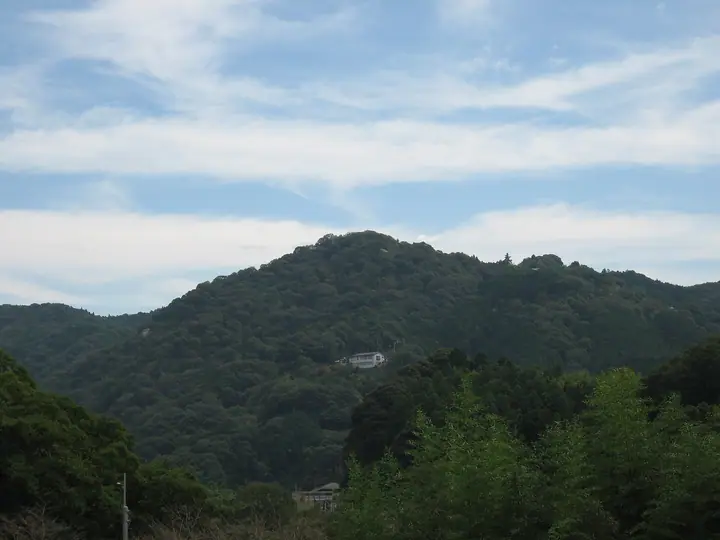
A 288-meter sacred peak on the south bank of the Kizu River in Kasagi-chō, Sōraku District, southern Kyoto Prefecture, celebrated for its dramatic granite boulders and the historic Kasagi-dera temple at its summit. Long revered as a Shugendō training site, the mountain is best known as the stage of the Genkō Incident of 1331, when Emperor Go-Daigo made it his refuge during his rising against the Kamakura shogunate. Designated a National Historic Site and Place of Scenic Beauty in 1932 and a Kyoto Prefectural Natural Park in 1964, the peak is served by several hiking trails starting from JR Kasagi Station and is featured in the Bunken Tozan guide of Kyoto mountains, the 339 Mountains of Kyoto, the Nihon Meizan Zue, and the 130 Mountains of the Kansai Region.
Mt. Kasagiyama at a glance
- Weather: The most settled day in the next 7 days is Mon, November 9: clear, gusts up to 9 m/s. Sat, Nov 7: strong wind (gusts up to 15 m/s).
Mt. Kasagiyama weather (hourly, 14 days)
Sunrise today 06:18, sunset 17:02
| Tue, 11/3 | Wed, 11/4 | Thu, 11/5 | Fri, 11/6 | Sat, 11/7 | Sun, 11/8 | Mon, 11/9 | Tue, 11/10 | Wed, 11/11 | Thu, 11/12 | Fri, 11/13 | Sat, 11/14 | Sun, 11/15 | Mon, 11/16 | Tue, 11/17 | |||||||||||||||||||||||||||||||||||||||||||||||||||||||||||||||||||||||
|---|---|---|---|---|---|---|---|---|---|---|---|---|---|---|---|---|---|---|---|---|---|---|---|---|---|---|---|---|---|---|---|---|---|---|---|---|---|---|---|---|---|---|---|---|---|---|---|---|---|---|---|---|---|---|---|---|---|---|---|---|---|---|---|---|---|---|---|---|---|---|---|---|---|---|---|---|---|---|---|---|---|---|---|---|---|
| Japan time | 15 | 17 | 19 | 21 | 23 | 1 | 3 | 5 | 7 | 9 | 11 | 13 | 15 | 18 | 21 | 0 | 3 | 6 | 9 | 12 | 15 | 18 | 21 | 0 | 3 | 6 | 9 | 12 | 15 | 18 | 21 | 0 | 3 | 6 | 9 | 12 | 15 | 18 | 21 | 0 | 3 | 6 | 9 | 12 | 15 | 18 | 21 | 0 | 3 | 6 | 9 | 15 | 21 | 3 | 9 | 15 | 21 | 3 | 9 | 15 | 21 | 3 | 9 | 15 | 21 | 3 | 9 | 15 | 21 | 3 | 9 | 15 | 21 | 3 | 9 | 15 | 21 | 3 | 9 | 15 | 21 | 3 | 9 | 15 | |
  | |   | | |  | | | |   | | |   |   | |   | |   |   | |  | | | |   |   | | | | |  | | | | | | | | | | | | | | | | | | | | |   | |   | | | | | | | |  | | | | | | | | | | | | | |   | | | | | | | | | ||
| Temperature | °C | 18° | 14° | 12° | 11° | 11° | 10° | 9° | 9° | 9° | 14° | 16° | 17° | 16° | 15° | 15° | 14° | 14° | 13° | 16° | 17° | 19° | 15° | 14° | 14° | 15° | 14° | 16° | 19° | 18° | 15° | 12° | 10° | 9° | 8° | 11° | 13° | 12° | 9° | 7° | 6° | 5° | 5° | 11° | 13° | 12° | 10° | 9° | 9° | 8° | 9° | 12° | 14° | 9° | 7° | 13° | 14° | 9° | 7° | 9° | 11° | 6° | 4° | 10° | 12° | 6° | 6° | 11° | 12° | 6° | 3° | 10° | 16° | 7° | 7° | 13° | 15° | 13° | 13° | 15° | 16° | 10° | 6° | 9° | 13° |
| Precipitation | mm | 0.7 | 1.0 | 0.3 | 0.3 | 0.5 | 0.5 | 0.7 | 0.2 | 0.1 | 0.4 | 0.1 | 0.9 | 13 | 0.2 | 0.8 | |||||||||||||||||||||||||||||||||||||||||||||||||||||||||||||||||||||
| New snow | cm | ||||||||||||||||||||||||||||||||||||||||||||||||||||||||||||||||||||||||||||||||||||
| Snow depth | cm | 0 | 0 | 0 | 0 | 0 | 0 | 0 | 0 | 0 | 0 | 0 | 0 | 0 | 0 | 0 | 0 | 0 | 0 | 0 | 0 | 0 | 0 | 0 | 0 | 0 | 0 | 0 | 0 | 0 | 0 | 0 | 0 | 0 | 0 | 0 | 0 | 0 | 0 | 0 | 0 | 0 | 0 | 0 | 0 | 0 | 0 | 0 | 0 | 0 | 0 | 0 | 0 | 0 | 0 | 0 | 0 | 0 | 0 | 0 | 0 | 0 | 0 | 0 | 0 | 0 | 0 | 0 | 0 | 0 | 0 | 0 | 0 | 0 | 0 | 0 | 0 | 0 | 0 | 0 | 0 | 0 | 0 | 0 | 0 |
| Wind | m/s | 3 | 3 | 2 | 1 | 1 | 1 | 1 | 0 | 1 | 1 | 2 | 3 | 4 | 4 | 5 | 3 | 3 | 2 | 2 | 2 | 1 | 1 | 1 | 1 | 4 | 3 | 5 | 6 | 5 | 5 | 4 | 5 | 4 | 4 | 5 | 7 | 6 | 4 | 2 | 2 | 1 | 1 | 1 | 4 | 3 | 1 | 1 | 1 | 1 | 1 | 2 | 4 | 1 | 1 | 3 | 4 | 3 | 5 | 3 | 6 | 2 | 1 | 2 | 3 | 2 | 2 | 2 | 5 | 1 | 1 | 1 | 1 | 1 | 2 | 3 | 4 | 2 | 0 | 3 | 5 | 3 | 3 | 2 | 2 |
| Wind gusts | m/s | 8 | 8 | 6 | 4 | 3 | 3 | 4 | 2 | 2 | 4 | 5 | 7 | 8 | 10 | 12 | 12 | 8 | 8 | 5 | 5 | 5 | 4 | 3 | 3 | 9 | 10 | 12 | 13 | 14 | 12 | 11 | 10 | 10 | 8 | 12 | 15 | 15 | 13 | 8 | 5 | 4 | 4 | 4 | 9 | 10 | 7 | 3 | 2 | 2 | 3 | 6 | 9 | 8 | 3 | 7 | 12 | 10 | 12 | 11 | 16 | 14 | 4 | 5 | 8 | 7 | 5 | 6 | 12 | 11 | 3 | 3 | 5 | 4 | 4 | 8 | 11 | 9 | 7 | 8 | 13 | 12 | 7 | 6 | 7 |
| Wind dir. | ↓ | ↓ | ↓ | ↓ | ↓ | ↓ | ↓ | ↓ | ↓ | ↓ | ↓ | ↓ | ↓ | ↓ | ↓ | ↓ | ↓ | ↓ | ↓ | ↓ | ↓ | ↓ | ↓ | ↓ | ↓ | ↓ | ↓ | ↓ | ↓ | ↓ | ↓ | ↓ | ↓ | ↓ | ↓ | ↓ | ↓ | ↓ | ↓ | ↓ | ↓ | ↓ | ↓ | ↓ | ↓ | ↓ | ↓ | ↓ | ↓ | ↓ | ↓ | ↓ | ↓ | ↓ | ↓ | ↓ | ↓ | ↓ | ↓ | ↓ | ↓ | ↓ | ↓ | ↓ | ↓ | ↓ | ↓ | ↓ | ↓ | ↓ | ↓ | ↓ | ↓ | ↓ | ↓ | ↓ | ↓ | ↓ | ↓ | ↓ | ↓ | ↓ | ↓ | ↓ | |
Huts, campsites and lodging near Mt. Kasagiyama
Campsites
- Kasagi Camping Ground
- Yamahachi Campground
- 奈良市青少年野外活動センター
Lodging
- Yoshiya
- 浜作
Lists that include Mt. Kasagiyama
Mt. Kasagiyama facts
- Elevation
- 288 m
- Location
- Kasagi, Kyoto
34.754673, 135.942281 - Website
- kankou-kasagi.com
- Trail Map
- kankou-kasagi.com
- Wikipedia
- ja.wikipedia.org