
Mt. Kanpō
寒峰
Miyoshi, Tokushima · Elevation 1,605 m
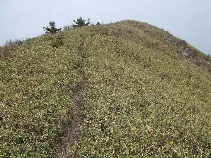
Mt. Kanpō (1,605 m) rises in the Higashi-Iya district of Miyoshi City, Tokushima Prefecture, on the main ridge of the northwestern Tsurugi Range, and is included in the Shikoku 100 Famous Mountains and Japan's 1000 Mountains lists. The mountain is renowned for its colonies of Amur adonis (fukujusō) that bloom in March, and the standard trail from Sumiyoshi Shrine passes through the wildflower fields on the way to the summit. A historical traverse from Ochiai Pass (1,520 m) over Mae-Eboshi-yama still links the peaks, and the open top affords sweeping views across the Iya mountains.
Mt. Kanpō at a glance
- Weather: The most settled day in the next 7 days is Sun, November 8: clear, gusts up to 7 m/s.
Mt. Kanpō weather (hourly, 14 days)
Sunrise today 06:25, sunset 17:11
| Tue, 11/3 | Wed, 11/4 | Thu, 11/5 | Fri, 11/6 | Sat, 11/7 | Sun, 11/8 | Mon, 11/9 | Tue, 11/10 | Wed, 11/11 | Thu, 11/12 | Fri, 11/13 | Sat, 11/14 | Sun, 11/15 | Mon, 11/16 | Tue, 11/17 | |||||||||||||||||||||||||||||||||||||||||||||||||||||||||||||||||||||||
|---|---|---|---|---|---|---|---|---|---|---|---|---|---|---|---|---|---|---|---|---|---|---|---|---|---|---|---|---|---|---|---|---|---|---|---|---|---|---|---|---|---|---|---|---|---|---|---|---|---|---|---|---|---|---|---|---|---|---|---|---|---|---|---|---|---|---|---|---|---|---|---|---|---|---|---|---|---|---|---|---|---|---|---|---|---|
| Japan time | 15 | 17 | 19 | 21 | 23 | 1 | 3 | 5 | 7 | 9 | 11 | 13 | 15 | 18 | 21 | 0 | 3 | 6 | 9 | 12 | 15 | 18 | 21 | 0 | 3 | 6 | 9 | 12 | 15 | 18 | 21 | 0 | 3 | 6 | 9 | 12 | 15 | 18 | 21 | 0 | 3 | 6 | 9 | 12 | 15 | 18 | 21 | 0 | 3 | 6 | 9 | 15 | 21 | 3 | 9 | 15 | 21 | 3 | 9 | 15 | 21 | 3 | 9 | 15 | 21 | 3 | 9 | 15 | 21 | 3 | 9 | 15 | 21 | 3 | 9 | 15 | 21 | 3 | 9 | 15 | 21 | 3 | 9 | 15 | |
 |   |   |   | | | | |   |   | | | | | |   | | |   | |   | | |   | | | | | |  | | | | | | | | | | | | | | | | | | | | | | | | | |   |   | | | | | | | | | | | | | | | | | | | | | | | | |   | | | ||
| Temperature | °C | 10° | 7° | 6° | 6° | 5° | 6° | 6° | 5° | 5° | 6° | 10° | 10° | 10° | 7° | 8° | 8° | 9° | 8° | 10° | 15° | 15° | 11° | 11° | 11° | 10° | 8° | 8° | 11° | 10° | 6° | 3° | 2° | 2° | 1° | 3° | 5° | 5° | 2° | 1° | -1° | -2° | -2° | 5° | 8° | 7° | 3° | 3° | 2° | 3° | 4° | 6° | 8° | 3° | 1° | 5° | 7° | 1° | 0° | 1° | 4° | 0° | -4° | 4° | 7° | 1° | 1° | 4° | 6° | 0° | -3° | 6° | 10° | 1° | 2° | 10° | 11° | 10° | 9° | 9° | 9° | 5° | 1° | 3° | 6° |
| Precipitation | mm | 0.9 | 1.3 | 1.3 | 0.8 | 0.1 | 2.0 | 1.1 | 0.5 | 0.3 | 1.2 | 0.6 | 0.2 | 0.3 | 0.1 | 0.7 | 0.1 | 1.9 | 2.1 | 3.5 | 3.0 | 0.5 | |||||||||||||||||||||||||||||||||||||||||||||||||||||||||||||||
| New snow | cm | ||||||||||||||||||||||||||||||||||||||||||||||||||||||||||||||||||||||||||||||||||||
| Snow depth | cm | 0 | 0 | 0 | 0 | 0 | 0 | 0 | 0 | 0 | 0 | 0 | 0 | 0 | 0 | 0 | 0 | 0 | 0 | 0 | 0 | 0 | 0 | 0 | 0 | 0 | 0 | 0 | 0 | 0 | 0 | 0 | 0 | 0 | 0 | 0 | 0 | 0 | 0 | 0 | 0 | 0 | 0 | 0 | 0 | 0 | 0 | 0 | 0 | 0 | 0 | 0 | 0 | 0 | 0 | 0 | 0 | 0 | 0 | 0 | 0 | 0 | 0 | 0 | 0 | 0 | 0 | 0 | 0 | 0 | 0 | 0 | 0 | 0 | 0 | 0 | 0 | 0 | 0 | 0 | 0 | 0 | 0 | 0 | 0 |
| Wind | m/s | 2 | 0 | 0 | 1 | 1 | 2 | 2 | 3 | 3 | 3 | 3 | 2 | 1 | 1 | 0 | 2 | 0 | 0 | 0 | 0 | 1 | 2 | 3 | 3 | 4 | 3 | 3 | 5 | 5 | 4 | 4 | 4 | 4 | 3 | 4 | 4 | 3 | 1 | 1 | 0 | 0 | 1 | 1 | 2 | 2 | 0 | 1 | 1 | 1 | 1 | 2 | 3 | 1 | 1 | 2 | 4 | 3 | 4 | 3 | 4 | 1 | 1 | 1 | 2 | 1 | 1 | 3 | 3 | 1 | 1 | 1 | 1 | 2 | 2 | 2 | 4 | 3 | 1 | 3 | 4 | 3 | 1 | 1 | 2 |
| Wind gusts | m/s | 8 | 6 | 3 | 4 | 4 | 5 | 7 | 7 | 9 | 9 | 9 | 8 | 6 | 5 | 4 | 7 | 7 | 3 | 3 | 4 | 7 | 7 | 10 | 12 | 13 | 13 | 12 | 14 | 15 | 15 | 14 | 13 | 13 | 13 | 14 | 14 | 12 | 11 | 6 | 5 | 3 | 3 | 5 | 7 | 7 | 7 | 3 | 4 | 5 | 4 | 7 | 10 | 8 | 5 | 7 | 12 | 11 | 13 | 13 | 13 | 12 | 4 | 5 | 8 | 8 | 7 | 8 | 11 | 10 | 4 | 5 | 6 | 6 | 7 | 9 | 13 | 15 | 13 | 10 | 14 | 12 | 8 | 4 | 8 |
| Wind dir. | ↓ | ↓ | ↓ | ↓ | ↓ | ↓ | ↓ | ↓ | ↓ | ↓ | ↓ | ↓ | ↓ | ↓ | ↓ | ↓ | ↓ | ↓ | ↓ | ↓ | ↓ | ↓ | ↓ | ↓ | ↓ | ↓ | ↓ | ↓ | ↓ | ↓ | ↓ | ↓ | ↓ | ↓ | ↓ | ↓ | ↓ | ↓ | ↓ | ↓ | ↓ | ↓ | ↓ | ↓ | ↓ | ↓ | ↓ | ↓ | ↓ | ↓ | ↓ | ↓ | ↓ | ↓ | ↓ | ↓ | ↓ | ↓ | ↓ | ↓ | ↓ | ↓ | ↓ | ↓ | ↓ | ↓ | ↓ | ↓ | ↓ | ↓ | ↓ | ↓ | ↓ | ↓ | ↓ | ↓ | ↓ | ↓ | ↓ | ↓ | ↓ | ↓ | ↓ | ||
Huts, campsites and lodging near Mt. Kanpō
Mountain huts
- 落合峠避難小屋
Lodging
- 雲外
- 蒼天
- Togenkyo-Iya
- 平家荘
- よしだ旅館
Lists that include Mt. Kanpō
Mt. Kanpō facts
- Elevation
- 1,605 m
- Location
- Miyoshi, Tokushima
33.901820, 133.903974 - Website
- www.rinya.maff.go.jp
- Wikipedia
- ja.wikipedia.org