
Mt. Inugatake
犬ヶ岳
Buzen, Fukuoka · Elevation 1,131 m
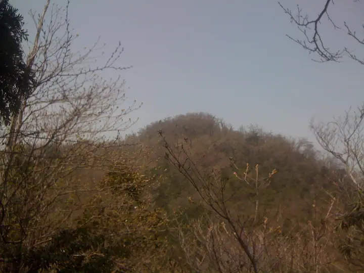
Mt. Inu-ga-take is a 1,130.8 m peak straddling the boundary between Buzen City in Fukuoka Prefecture and Nakatsu City in Ōita Prefecture, the highest summit of the Buzen range. The area lies within Yaba-Hita-Hikosan Quasi-National Park, and the Kyūshū Nature Trail runs along its crest. The natural rhododendron forest between Mt. Inu-ga-take and Oitsuri Pass — Tsukushi-shakunage of about 30 ha — is a designated National Natural Monument, blooming in pale pink between late April and early May. The mountain shares the area with the Shugendō sacred peak of Kubote-san and ravine features such as the Osoroshi Gorge and Meoto Falls. It is listed in the Kyūshū 100 Famous Mountains, the prefectural climbing guides for Fukuoka and Ōita, the 2017 100 Low Mountains of Japan and other selections, and ranks as a representative peak of the Buzen region.
Mt. Inugatake at a glance
- Weather: The most settled day in the next 7 days is Sun, November 8: clear, gusts up to 7 m/s.
- Route: The shortest is Mount Inugatake Loop via Shakagatake and Ninodake: about 4 h 59 min, 8.1 km, about 850 m of climbing.
Mt. Inugatake weather (hourly, 14 days)
Sunrise today 06:36, sunset 17:23
| Tue, 11/3 | Wed, 11/4 | Thu, 11/5 | Fri, 11/6 | Sat, 11/7 | Sun, 11/8 | Mon, 11/9 | Tue, 11/10 | Wed, 11/11 | Thu, 11/12 | Fri, 11/13 | Sat, 11/14 | Sun, 11/15 | Mon, 11/16 | Tue, 11/17 | |||||||||||||||||||||||||||||||||||||||||||||||||||||||||||||||||||||||
|---|---|---|---|---|---|---|---|---|---|---|---|---|---|---|---|---|---|---|---|---|---|---|---|---|---|---|---|---|---|---|---|---|---|---|---|---|---|---|---|---|---|---|---|---|---|---|---|---|---|---|---|---|---|---|---|---|---|---|---|---|---|---|---|---|---|---|---|---|---|---|---|---|---|---|---|---|---|---|---|---|---|---|---|---|---|
| Japan time | 15 | 17 | 19 | 21 | 23 | 1 | 3 | 5 | 7 | 9 | 11 | 13 | 15 | 18 | 21 | 0 | 3 | 6 | 9 | 12 | 15 | 18 | 21 | 0 | 3 | 6 | 9 | 12 | 15 | 18 | 21 | 0 | 3 | 6 | 9 | 12 | 15 | 18 | 21 | 0 | 3 | 6 | 9 | 12 | 15 | 18 | 21 | 0 | 3 | 6 | 9 | 15 | 21 | 3 | 9 | 15 | 21 | 3 | 9 | 15 | 21 | 3 | 9 | 15 | 21 | 3 | 9 | 15 | 21 | 3 | 9 | 15 | 21 | 3 | 9 | 15 | 21 | 3 | 9 | 15 | 21 | 3 | 9 | 15 | |
  | |   | | | |   | |   |   | | |   |   | | |   | | |   | |   | | | |  | | |  | | | | | | | | | | | | | | | | | | | | | | |   | | | | | | | | |   |  | | | | | | | | | | | |   | | | | | | | | | | | ||
| Temperature | °C | 11° | 10° | 8° | 6° | 6° | 6° | 7° | 6° | 6° | 9° | 11° | 12° | 12° | 9° | 8° | 8° | 8° | 9° | 11° | 13° | 15° | 13° | 13° | 11° | 9° | 7° | 10° | 12° | 10° | 5° | 4° | 3° | 2° | 1° | 4° | 7° | 7° | 2° | 1° | 0° | 1° | 1° | 6° | 8° | 8° | 5° | 5° | 5° | 4° | 5° | 8° | 10° | 4° | 3° | 7° | 8° | 4° | 3° | 4° | 7° | 1° | 0° | 6° | 9° | 2° | 3° | 8° | 9° | 4° | 2° | 7° | 11° | 6° | 7° | 9° | 11° | 11° | 10° | 9° | 11° | 5° | 5° | 6° | 9° |
| Precipitation | mm | 0.3 | 1.1 | 0.8 | 0.1 | 1.1 | 3.9 | 0.4 | 1.5 | 0.2 | 0.1 | 0.2 | 0.1 | 0.3 | 0.6 | 0.4 | 0.9 | 8 | 12 | 0.7 | 1.1 | 1.0 | 0.2 | 0.3 | |||||||||||||||||||||||||||||||||||||||||||||||||||||||||||||
| New snow | cm | ||||||||||||||||||||||||||||||||||||||||||||||||||||||||||||||||||||||||||||||||||||
| Snow depth | cm | 0 | 0 | 0 | 0 | 0 | 0 | 0 | 0 | 0 | 0 | 0 | 0 | 0 | 0 | 0 | 0 | 0 | 0 | 0 | 0 | 0 | 0 | 0 | 0 | 0 | 0 | 0 | 0 | 0 | 0 | 0 | 0 | 0 | 0 | 0 | 0 | 0 | 0 | 0 | 0 | 0 | 0 | 0 | 0 | 0 | 0 | 0 | 0 | 0 | 0 | 0 | 0 | 0 | 0 | 0 | 0 | 0 | 0 | 0 | 0 | 0 | 0 | 0 | 0 | 0 | 0 | 0 | 0 | 0 | 0 | 0 | 0 | 0 | 0 | 0 | 0 | 0 | 0 | 0 | 0 | 0 | 0 | 0 | 0 |
| Wind | m/s | 3 | 3 | 3 | 2 | 2 | 2 | 2 | 1 | 2 | 3 | 4 | 4 | 4 | 2 | 2 | 1 | 1 | 1 | 2 | 2 | 4 | 4 | 4 | 3 | 4 | 3 | 5 | 6 | 5 | 4 | 4 | 4 | 4 | 4 | 4 | 4 | 3 | 1 | 1 | 0 | 0 | 1 | 2 | 2 | 2 | 1 | 1 | 0 | 1 | 2 | 2 | 3 | 1 | 2 | 4 | 5 | 2 | 4 | 4 | 3 | 1 | 1 | 1 | 3 | 2 | 1 | 2 | 2 | 1 | 2 | 2 | 2 | 1 | 1 | 2 | 1 | 3 | 3 | 3 | 4 | 2 | 2 | 2 | 2 |
| Wind gusts | m/s | 7 | 7 | 5 | 5 | 4 | 4 | 4 | 3 | 5 | 8 | 10 | 10 | 9 | 9 | 6 | 5 | 3 | 2 | 5 | 7 | 9 | 11 | 11 | 10 | 8 | 8 | 10 | 13 | 13 | 13 | 10 | 10 | 9 | 9 | 10 | 10 | 9 | 8 | 3 | 3 | 2 | 2 | 5 | 7 | 7 | 6 | 3 | 3 | 3 | 4 | 5 | 8 | 9 | 4 | 9 | 12 | 12 | 9 | 9 | 9 | 8 | 3 | 4 | 8 | 8 | 4 | 5 | 8 | 6 | 5 | 6 | 7 | 6 | 4 | 6 | 8 | 8 | 7 | 7 | 11 | 10 | 6 | 6 | 7 |
| Wind dir. | ↓ | ↓ | ↓ | ↓ | ↓ | ↓ | ↓ | ↓ | ↓ | ↓ | ↓ | ↓ | ↓ | ↓ | ↓ | ↓ | ↓ | ↓ | ↓ | ↓ | ↓ | ↓ | ↓ | ↓ | ↓ | ↓ | ↓ | ↓ | ↓ | ↓ | ↓ | ↓ | ↓ | ↓ | ↓ | ↓ | ↓ | ↓ | ↓ | ↓ | ↓ | ↓ | ↓ | ↓ | ↓ | ↓ | ↓ | ↓ | ↓ | ↓ | ↓ | ↓ | ↓ | ↓ | ↓ | ↓ | ↓ | ↓ | ↓ | ↓ | ↓ | ↓ | ↓ | ↓ | ↓ | ↓ | ↓ | ↓ | ↓ | ↓ | ↓ | ↓ | ↓ | ↓ | ↓ | ↓ | ↓ | ↓ | ↓ | ↓ | ↓ | ↓ | ↓ | ↓ | |
Mt. Inugatake hiking routes
Hiking times are estimates calculated from the terrain.
Huts, campsites and lodging near Mt. Inugatake
Mountain huts
Campsites
- 求菩提キャンプ場
Lists that include Mt. Inugatake
Kyushu 100 Famous Mountains · Oita 100 Mountains · Elevations of 1003 Mountains of Japan · 1000 Mountains of Japan
Mt. Inugatake facts
- Elevation
- 1,131 m
- Location
- Buzen, Fukuoka
33.512256, 131.001749 - National Park
- 耶馬日田英彦山国定公園
- Website
- www.city.buzen.lg.jp
- Trail Map
- www.city.buzen.lg.jp
- Access Information
- www.city.buzen.lg.jp