
Mt. Higashitokonoosan
東床尾山
Toyooka, Hyogo · Elevation 839 m
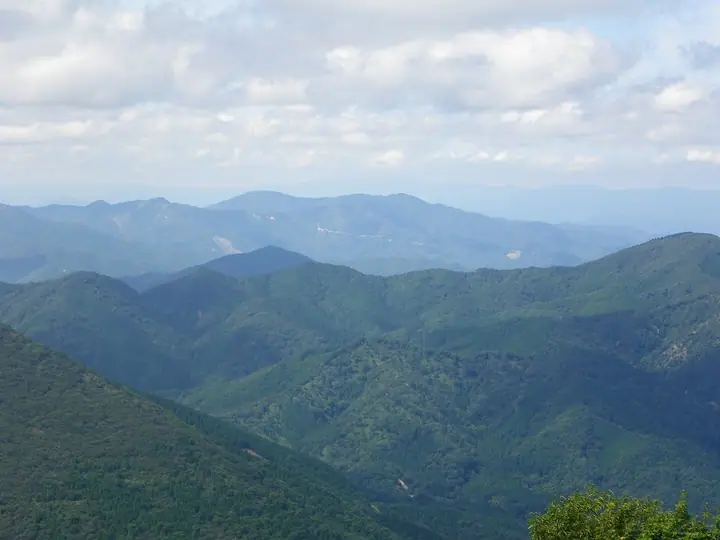
Mt. Higashitokonoosan is an 839.1 m peak straddling the border of Toyooka City and Asago City in Hyogo Prefecture, the principal summit of the Tokono Mountain Chain in the Tanba Highlands. It forms the core of Izushi-Itoi Prefectural Natural Park, with a first-class triangulation point at the top commanding views to Mt. Hyono, Mt. Sobu, and Mt. Oe. At the foot stands the Itoi-no-Daikatsura, a roughly 2,000-year-old Japanese katsura tree (national natural monument) with a 19.2 m trunk girth. Three trails climb the peak, including approaches from Itoi in Wadayama-cho and from Kirino. The peak appears in the Kansai 100, Kinki 100, Furusato Hyogo 100, Osaka-area 250, Japan 1000, and Japan 1003 Mountain Elevations lists.
Mt. Higashitokonoosan at a glance
- Weather: The most settled day in the next 7 days is Wed, November 4: clear, gusts up to 8 m/s. Sat, Nov 7: strong wind (gusts up to 15 m/s).
Mt. Higashitokonoosan weather (hourly, 14 days)
Sunrise today 06:23, sunset 17:05
| Tue, 11/3 | Wed, 11/4 | Thu, 11/5 | Fri, 11/6 | Sat, 11/7 | Sun, 11/8 | Mon, 11/9 | Tue, 11/10 | Wed, 11/11 | Thu, 11/12 | Fri, 11/13 | Sat, 11/14 | Sun, 11/15 | Mon, 11/16 | Tue, 11/17 | |||||||||||||||||||||||||||||||||||||||||||||||||||||||||||||||||||||||
|---|---|---|---|---|---|---|---|---|---|---|---|---|---|---|---|---|---|---|---|---|---|---|---|---|---|---|---|---|---|---|---|---|---|---|---|---|---|---|---|---|---|---|---|---|---|---|---|---|---|---|---|---|---|---|---|---|---|---|---|---|---|---|---|---|---|---|---|---|---|---|---|---|---|---|---|---|---|---|---|---|---|---|---|---|---|
| Japan time | 15 | 17 | 19 | 21 | 23 | 1 | 3 | 5 | 7 | 9 | 11 | 13 | 15 | 18 | 21 | 0 | 3 | 6 | 9 | 12 | 15 | 18 | 21 | 0 | 3 | 6 | 9 | 12 | 15 | 18 | 21 | 0 | 3 | 6 | 9 | 12 | 15 | 18 | 21 | 0 | 3 | 6 | 9 | 12 | 15 | 18 | 21 | 0 | 3 | 6 | 9 | 15 | 21 | 3 | 9 | 15 | 21 | 3 | 9 | 15 | 21 | 3 | 9 | 15 | 21 | 3 | 9 | 15 | 21 | 3 | 9 | 15 | 21 | 3 | 9 | 15 | 21 | 3 | 9 | 15 | 21 | 3 | 9 | 15 | |
  | |   |   | | | | |   |  | | | | |   |   | | |   |   |   |   | | | | | | |   | | | | | | | | | | | | | | | | | | | | | | | |   | | | | | | | | | | | | | | | | | | | | | | | | | | | | | | | | ||
| Temperature | °C | 11° | 8° | 8° | 6° | 6° | 6° | 5° | 6° | 6° | 11° | 13° | 14° | 13° | 9° | 8° | 9° | 9° | 9° | 10° | 17° | 15° | 11° | 11° | 10° | 10° | 10° | 12° | 15° | 12° | 10° | 8° | 6° | 6° | 5° | 7° | 8° | 7° | 5° | 6° | 6° | 6° | 5° | 9° | 10° | 9° | 7° | 6° | 6° | 6° | 5° | 8° | 9° | 5° | 5° | 8° | 10° | 5° | 4° | 7° | 7° | 5° | 4° | 8° | 10° | 3° | 4° | 7° | 8° | 4° | 3° | 8° | 12° | 4° | 6° | 11° | 11° | 11° | 10° | 10° | 8° | 5° | 4° | 6° | 7° |
| Precipitation | mm | 0.4 | 0.3 | 0.6 | 2.3 | 0.9 | 0.4 | 0.7 | 0.6 | 3.2 | 1.6 | 0.1 | 0.6 | 0.2 | 0.2 | 0.1 | 0.3 | 2.1 | 0.6 | 1.2 | 0.4 | 1.5 | 0.7 | 0.4 | 0.5 | 3.1 | 0.1 | 6 | 5 | 1.3 | 5.0 | 2.4 | |||||||||||||||||||||||||||||||||||||||||||||||||||||
| New snow | cm | ||||||||||||||||||||||||||||||||||||||||||||||||||||||||||||||||||||||||||||||||||||
| Snow depth | cm | 0 | 0 | 0 | 0 | 0 | 0 | 0 | 0 | 0 | 0 | 0 | 0 | 0 | 0 | 0 | 0 | 0 | 0 | 0 | 0 | 0 | 0 | 0 | 0 | 0 | 0 | 0 | 0 | 0 | 0 | 0 | 0 | 0 | 0 | 0 | 0 | 0 | 0 | 0 | 0 | 0 | 0 | 0 | 0 | 0 | 0 | 0 | 0 | 0 | 0 | 0 | 0 | 0 | 0 | 0 | 0 | 0 | 0 | 0 | 0 | 0 | 0 | 0 | 0 | 0 | 0 | 0 | 0 | 0 | 0 | 0 | 0 | 0 | 0 | 0 | 0 | 0 | 0 | 0 | 0 | 0 | 0 | 0 | 0 |
| Wind | m/s | 3 | 1 | 1 | 1 | 1 | 1 | 1 | 1 | 1 | 1 | 3 | 3 | 3 | 1 | 1 | 3 | 2 | 0 | 1 | 0 | 1 | 0 | 1 | 2 | 2 | 2 | 4 | 5 | 6 | 4 | 4 | 4 | 4 | 5 | 6 | 6 | 5 | 3 | 2 | 2 | 1 | 0 | 0 | 4 | 3 | 1 | 1 | 1 | 1 | 1 | 1 | 3 | 2 | 1 | 1 | 5 | 4 | 7 | 6 | 5 | 2 | 1 | 1 | 2 | 1 | 2 | 5 | 5 | 2 | 1 | 1 | 2 | 3 | 3 | 3 | 4 | 4 | 1 | 3 | 6 | 4 | 2 | 3 | 3 |
| Wind gusts | m/s | 8 | 7 | 3 | 3 | 3 | 2 | 3 | 3 | 3 | 4 | 7 | 8 | 7 | 7 | 3 | 7 | 8 | 5 | 4 | 4 | 5 | 4 | 3 | 5 | 6 | 7 | 9 | 13 | 14 | 13 | 10 | 11 | 10 | 11 | 13 | 15 | 15 | 12 | 7 | 6 | 5 | 4 | 3 | 10 | 12 | 8 | 2 | 2 | 2 | 3 | 4 | 11 | 8 | 4 | 5 | 13 | 12 | 17 | 18 | 15 | 12 | 4 | 4 | 6 | 6 | 5 | 11 | 14 | 12 | 5 | 4 | 5 | 6 | 7 | 9 | 12 | 13 | 10 | 9 | 13 | 13 | 10 | 8 | 9 |
| Wind dir. | ↓ | ↓ | ↓ | ↓ | ↓ | ↓ | ↓ | ↓ | ↓ | ↓ | ↓ | ↓ | ↓ | ↓ | ↓ | ↓ | ↓ | ↓ | ↓ | ↓ | ↓ | ↓ | ↓ | ↓ | ↓ | ↓ | ↓ | ↓ | ↓ | ↓ | ↓ | ↓ | ↓ | ↓ | ↓ | ↓ | ↓ | ↓ | ↓ | ↓ | ↓ | ↓ | ↓ | ↓ | ↓ | ↓ | ↓ | ↓ | ↓ | ↓ | ↓ | ↓ | ↓ | ↓ | ↓ | ↓ | ↓ | ↓ | ↓ | ↓ | ↓ | ↓ | ↓ | ↓ | ↓ | ↓ | ↓ | ↓ | ↓ | ↓ | ↓ | ↓ | ↓ | ↓ | ↓ | ↓ | ↓ | ↓ | ↓ | ↓ | ↓ | ↓ | ↓ | ↓ | |
Lists that include Mt. Higashitokonoosan
Kansai 100 Famous Mountains · Kinki 100 Famous Mountains · 100 Mountains of Our Home Hyogo · Elevations of 1003 Mountains of Japan · 1000 Mountains of Japan
Mt. Higashitokonoosan facts
- Elevation
- 839 m
- Location
- Toyooka, Hyogo
35.421935, 134.915822 - Website
- www.city.asago.hyogo.jp
- Trail Map
- www.city.asago.hyogo.jp (PDF)
- Wikipedia
- ja.wikipedia.org