
Mt. Genjiyama
源氏山
Kamakura, Kanagawa · Elevation 93 m
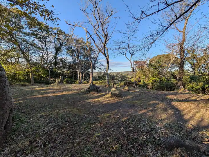
Genjiyama is a 93-meter low hill in Ogigayatsu, Kamakura City, Kanagawa Prefecture, west of Kamakura Station. The name is said to come from a tradition that Minamoto no Yoritomo raised his banner here during the Earlier Nine Years' War. The summit area is now Genjiyama Park, opened in 1966, where a statue of Yoritomo stands amid cherry blossoms in spring and brilliant autumn foliage. The hill marks the midpoint of the Kuzuharaoka-Daibutsu hiking course linking Kuzuharaoka Shrine, Zeniarai Benzaiten Ugafuku Shrine, and the Kewaizaka pass, a designated National Historic Site, and is one of Kamakura's signature short walking routes.
Mt. Genjiyama at a glance
- Weather: The most settled day in the next 7 days is Fri, November 6: clear, gusts up to 5 m/s.
- Route: The shortest is Tsurugaoka Hachimangu–Genjiyama–Great Buddha Walk: about 1 h 31 min, 4.9 km, about 120 m of climbing.
Mt. Genjiyama weather (hourly, 14 days)
Sunrise today 06:04, sunset 16:46
| Tue, 11/3 | Wed, 11/4 | Thu, 11/5 | Fri, 11/6 | Sat, 11/7 | Sun, 11/8 | Mon, 11/9 | Tue, 11/10 | Wed, 11/11 | Thu, 11/12 | Fri, 11/13 | Sat, 11/14 | Sun, 11/15 | Mon, 11/16 | Tue, 11/17 | |||||||||||||||||||||||||||||||||||||||||||||||||||||||||||||||||||||||
|---|---|---|---|---|---|---|---|---|---|---|---|---|---|---|---|---|---|---|---|---|---|---|---|---|---|---|---|---|---|---|---|---|---|---|---|---|---|---|---|---|---|---|---|---|---|---|---|---|---|---|---|---|---|---|---|---|---|---|---|---|---|---|---|---|---|---|---|---|---|---|---|---|---|---|---|---|---|---|---|---|---|---|---|---|---|
| Japan time | 15 | 17 | 19 | 21 | 23 | 1 | 3 | 5 | 7 | 9 | 11 | 13 | 15 | 18 | 21 | 0 | 3 | 6 | 9 | 12 | 15 | 18 | 21 | 0 | 3 | 6 | 9 | 12 | 15 | 18 | 21 | 0 | 3 | 6 | 9 | 12 | 15 | 18 | 21 | 0 | 3 | 6 | 9 | 12 | 15 | 18 | 21 | 0 | 3 | 6 | 9 | 15 | 21 | 3 | 9 | 15 | 21 | 3 | 9 | 15 | 21 | 3 | 9 | 15 | 21 | 3 | 9 | 15 | 21 | 3 | 9 | 15 | 21 | 3 | 9 | 15 | 21 | 3 | 9 | 15 | 21 | 3 | 9 | 15 | |
  |   | | | | | |   |   |   | | | | | | | | | | |   |   | |   |   | |   |  | |  | | | | | | | | | | | | | | | | | | | | | | | | | |   | | | | |   | | | | |  | | | | | | | | | | | | | | | | | | | ||
| Temperature | °C | 18° | 17° | 16° | 15° | 15° | 13° | 13° | 12° | 12° | 12° | 13° | 14° | 14° | 13° | 11° | 11° | 11° | 13° | 15° | 19° | 18° | 16° | 15° | 15° | 13° | 13° | 16° | 20° | 21° | 18° | 17° | 16° | 14° | 12° | 14° | 16° | 17° | 14° | 11° | 10° | 9° | 9° | 11° | 14° | 14° | 13° | 13° | 12° | 11° | 10° | 10° | 13° | 12° | 10° | 10° | 13° | 9° | 8° | 12° | 15° | 10° | 8° | 11° | 14° | 12° | 10° | 12° | 15° | 10° | 8° | 10° | 13° | 11° | 8° | 10° | 18° | 16° | 17° | 15° | 21° | 13° | 11° | 10° | 12° |
| Precipitation | mm | 0.4 | 0.5 | 0.4 | 0.6 | 0.1 | 0.4 | 3.9 | 3.9 | 7 | 12 | 7 | 1.2 | 3.3 | 0.2 | 0.2 | 0.2 | 0.3 | 0.3 | 5 | 20 | 1.1 | |||||||||||||||||||||||||||||||||||||||||||||||||||||||||||||||
| New snow | cm | ||||||||||||||||||||||||||||||||||||||||||||||||||||||||||||||||||||||||||||||||||||
| Snow depth | cm | 0 | 0 | 0 | 0 | 0 | 0 | 0 | 0 | 0 | 0 | 0 | 0 | 0 | 0 | 0 | 0 | 0 | 0 | 0 | 0 | 0 | 0 | 0 | 0 | 0 | 0 | 0 | 0 | 0 | 0 | 0 | 0 | 0 | 0 | 0 | 0 | 0 | 0 | 0 | 0 | 0 | 0 | 0 | 0 | 0 | 0 | 0 | 0 | 0 | 0 | 0 | 0 | 0 | 0 | 0 | 0 | 0 | 0 | 0 | 0 | 0 | 0 | 0 | 0 | 0 | 0 | 0 | 0 | 0 | 0 | 0 | 0 | 0 | 0 | 0 | 0 | 0 | 0 | 0 | 0 | 0 | 0 | 0 | 0 |
| Wind | m/s | 2 | 1 | 1 | 1 | 3 | 4 | 4 | 4 | 4 | 4 | 4 | 4 | 4 | 5 | 5 | 6 | 6 | 6 | 6 | 5 | 2 | 1 | 2 | 2 | 1 | 1 | 1 | 1 | 1 | 0 | 2 | 4 | 4 | 3 | 4 | 3 | 2 | 3 | 4 | 4 | 4 | 4 | 4 | 3 | 2 | 2 | 2 | 2 | 4 | 4 | 4 | 4 | 4 | 4 | 4 | 3 | 2 | 2 | 1 | 6 | 5 | 4 | 2 | 2 | 2 | 1 | 1 | 4 | 4 | 3 | 2 | 1 | 1 | 2 | 1 | 5 | 5 | 2 | 1 | 2 | 7 | 4 | 3 | 3 |
| Wind gusts | m/s | 7 | 6 | 3 | 3 | 6 | 8 | 8 | 9 | 9 | 9 | 9 | 9 | 10 | 11 | 11 | 13 | 14 | 13 | 14 | 14 | 11 | 4 | 4 | 4 | 3 | 2 | 4 | 4 | 5 | 4 | 4 | 8 | 8 | 8 | 9 | 9 | 7 | 7 | 9 | 9 | 8 | 8 | 9 | 9 | 7 | 5 | 5 | 5 | 8 | 9 | 9 | 11 | 10 | 10 | 10 | 11 | 8 | 5 | 11 | 16 | 14 | 10 | 7 | 5 | 5 | 7 | 5 | 11 | 12 | 9 | 7 | 7 | 3 | 5 | 5 | 11 | 11 | 18 | 6 | 7 | 16 | 14 | 9 | 9 |
| Wind dir. | ↓ | ↓ | ↓ | ↓ | ↓ | ↓ | ↓ | ↓ | ↓ | ↓ | ↓ | ↓ | ↓ | ↓ | ↓ | ↓ | ↓ | ↓ | ↓ | ↓ | ↓ | ↓ | ↓ | ↓ | ↓ | ↓ | ↓ | ↓ | ↓ | ↓ | ↓ | ↓ | ↓ | ↓ | ↓ | ↓ | ↓ | ↓ | ↓ | ↓ | ↓ | ↓ | ↓ | ↓ | ↓ | ↓ | ↓ | ↓ | ↓ | ↓ | ↓ | ↓ | ↓ | ↓ | ↓ | ↓ | ↓ | ↓ | ↓ | ↓ | ↓ | ↓ | ↓ | ↓ | ↓ | ↓ | ↓ | ↓ | ↓ | ↓ | ↓ | ↓ | ↓ | ↓ | ↓ | ↓ | ↓ | ↓ | ↓ | ↓ | ↓ | ↓ | ↓ | ↓ | |
Mt. Genjiyama hiking routes
Hiking times are estimates calculated from the terrain.
Huts, campsites and lodging near Mt. Genjiyama
Lodging
- Hotel New Kamakura
- 鶴ヶ岡会館
- GEN Hotel Kamakura
- Hotel 鎌倉 Mori
- ホテルあじさい
Mt. Genjiyama facts
- Elevation
- 93 m
- Location
- Kamakura, Kanagawa
35.324558, 139.546275 - Website
- www.city.kamakura.kanagawa.jp