
Mt. Dōgo
道後山
Nichinan, Tottori / Shōbara-shi, Hiroshima · Elevation 1,271 m
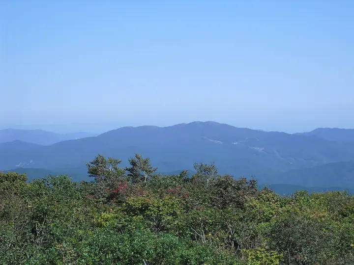
Dōgoyama is a 1,271 m peak straddling the boundary between Nichinan Town in Tottori Prefecture and Shōbara City in Hiroshima Prefecture, part of the Hiba Range in the northeastern Chūgoku Mountains. Its gentle rounded contour has long earned it the epithet "Queen of the Chūgoku Mountains," and the broad summit grasslands of Tsukimi-ga-oka are celebrated for alpine wildflowers — securing it a place in the New Hundred Famous Flower Mountains. The mountain lies within Hiba-Dōgo-Taishaku Quasi-National Park; a road on the Shōbara side climbs to about 1,080 m via the Dōgoyama Kōgen ski resort, leaving an unusually short hike to the summit. It is also listed among the Japanese 300 Famous Mountains.
Mt. Dōgo at a glance
- Weather: The most settled day in the next 7 days is Wed, November 4: clear, gusts up to 8 m/s. Fri, Nov 6, Sat, Nov 7: strong wind (gusts up to 17 m/s).
- Route: The shortest is Mount Dogo and Mount Iwatoi Loop from Tsukimigaoka: about 3 h 10 min, 5.8 km, about 310 m of climbing.
Mt. Dōgo weather (hourly, 14 days)
Sunrise today 06:29, sunset 17:12
| Tue, 11/3 | Wed, 11/4 | Thu, 11/5 | Fri, 11/6 | Sat, 11/7 | Sun, 11/8 | Mon, 11/9 | Tue, 11/10 | Wed, 11/11 | Thu, 11/12 | Fri, 11/13 | Sat, 11/14 | Sun, 11/15 | Mon, 11/16 | Tue, 11/17 | |||||||||||||||||||||||||||||||||||||||||||||||||||||||||||||||||||||||
|---|---|---|---|---|---|---|---|---|---|---|---|---|---|---|---|---|---|---|---|---|---|---|---|---|---|---|---|---|---|---|---|---|---|---|---|---|---|---|---|---|---|---|---|---|---|---|---|---|---|---|---|---|---|---|---|---|---|---|---|---|---|---|---|---|---|---|---|---|---|---|---|---|---|---|---|---|---|---|---|---|---|---|---|---|---|
| Japan time | 15 | 17 | 19 | 21 | 23 | 1 | 3 | 5 | 7 | 9 | 11 | 13 | 15 | 18 | 21 | 0 | 3 | 6 | 9 | 12 | 15 | 18 | 21 | 0 | 3 | 6 | 9 | 12 | 15 | 18 | 21 | 0 | 3 | 6 | 9 | 12 | 15 | 18 | 21 | 0 | 3 | 6 | 9 | 12 | 15 | 18 | 21 | 0 | 3 | 6 | 9 | 15 | 21 | 3 | 9 | 15 | 21 | 3 | 9 | 15 | 21 | 3 | 9 | 15 | 21 | 3 | 9 | 15 | 21 | 3 | 9 | 15 | 21 | 3 | 9 | 15 | 21 | 3 | 9 | 15 | 21 | 3 | 9 | 15 | |
  | |   | | | |   | |   | | | |   |   | |   | | | |   | |   | | | | |   | | | | | | | |   | |  |  | | | | | | | | | | | | | | |   | | | | | | | | |  | | | | | | | | | | | | | | | | | | | | | | | ||
| Temperature | °C | 10° | 7° | 6° | 5° | 5° | 5° | 4° | 4° | 4° | 8° | 11° | 12° | 12° | 8° | 8° | 7° | 7° | 7° | 11° | 12° | 11° | 10° | 10° | 9° | 9° | 8° | 9° | 11° | 9° | 5° | 4° | 4° | 2° | 2° | 4° | 6° | 6° | 1° | 0° | -1° | -1° | -1° | 5° | 7° | 7° | 4° | 3° | 4° | 4° | 3° | 7° | 7° | 2° | 3° | 6° | 7° | 2° | 0° | 3° | 4° | 0° | -2° | 4° | 8° | 3° | 3° | 4° | 5° | 0° | -1° | 5° | 10° | 3° | 4° | 7° | 8° | 8° | 10° | 9° | 6° | 3° | 0° | 3° | 5° |
| Precipitation | mm | 0.3 | 0.2 | 0.1 | 0.7 | 1.6 | 1.7 | 1.9 | 1.8 | 2.4 | 0.1 | 0.3 | 0.4 | 0.5 | 0.1 | 0.1 | 0.4 | 0.1 | 0.7 | 0.2 | 0.5 | 0.2 | 1.2 | 0.2 | 0.2 | 11 | 14 | 0.3 | 1.7 | 3.1 | 1.9 | ||||||||||||||||||||||||||||||||||||||||||||||||||||||
| New snow | cm | ||||||||||||||||||||||||||||||||||||||||||||||||||||||||||||||||||||||||||||||||||||
| Snow depth | cm | 0 | 0 | 0 | 0 | 0 | 0 | 0 | 0 | 0 | 0 | 0 | 0 | 0 | 0 | 0 | 0 | 0 | 0 | 0 | 0 | 0 | 0 | 0 | 0 | 0 | 0 | 0 | 0 | 0 | 0 | 0 | 0 | 0 | 0 | 0 | 0 | 0 | 0 | 0 | 0 | 0 | 0 | 0 | 0 | 0 | 0 | 0 | 0 | 0 | 0 | 0 | 0 | 0 | 0 | 0 | 0 | 0 | 0 | 0 | 0 | 0 | 0 | 0 | 0 | 0 | 0 | 0 | 0 | 0 | 0 | 0 | 0 | 0 | 0 | 0 | 0 | 0 | 0 | 0 | 0 | 0 | 0 | 0 | 0 |
| Wind | m/s | 3 | 3 | 3 | 3 | 2 | 2 | 2 | 2 | 1 | 1 | 3 | 2 | 3 | 1 | 3 | 2 | 1 | 2 | 0 | 2 | 2 | 2 | 1 | 3 | 5 | 5 | 6 | 6 | 5 | 5 | 4 | 4 | 5 | 5 | 6 | 5 | 5 | 2 | 2 | 2 | 2 | 1 | 3 | 3 | 3 | 1 | 1 | 1 | 2 | 2 | 4 | 3 | 3 | 3 | 6 | 6 | 6 | 6 | 5 | 4 | 2 | 1 | 1 | 4 | 3 | 4 | 4 | 4 | 2 | 2 | 2 | 3 | 2 | 3 | 3 | 4 | 3 | 5 | 4 | 5 | 5 | 3 | 3 | 3 |
| Wind gusts | m/s | 9 | 9 | 8 | 8 | 7 | 6 | 6 | 6 | 5 | 5 | 8 | 8 | 8 | 8 | 8 | 9 | 6 | 4 | 4 | 6 | 6 | 6 | 9 | 8 | 12 | 13 | 14 | 15 | 15 | 13 | 12 | 11 | 13 | 13 | 17 | 16 | 14 | 12 | 6 | 6 | 6 | 6 | 7 | 9 | 10 | 8 | 3 | 3 | 5 | 6 | 10 | 11 | 9 | 8 | 14 | 15 | 16 | 18 | 16 | 14 | 10 | 5 | 5 | 9 | 9 | 11 | 11 | 13 | 12 | 6 | 5 | 7 | 7 | 7 | 8 | 10 | 12 | 12 | 13 | 14 | 14 | 13 | 9 | 9 |
| Wind dir. | ↓ | ↓ | ↓ | ↓ | ↓ | ↓ | ↓ | ↓ | ↓ | ↓ | ↓ | ↓ | ↓ | ↓ | ↓ | ↓ | ↓ | ↓ | ↓ | ↓ | ↓ | ↓ | ↓ | ↓ | ↓ | ↓ | ↓ | ↓ | ↓ | ↓ | ↓ | ↓ | ↓ | ↓ | ↓ | ↓ | ↓ | ↓ | ↓ | ↓ | ↓ | ↓ | ↓ | ↓ | ↓ | ↓ | ↓ | ↓ | ↓ | ↓ | ↓ | ↓ | ↓ | ↓ | ↓ | ↓ | ↓ | ↓ | ↓ | ↓ | ↓ | ↓ | ↓ | ↓ | ↓ | ↓ | ↓ | ↓ | ↓ | ↓ | ↓ | ↓ | ↓ | ↓ | ↓ | ↓ | ↓ | ↓ | ↓ | ↓ | ↓ | ↓ | ↓ | ↓ | |
Mt. Dōgo hiking routes
Hiking times are estimates calculated from the terrain.
Huts, campsites and lodging near Mt. Dōgo
Campsites
- 道後山キャンプ場
Lists that include Mt. Dōgo
Japan's 300 Famous Mountains · New 100 Famous Flower Mountains · Chugoku 100 Famous Mountains · Hiroshima Prefecture 100 Famous Mountains · Elevations of 1003 Mountains of Japan · 1000 Mountains of Japan
Mt. Dōgo facts
- Elevation
- 1,271 m
- Location
- Nichinan, Tottori / Shōbara-shi, Hiroshima
35.069494, 133.232848 - National Park
- 比婆道後帝釈国定公園
- Website
- www.shobara-info.com
- Access Information
- dive-hiroshima.com
- Wikipedia
- ja.wikipedia.org