
Mt. Asahigamaru
旭ケ丸
Kamikatsu, Tokushima / Sanagōchi-son, Tokushima / Kamiyama, Tokushima · Elevation 1,020 m
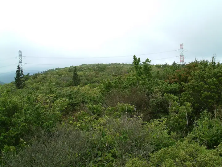
A 1,019.5-meter peak on the boundary between Sanagōchi Village (Myōdō District) and Kamikatsu Town (Katsuura District) in Tokushima Prefecture, and the highest summit of the Ōkawara plateau. Its name ("morning-sun hill") reflects the fact that, seen from Tokushima City, it is the first ridge struck by the dawn sun. The plateau-like summit area carries roughly 5 hectares of Awa-mitsuba-tsutsuji azaleas — some 30,000 plants — that turn the ridge purple in early July, and fifteen wind turbines line the crest. The summit looks across the Kii Channel and the Tokushima Plain, with Takahoko-yama and Tarō-yama extending eastward along the ridge. Reached in about thirty minutes from a trailhead 50 minutes by car from Tokushima City, it is listed in the Shikoku 100 Famous Mountains and Shikoku Hyakuzan.
Mt. Asahigamaru at a glance
- Weather: The most settled day in the next 7 days is Sun, November 8: clear, gusts up to 10 m/s. Fri, Nov 6, Sat, Nov 7: strong wind (gusts up to 17 m/s).
Mt. Asahigamaru weather (hourly, 14 days)
Sunrise today 06:23, sunset 17:09
| Tue, 11/3 | Wed, 11/4 | Thu, 11/5 | Fri, 11/6 | Sat, 11/7 | Sun, 11/8 | Mon, 11/9 | Tue, 11/10 | Wed, 11/11 | Thu, 11/12 | Fri, 11/13 | Sat, 11/14 | Sun, 11/15 | Mon, 11/16 | Tue, 11/17 | |||||||||||||||||||||||||||||||||||||||||||||||||||||||||||||||||||||||
|---|---|---|---|---|---|---|---|---|---|---|---|---|---|---|---|---|---|---|---|---|---|---|---|---|---|---|---|---|---|---|---|---|---|---|---|---|---|---|---|---|---|---|---|---|---|---|---|---|---|---|---|---|---|---|---|---|---|---|---|---|---|---|---|---|---|---|---|---|---|---|---|---|---|---|---|---|---|---|---|---|---|---|---|---|---|
| Japan time | 15 | 17 | 19 | 21 | 23 | 1 | 3 | 5 | 7 | 9 | 11 | 13 | 15 | 18 | 21 | 0 | 3 | 6 | 9 | 12 | 15 | 18 | 21 | 0 | 3 | 6 | 9 | 12 | 15 | 18 | 21 | 0 | 3 | 6 | 9 | 12 | 15 | 18 | 21 | 0 | 3 | 6 | 9 | 12 | 15 | 18 | 21 | 0 | 3 | 6 | 9 | 15 | 21 | 3 | 9 | 15 | 21 | 3 | 9 | 15 | 21 | 3 | 9 | 15 | 21 | 3 | 9 | 15 | 21 | 3 | 9 | 15 | 21 | 3 | 9 | 15 | 21 | 3 | 9 | 15 | 21 | 3 | 9 | 15 | |
 |   |   |   | | | | | |   | | |   |   | |   | | |   |   | |   | | | |  | | | | | | | | | | | | | | | | | | | | | | | | | | |   | | | | | | | | |  | | | | | | | | | | | | | |   | | | | | | | | | ||
| Temperature | °C | 13° | 10° | 9° | 8° | 8° | 8° | 8° | 7° | 7° | 10° | 12° | 11° | 11° | 10° | 11° | 9° | 9° | 9° | 10° | 13° | 16° | 11° | 11° | 11° | 11° | 9° | 12° | 14° | 14° | 10° | 7° | 5° | 5° | 4° | 6° | 8° | 9° | 5° | 4° | 3° | 2° | 3° | 8° | 10° | 9° | 5° | 7° | 6° | 6° | 6° | 9° | 11° | 6° | 4° | 9° | 11° | 5° | 3° | 5° | 7° | 4° | 1° | 7° | 10° | 3° | 4° | 8° | 9° | 4° | 2° | 7° | 11° | 4° | 5° | 12° | 13° | 11° | 9° | 12° | 14° | 6° | 4° | 5° | 7° |
| Precipitation | mm | 1.4 | 0.4 | 0.7 | 0.1 | 0.9 | 0.3 | 0.1 | 4.6 | 2.2 | 0.1 | 2.5 | 0.7 | ||||||||||||||||||||||||||||||||||||||||||||||||||||||||||||||||||||||||
| New snow | cm | ||||||||||||||||||||||||||||||||||||||||||||||||||||||||||||||||||||||||||||||||||||
| Snow depth | cm | 0 | 0 | 0 | 0 | 0 | 0 | 0 | 0 | 0 | 0 | 0 | 0 | 0 | 0 | 0 | 0 | 0 | 0 | 0 | 0 | 0 | 0 | 0 | 0 | 0 | 0 | 0 | 0 | 0 | 0 | 0 | 0 | 0 | 0 | 0 | 0 | 0 | 0 | 0 | 0 | 0 | 0 | 0 | 0 | 0 | 0 | 0 | 0 | 0 | 0 | 0 | 0 | 0 | 0 | 0 | 0 | 0 | 0 | 0 | 0 | 0 | 0 | 0 | 0 | 0 | 0 | 0 | 0 | 0 | 0 | 0 | 0 | 0 | 0 | 0 | 0 | 0 | 0 | 0 | 0 | 0 | 0 | 0 | 0 |
| Wind | m/s | 4 | 1 | 2 | 2 | 2 | 2 | 3 | 2 | 2 | 3 | 3 | 2 | 2 | 1 | 2 | 2 | 2 | 2 | 1 | 0 | 2 | 2 | 2 | 1 | 4 | 5 | 6 | 6 | 5 | 4 | 6 | 5 | 4 | 4 | 6 | 6 | 5 | 4 | 3 | 3 | 3 | 3 | 3 | 3 | 4 | 2 | 1 | 1 | 1 | 2 | 3 | 4 | 3 | 2 | 4 | 4 | 5 | 7 | 6 | 6 | 3 | 2 | 2 | 3 | 2 | 4 | 4 | 5 | 3 | 2 | 2 | 2 | 2 | 2 | 3 | 4 | 3 | 3 | 5 | 6 | 4 | 3 | 3 | 4 |
| Wind gusts | m/s | 11 | 9 | 5 | 5 | 5 | 6 | 7 | 7 | 6 | 8 | 8 | 7 | 5 | 5 | 4 | 7 | 4 | 5 | 5 | 5 | 5 | 5 | 7 | 7 | 10 | 14 | 16 | 17 | 15 | 13 | 15 | 15 | 14 | 13 | 16 | 15 | 15 | 13 | 10 | 8 | 8 | 8 | 9 | 10 | 10 | 9 | 5 | 4 | 4 | 5 | 8 | 12 | 11 | 6 | 9 | 14 | 13 | 18 | 19 | 18 | 15 | 8 | 7 | 9 | 7 | 10 | 11 | 14 | 13 | 8 | 6 | 6 | 6 | 6 | 10 | 13 | 12 | 10 | 14 | 16 | 15 | 10 | 9 | 10 |
| Wind dir. | ↓ | ↓ | ↓ | ↓ | ↓ | ↓ | ↓ | ↓ | ↓ | ↓ | ↓ | ↓ | ↓ | ↓ | ↓ | ↓ | ↓ | ↓ | ↓ | ↓ | ↓ | ↓ | ↓ | ↓ | ↓ | ↓ | ↓ | ↓ | ↓ | ↓ | ↓ | ↓ | ↓ | ↓ | ↓ | ↓ | ↓ | ↓ | ↓ | ↓ | ↓ | ↓ | ↓ | ↓ | ↓ | ↓ | ↓ | ↓ | ↓ | ↓ | ↓ | ↓ | ↓ | ↓ | ↓ | ↓ | ↓ | ↓ | ↓ | ↓ | ↓ | ↓ | ↓ | ↓ | ↓ | ↓ | ↓ | ↓ | ↓ | ↓ | ↓ | ↓ | ↓ | ↓ | ↓ | ↓ | ↓ | ↓ | ↓ | ↓ | ↓ | ↓ | ↓ | ↓ | |
Huts, campsites and lodging near Mt. Asahigamaru
Campsites
- いきものふれあい の里キャンプ場
- コットンフィールドキャンプ場
- nature healing
Lodging
- 明日香
- 神山温泉 ホテル四季の里&いやしの湯
- つじ荘
- ふれあいの里 さかもと(休止)
Lists that include Mt. Asahigamaru
Mt. Asahigamaru facts
- Elevation
- 1,020 m
- Location
- Kamikatsu, Tokushima / Sanagōchi-son, Tokushima / Kamiyama, Tokushima
33.951432, 134.402677 - Website
- www.pref.tokushima.lg.jp
- Wikipedia
- ja.wikipedia.org