
Mount Togura
戸倉山
Ina, Nagano / Komagane, Nagano · Elevation 1,681 m
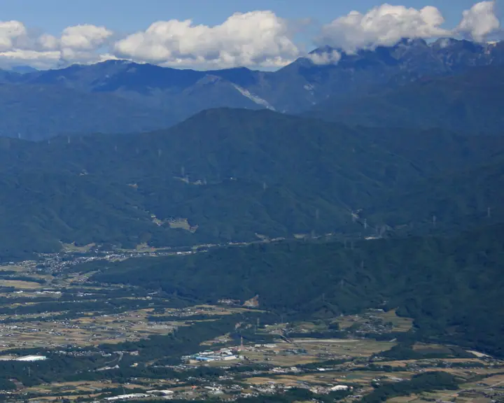
Mount Togura (1,681 m) is an independent peak on the border of Ina City and Komagane City in Nagano Prefecture, forming part of the northern Ina Mountains. Its symmetrical silhouette as seen from the north has earned it the nickname "Ina Fuji," and the summit is a twin peak — the eastern peak holds a first-order triangulation point while the western peak hosts a kōshintō stone said to be the highest in Japan. Offering views of both the Central Alps and the Southern Alps, it appears in the Shinshū Hyakumeizan, the Shinshū Furusato 120 Mountains, and the Nihon Hyaku-meifuji.
Mount Togura at a glance
- Weather: The most settled day in the next 7 days is Sun, November 8: clear, gusts up to 8 m/s. Tue, Nov 10: strong wind (gusts up to 15 m/s).
- Route: The shortest is Mount Tokura via the Campground Trail: about 4 h 25 min, 6.4 km, about 760 m of climbing.
Mount Togura weather (hourly, 14 days)
Sunrise today 06:12, sunset 16:51
| Tue, 11/3 | Wed, 11/4 | Thu, 11/5 | Fri, 11/6 | Sat, 11/7 | Sun, 11/8 | Mon, 11/9 | Tue, 11/10 | Wed, 11/11 | Thu, 11/12 | Fri, 11/13 | Sat, 11/14 | Sun, 11/15 | Mon, 11/16 | Tue, 11/17 | |||||||||||||||||||||||||||||||||||||||||||||||||||||||||||||||||||||||
|---|---|---|---|---|---|---|---|---|---|---|---|---|---|---|---|---|---|---|---|---|---|---|---|---|---|---|---|---|---|---|---|---|---|---|---|---|---|---|---|---|---|---|---|---|---|---|---|---|---|---|---|---|---|---|---|---|---|---|---|---|---|---|---|---|---|---|---|---|---|---|---|---|---|---|---|---|---|---|---|---|---|---|---|---|---|
| Japan time | 21 | 23 | 1 | 3 | 5 | 7 | 9 | 11 | 13 | 15 | 17 | 19 | 21 | 0 | 3 | 6 | 9 | 12 | 15 | 18 | 21 | 0 | 3 | 6 | 9 | 12 | 15 | 18 | 21 | 0 | 3 | 6 | 9 | 12 | 15 | 18 | 21 | 0 | 3 | 6 | 9 | 12 | 15 | 18 | 21 | 0 | 3 | 6 | 9 | 12 | 15 | 21 | 3 | 9 | 15 | 21 | 3 | 9 | 15 | 21 | 3 | 9 | 15 | 21 | 3 | 9 | 15 | 21 | 3 | 9 | 15 | 21 | 3 | 9 | 15 | 21 | 3 | 9 | 15 | 21 | 3 | 9 | 15 | 21 | |
 |   | | | |   |   | |   | |   | |   | | |   |   | | |   | | | | |  | | |  | | | | | | | | | | | | | | | | | | | | | | | | |   | | | | |   | |   |  | | | | | | | | | | | | | | | | | |   | | | | | | ||
| Temperature | °C | 2° | 1° | 1° | 0° | 0° | 1° | 6° | 9° | 11° | 10° | 7° | 6° | 5° | 5° | 4° | 5° | 8° | 12° | 12° | 9° | 9° | 8° | 6° | 6° | 9° | 12° | 11° | 5° | 3° | 1° | 1° | -1° | 5° | 7° | 5° | -1° | -3° | -4° | -4° | -4° | 3° | 8° | 8° | 3° | 1° | 3° | 3° | 4° | 5° | 10° | 9° | 2° | 1° | 5° | 6° | 2° | -1° | 0° | 3° | -4° | -5° | 3° | 6° | -2° | -2° | 4° | 5° | -4° | -5° | 3° | 8° | 0° | 0° | 6° | 7° | 5° | 5° | 9° | 11° | 1° | -1° | 2° | 6° | 2° |
| Precipitation | mm | 0.3 | 4.8 | 9 | 3.6 | 0.4 | 0.1 | 2.0 | 0.5 | 0.2 | 0.4 | 0.5 | 0.3 | 0.2 | 0.4 | 14 | 15 | 0.3 | 0.4 | ||||||||||||||||||||||||||||||||||||||||||||||||||||||||||||||||||
| New snow | cm | <.1 | |||||||||||||||||||||||||||||||||||||||||||||||||||||||||||||||||||||||||||||||||||
| Snow depth | cm | 0 | 0 | 0 | 0 | 0 | 0 | 0 | 0 | 0 | 0 | 0 | 0 | 0 | 0 | 0 | 0 | 0 | 0 | 0 | 0 | 0 | 0 | 0 | 0 | 0 | 0 | 0 | 0 | 0 | 0 | 0 | 0 | 0 | 0 | 0 | 0 | 0 | 0 | 0 | 0 | 0 | 0 | 0 | 0 | 0 | 0 | 0 | 0 | 0 | 0 | 0 | 0 | 0 | 0 | 0 | 0 | 0 | 0 | 0 | 0 | 0 | 0 | 0 | 0 | 0 | 0 | 0 | 0 | 0 | 0 | 0 | 0 | 0 | 0 | 0 | 0 | 0 | 0 | 0 | 0 | 0 | 0 | 0 | 0 |
| Wind | m/s | 0 | 0 | 0 | 1 | 1 | 1 | 2 | 2 | 1 | 0 | 1 | 1 | 2 | 1 | 2 | 1 | 1 | 1 | 2 | 3 | 3 | 4 | 4 | 1 | 1 | 3 | 4 | 3 | 2 | 0 | 1 | 1 | 2 | 2 | 3 | 1 | 1 | 1 | 1 | 2 | 2 | 2 | 2 | 0 | 0 | 1 | 1 | 2 | 3 | 4 | 3 | 1 | 0 | 3 | 4 | 4 | 3 | 3 | 4 | 2 | 0 | 3 | 4 | 1 | 1 | 2 | 3 | 2 | 1 | 1 | 3 | 2 | 2 | 4 | 3 | 3 | 3 | 4 | 3 | 2 | 2 | 1 | 3 | 2 |
| Wind gusts | m/s | 3 | 3 | 3 | 3 | 4 | 5 | 6 | 7 | 6 | 5 | 3 | 4 | 6 | 8 | 9 | 7 | 5 | 6 | 9 | 9 | 11 | 13 | 13 | 12 | 5 | 10 | 12 | 12 | 9 | 6 | 4 | 4 | 7 | 9 | 9 | 9 | 4 | 4 | 5 | 6 | 7 | 8 | 8 | 6 | 5 | 7 | 8 | 7 | 9 | 13 | 13 | 5 | 5 | 10 | 15 | 13 | 12 | 10 | 12 | 11 | 7 | 10 | 14 | 11 | 3 | 7 | 9 | 9 | 7 | 4 | 11 | 10 | 8 | 12 | 14 | 13 | 15 | 11 | 10 | 9 | 8 | 7 | 11 | 10 |
| Wind dir. | ↓ | ↓ | ↓ | ↓ | ↓ | ↓ | ↓ | ↓ | ↓ | ↓ | ↓ | ↓ | ↓ | ↓ | ↓ | ↓ | ↓ | ↓ | ↓ | ↓ | ↓ | ↓ | ↓ | ↓ | ↓ | ↓ | ↓ | ↓ | ↓ | ↓ | ↓ | ↓ | ↓ | ↓ | ↓ | ↓ | ↓ | ↓ | ↓ | ↓ | ↓ | ↓ | ↓ | ↓ | ↓ | ↓ | ↓ | ↓ | ↓ | ↓ | ↓ | ↓ | ↓ | ↓ | ↓ | ↓ | ↓ | ↓ | ↓ | ↓ | ↓ | ↓ | ↓ | ↓ | ↓ | ↓ | ↓ | ↓ | ↓ | ↓ | ↓ | ↓ | ↓ | ↓ | ↓ | ↓ | ↓ | ↓ | ↓ | ↓ | ↓ | ↓ | ↓ | ↓ | |
Mount Togura hiking routes
Hiking times are estimates calculated from the terrain.
Huts, campsites and lodging near Mount Togura
Mountain huts
- 戸倉山避難小屋
Campsites
- 戸倉山キャンプ場
Lodging
- Farmstay Kominka Higashi (Wakka Agri)
- Senryuso
Lists that include Mount Togura
100 Fujis of Japan · Shinshu 100 Famous Mountains · Elevations of 1003 Mountains of Japan · 1000 Mountains of Japan
Mount Togura facts
- Also known as
- 伊那富士 · 袴腰
- Elevation
- 1,681 m
- Location
- Ina, Nagano / Komagane, Nagano
35.745036, 138.051957 - Website
- www.inacity.jp
- Trail Map
- www.inacity.jp (PDF)
- Wikipedia
- ja.wikipedia.org