
Mount Sobatsubu
蕎麦粒山
Chichibu, Saitama · Elevation 1,473 m
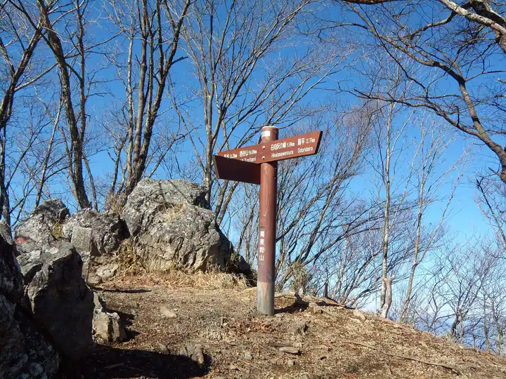
Mount Sobatsubu is a 1,472.9 m peak on the Tokyo–Saitama border, rising along the main ridge of the Okutama range between Okutama Town and Chichibu City. Its tidy isosceles-triangle profile, said to resemble a buckwheat seed, gives the mountain its name; it also goes by Sankaku-yama and Hiuchi-ishi-yama. Quieter than neighbouring Kawanori or Kumotori, it offers fine views from autumn through spring and appears in numerous selections including Kantō Hyakuzan, Kantō Hyakumeizan, Tama 100, and Tōkyō Hyakumeizan.
Mount Sobatsubu at a glance
- Weather: The most settled day in the next 7 days is Fri, November 6: clear, gusts up to 7 m/s.
Mount Sobatsubu weather (hourly, 14 days)
Sunrise today 06:07, sunset 16:47
| Tue, 11/3 | Wed, 11/4 | Thu, 11/5 | Fri, 11/6 | Sat, 11/7 | Sun, 11/8 | Mon, 11/9 | Tue, 11/10 | Wed, 11/11 | Thu, 11/12 | Fri, 11/13 | Sat, 11/14 | Sun, 11/15 | Mon, 11/16 | Tue, 11/17 | |||||||||||||||||||||||||||||||||||||||||||||||||||||||||||||||||||||||
|---|---|---|---|---|---|---|---|---|---|---|---|---|---|---|---|---|---|---|---|---|---|---|---|---|---|---|---|---|---|---|---|---|---|---|---|---|---|---|---|---|---|---|---|---|---|---|---|---|---|---|---|---|---|---|---|---|---|---|---|---|---|---|---|---|---|---|---|---|---|---|---|---|---|---|---|---|---|---|---|---|---|---|---|---|---|
| Japan time | 21 | 23 | 1 | 3 | 5 | 7 | 9 | 11 | 13 | 15 | 17 | 19 | 21 | 0 | 3 | 6 | 9 | 12 | 15 | 18 | 21 | 0 | 3 | 6 | 9 | 12 | 15 | 18 | 21 | 0 | 3 | 6 | 9 | 12 | 15 | 18 | 21 | 0 | 3 | 6 | 9 | 12 | 15 | 18 | 21 | 0 | 3 | 6 | 9 | 12 | 15 | 21 | 3 | 9 | 15 | 21 | 3 | 9 | 15 | 21 | 3 | 9 | 15 | 21 | 3 | 9 | 15 | 21 | 3 | 9 | 15 | 21 | 3 | 9 | 15 | 21 | 3 | 9 | 15 | 21 | 3 | 9 | 15 | 21 | |
  | |   | | |   | | | |   | | | | | | | |   |   |   | |  | | |  | |   |   | | | | | | | | | | | | | | | | |   | | | | | | | | | | | | | | |   |  | | | | | | | | | | | | | | | |   | | | | | | | | ||
| Temperature | °C | 5° | 5° | 5° | 5° | 5° | 5° | 5° | 6° | 6° | 5° | 4° | 4° | 4° | 5° | 5° | 6° | 8° | 13° | 11° | 8° | 7° | 6° | 6° | 5° | 14° | 17° | 14° | 9° | 7° | 5° | 2° | 3° | 9° | 10° | 8° | 2° | 1° | 0° | 0° | -1° | 6° | 8° | 6° | 3° | 2° | 2° | 2° | 2° | 4° | 5° | 4° | 3° | 1° | 2° | 5° | 2° | -2° | 4° | 5° | -2° | -1° | 5° | 5° | 3° | -1° | 7° | 7° | -2° | -1° | 4° | 5° | 1° | -1° | 7° | 8° | 6° | 7° | 13° | 13° | 4° | 3° | 2° | 4° | 1° |
| Precipitation | mm | 1.4 | 1.1 | 0.4 | 0.8 | 1.5 | 3.6 | 10 | 17 | 8 | 1.8 | 0.4 | 0.2 | 0.1 | 0.5 | 0.2 | 0.1 | 0.6 | 1.2 | 0.3 | 0.2 | 0.2 | 4.0 | 15 | 0.1 | ||||||||||||||||||||||||||||||||||||||||||||||||||||||||||||
| New snow | cm | ||||||||||||||||||||||||||||||||||||||||||||||||||||||||||||||||||||||||||||||||||||
| Snow depth | cm | 0 | 0 | 0 | 0 | 0 | 0 | 0 | 0 | 0 | 0 | 0 | 0 | 0 | 0 | 0 | 0 | 0 | 0 | 0 | 0 | 0 | 0 | 0 | 0 | 0 | 0 | 0 | 0 | 0 | 0 | 0 | 0 | 0 | 0 | 0 | 0 | 0 | 0 | 0 | 0 | 0 | 0 | 0 | 0 | 0 | 0 | 0 | 0 | 0 | 0 | 0 | 0 | 0 | 0 | 0 | 0 | 0 | 0 | 0 | 0 | 0 | 0 | 0 | 0 | 0 | 0 | 0 | 0 | 0 | 0 | 0 | 0 | 0 | 0 | 0 | 0 | 0 | 0 | 0 | 0 | 0 | 0 | 0 | 0 |
| Wind | m/s | 0 | 1 | 1 | 0 | 1 | 1 | 1 | 2 | 1 | 2 | 1 | 1 | 1 | 1 | 1 | 2 | 2 | 2 | 1 | 1 | 1 | 1 | 1 | 1 | 1 | 2 | 2 | 1 | 1 | 1 | 1 | 0 | 1 | 2 | 3 | 0 | 0 | 1 | 1 | 1 | 1 | 1 | 2 | 1 | 1 | 1 | 1 | 0 | 1 | 2 | 1 | 1 | 2 | 2 | 3 | 1 | 1 | 7 | 5 | 2 | 0 | 1 | 2 | 1 | 1 | 3 | 4 | 1 | 0 | 1 | 1 | 0 | 0 | 1 | 1 | 1 | 0 | 1 | 5 | 4 | 0 | 1 | 2 | 1 |
| Wind gusts | m/s | 2 | 3 | 4 | 3 | 3 | 3 | 4 | 6 | 6 | 5 | 5 | 4 | 4 | 5 | 5 | 6 | 7 | 7 | 5 | 4 | 5 | 6 | 6 | 6 | 5 | 6 | 7 | 5 | 3 | 5 | 5 | 4 | 4 | 7 | 8 | 8 | 3 | 4 | 4 | 3 | 4 | 6 | 6 | 5 | 4 | 5 | 5 | 4 | 5 | 6 | 6 | 5 | 5 | 5 | 8 | 8 | 5 | 23 | 24 | 16 | 6 | 4 | 8 | 5 | 4 | 10 | 16 | 11 | 4 | 4 | 7 | 5 | 3 | 5 | 8 | 6 | 7 | 6 | 14 | 18 | 10 | 4 | 6 | 5 |
| Wind dir. | ↓ | ↓ | ↓ | ↓ | ↓ | ↓ | ↓ | ↓ | ↓ | ↓ | ↓ | ↓ | ↓ | ↓ | ↓ | ↓ | ↓ | ↓ | ↓ | ↓ | ↓ | ↓ | ↓ | ↓ | ↓ | ↓ | ↓ | ↓ | ↓ | ↓ | ↓ | ↓ | ↓ | ↓ | ↓ | ↓ | ↓ | ↓ | ↓ | ↓ | ↓ | ↓ | ↓ | ↓ | ↓ | ↓ | ↓ | ↓ | ↓ | ↓ | ↓ | ↓ | ↓ | ↓ | ↓ | ↓ | ↓ | ↓ | ↓ | ↓ | ↓ | ↓ | ↓ | ↓ | ↓ | ↓ | ↓ | ↓ | ↓ | ↓ | ↓ | ↓ | ↓ | ↓ | ↓ | ↓ | ↓ | ↓ | ↓ | ↓ | ↓ | ↓ | ↓ | ↓ | |
Huts, campsites and lodging near Mount Sobatsubu
Mountain huts
Campsites
- 秩父彩の国キャンプ村
Lists that include Mount Sobatsubu
100 Mountains of Tama · 50 Mountains of Saitama Prefecture · 1000 Mountains of Japan
Mount Sobatsubu facts
- Also known as
- 火打石山 · 三等三角点仙還 · 三角山 · ソバ粒山
- Elevation
- 1,473 m
- Location
- Chichibu, Saitama
35.872155, 139.087188 - Trail Map
- www.env.go.jp (PDF)
- Wikipedia
- ja.wikipedia.org