
Mount Obako
伯母子岳
Nosegawa, Nara / Totsukawa, Nara · Elevation 1,344 m
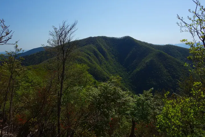
Mount Obako is a 1,344 m peak straddling Nosegawa Village and Totsukawa Village in Yoshino District, Nara Prefecture, the signature summit of the Oku-Kōya area at the western end of the Kii Range. Listed in the Nihon Nihyaku Meizan, the Kansai Hyakumeizan, and the Kinki Hyakumeizan, its summit gives an unobstructed 360° view: Ryūjin-dake and Goma-dan-zan to the west, the Ōmine main ridge with Misen, Hakkyō-ga-take, and Shaka-ga-take to the east, the Hatenashi Range to the south, and the Kōya-san area to the north. The Obako Pass crossing its flanks is the highest point on the Kohechi pilgrimage route from Kōya-san to Kumano Hongū Taisha, part of the UNESCO World Heritage "Sacred Sites and Pilgrimage Routes in the Kii Mountain Range." The standard ascent climbs the Kohechi from Ōmata in Nosegawa to Obako Pass and the summit; a longer through-walk from Miura-guchi in Totsukawa makes the same line in reverse along the World Heritage path.
Mount Obako at a glance
- Weather: The most settled day in the next 7 days is Mon, November 9: clear, gusts up to 11 m/s. Fri, Nov 6, Sat, Nov 7: strong wind (gusts up to 19 m/s).
- Route: The shortest is Mount Obako Out-and-Back from Kuchisenjo Trailhead: about 6 h 2 min, 10.8 km, about 650 m of climbing.
Mount Obako weather (hourly, 14 days)
Sunrise today 06:18, sunset 17:04
| Tue, 11/3 | Wed, 11/4 | Thu, 11/5 | Fri, 11/6 | Sat, 11/7 | Sun, 11/8 | Mon, 11/9 | Tue, 11/10 | Wed, 11/11 | Thu, 11/12 | Fri, 11/13 | Sat, 11/14 | Sun, 11/15 | Mon, 11/16 | Tue, 11/17 | |||||||||||||||||||||||||||||||||||||||||||||||||||||||||||||||||||||||
|---|---|---|---|---|---|---|---|---|---|---|---|---|---|---|---|---|---|---|---|---|---|---|---|---|---|---|---|---|---|---|---|---|---|---|---|---|---|---|---|---|---|---|---|---|---|---|---|---|---|---|---|---|---|---|---|---|---|---|---|---|---|---|---|---|---|---|---|---|---|---|---|---|---|---|---|---|---|---|---|---|---|---|---|---|---|
| Japan time | 15 | 17 | 19 | 21 | 23 | 1 | 3 | 5 | 7 | 9 | 11 | 13 | 15 | 18 | 21 | 0 | 3 | 6 | 9 | 12 | 15 | 18 | 21 | 0 | 3 | 6 | 9 | 12 | 15 | 18 | 21 | 0 | 3 | 6 | 9 | 12 | 15 | 18 | 21 | 0 | 3 | 6 | 9 | 12 | 15 | 18 | 21 | 0 | 3 | 6 | 9 | 15 | 21 | 3 | 9 | 15 | 21 | 3 | 9 | 15 | 21 | 3 | 9 | 15 | 21 | 3 | 9 | 15 | 21 | 3 | 9 | 15 | 21 | 3 | 9 | 15 | 21 | 3 | 9 | 15 | 21 | 3 | 9 | 15 | |
  | |   | | | |   | | |   | | |   |   | | | | | |   | | | |   | | |   | | | | |   | | | | | | |  | | | |  | | | | | | | | | | |   | | | | | | | | | | | | | |   |  | | | | | | | | | | | | | | | | ||
| Temperature | °C | 11° | 7° | 5° | 5° | 5° | 3° | 5° | 4° | 4° | 10° | 14° | 13° | 12° | 8° | 9° | 9° | 9° | 9° | 15° | 14° | 15° | 10° | 9° | 10° | 12° | 10° | 9° | 12° | 11° | 8° | 6° | 4° | 2° | 2° | 4° | 5° | 6° | 2° | 0° | 0° | 0° | 0° | 5° | 8° | 7° | 2° | 2° | 2° | 2° | 3° | 8° | 9° | 2° | 1° | 7° | 8° | 4° | 1° | 2° | 5° | 0° | -2° | 4° | 7° | -1° | 1° | 4° | 5° | 0° | -2° | 7° | 10° | 1° | 3° | 8° | 9° | 9° | 11° | 10° | 10° | 4° | 0° | 3° | 7° |
| Precipitation | mm | 1.0 | 0.3 | 0.1 | 0.8 | 0.9 | 0.5 | 0.2 | 0.1 | 0.5 | 0.3 | 0.2 | 0.4 | 1.8 | 9 | 15 | 0.5 | 1.5 | 0.7 | ||||||||||||||||||||||||||||||||||||||||||||||||||||||||||||||||||
| New snow | cm | ||||||||||||||||||||||||||||||||||||||||||||||||||||||||||||||||||||||||||||||||||||
| Snow depth | cm | 0 | 0 | 0 | 0 | 0 | 0 | 0 | 0 | 0 | 0 | 0 | 0 | 0 | 0 | 0 | 0 | 0 | 0 | 0 | 0 | 0 | 0 | 0 | 0 | 0 | 0 | 0 | 0 | 0 | 0 | 0 | 0 | 0 | 0 | 0 | 0 | 0 | 0 | 0 | 0 | 0 | 0 | 0 | 0 | 0 | 0 | 0 | 0 | 0 | 0 | 0 | 0 | 0 | 0 | 0 | 0 | 0 | 0 | 0 | 0 | 0 | 0 | 0 | 0 | 0 | 0 | 0 | 0 | 0 | 0 | 0 | 0 | 0 | 0 | 0 | 0 | 0 | 0 | 0 | 0 | 0 | 0 | 0 | 0 |
| Wind | m/s | 3 | 3 | 3 | 3 | 3 | 3 | 3 | 3 | 2 | 1 | 3 | 4 | 2 | 1 | 2 | 1 | 1 | 1 | 2 | 2 | 2 | 1 | 1 | 2 | 3 | 5 | 5 | 6 | 6 | 5 | 6 | 6 | 6 | 6 | 7 | 7 | 7 | 5 | 5 | 5 | 5 | 5 | 5 | 4 | 4 | 3 | 2 | 1 | 2 | 3 | 3 | 4 | 2 | 1 | 1 | 3 | 5 | 7 | 9 | 7 | 6 | 4 | 3 | 3 | 2 | 4 | 4 | 6 | 5 | 3 | 2 | 2 | 1 | 1 | 3 | 2 | 4 | 2 | 5 | 6 | 6 | 4 | 3 | 2 |
| Wind gusts | m/s | 9 | 9 | 7 | 7 | 7 | 7 | 8 | 8 | 7 | 6 | 8 | 10 | 9 | 6 | 6 | 7 | 6 | 4 | 5 | 6 | 6 | 5 | 5 | 7 | 9 | 14 | 14 | 16 | 17 | 17 | 15 | 17 | 17 | 17 | 19 | 19 | 18 | 17 | 14 | 14 | 13 | 14 | 14 | 14 | 11 | 10 | 7 | 5 | 5 | 7 | 9 | 11 | 10 | 5 | 5 | 9 | 13 | 19 | 23 | 23 | 18 | 15 | 9 | 8 | 8 | 10 | 12 | 16 | 16 | 12 | 7 | 7 | 6 | 5 | 8 | 10 | 12 | 12 | 12 | 16 | 15 | 15 | 11 | 10 |
| Wind dir. | ↓ | ↓ | ↓ | ↓ | ↓ | ↓ | ↓ | ↓ | ↓ | ↓ | ↓ | ↓ | ↓ | ↓ | ↓ | ↓ | ↓ | ↓ | ↓ | ↓ | ↓ | ↓ | ↓ | ↓ | ↓ | ↓ | ↓ | ↓ | ↓ | ↓ | ↓ | ↓ | ↓ | ↓ | ↓ | ↓ | ↓ | ↓ | ↓ | ↓ | ↓ | ↓ | ↓ | ↓ | ↓ | ↓ | ↓ | ↓ | ↓ | ↓ | ↓ | ↓ | ↓ | ↓ | ↓ | ↓ | ↓ | ↓ | ↓ | ↓ | ↓ | ↓ | ↓ | ↓ | ↓ | ↓ | ↓ | ↓ | ↓ | ↓ | ↓ | ↓ | ↓ | ↓ | ↓ | ↓ | ↓ | ↓ | ↓ | ↓ | ↓ | ↓ | ↓ | ↓ | |
Mount Obako hiking routes
- Mount Obako Out-and-Back from Kuchisenjo Trailhead 10.8 km · Ascent 655 m
- Kumano Kodo Kohechi: Omata to Miura-guchi via Mount Obako 13.2 km · Ascent 962 m parking
Hiking times are estimates calculated from the terrain.
Huts, campsites and lodging near Mount Obako
Mountain huts
Lists that include Mount Obako
Japan 200 Famous Mountains · Japan's 300 Famous Mountains · Kansai 100 Famous Mountains · Kinki 100 Famous Mountains · Nara 100 Mountains to Explore · Elevations of 1003 Mountains of Japan
Mount Obako facts
- Elevation
- 1,344 m
- Location
- Nosegawa, Nara / Totsukawa, Nara
34.077487, 135.650328 - Website
- www.vill.nosegawa.nara.jp
- Trail Map
- www.vill.totsukawa.lg.jp (PDF)
- Access Information
- www.vill.totsukawa.lg.jp
- Wikipedia
- ja.wikipedia.org