
Mount Kenbi
剣尾山
Nose, Osaka · Elevation 784 m
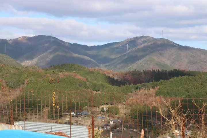
Mount Kenbi (784 m) is one of the principal summits of the Hokusetsu Mountains, rising in Nose Town, Toyono District, Osaka Prefecture. Long a centre of Shugendō mountain asceticism, the ridge to neighbouring Mount Gyōja preserves a seated Mahāvairocana rock carving and other ascetic sites, and the ruins of Geppō-ji Temple stand just below the summit. The rocky, grass-covered top opens to a 360° panorama as far as Ponpon-yama, Mount Atago and Mount Hiei. The standard trail starts at the Gyōjaguchi bus stop and climbs via Mount Gyōja. The peak is included in the One Hundred Mountains of Kansai and the Hundred Famous Low Mountains of Japan.
Mount Kenbi at a glance
- Weather: The most settled day in the next 7 days is Thu, November 5: clear, gusts up to 4 m/s. Sat, Nov 7: strong wind (gusts up to 15 m/s).
- Route: The shortest is Gyōjazan–Kenpizan–Yokoyama Loop from Nose Onsen: about 4 h 23 min, 8.4 km, about 650 m of climbing.
Mount Kenbi weather (hourly, 14 days)
Sunrise today 06:20, sunset 17:04
| Tue, 11/3 | Wed, 11/4 | Thu, 11/5 | Fri, 11/6 | Sat, 11/7 | Sun, 11/8 | Mon, 11/9 | Tue, 11/10 | Wed, 11/11 | Thu, 11/12 | Fri, 11/13 | Sat, 11/14 | Sun, 11/15 | Mon, 11/16 | Tue, 11/17 | |||||||||||||||||||||||||||||||||||||||||||||||||||||||||||||||||||||||
|---|---|---|---|---|---|---|---|---|---|---|---|---|---|---|---|---|---|---|---|---|---|---|---|---|---|---|---|---|---|---|---|---|---|---|---|---|---|---|---|---|---|---|---|---|---|---|---|---|---|---|---|---|---|---|---|---|---|---|---|---|---|---|---|---|---|---|---|---|---|---|---|---|---|---|---|---|---|---|---|---|---|---|---|---|---|
| Japan time | 21 | 23 | 1 | 3 | 5 | 7 | 9 | 11 | 13 | 15 | 17 | 19 | 21 | 0 | 3 | 6 | 9 | 12 | 15 | 18 | 21 | 0 | 3 | 6 | 9 | 12 | 15 | 18 | 21 | 0 | 3 | 6 | 9 | 12 | 15 | 18 | 21 | 0 | 3 | 6 | 9 | 12 | 15 | 18 | 21 | 0 | 3 | 6 | 9 | 12 | 15 | 21 | 3 | 9 | 15 | 21 | 3 | 9 | 15 | 21 | 3 | 9 | 15 | 21 | 3 | 9 | 15 | 21 | 3 | 9 | 15 | 21 | 3 | 9 | 15 | 21 | 3 | 9 | 15 | 21 | 3 | 9 | 15 | 21 | |
  | | | |   |   | |   | | |   |   | |   | | | |   | |   | |   | | | |   | | | | |  | | |   | | | | | | | | | | | | | | |  | | |   | | | | | | | | |  | | | | | | | | | | | | | | | | | | | | | | |  | ||
| Temperature | °C | 7° | 6° | 6° | 5° | 6° | 6° | 11° | 13° | 13° | 14° | 11° | 10° | 11° | 10° | 10° | 10° | 12° | 17° | 18° | 13° | 12° | 14° | 11° | 10° | 12° | 15° | 14° | 9° | 8° | 6° | 5° | 4° | 8° | 8° | 7° | 5° | 5° | 4° | 5° | 4° | 7° | 8° | 8° | 5° | 6° | 5° | 5° | 6° | 10° | 13° | 12° | 5° | 2° | 8° | 11° | 5° | 4° | 7° | 8° | 4° | 2° | 7° | 10° | 3° | 4° | 8° | 8° | 3° | 2° | 7° | 12° | 4° | 5° | 10° | 12° | 10° | 10° | 12° | 11° | 6° | 3° | 7° | 9° | 3° |
| Precipitation | mm | 0.8 | 0.8 | 2.2 | 0.1 | 0.2 | 0.3 | 0.2 | 0.5 | 0.6 | 0.1 | 0.5 | 0.6 | 0.2 | 0.1 | 0.1 | 0.1 | 4.2 | 2.3 | 0.2 | 1.3 | 0.2 | |||||||||||||||||||||||||||||||||||||||||||||||||||||||||||||||
| New snow | cm | ||||||||||||||||||||||||||||||||||||||||||||||||||||||||||||||||||||||||||||||||||||
| Snow depth | cm | 0 | 0 | 0 | 0 | 0 | 0 | 0 | 0 | 0 | 0 | 0 | 0 | 0 | 0 | 0 | 0 | 0 | 0 | 0 | 0 | 0 | 0 | 0 | 0 | 0 | 0 | 0 | 0 | 0 | 0 | 0 | 0 | 0 | 0 | 0 | 0 | 0 | 0 | 0 | 0 | 0 | 0 | 0 | 0 | 0 | 0 | 0 | 0 | 0 | 0 | 0 | 0 | 0 | 0 | 0 | 0 | 0 | 0 | 0 | 0 | 0 | 0 | 0 | 0 | 0 | 0 | 0 | 0 | 0 | 0 | 0 | 0 | 0 | 0 | 0 | 0 | 0 | 0 | 0 | 0 | 0 | 0 | 0 | 0 |
| Wind | m/s | 2 | 2 | 1 | 2 | 2 | 2 | 3 | 3 | 3 | 2 | 1 | 1 | 3 | 3 | 2 | 0 | 1 | 0 | 2 | 2 | 3 | 5 | 4 | 2 | 3 | 5 | 5 | 4 | 3 | 3 | 4 | 3 | 6 | 6 | 6 | 4 | 3 | 3 | 4 | 3 | 5 | 5 | 5 | 3 | 2 | 1 | 2 | 1 | 1 | 4 | 4 | 1 | 1 | 2 | 4 | 3 | 5 | 7 | 6 | 3 | 2 | 2 | 2 | 1 | 2 | 6 | 6 | 2 | 2 | 1 | 2 | 2 | 2 | 3 | 3 | 2 | 1 | 5 | 7 | 6 | 4 | 5 | 4 | 2 |
| Wind gusts | m/s | 6 | 5 | 6 | 5 | 6 | 6 | 7 | 8 | 8 | 7 | 5 | 3 | 7 | 8 | 8 | 5 | 3 | 3 | 4 | 5 | 7 | 11 | 12 | 9 | 7 | 12 | 11 | 12 | 8 | 8 | 9 | 9 | 15 | 15 | 15 | 14 | 9 | 8 | 9 | 10 | 12 | 13 | 13 | 12 | 6 | 4 | 4 | 4 | 4 | 10 | 11 | 10 | 4 | 7 | 12 | 8 | 13 | 15 | 17 | 15 | 7 | 5 | 7 | 6 | 5 | 13 | 15 | 14 | 6 | 4 | 5 | 5 | 5 | 7 | 9 | 8 | 8 | 10 | 15 | 16 | 14 | 12 | 12 | 9 |
| Wind dir. | ↓ | ↓ | ↓ | ↓ | ↓ | ↓ | ↓ | ↓ | ↓ | ↓ | ↓ | ↓ | ↓ | ↓ | ↓ | ↓ | ↓ | ↓ | ↓ | ↓ | ↓ | ↓ | ↓ | ↓ | ↓ | ↓ | ↓ | ↓ | ↓ | ↓ | ↓ | ↓ | ↓ | ↓ | ↓ | ↓ | ↓ | ↓ | ↓ | ↓ | ↓ | ↓ | ↓ | ↓ | ↓ | ↓ | ↓ | ↓ | ↓ | ↓ | ↓ | ↓ | ↓ | ↓ | ↓ | ↓ | ↓ | ↓ | ↓ | ↓ | ↓ | ↓ | ↓ | ↓ | ↓ | ↓ | ↓ | ↓ | ↓ | ↓ | ↓ | ↓ | ↓ | ↓ | ↓ | ↓ | ↓ | ↓ | ↓ | ↓ | ↓ | ↓ | ↓ | ↓ | |
Mount Kenbi hiking routes
Hiking times are estimates calculated from the terrain.
Huts, campsites and lodging near Mount Kenbi
Campsites
- 能勢温泉キャンプ場
- HOMURA FIELD 能勢 キャンプ場 ホムラフィールド能勢
Lodging
- 貸切風呂旅館 こぶし
- るり渓温泉
Lists that include Mount Kenbi
Kansai 100 Famous Mountains · Kinki 100 Famous Mountains · Osaka 50 Mountains · Elevations of 1003 Mountains of Japan · 1000 Mountains of Japan
Mount Kenbi facts
- Elevation
- 784 m
- Location
- Nose, Osaka
35.003355, 135.403844 - Website
- town-of-nose.jp
- Wikipedia
- ja.wikipedia.org