
Mount Jiromaru
次郎丸嶽
Kamiamakusa, Kumamoto · Elevation 397 m
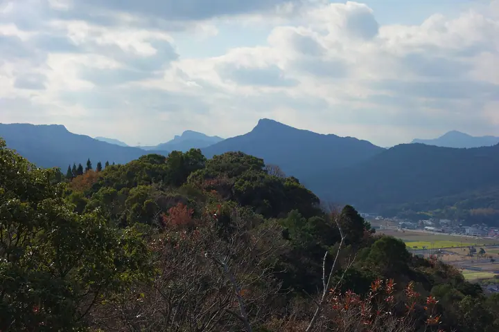
A 397-meter rocky peak in the centre of Amakusa Kamishima Island in Kamiamakusa City, Kumamoto Prefecture, the taller of the affectionate "brother peaks" with the neighbouring Mount Taromaru (281 m). According to local legend the elder brother Taromaru bowed his head so that his younger brother could see the Matsushima sunset, leaving Jiromaru the higher of the two. The shared trail climbs a varied course past rock features called Inazuma-gaeshi and Jiro-otoshi, with a rope-assisted scramble up the final boulder; the summit offers a panorama over the five Amakusa Bridges, Matsushima Bay and the Yatsushiro Sea. The peak appears in numerous selections including the 100 Famous Mountains of Kyushu, the 100 Famous Low Mountains of Japan, and the Kumamoto Hundred Famous Mountains.
Mount Jiromaru at a glance
- Weather: The most settled day in the next 7 days is Sun, November 8: clear, gusts up to 5 m/s.
- Route: The shortest is Mount Taromaru and Mount Jiromaru Out-and-Back from Imaizumi Trailhead: about 3 h 16 min, 5.8 km, about 500 m of climbing.
Mount Jiromaru weather (hourly, 14 days)
Sunrise today 06:37, sunset 17:27
| Tue, 11/3 | Wed, 11/4 | Thu, 11/5 | Fri, 11/6 | Sat, 11/7 | Sun, 11/8 | Mon, 11/9 | Tue, 11/10 | Wed, 11/11 | Thu, 11/12 | Fri, 11/13 | Sat, 11/14 | Sun, 11/15 | Mon, 11/16 | Tue, 11/17 | |||||||||||||||||||||||||||||||||||||||||||||||||||||||||||||||||||||||
|---|---|---|---|---|---|---|---|---|---|---|---|---|---|---|---|---|---|---|---|---|---|---|---|---|---|---|---|---|---|---|---|---|---|---|---|---|---|---|---|---|---|---|---|---|---|---|---|---|---|---|---|---|---|---|---|---|---|---|---|---|---|---|---|---|---|---|---|---|---|---|---|---|---|---|---|---|---|---|---|---|---|---|---|---|---|
| Japan time | 15 | 17 | 19 | 21 | 23 | 1 | 3 | 5 | 7 | 9 | 11 | 13 | 15 | 18 | 21 | 0 | 3 | 6 | 9 | 12 | 15 | 18 | 21 | 0 | 3 | 6 | 9 | 12 | 15 | 18 | 21 | 0 | 3 | 6 | 9 | 12 | 15 | 18 | 21 | 0 | 3 | 6 | 9 | 12 | 15 | 18 | 21 | 0 | 3 | 6 | 9 | 15 | 21 | 3 | 9 | 15 | 21 | 3 | 9 | 15 | 21 | 3 | 9 | 15 | 21 | 3 | 9 | 15 | 21 | 3 | 9 | 15 | 21 | 3 | 9 | 15 | 21 | 3 | 9 | 15 | 21 | 3 | 9 | 15 | |
 |   |   |   | | | | |   | | | | |   | |   | | | |   |   | |   | |  | | | | | | | | | | | | | | | | | | | | | | | | | | | |   | | | | | | | | | | | |  | | | | | | | | | | | | |   |   | | | | | | ||
| Temperature | °C | 18° | 17° | 17° | 16° | 15° | 14° | 14° | 14° | 14° | 15° | 16° | 18° | 18° | 17° | 17° | 16° | 15° | 15° | 17° | 20° | 19° | 18° | 18° | 17° | 16° | 15° | 16° | 18° | 18° | 15° | 14° | 12° | 11° | 10° | 10° | 12° | 13° | 12° | 11° | 9° | 9° | 8° | 11° | 13° | 14° | 14° | 13° | 12° | 13° | 13° | 14° | 16° | 14° | 12° | 12° | 14° | 12° | 11° | 11° | 13° | 11° | 9° | 11° | 14° | 11° | 10° | 11° | 15° | 12° | 9° | 11° | 17° | 14° | 15° | 17° | 18° | 16° | 16° | 16° | 18° | 14° | 12° | 12° | 16° |
| Precipitation | mm | 0.3 | 1.2 | 1.1 | 0.6 | 8 | 4.0 | 0.7 | 0.2 | 8 | 4.5 | 0.6 | 1.6 | 0.4 | |||||||||||||||||||||||||||||||||||||||||||||||||||||||||||||||||||||||
| New snow | cm | ||||||||||||||||||||||||||||||||||||||||||||||||||||||||||||||||||||||||||||||||||||
| Snow depth | cm | 0 | 0 | 0 | 0 | 0 | 0 | 0 | 0 | 0 | 0 | 0 | 0 | 0 | 0 | 0 | 0 | 0 | 0 | 0 | 0 | 0 | 0 | 0 | 0 | 0 | 0 | 0 | 0 | 0 | 0 | 0 | 0 | 0 | 0 | 0 | 0 | 0 | 0 | 0 | 0 | 0 | 0 | 0 | 0 | 0 | 0 | 0 | 0 | 0 | 0 | 0 | 0 | 0 | 0 | 0 | 0 | 0 | 0 | 0 | 0 | 0 | 0 | 0 | 0 | 0 | 0 | 0 | 0 | 0 | 0 | 0 | 0 | 0 | 0 | 0 | 0 | 0 | 0 | 0 | 0 | 0 | 0 | 0 | 0 |
| Wind | m/s | 5 | 5 | 5 | 5 | 4 | 3 | 3 | 3 | 3 | 2 | 3 | 4 | 3 | 2 | 1 | 2 | 2 | 1 | 1 | 3 | 5 | 2 | 3 | 3 | 3 | 3 | 4 | 4 | 6 | 6 | 5 | 5 | 7 | 7 | 6 | 5 | 5 | 5 | 4 | 3 | 2 | 2 | 2 | 2 | 1 | 3 | 2 | 2 | 2 | 3 | 4 | 5 | 5 | 4 | 4 | 5 | 4 | 2 | 6 | 5 | 4 | 2 | 1 | 2 | 2 | 2 | 3 | 3 | 2 | 1 | 1 | 3 | 2 | 1 | 5 | 4 | 2 | 3 | 4 | 5 | 4 | 4 | 4 | 4 |
| Wind gusts | m/s | 8 | 9 | 8 | 9 | 8 | 6 | 6 | 6 | 5 | 5 | 5 | 6 | 6 | 5 | 4 | 4 | 4 | 5 | 3 | 4 | 8 | 8 | 6 | 6 | 6 | 6 | 6 | 7 | 9 | 10 | 9 | 9 | 11 | 11 | 11 | 10 | 8 | 8 | 8 | 7 | 5 | 5 | 4 | 5 | 4 | 5 | 5 | 4 | 4 | 6 | 7 | 8 | 8 | 8 | 7 | 8 | 9 | 7 | 10 | 10 | 8 | 7 | 5 | 5 | 5 | 5 | 5 | 7 | 5 | 4 | 4 | 5 | 5 | 4 | 8 | 9 | 6 | 4 | 7 | 7 | 8 | 7 | 6 | 6 |
| Wind dir. | ↓ | ↓ | ↓ | ↓ | ↓ | ↓ | ↓ | ↓ | ↓ | ↓ | ↓ | ↓ | ↓ | ↓ | ↓ | ↓ | ↓ | ↓ | ↓ | ↓ | ↓ | ↓ | ↓ | ↓ | ↓ | ↓ | ↓ | ↓ | ↓ | ↓ | ↓ | ↓ | ↓ | ↓ | ↓ | ↓ | ↓ | ↓ | ↓ | ↓ | ↓ | ↓ | ↓ | ↓ | ↓ | ↓ | ↓ | ↓ | ↓ | ↓ | ↓ | ↓ | ↓ | ↓ | ↓ | ↓ | ↓ | ↓ | ↓ | ↓ | ↓ | ↓ | ↓ | ↓ | ↓ | ↓ | ↓ | ↓ | ↓ | ↓ | ↓ | ↓ | ↓ | ↓ | ↓ | ↓ | ↓ | ↓ | ↓ | ↓ | ↓ | ↓ | ↓ | ↓ | |
Mount Jiromaru hiking routes
Hiking times are estimates calculated from the terrain.
Huts, campsites and lodging near Mount Jiromaru
Campsites
- 白嶽森林公園キャンプ場
- 小島公園キャンプ場
Lodging
- 熊本県立天草青年の家
- Tenshou
Lists that include Mount Jiromaru
Mount Jiromaru facts
- Elevation
- 397 m
- Location
- Kamiamakusa, Kumamoto
32.478845, 130.406658 - Website
- www.city.kamiamakusa.kumamoto.jp
- Trail Map
- www.city.kamiamakusa.kumamoto.jp (PDF)
- Wikipedia
- ja.wikipedia.org