
Mount Jiromaru
次郎丸嶽
คามิอามากูซะ, คุมาโมโตะ · ความสูง 397 ม.
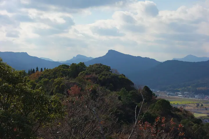
A 397-meter rocky peak in the centre of Amakusa Kamishima Island in Kamiamakusa City, Kumamoto Prefecture, the taller of the affectionate "brother peaks" with the neighbouring Mount Taromaru (281 m). According to local legend the elder brother Taromaru bowed his head so that his younger brother could see the Matsushima sunset, leaving Jiromaru the higher of the two. The shared trail climbs a varied course past rock features called Inazuma-gaeshi and Jiro-otoshi, with a rope-assisted scramble up the final boulder; the summit offers a panorama over the five Amakusa Bridges, Matsushima Bay and the Yatsushiro Sea. The peak appears in numerous selections including the 100 Famous Mountains of Kyushu, the 100 Famous Low Mountains of Japan, and the Kumamoto Hundred Famous Mountains.
สรุป Mount Jiromaru
- อากาศ: วันที่อากาศคงที่ที่สุดใน 7 วันข้างหน้าคือ อาทิตย์ 8 พฤศจิกายน: ท้องฟ้าแจ่มใส ลมกระโชกสูงสุด 5 ม./วินาที
- เส้นทาง: เส้นทางที่สั้นที่สุดคือ Mount Taromaru and Mount Jiromaru Out-and-Back from Imaizumi Trailhead: ประมาณ 3 ชม. 16 นาที 5.8 km ขึ้นประมาณ 500 m
อากาศ Mount Jiromaru (รายชั่วโมง 2 สัปดาห์)
วันนี้พระอาทิตย์ขึ้น 06:37 ตก 17:27
| อังคาร 3/11 | พุธ 4/11 | พฤหัส 5/11 | ศุกร์ 6/11 | เสาร์ 7/11 | อาทิตย์ 8/11 | จันทร์ 9/11 | อังคาร 10/11 | พุธ 11/11 | พฤหัส 12/11 | ศุกร์ 13/11 | เสาร์ 14/11 | อาทิตย์ 15/11 | จันทร์ 16/11 | อังคาร 17/11 | |||||||||||||||||||||||||||||||||||||||||||||||||||||||||||||||||||||||
|---|---|---|---|---|---|---|---|---|---|---|---|---|---|---|---|---|---|---|---|---|---|---|---|---|---|---|---|---|---|---|---|---|---|---|---|---|---|---|---|---|---|---|---|---|---|---|---|---|---|---|---|---|---|---|---|---|---|---|---|---|---|---|---|---|---|---|---|---|---|---|---|---|---|---|---|---|---|---|---|---|---|---|---|---|---|
| เวลาญี่ปุ่น | 15 | 17 | 19 | 21 | 23 | 1 | 3 | 5 | 7 | 9 | 11 | 13 | 15 | 18 | 21 | 0 | 3 | 6 | 9 | 12 | 15 | 18 | 21 | 0 | 3 | 6 | 9 | 12 | 15 | 18 | 21 | 0 | 3 | 6 | 9 | 12 | 15 | 18 | 21 | 0 | 3 | 6 | 9 | 12 | 15 | 18 | 21 | 0 | 3 | 6 | 9 | 15 | 21 | 3 | 9 | 15 | 21 | 3 | 9 | 15 | 21 | 3 | 9 | 15 | 21 | 3 | 9 | 15 | 21 | 3 | 9 | 15 | 21 | 3 | 9 | 15 | 21 | 3 | 9 | 15 | 21 | 3 | 9 | 15 | |
 |   |   |   | | | | |   | | | | |   | |   | | | |   |   | |   | |  | | | | | | | | | | | | | | | | | | | | | | | | | | | |   | | | | | | | | | | | |  | | | | | | | | | | | | |   |   | | | | | | ||
| อุณหภูมิ | °C | 18° | 17° | 17° | 16° | 15° | 14° | 14° | 14° | 14° | 15° | 16° | 18° | 18° | 17° | 17° | 16° | 15° | 15° | 17° | 20° | 19° | 18° | 18° | 17° | 16° | 15° | 16° | 18° | 18° | 15° | 14° | 12° | 11° | 10° | 10° | 12° | 13° | 12° | 11° | 9° | 9° | 8° | 11° | 13° | 14° | 14° | 13° | 12° | 13° | 13° | 14° | 16° | 14° | 12° | 12° | 14° | 12° | 11° | 11° | 13° | 11° | 9° | 11° | 14° | 11° | 10° | 11° | 15° | 12° | 9° | 11° | 17° | 14° | 15° | 17° | 18° | 16° | 16° | 16° | 18° | 14° | 12° | 12° | 16° |
| ฝนและหิมะ | mm | 0.3 | 1.2 | 1.1 | 0.6 | 8 | 4.0 | 0.7 | 0.2 | 8 | 4.5 | 0.6 | 1.6 | 0.4 | |||||||||||||||||||||||||||||||||||||||||||||||||||||||||||||||||||||||
| หิมะตก | cm | ||||||||||||||||||||||||||||||||||||||||||||||||||||||||||||||||||||||||||||||||||||
| หิมะสะสม | cm | 0 | 0 | 0 | 0 | 0 | 0 | 0 | 0 | 0 | 0 | 0 | 0 | 0 | 0 | 0 | 0 | 0 | 0 | 0 | 0 | 0 | 0 | 0 | 0 | 0 | 0 | 0 | 0 | 0 | 0 | 0 | 0 | 0 | 0 | 0 | 0 | 0 | 0 | 0 | 0 | 0 | 0 | 0 | 0 | 0 | 0 | 0 | 0 | 0 | 0 | 0 | 0 | 0 | 0 | 0 | 0 | 0 | 0 | 0 | 0 | 0 | 0 | 0 | 0 | 0 | 0 | 0 | 0 | 0 | 0 | 0 | 0 | 0 | 0 | 0 | 0 | 0 | 0 | 0 | 0 | 0 | 0 | 0 | 0 |
| ลม | m/s | 5 | 5 | 5 | 5 | 4 | 3 | 3 | 3 | 3 | 2 | 3 | 4 | 3 | 2 | 1 | 2 | 2 | 1 | 1 | 3 | 5 | 2 | 3 | 3 | 3 | 3 | 4 | 4 | 6 | 6 | 5 | 5 | 7 | 7 | 6 | 5 | 5 | 5 | 4 | 3 | 2 | 2 | 2 | 2 | 1 | 3 | 2 | 2 | 2 | 3 | 4 | 5 | 5 | 4 | 4 | 5 | 4 | 2 | 6 | 5 | 4 | 2 | 1 | 2 | 2 | 2 | 3 | 3 | 2 | 1 | 1 | 3 | 2 | 1 | 5 | 4 | 2 | 3 | 4 | 5 | 4 | 4 | 4 | 4 |
| ลมกระโชก | m/s | 8 | 9 | 8 | 9 | 8 | 6 | 6 | 6 | 5 | 5 | 5 | 6 | 6 | 5 | 4 | 4 | 4 | 5 | 3 | 4 | 8 | 8 | 6 | 6 | 6 | 6 | 6 | 7 | 9 | 10 | 9 | 9 | 11 | 11 | 11 | 10 | 8 | 8 | 8 | 7 | 5 | 5 | 4 | 5 | 4 | 5 | 5 | 4 | 4 | 6 | 7 | 8 | 8 | 8 | 7 | 8 | 9 | 7 | 10 | 10 | 8 | 7 | 5 | 5 | 5 | 5 | 5 | 7 | 5 | 4 | 4 | 5 | 5 | 4 | 8 | 9 | 6 | 4 | 7 | 7 | 8 | 7 | 6 | 6 |
| ทิศทางลม | ↓ | ↓ | ↓ | ↓ | ↓ | ↓ | ↓ | ↓ | ↓ | ↓ | ↓ | ↓ | ↓ | ↓ | ↓ | ↓ | ↓ | ↓ | ↓ | ↓ | ↓ | ↓ | ↓ | ↓ | ↓ | ↓ | ↓ | ↓ | ↓ | ↓ | ↓ | ↓ | ↓ | ↓ | ↓ | ↓ | ↓ | ↓ | ↓ | ↓ | ↓ | ↓ | ↓ | ↓ | ↓ | ↓ | ↓ | ↓ | ↓ | ↓ | ↓ | ↓ | ↓ | ↓ | ↓ | ↓ | ↓ | ↓ | ↓ | ↓ | ↓ | ↓ | ↓ | ↓ | ↓ | ↓ | ↓ | ↓ | ↓ | ↓ | ↓ | ↓ | ↓ | ↓ | ↓ | ↓ | ↓ | ↓ | ↓ | ↓ | ↓ | ↓ | ↓ | ↓ | |
เส้นทางเดินป่า Mount Jiromaru
เวลาเดินเป็นค่าประมาณที่คำนวณจากภูมิประเทศ
กระท่อม ที่ตั้งแคมป์ และที่พักใกล้ Mount Jiromaru
ที่ตั้งแคมป์
- 白嶽森林公園キャンプ場
- 小島公園キャンプ場
ที่พัก
- 熊本県立天草青年の家
- Tenshou
รายชื่อที่มี Mount Jiromaru
100 ภูเขาที่มีชื่อเสียงของคิวชู · 100 ภูเขาที่มีชื่อเสียงของคูมาโมโตะ
ข้อมูลพื้นฐาน Mount Jiromaru
- ความสูง
- 397 ม.
- ที่ตั้ง
- คามิอามากูซะ, คุมาโมโตะ
32.478845, 130.406658 - เว็บไซต์
- www.city.kamiamakusa.kumamoto.jp
- แผนที่เส้นทางเดินเขา
- www.city.kamiamakusa.kumamoto.jp (PDF)
- วิกิพีเดีย
- ja.wikipedia.org